Category:United Kingdom photographs taken on 2009-06-29
Jump to navigation
Jump to search

Subcategories
This category has the following 4 subcategories, out of 4 total.
Media in category "United Kingdom photographs taken on 2009-06-29"
The following 200 files are in this category, out of 1,156 total.
(previous page) (next page)-
 "Cuckoo's Spittle" - geograph.org.uk - 1377055.jpg 640 × 485; 68 KB
-
 (1032) Aleimma loeflingiana (3669385939).jpg 926 × 676; 145 KB
-
 (1136) Epinotia immundana (3669386087).jpg 960 × 667; 59 KB
-
 (1354) Small China-mark (Cataclysta lemnata) (3673716691).jpg 1,500 × 1,004; 1.34 MB
-
 (1754) The Phoenix (Eulithis prunata) (3674525470).jpg 1,500 × 1,004; 659 KB
-
 (2345) Small Dotted Buff (Photedes minima) (3674527292).jpg 1,500 × 1,004; 1.26 MB
-
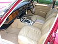
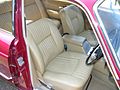
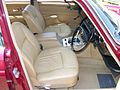
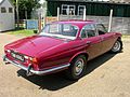
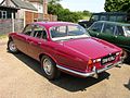
 1970 Jaguar XJ6 4.2 Series 1 - Flickr - The Car Spy (1).jpg 1,600 × 1,200; 339 KB
-
 1970 Jaguar XJ6 4.2 Series 1 - Flickr - The Car Spy (10).jpg 1,600 × 1,200; 223 KB
-
 1970 Jaguar XJ6 4.2 Series 1 - Flickr - The Car Spy (11).jpg 1,600 × 1,200; 318 KB
-
 1970 Jaguar XJ6 4.2 Series 1 - Flickr - The Car Spy (12).jpg 1,600 × 1,200; 347 KB
-
 1970 Jaguar XJ6 4.2 Series 1 - Flickr - The Car Spy (13).jpg 1,527 × 483; 106 KB
-
 1970 Jaguar XJ6 4.2 Series 1 - Flickr - The Car Spy (14).jpg 1,449 × 729; 191 KB
-
 1970 Jaguar XJ6 4.2 Series 1 - Flickr - The Car Spy (15).jpg 1,600 × 1,200; 277 KB
-
 1970 Jaguar XJ6 4.2 Series 1 - Flickr - The Car Spy (16).jpg 1,600 × 1,200; 250 KB
-
 1970 Jaguar XJ6 4.2 Series 1 - Flickr - The Car Spy (17).jpg 1,600 × 1,200; 206 KB
-
 1970 Jaguar XJ6 4.2 Series 1 - Flickr - The Car Spy (18).jpg 1,600 × 1,200; 255 KB
-
 1970 Jaguar XJ6 4.2 Series 1 - Flickr - The Car Spy (19).jpg 1,600 × 1,200; 218 KB
-
 1970 Jaguar XJ6 4.2 Series 1 - Flickr - The Car Spy (2).jpg 1,600 × 1,200; 245 KB
-
 1970 Jaguar XJ6 4.2 Series 1 - Flickr - The Car Spy (20).jpg 1,600 × 1,200; 248 KB
-
 1970 Jaguar XJ6 4.2 Series 1 - Flickr - The Car Spy (21).jpg 1,600 × 1,200; 245 KB
-
 1970 Jaguar XJ6 4.2 Series 1 - Flickr - The Car Spy (22).jpg 1,600 × 1,200; 252 KB
-
 1970 Jaguar XJ6 4.2 Series 1 - Flickr - The Car Spy (23).jpg 1,600 × 1,200; 245 KB
-
 1970 Jaguar XJ6 4.2 Series 1 - Flickr - The Car Spy (24).jpg 1,600 × 1,200; 219 KB
-
 1970 Jaguar XJ6 4.2 Series 1 - Flickr - The Car Spy (25).jpg 1,600 × 1,200; 259 KB
-
 1970 Jaguar XJ6 4.2 Series 1 - Flickr - The Car Spy (26).jpg 1,600 × 1,200; 263 KB
-
 1970 Jaguar XJ6 4.2 Series 1 - Flickr - The Car Spy (27).jpg 1,600 × 1,200; 259 KB
-
 1970 Jaguar XJ6 4.2 Series 1 - Flickr - The Car Spy (3).jpg 1,600 × 1,200; 119 KB
-
 1970 Jaguar XJ6 4.2 Series 1 - Flickr - The Car Spy (4).jpg 1,600 × 1,200; 324 KB
-
 1970 Jaguar XJ6 4.2 Series 1 - Flickr - The Car Spy (5).jpg 1,600 × 1,200; 358 KB
-
 1970 Jaguar XJ6 4.2 Series 1 - Flickr - The Car Spy (6).jpg 1,600 × 1,200; 368 KB
-
 1970 Jaguar XJ6 4.2 Series 1 - Flickr - The Car Spy (7).jpg 1,600 × 1,200; 301 KB
-
 1970 Jaguar XJ6 4.2 Series 1 - Flickr - The Car Spy (8).jpg 1,600 × 1,200; 247 KB
-
 1970 Jaguar XJ6 4.2 Series 1 - Flickr - The Car Spy (9).jpg 1,600 × 1,200; 244 KB
-
 1970 Jaguar XJ6 4.2 Series 1 - Flickr - The Car Spy.jpg 1,600 × 1,200; 147 KB
-
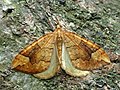 70.091 BF1756 Northern Spinach, Eulithis populata (3674085363).jpg 3,648 × 2,736; 3.9 MB
-
 70.127 BF1782 The Fern, Horisme tersata (3674896894).jpg 3,648 × 2,500; 4.07 MB
-
 70.128 BF1784 Pretty Chalk Carpet, Melanthia procellata (3684314768).jpg 3,648 × 2,628; 3.88 MB
-
 70.144 BF1860 Green Pug, Pasiphila rectangulata (3674030603).jpg 3,644 × 2,564; 3.43 MB
-
 70.146 BF1813 Haworth's Pug, Eupithecia haworthiata (3674090167).jpg 3,648 × 2,308; 3.73 MB
-
 A bit of the old Slug Road - geograph.org.uk - 1377179.jpg 640 × 480; 94 KB
-
 A building by Carpenter's Croft - geograph.org.uk - 1379980.jpg 640 × 480; 76 KB
-
 A bus shelter at Fairy Cross - geograph.org.uk - 1460122.jpg 640 × 427; 96 KB
-

-

-
 A corner of Kettlewell - geograph.org.uk - 1387215.jpg 640 × 439; 324 KB
-

-
 A field by Turfcraig - geograph.org.uk - 1379986.jpg 640 × 456; 82 KB
-
 A Footpath to Elloughton - geograph.org.uk - 1380906.jpg 480 × 640; 154 KB
-
 A green on Stonehaven golf course - geograph.org.uk - 1379184.jpg 640 × 480; 61 KB
-
 A hawthorn tree on Morebattle Hill - geograph.org.uk - 1380879.jpg 640 × 427; 128 KB
-
 A hill fort on Morebattle Hill - geograph.org.uk - 1380883.jpg 640 × 427; 165 KB
-
 A load of bales on Kington Lane - geograph.org.uk - 1404848.jpg 640 × 532; 155 KB
-
 A pair of Rabbits, Aberdeenshire - geograph.org.uk - 1379419.jpg 640 × 640; 80 KB
-
 A Pair of Ravens - geograph.org.uk - 1382708.jpg 640 × 480; 52 KB
-
 A weir on the Cowie Water - geograph.org.uk - 1379473.jpg 480 × 640; 100 KB
-

-
 A4110 Looking North - geograph.org.uk - 1377047.jpg 640 × 480; 173 KB
-
 A4110 Looking North - geograph.org.uk - 1377063.jpg 640 × 480; 211 KB
-
 A4110, Looking North - geograph.org.uk - 1377302.jpg 640 × 480; 211 KB
-
 A4160 Penarth Road.jpg 640 × 425; 92 KB
-
 A429 at Junction 17 - geograph.org.uk - 1407341.jpg 640 × 495; 111 KB
-
 A429 looking south at Junction 17 - geograph.org.uk - 1407342.jpg 640 × 497; 119 KB
-
 A429 near Lower Stanton St. Quintin - geograph.org.uk - 1407336.jpg 640 × 508; 132 KB
-
 A49, Looking North - geograph.org.uk - 1377122.jpg 640 × 480; 150 KB
-
 A49, Looking North - geograph.org.uk - 1377133.jpg 640 × 480; 163 KB
-
 A49, Looking North - geograph.org.uk - 1377188.jpg 640 × 480; 162 KB
-

-
 A49, Looking South - geograph.org.uk - 1377124.jpg 640 × 480; 158 KB
-
 A49, Looking South - geograph.org.uk - 1377136.jpg 640 × 480; 135 KB
-
 A947 by Cowton Burn - geograph.org.uk - 1377694.jpg 640 × 400; 38 KB
-
 A947 near North Glenton - geograph.org.uk - 1377670.jpg 640 × 455; 56 KB
-
 Aberystwith - panoramio - Tanya Dedyukhina (1).jpg 1,408 × 1,056; 485 KB
-
 Aberystwith - panoramio - Tanya Dedyukhina (2).jpg 1,408 × 1,056; 667 KB
-
 Aberystwith - panoramio - Tanya Dedyukhina (3).jpg 1,408 × 1,056; 780 KB
-
 Aberystwith - panoramio - Tanya Dedyukhina (4).jpg 1,408 × 1,056; 439 KB
-
 Aberystwith - panoramio - Tanya Dedyukhina (5).jpg 1,408 × 1,056; 442 KB
-
 Aberystwith - panoramio - Tanya Dedyukhina (6).jpg 1,408 × 1,056; 653 KB
-
 Aberystwith - panoramio - Tanya Dedyukhina (7).jpg 1,408 × 1,056; 653 KB
-
 Aberystwith - panoramio - Tanya Dedyukhina (8).jpg 1,408 × 1,056; 356 KB
-
 Aberystwith Harbour - panoramio.jpg 1,408 × 1,056; 552 KB
-
 Aberystwith harbour - panoramio.jpg 1,408 × 1,056; 479 KB
-
 Aberystwith Railway St - panoramio.jpg 1,408 × 1,056; 482 KB
-
 Above Gasgale - geograph.org.uk - 1382700.jpg 640 × 480; 37 KB
-
 Above the waterfall - geograph.org.uk - 1378103.jpg 640 × 480; 95 KB
-
 Access road to Westfield Farm - geograph.org.uk - 1379312.jpg 640 × 480; 84 KB
-

-
 Access to Altries Croft - geograph.org.uk - 1380000.jpg 640 × 477; 122 KB
-
 Access to Ardmillan - geograph.org.uk - 1377164.jpg 640 × 520; 91 KB
-
 Access to Easter Ashentilly - geograph.org.uk - 1379973.jpg 640 × 480; 69 KB
-
 Access to Nether Ashentilly - geograph.org.uk - 1379592.jpg 640 × 480; 100 KB
-
 Accrington Road - geograph.org.uk - 1378445.jpg 640 × 480; 65 KB
-
 Alegar Street - Wakefield Road - geograph.org.uk - 1377224.jpg 640 × 481; 240 KB
-
 All Saints' church interior - geograph.org.uk - 1395223.jpg 426 × 640; 56 KB
-
 All Saints' font - geograph.org.uk - 1395245.jpg 640 × 426; 57 KB
-
 All Saints' nave - geograph.org.uk - 1395237.jpg 426 × 640; 68 KB
-
 Allt Breineag running low in Glen Brein - geograph.org.uk - 1378829.jpg 640 × 480; 117 KB
-
 Allt Mhicheil - geograph.org.uk - 1378095.jpg 480 × 640; 125 KB
-
 Allt Mhicheil flows into Glen Dibidal - geograph.org.uk - 1378129.jpg 640 × 480; 104 KB
-
 Allt Mhicheil in Glen Dibidal - geograph.org.uk - 1378119.jpg 640 × 480; 96 KB
-
 Almshouse in the village - geograph.org.uk - 1397006.jpg 640 × 480; 82 KB
-
 Almshouses By The A49 - geograph.org.uk - 1377141.jpg 640 × 480; 169 KB
-
 Amport Close - Danebury Road - geograph.org.uk - 1378046.jpg 640 × 480; 220 KB
-

-

-

-

-
 Anglesey Court - geograph.org.uk - 1387285.jpg 640 × 480; 79 KB
-
 Another old pillbox - geograph.org.uk - 1420595.jpg 640 × 480; 150 KB
-
 Another View of Turton Cottages - geograph.org.uk - 1389838.jpg 640 × 426; 111 KB
-
 Anyone fancy a game of cricket^ - geograph.org.uk - 1379033.jpg 640 × 480; 63 KB
-
 Apamea remissa (3674526210).jpg 1,500 × 1,004; 704 KB
-
 Approach to Bogfon Cottage - geograph.org.uk - 1379977.jpg 640 × 471; 71 KB
-
 Approach to Clachanshiels - geograph.org.uk - 1377288.jpg 640 × 480; 54 KB
-
 Approach to Cockley junction - geograph.org.uk - 1379984.jpg 640 × 395; 36 KB
-
 Approach to St Mary of the storms - geograph.org.uk - 1378078.jpg 640 × 480; 81 KB
-
 Approach to Turfcraig junction - geograph.org.uk - 1379944.jpg 640 × 511; 69 KB
-
 Approaching Deep Dale - geograph.org.uk - 1379074.jpg 640 × 480; 87 KB
-
 Approaching Duke Bar from Reedley - geograph.org.uk - 1378428.jpg 640 × 480; 59 KB
-
 Approaching Hobcarton End - geograph.org.uk - 1383857.jpg 640 × 480; 76 KB
-
 Approaching Hopegill Head - geograph.org.uk - 1382692.jpg 640 × 480; 70 KB
-
 Approaching the mansion at Wyfold court - geograph.org.uk - 1381175.jpg 640 × 480; 104 KB
-
 Archbell Avenue - Daisy Road - geograph.org.uk - 1377998.jpg 640 × 480; 283 KB
-

-
 Armitage Avenue - Woodhouse Lane - geograph.org.uk - 1378059.jpg 640 × 480; 288 KB
-

-

-
 Ascending Ladyside Pike - geograph.org.uk - 1382685.jpg 640 × 480; 50 KB
-
 ASDA superstore in Bideford - geograph.org.uk - 1460135.jpg 640 × 294; 32 KB
-
 Ashlea Avenue - Archbell Avenue - geograph.org.uk - 1378053.jpg 640 × 480; 189 KB
-
 Ashlea Avenue - Daisy Road - geograph.org.uk - 1377997.jpg 640 × 480; 283 KB
-
 Ashlea Avenue - Wherwell Road - geograph.org.uk - 1378049.jpg 640 × 480; 212 KB
-
 Asquith Close - geograph.org.uk - 1376782.jpg 640 × 480; 76 KB
-
 At Brodie Castle Station near Forres - geograph.org.uk - 1380986.jpg 640 × 479; 125 KB
-
 At the junction of B4122 and B4069 - geograph.org.uk - 1407362.jpg 640 × 553; 142 KB
-
 Atlantic Village Shopping Outlet - geograph.org.uk - 1460129.jpg 640 × 408; 54 KB
-
 Atlas Mill Road - Bridge Road - geograph.org.uk - 1378392.jpg 640 × 480; 286 KB
-

-
 Auberrow Crossroads - geograph.org.uk - 1377079.jpg 640 × 480; 180 KB
-
 B4069 approaching Kington Langley - geograph.org.uk - 1407370.jpg 640 × 539; 176 KB
-
 B4069 from the junction with B4122 - geograph.org.uk - 1381512.jpg 640 × 483; 156 KB
-
 B4122 looking west - geograph.org.uk - 1407353.jpg 640 × 556; 172 KB
-
 B4122 near Draycott Cerne - geograph.org.uk - 1407377.jpg 640 × 553; 186 KB
-
 B4122 near Westbrook Farm - geograph.org.uk - 1381251.jpg 640 × 484; 169 KB
-
 Backglen Road - geograph.org.uk - 1376988.jpg 640 × 479; 61 KB
-
 Backglen Road - geograph.org.uk - 1377048.jpg 640 × 479; 47 KB
-
 Backglen Road - geograph.org.uk - 1377064.jpg 640 × 479; 63 KB
-
 Backglen Road - geograph.org.uk - 1377084.jpg 640 × 479; 64 KB
-
 Backglen Road, Ballynaquilly - geograph.org.uk - 1376968.jpg 640 × 479; 55 KB
-
 Backglen Road, Ballynaquilly - geograph.org.uk - 1377022.jpg 640 × 479; 88 KB
-
 Backglen Road, Faccary - geograph.org.uk - 1377093.jpg 640 × 479; 75 KB
-
 Backglen Road, Omagh - geograph.org.uk - 1376767.jpg 640 × 479; 51 KB
-
 Ballynaquilly Townland - geograph.org.uk - 1376764.jpg 640 × 479; 60 KB
-
 Ballynaquilly Townland - geograph.org.uk - 1376770.jpg 640 × 479; 57 KB
-
 Ballynaquilly Townland - geograph.org.uk - 1376962.jpg 640 × 479; 76 KB
-
 Ballynaquilly Townland - geograph.org.uk - 1376964.jpg 640 × 479; 58 KB
-
 Ballynaquilly Townland - geograph.org.uk - 1376971.jpg 640 × 479; 71 KB
-
 Ballynaquilly Townland - geograph.org.uk - 1376974.jpg 640 × 479; 82 KB
-
 Ballynaquilly Townland - geograph.org.uk - 1376979.jpg 640 × 479; 60 KB
-
 Ballynaquilly Townland - geograph.org.uk - 1376993.jpg 640 × 479; 68 KB
-
 Ballynaquilly Townland - geograph.org.uk - 1377000.jpg 640 × 479; 93 KB
-
 Ballynaquilly Townland - geograph.org.uk - 1377012.jpg 640 × 479; 77 KB
-
 Ballynaquilly Townland - geograph.org.uk - 1377025.jpg 640 × 479; 87 KB
-
 Ballynaquilly Townland - geograph.org.uk - 1377059.jpg 640 × 479; 86 KB
-
 Ballynaquilly Townland - geograph.org.uk - 1377067.jpg 640 × 479; 61 KB
-
 Barholm Road - geograph.org.uk - 1376726.jpg 640 × 480; 73 KB
-
 Barley field and road to Horringer - geograph.org.uk - 1385892.jpg 427 × 640; 82 KB
-
 Barley field near Bramford - geograph.org.uk - 1385787.jpg 640 × 427; 86 KB
-
 Bathgate Drive, Belfast - geograph.org.uk - 1379342.jpg 640 × 371; 78 KB
-
 Beach at Hartland Quay - geograph.org.uk - 1416234.jpg 640 × 415; 49 KB
-
 Beach at Hartland Quay - geograph.org.uk - 1416235.jpg 640 × 427; 79 KB
-
 Beach at Hartland Quay - geograph.org.uk - 1416250.jpg 640 × 427; 72 KB
-
 Beach huts in Bude - geograph.org.uk - 1457354.jpg 640 × 427; 61 KB
-
 Bealach Bharcasaig - geograph.org.uk - 1378088.jpg 640 × 480; 99 KB
-
 Beech bole in wood by Cowie Water - geograph.org.uk - 1377231.jpg 480 × 640; 101 KB
-
 Beech leaves - geograph.org.uk - 1377408.jpg 640 × 480; 101 KB
-
 Beinn a' Chapuill - geograph.org.uk - 1377438.jpg 640 × 480; 142 KB
-
 Belle Vue in Bude - geograph.org.uk - 1455741.jpg 640 × 423; 79 KB
-
 Belmont Park - geograph.org.uk - 1379606.jpg 640 × 532; 73 KB
-
 Ben Connan - geograph.org.uk - 1377407.jpg 640 × 480; 117 KB
-
 Benches, Loxbury Road - geograph.org.uk - 1381747.jpg 640 × 480; 133 KB
-
 Bend in road near Turfcraig - geograph.org.uk - 1379937.jpg 640 × 445; 47 KB
-
 Benkid77 Class 175 DMU, Flint 290609.JPG 1,280 × 1,024; 245 KB
-
 Benkid77 Flint railway station 1 290609.JPG 1,280 × 1,024; 371 KB
-
 Benkid77 Prestatyn sign 290609.JPG 1,280 × 1,024; 259 KB
-
 Benkid77 Rhyl Stone Circle 290609.JPG 1,280 × 1,024; 326 KB
-
 Benkid77 Royal Alexandra Hospital, Rhyl 290609.JPG 1,280 × 1,024; 249 KB
-
 Benkid77 Shotton low level class 175 DMU 290609.JPG 1,280 × 1,024; 352 KB
-
 Benkid77 Sunny Rhyl Mural 290609.JPG 1,280 × 1,024; 411 KB
-
 Benkid77 Welsh litter bin 290609.JPG 1,024 × 1,280; 467 KB
-
 Bin Day on Hockers Lane - geograph.org.uk - 1377483.jpg 640 × 427; 55 KB
-
 Birds Royd Lane - Huddersfield Road - geograph.org.uk - 1377553.jpg 640 × 480; 258 KB
-
 Black and White Cottage at Chirbury - geograph.org.uk - 1376684.jpg 640 × 426; 73 KB
-
 Black Crag - geograph.org.uk - 1383879.jpg 640 × 480; 78 KB
-
 Boat o' Brig over the Spey - geograph.org.uk - 1393992.jpg 640 × 427; 72 KB
-
 Boat o' Brig Rail - geograph.org.uk - 1393975.jpg 427 × 640; 103 KB
-
 Boathouse, Lake Vyrnwy - geograph.org.uk - 1383769.jpg 640 × 427; 76 KB
-
 Bogfon Cottage - geograph.org.uk - 1379976.jpg 640 × 478; 57 KB
-
 Bolton Street, Brixham - geograph.org.uk - 1377827.jpg 640 × 480; 73 KB
-
 Bowling Alley Terrace - Bowling Alley - geograph.org.uk - 1378083.jpg 640 × 480; 309 KB
-
 Bracken, trees and hillside. - geograph.org.uk - 1380721.jpg 640 × 480; 83 KB

_Aleimma_loeflingiana_(3669385939).jpg)
_Epinotia_immundana_(3669386087).jpg)
_Small_China-mark_(Cataclysta_lemnata)_(3673716691).jpg)
_The_Phoenix_(Eulithis_prunata)_(3674525470).jpg)
_Small_Dotted_Buff_(Photedes_minima)_(3674527292).jpg)
.jpg)
.jpg)
.jpg)
.jpg)
.jpg)
.jpg)
.jpg)
.jpg)
.jpg)
.jpg)
.jpg)
.jpg)
.jpg)
.jpg)
.jpg)
.jpg)
.jpg)
.jpg)
.jpg)
.jpg)
.jpg)
.jpg)
.jpg)
.jpg)
.jpg)
.jpg)

.jpg)
.jpg)
.jpg)
.jpg)
.jpg)


.jpg)
.jpg)
.jpg)
.jpg)
.jpg)
.jpg)
.jpg)
.jpg)


.jpg)


.jpg)