Category:United Kingdom photographs taken on 2009-06-17
Jump to navigation
Jump to search

Subcategories
This category has the following 3 subcategories, out of 3 total.
K
Media in category "United Kingdom photographs taken on 2009-06-17"
The following 200 files are in this category, out of 778 total.
(previous page) (next page)-
 "The Cuan", Strangford - geograph.org.uk - 1359324.jpg 640 × 451; 66 KB
-
 (0977) Large Fruit-tree Tortrix (Archips podana) (3635774744).jpg 1,500 × 1,004; 1.66 MB
-
 (1002) Lozotaenia forsterana (3634977687).jpg 1,500 × 1,004; 1.45 MB
-
 (1302) Crambus perlella (3635776408).jpg 959 × 649; 91 KB
-
 (1333) Scoparia pyralella (3634982425).jpg 1,500 × 1,004; 1.31 MB
-
 (1758) Barred Straw (Eulithis pyraliata) (3635776270).jpg 1,500 × 1,004; 1.36 MB
-
 (1827) Freyer's Pug (Eupithecia intricata) (3634970727).jpg 1,500 × 1,004; 1.5 MB
-
 (1924) Orange Moth (Angerona prunaria) (3634980875).jpg 1,500 × 2,241; 2.68 MB
-
 (2089) Heart & Dart (Agrotis exclamationis) (3634976041).jpg 1,500 × 1,004; 1.41 MB
-
 (2198) Smoky Wainscot (Mythimna impura) (3634983905).jpg 1,500 × 1,004; 1.52 MB
-
 (2216) The Shark (Cucullia umbratica) (3640139432).jpg 1,500 × 1,004; 1.28 MB
-
 (2381) The Uncertain (Hoplodrina alsines) (3635797140).jpg 1,500 × 1,004; 1.51 MB
-
 Cambridge MMB 02 Senate House.jpg 2,400 × 1,600; 1.57 MB
-
 4 Hawk-moths (3635785618).jpg 2,560 × 1,920; 2.81 MB
-
 99p Store, Gillingham High Street - geograph.org.uk - 1374746.jpg 640 × 480; 87 KB
-
 A field of Legumes, Ightham Mote Estate - geograph.org.uk - 1362564.jpg 640 × 430; 149 KB
-
 A field of Legumes, Ightham Mote Estate - geograph.org.uk - 1362670.jpg 640 × 430; 124 KB
-
 A field off Mote Rd near Budds Green - geograph.org.uk - 1362561.jpg 640 × 430; 135 KB
-
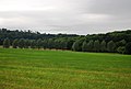 A line of trees west of Shipbourne - geograph.org.uk - 1362505.jpg 640 × 430; 77 KB
-
 A rainy day in Providence Lane, Rothbury - geograph.org.uk - 1382815.jpg 640 × 443; 121 KB
-

-

-
 A14 Looking Northwest - geograph.org.uk - 1367794 (cropped).jpg 268 × 477; 26 KB
-
 A14 Looking Northwest - geograph.org.uk - 1367794.jpg 640 × 480; 64 KB
-
 A227, Ightham Rd looking north - geograph.org.uk - 1363730.jpg 640 × 430; 143 KB
-
 A227, Ightham Rd looking south - geograph.org.uk - 1363732.jpg 640 × 430; 159 KB
-
 A228 Cuxton Road, Strood - geograph.org.uk - 1359959.jpg 640 × 480; 65 KB
-
 A228 Cuxton Road, towards Strood - geograph.org.uk - 1359939.jpg 640 × 480; 55 KB
-
 A828 roundabout - geograph.org.uk - 1528993.jpg 640 × 480; 147 KB
-
 Airds Lodge - geograph.org.uk - 1529990.jpg 640 × 480; 143 KB
-
 Airparks airport parking at Gatwick - geograph.org.uk - 1360102.jpg 640 × 480; 65 KB
-
 Albany Road, Rochester - geograph.org.uk - 1359064.jpg 640 × 480; 121 KB
-
 Albert Road, Rochester - geograph.org.uk - 1359081.jpg 640 × 480; 85 KB
-
 Aldham-sign.jpg 1,852 × 2,761; 906 KB
-
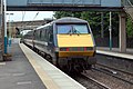
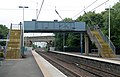
 Alnmouth railway station (1) - geograph.org.uk - 1365833.jpg 640 × 432; 88 KB
-
 Alnmouth railway station (10) - geograph.org.uk - 1365901.jpg 640 × 418; 126 KB
-
 Alnmouth railway station (11) - geograph.org.uk - 1365910.jpg 640 × 426; 115 KB
-
 Alnmouth railway station (12) - geograph.org.uk - 1365914.jpg 640 × 472; 92 KB
-
 Alnmouth railway station (13) - geograph.org.uk - 1365923.jpg 640 × 420; 121 KB
-
 Alnmouth railway station (14) - geograph.org.uk - 1365931.jpg 640 × 436; 113 KB
-
 Alnmouth railway station (15) - geograph.org.uk - 1365938.jpg 640 × 426; 99 KB
-
 Alnmouth railway station (16) - geograph.org.uk - 1365950.jpg 640 × 388; 83 KB
-
 Alnmouth railway station (17) - geograph.org.uk - 1365958.jpg 640 × 461; 135 KB
-
 Alnmouth railway station (2) - geograph.org.uk - 1365843.jpg 640 × 426; 91 KB
-
 Alnmouth railway station (3) - geograph.org.uk - 1365848.jpg 640 × 451; 112 KB
-
 Alnmouth railway station (4) - geograph.org.uk - 1365856.jpg 640 × 428; 112 KB
-
 Alnmouth railway station (5) - geograph.org.uk - 1365863.jpg 640 × 426; 107 KB
-
 Alnmouth railway station (6) - geograph.org.uk - 1365873.jpg 640 × 448; 98 KB
-
 Alnmouth railway station (7) - geograph.org.uk - 1365881.jpg 640 × 467; 124 KB
-
 Alnmouth railway station (8) - geograph.org.uk - 1365885.jpg 640 × 409; 100 KB
-
 Alnmouth railway station (9) - geograph.org.uk - 1365893.jpg 640 × 408; 114 KB
-
 Amblyptilia acanthadactyla (3634961009).jpg 1,500 × 1,004; 1.59 MB
-
 Amphitheatre at Folkestone, Kent - geograph.org.uk - 1361826.jpg 640 × 428; 85 KB
-
 Amphitheatre at Folkestone, Kent - geograph.org.uk - 1361832.jpg 640 × 428; 84 KB
-

-
 An ornamental footbridge at Cragside - geograph.org.uk - 1387570.jpg 640 × 426; 175 KB
-
 An out building, Fairlawne House grounds - geograph.org.uk - 1363750.jpg 640 × 430; 146 KB
-
 As calm as a mill pond - geograph.org.uk - 1366751.jpg 640 × 480; 47 KB
-
 ASDA Wal-mart supercentre in Swindon - geograph.org.uk - 1359468.jpg 640 × 480; 67 KB
-
 Asking for directions, Hoprig Road - geograph.org.uk - 1359095.jpg 640 × 360; 68 KB
-
 Ballard Business Park, Strood - geograph.org.uk - 1359948.jpg 640 × 480; 59 KB
-

-

-
 Banks Methodist Church.jpg 640 × 479; 66 KB
-
 Banks Road - geograph.org.uk - 1359633.jpg 640 × 480; 51 KB
-
 Barclays Bank, Rothbury - geograph.org.uk - 1382781.jpg 640 × 603; 148 KB
-
 Barn at Yanley Farm - geograph.org.uk - 1358716.jpg 640 × 480; 70 KB
-
 Barn, Fairlawne Home Farm, Plaxtol - geograph.org.uk - 1363994.jpg 640 × 430; 136 KB
-

-

-
 Basin at Lock 12 - geograph.org.uk - 1729073.jpg 640 × 382; 94 KB
-
 Basin at Lock 12 - geograph.org.uk - 1729089.jpg 640 × 353; 93 KB
-
 Bayes' Theorem MMB 01.jpg 2,148 × 1,377; 1.14 MB
-
 Beach at Folkestone, Kent - geograph.org.uk - 1361608.jpg 640 × 360; 50 KB
-
 Beach at Sandgate, Kent - geograph.org.uk - 1361462.jpg 640 × 360; 52 KB
-
 Beach at Sandgate, Kent - geograph.org.uk - 1361559.jpg 640 × 360; 51 KB
-
 Beach at Sandgate, Kent - geograph.org.uk - 1361573.jpg 640 × 360; 53 KB
-
 Beach at Sandgate, Kent - geograph.org.uk - 1361576.jpg 640 × 360; 48 KB
-
 Beach Huts Near Sandgate, Kent - geograph.org.uk - 1361588.jpg 640 × 360; 54 KB
-
 Beacon at Folkestone, Kent - geograph.org.uk - 1362974.jpg 360 × 640; 58 KB
-
 Bear Manor Oast, Shipbourne - geograph.org.uk - 1364081.jpg 640 × 430; 169 KB
-
 Beinn Shleibhe - geograph.org.uk - 1573684.jpg 640 × 426; 60 KB
-
 Beside the railway near Lesbury - geograph.org.uk - 1366478.jpg 640 × 426; 92 KB
-
 Bilsdean - geograph.org.uk - 1366546.jpg 640 × 360; 87 KB
-
 Black Crags - geograph.org.uk - 1399995.jpg 600 × 450; 80 KB
-
 Black Horse Pub Giggleswick - geograph.org.uk - 1384111.jpg 480 × 640; 46 KB
-
 Blackhouse - geograph.org.uk - 1573694.jpg 640 × 426; 79 KB
-
 Boarded up, Broomhall, Sheffield - geograph.org.uk - 1358435.jpg 480 × 640; 70 KB
-
 Booty Lane - geograph.org.uk - 1369972.jpg 640 × 480; 56 KB
-
 Borstal Baptist Church - geograph.org.uk - 1359864.jpg 640 × 480; 77 KB
-
 Brandon House milestone in detail - geograph.org.uk - 1381148.jpg 480 × 640; 124 KB
-
 Brentford Marina - panoramio - Maxwell Hamilton.jpg 3,648 × 2,736; 3.23 MB
-
 Brentford Marina - panoramio.jpg 3,648 × 2,736; 4.14 MB
-
 Brentford Marina Lock Gate - panoramio - Maxwell Hamilton.jpg 3,648 × 2,736; 4.3 MB
-
 Brentford Marina Lock Gate - panoramio.jpg 3,648 × 2,736; 4.24 MB
-
 Bridge and footbridge at Cadger Ford - geograph.org.uk - 1396934.jpg 600 × 450; 91 KB
-
 Bridge at Settle over the Ribble - geograph.org.uk - 1384318.jpg 640 × 480; 125 KB
-
 Bridge over Shepherd's Burn - geograph.org.uk - 1400078.jpg 600 × 450; 133 KB
-
 Bridleway east of Ightham Mote (2) - geograph.org.uk - 1362676.jpg 640 × 430; 149 KB
-
 Bridleway east of Ightham Mote (3) - geograph.org.uk - 1362694.jpg 640 × 430; 146 KB
-
 Bridleway east of Ightham Mote - geograph.org.uk - 1362674.jpg 640 × 430; 135 KB
-
 Bridleway heading north - geograph.org.uk - 1362687.jpg 640 × 430; 183 KB
-

-
 Bridleway to Cadger Ford, Bower - geograph.org.uk - 1398015.jpg 600 × 450; 127 KB
-
 Bridleway to Chirdon Moor, Bower - geograph.org.uk - 1398019.jpg 600 × 450; 118 KB
-
 Bridleway to Roughside - geograph.org.uk - 1398671.jpg 600 × 450; 132 KB
-
 Bridleway to Smalesmouth - geograph.org.uk - 1398662.jpg 600 × 450; 83 KB
-
 Brighton Beach - panoramio.jpg 3,008 × 2,000; 2.43 MB
-
 Brighton old pier - panoramio.jpg 2,720 × 1,700; 687 KB
-
 Broadford Bay - geograph.org.uk - 1380780.jpg 1,024 × 685; 848 KB
-
 Broken Stile - geograph.org.uk - 1365769.jpg 480 × 640; 79 KB
-

-
 Budds Oast, Mote Rd - geograph.org.uk - 1362549.jpg 640 × 361; 91 KB
-
 Bull's Head, Strood - geograph.org.uk - 1360021.jpg 640 × 480; 65 KB
-

-
 Burham Road, near Borstal - geograph.org.uk - 1359918.jpg 640 × 480; 100 KB
-
 Cambridge MMB 04.jpg 2,400 × 1,600; 1.52 MB
-
 Cambridge MMB 07 Emmanuel College.jpg 2,325 × 1,533; 1.14 MB
-
 Cambridge railway station MMB 01 365515.jpg 2,337 × 1,539; 1.48 MB
-
 Cambridge railway station MMB 02 317672.jpg 2,268 × 1,494; 1.28 MB
-
 Cambridge railway station MMB 03 365504 317672.jpg 2,365 × 1,560; 1.58 MB
-
 Cambridge railway station MMB 04 317672 365504 317658.jpg 2,367 × 1,542; 1.55 MB
-
 Cambridge railway station MMB 05 170272.jpg 2,238 × 1,545; 1.5 MB
-
 Cambridge railway station MMB 06.jpg 2,358 × 1,332; 1.7 MB
-
 Cambridge railway station MMB 07.jpg 2,304 × 1,485; 1.52 MB
-
 Cambridge railway station MMB 08 317342.jpg 2,340 × 1,498; 1.42 MB
-
 Cambridge railway station MMB 09 365506.jpg 2,280 × 1,543; 1.67 MB
-
 Car Park at Port Appin - geograph.org.uk - 1529821.jpg 480 × 640; 157 KB
-
 Castle Hotel, Saltwood, Kent - geograph.org.uk - 1359968.jpg 640 × 360; 77 KB
-
 Castle Street, Strangford (2) - geograph.org.uk - 1360296.jpg 640 × 389; 88 KB
-
 Ceann an t-Sailein - geograph.org.uk - 1529984.jpg 640 × 480; 114 KB
-
 Cecil Road, Rochester - geograph.org.uk - 1359776.jpg 640 × 480; 87 KB
-

-
 Font, St Mary's Church, Chadwell - geograph.org.uk - 1369907.jpg 640 × 480; 96 KB
-
 Railway Street, Chatham - geograph.org.uk - 1358957.jpg 640 × 480; 67 KB
-
 Chatham Chest, Chatham - geograph.org.uk - 1358918.jpg 640 × 480; 92 KB
-

-
 Chirdon Burn - geograph.org.uk - 1396937.jpg 600 × 450; 141 KB
-
 Church Hill, Hythe, Kent - geograph.org.uk - 1360273.jpg 360 × 640; 60 KB
-
 Church Hill, Hythe, Kent - geograph.org.uk - 1360282.jpg 640 × 360; 84 KB
-
 Church Lane, East Stoke - geograph.org.uk - 1363108.jpg 640 × 480; 138 KB
-
 Churchyard and adjacent buildings - geograph.org.uk - 1359138.jpg 640 × 480; 101 KB
-
 Clach Tholl - geograph.org.uk - 1529866.jpg 640 × 480; 182 KB
-
 Claremont Way, Chatham - geograph.org.uk - 1358900.jpg 640 × 480; 66 KB
-
 Classic car at Cragside - geograph.org.uk - 1387572.jpg 640 × 426; 137 KB
-
 Cleit a Ghlaisrig - geograph.org.uk - 1362204.jpg 640 × 480; 94 KB
-
 Clive Road, Rochester - geograph.org.uk - 1359764.jpg 640 × 480; 69 KB
-

-
 Closed Footpath off School Lane, Plaxtol - geograph.org.uk - 1363878.jpg 640 × 430; 130 KB
-
 Cnoc Lodge - geograph.org.uk - 1529032.jpg 640 × 480; 86 KB
-
 Coach boarding the ferry, Strangford - geograph.org.uk - 1359244.jpg 640 × 428; 86 KB
-
 Coal yard at Alnmouth station - geograph.org.uk - 1365969.jpg 640 × 426; 103 KB
-
 Coelard - geograph.org.uk - 1529563.jpg 640 × 480; 95 KB
-
 Cold Blows Wood (2) - geograph.org.uk - 1362507.jpg 640 × 430; 88 KB
-
 Cold Blows Wood - geograph.org.uk - 1362481.jpg 640 × 430; 185 KB
-

-
 Cold Norton milestone detail - geograph.org.uk - 1381159.jpg 480 × 640; 85 KB
-
 Cold Norton milestone in its setting - geograph.org.uk - 1381388.jpg 640 × 480; 43 KB
-

-
 Cookham Hill, Borstal - geograph.org.uk - 1359853.jpg 640 × 480; 72 KB
-
 Copperfield House, New Road, Chatham - geograph.org.uk - 1358853.jpg 640 × 480; 86 KB
-

-
 Corridor,Edinburgh College Of Art - geograph.org.uk - 1469709.jpg 480 × 640; 54 KB
-
 Country House fresh meat and fish - geograph.org.uk - 1389571.jpg 640 × 480; 147 KB
-

-
 Cotehele Upper Garden - geograph.org.uk - 1389553.jpg 640 × 480; 97 KB
-
 Cotehele Upper Garden Tulip Tree - geograph.org.uk - 1389581.jpg 640 × 480; 118 KB
-
 Cottage at North Shian - geograph.org.uk - 1529568.jpg 640 × 480; 104 KB
-
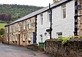
 Cottages , The Common, Shipbourne - geograph.org.uk - 1364085.jpg 640 × 430; 151 KB
-
 Cottages on Cragside estate - geograph.org.uk - 1387547.jpg 640 × 426; 110 KB
-
 Country Lane - geograph.org.uk - 1365729.jpg 480 × 640; 103 KB
-
 County march, Berwick Bridge - geograph.org.uk - 1359132.jpg 640 × 480; 101 KB
-
 Cragside house and the Iron Bridge - geograph.org.uk - 1387553.jpg 600 × 429; 132 KB
-
 Cropper's Farm - geograph.org.uk - 1359571.jpg 640 × 480; 73 KB
-
 Crossens Pool - geograph.org.uk - 1359629.jpg 640 × 480; 39 KB
-

-
 Crystal Palace, Rochester - geograph.org.uk - 1359021.jpg 640 × 480; 81 KB
-
 Cupola, Edinburgh College Of Art - geograph.org.uk - 1469712.jpg 480 × 640; 71 KB
-
 Didcot Power Station - geograph.org.uk - 1410667.jpg 640 × 480; 77 KB
-
 Disused level crossing near Lesbury - geograph.org.uk - 1366475.jpg 640 × 435; 111 KB
-
 Druim Ban - geograph.org.uk - 1529572.jpg 640 × 480; 122 KB
-
 Ducks on Mount Pond - geograph.org.uk - 1439542.jpg 640 × 480; 83 KB
-
 Dunkel Cathedral 20090617 choir exterior.jpg 800 × 555; 219 KB
-
 Dunkeld Cathedral 20090617 Apostles' Stone.jpg 403 × 800; 171 KB
-
 Dunkeld Cathedral 20090617 choir interior.jpg 800 × 612; 269 KB
-
 Dunkeld Cathedral 20090617 effigy Sinclair.jpg 800 × 605; 295 KB
-
 Dunkeld Cathedral 20090617 nave exterior.jpg 800 × 604; 268 KB
-
 Dunkeld Cathedral 20090617 nave interior looking east.jpg 800 × 524; 232 KB
-
 Dunkeld Cathedral 20090617 nave interior looking west.jpg 546 × 800; 223 KB
-
 Dunkeld Cathedral 20090617 south porch.jpg 800 × 558; 304 KB
-
 Dunkeld Cathedral 20090617 tomb Wolf of Badenoch.jpg 800 × 483; 211 KB
-
 Dupplin Cross 20090617 east.jpg 329 × 800; 140 KB
-
 Dupplin Cross 20090617 northwest (cropped).jpg 154 × 702; 81 KB
-
 Dupplin Cross 20090617 northwest.jpg 396 × 800; 195 KB
-
 Dymchurch Beach, Kent - geograph.org.uk - 1360530.jpg 640 × 360; 34 KB
-
 Dymchurch Beach, Kent - geograph.org.uk - 1360556.jpg 640 × 360; 32 KB
-
 Dymchurch Beach, Kent - geograph.org.uk - 1360574.jpg 640 × 358; 27 KB
-
 Dymchurch Railway Station - geograph.org.uk - 1359750.jpg 640 × 360; 76 KB
-
 Dymchurch Seafront, Kent - geograph.org.uk - 1360540.jpg 640 × 360; 36 KB
-

_Large_Fruit-tree_Tortrix_(Archips_podana)_(3635774744).jpg)
_Lozotaenia_forsterana_(3634977687).jpg)
_Crambus_perlella_(3635776408).jpg)
_Scoparia_pyralella_(3634982425).jpg)
_Barred_Straw_(Eulithis_pyraliata)_(3635776270).jpg)
_Freyer%27s_Pug_(Eupithecia_intricata)_(3634970727).jpg)
_Orange_Moth_(Angerona_prunaria)_(3634980875).jpg)
_Heart_%26_Dart_(Agrotis_exclamationis)_(3634976041).jpg)
_Smoky_Wainscot_(Mythimna_impura)_(3634983905).jpg)
_The_Shark_(Cucullia_umbratica)_(3640139432).jpg)
_The_Uncertain_(Hoplodrina_alsines)_(3635797140).jpg)

.jpg)


.jpg)


_-_geograph.org.uk_-_1365833.jpg)
_-_geograph.org.uk_-_1365901.jpg)
_-_geograph.org.uk_-_1365910.jpg)
_-_geograph.org.uk_-_1365914.jpg)
_-_geograph.org.uk_-_1365923.jpg)
_-_geograph.org.uk_-_1365931.jpg)
_-_geograph.org.uk_-_1365938.jpg)
_-_geograph.org.uk_-_1365950.jpg)
_-_geograph.org.uk_-_1365958.jpg)
_-_geograph.org.uk_-_1365843.jpg)
_-_geograph.org.uk_-_1365848.jpg)
_-_geograph.org.uk_-_1365856.jpg)
_-_geograph.org.uk_-_1365863.jpg)
_-_geograph.org.uk_-_1365873.jpg)
_-_geograph.org.uk_-_1365881.jpg)
_-_geograph.org.uk_-_1365885.jpg)
_-_geograph.org.uk_-_1365893.jpg)
.jpg)


_-_geograph.org.uk_-_1362676.jpg)
_-_geograph.org.uk_-_1362694.jpg)


_-_geograph.org.uk_-_1360296.jpg)


_-_geograph.org.uk_-_1362507.jpg)


.jpg)