Category:United Kingdom photographs taken on 2009-04-10
Jump to navigation
Jump to search
| ← | Friday 10 April 2009 | → | ||
| ← | April 2009 | → | ||

United Kingdom photographs taken on 10 April 2009.
Image files should be categorized here automatically using {{taken on}} template. Direct categorisation is also possible, if automatic is impossible.
Subcategories
This category has the following 2 subcategories, out of 2 total.
Media in category "United Kingdom photographs taken on 2009-04-10"
The following 200 files are in this category, out of 1,146 total.
(previous page) (next page)-
 "Er Sir, can you come down please" - geograph.org.uk - 1245529.jpg 480 × 640; 55 KB
-

-

-
 (1917) Early Thorn (Selenia dentaria) (3438336380).jpg 1,500 × 1,004; 1.57 MB
-
 (2260) Dotted Chestnut (Conistra rubiginea) (3437518871).jpg 1,500 × 1,004; 962 KB
-
 (2260) Dotted Chestnut (Conistra rubiginea) (3438326866).jpg 1,500 × 1,004; 965 KB
-
 1971 AMC Javelin muscle car at Wheels Day 2009 in UK.jpg 3,573 × 2,592; 3.77 MB
-

-
 2009 at Carbis Bay station - entrance.jpg 1,024 × 1,366; 399 KB
-
 2009 at Carbis Bay station - platform.jpg 1,366 × 1,024; 616 KB
-
 2009 at Hayle station - crossing entrance.jpg 1,366 × 1,024; 391 KB
-
 2009 at Hayle station - crossing sign.jpg 1,366 × 1,024; 529 KB
-
 2009 at Hayle station - down side entrance.jpg 1,366 × 1,024; 445 KB
-
 2009 at Lelant Saltings station - direction sign.jpg 1,366 × 1,024; 363 KB
-
 2009 at Lelant Saltings station - notice boards.jpg 1,366 × 910; 557 KB
-
 2009 at Lelant Saltings station - platform.jpg 1,366 × 1,024; 535 KB
-
 2009 at Lelant Saltings station - road sign.jpg 1,366 × 1,024; 424 KB
-
 2009 at Lelant station - road side of the building.jpg 1,366 × 1,024; 494 KB
-
 2009 at St Erth station - down side shed.jpg 1,366 × 1,024; 511 KB
-
 2009 at St Erth station - entrance from the road.jpg 1,366 × 1,024; 329 KB
-
 2009 at St Erth station - footbridge.jpg 1,366 × 1,024; 488 KB
-
 2009 at St Ives station - the shop.jpg 1,366 × 1,024; 342 KB
-
 4 Benhall Mill Rd - geograph.org.uk - 1272377.jpg 640 × 430; 75 KB
-
 8 Benhall Mill Rd - geograph.org.uk - 1272381.jpg 640 × 430; 83 KB
-
 A Early Example of Recycling - geograph.org.uk - 1244831.jpg 427 × 640; 265 KB
-
 A group of houses just off Birling Rd - geograph.org.uk - 1272347.jpg 640 × 430; 116 KB
-
-
 A new arrival near Rovie Farm - geograph.org.uk - 1251704.jpg 640 × 482; 222 KB
-
-
 A spring display - geograph.org.uk - 1251053.jpg 640 × 480; 273 KB
-
-

-
 A12 at Feering - geograph.org.uk - 1278329.jpg 640 × 480; 94 KB
-
 A859 - geograph.org.uk - 1257155.jpg 640 × 480; 87 KB
-
 A859 - geograph.org.uk - 1423081.jpg 640 × 480; 86 KB
-
 A859, Seilebost - geograph.org.uk - 1257564.jpg 640 × 480; 129 KB
-
 Abandoned canal, Upper Framilode - geograph.org.uk - 1555161.jpg 640 × 480; 69 KB
-
 Abbey orchard - geograph.org.uk - 1247088.jpg 640 × 426; 123 KB
-
 Abergavenny Arms, Frant - geograph.org.uk - 1272575.jpg 640 × 430; 57 KB
-
 Abhainn Gil an Tàilleir - geograph.org.uk - 1255698.jpg 640 × 480; 103 KB
-
 Above Thornton Force - panoramio - Keith Ruffles.jpg 3,648 × 2,736; 2.48 MB
-
 Above Thornton Force - panoramio.jpg 3,648 × 2,736; 2.47 MB
-
 Across Norber Sike - geograph.org.uk - 1332327.jpg 640 × 480; 176 KB
-
 Airde-chleibhe - geograph.org.uk - 1257116.jpg 640 × 359; 89 KB
-
 Airigh an Domhnall - geograph.org.uk - 1275385.jpg 640 × 427; 110 KB
-
 All gone - geograph.org.uk - 1244715.jpg 640 × 480; 88 KB
-
 All Saints Church, Ellough - geograph.org.uk - 1245377.jpg 640 × 480; 47 KB
-
 All Saints Mappleton - geograph.org.uk - 1801509.jpg 4,000 × 3,000; 2.82 MB
-
 All Saints' church - geograph.org.uk - 1245096.jpg 426 × 640; 87 KB
-
 Allt Bad an t-Seabhaig - geograph.org.uk - 1251852.jpg 640 × 480; 91 KB
-
 Allt Bealach na Ciste - geograph.org.uk - 1256126.jpg 640 × 480; 86 KB
-
 Allt Braglenmore - geograph.org.uk - 1244659.jpg 640 × 480; 97 KB
-
 Almond Grove, Hempstead - geograph.org.uk - 1250226.jpg 640 × 480; 78 KB
-
 Almond Grove, Hempstead - geograph.org.uk - 1250227.jpg 640 × 480; 92 KB
-
 Alucita hexadactyla (3437528917).jpg 1,500 × 1,004; 1.55 MB
-
 An Coileach - geograph.org.uk - 1256541.jpg 640 × 359; 79 KB
-
 An Coileach - geograph.org.uk - 1256546.jpg 640 × 480; 72 KB
-
 An Coileach - geograph.org.uk - 1256562.jpg 640 × 480; 119 KB
-
 An Elric from Bealach an Amais - geograph.org.uk - 1257396.jpg 640 × 428; 49 KB
-
 An t-Eileach and Feith Bhuidhe - geograph.org.uk - 1257921.jpg 640 × 480; 225 KB
-

-
 Approaching Bodsham - geograph.org.uk - 1261138.jpg 640 × 480; 128 KB
-
 Approaching Bodsham from the west - geograph.org.uk - 1261146.jpg 640 × 480; 163 KB
-
 Approaching Cold Aston - geograph.org.uk - 1246386.jpg 640 × 427; 102 KB
-
 Approaching Fineglen - geograph.org.uk - 1244724.jpg 640 × 480; 95 KB
-

-

-
 Aquatic Sun Set - Flickr - Antonis Lamnatos.jpg 709 × 1,024; 239 KB
-
 At Old Mill Lane, near Antrobus - geograph.org.uk - 1283490.jpg 480 × 640; 97 KB
-
 Aultachurn - geograph.org.uk - 1246715.jpg 640 × 427; 231 KB
-
 Aultahuish - geograph.org.uk - 1244864.jpg 640 × 403; 211 KB
-
 Aultahurn - geograph.org.uk - 1244964.jpg 640 × 427; 221 KB
-
 Aultahurn - geograph.org.uk - 1244991.jpg 640 × 427; 243 KB
-
 Aultahurn - geograph.org.uk - 1244996.jpg 640 × 427; 249 KB
-
 Aultahurn - geograph.org.uk - 1246724.jpg 640 × 427; 242 KB
-
 Aultaquhorn - geograph.org.uk - 1245002.jpg 640 × 400; 224 KB
-
 Austwick Beck - geograph.org.uk - 1332253.jpg 640 × 480; 140 KB
-
 Ayshford Bridge, Grand Western Canal - geograph.org.uk - 1244955.jpg 640 × 480; 108 KB
-
-
 Babell Chapel - geograph.org.uk - 1571724.jpg 640 × 480; 95 KB
-
 Back Towards the Join - geograph.org.uk - 1245704.jpg 640 × 480; 42 KB
-
 Ballachraggan - geograph.org.uk - 1244948.jpg 640 × 407; 242 KB
-
 Ballachraggan - geograph.org.uk - 1244957.jpg 640 × 427; 291 KB
-
 Bank Street - geograph.org.uk - 1253639.jpg 640 × 486; 77 KB
-
 Bank Street - geograph.org.uk - 1253653.jpg 640 × 480; 80 KB
-
 Barn conversion at Woodlands Farm - geograph.org.uk - 1244742.jpg 640 × 480; 84 KB
-
 Barn next to track to Wharfe - geograph.org.uk - 1332264.jpg 640 × 480; 155 KB
-
 Barrow Haven - geograph.org.uk - 1245270.jpg 640 × 426; 63 KB
-
 Barrow Haven - geograph.org.uk - 1245288.jpg 640 × 426; 63 KB
-
 Barrow Haven level crossing - geograph.org.uk - 1245279.jpg 426 × 640; 82 KB
-
 Barrow Haven rail bridge - geograph.org.uk - 1245299.jpg 640 × 426; 74 KB
-
 Bayham Rd, looking SE. - geograph.org.uk - 1272448.jpg 640 × 430; 95 KB
-
 Beach Huts, Beachlands - geograph.org.uk - 1245721.jpg 640 × 480; 65 KB
-
 Beach Huts, West Beach - geograph.org.uk - 1245543.jpg 480 × 640; 49 KB
-
 Beacon in a sheep field, Elmsted - geograph.org.uk - 1245913.jpg 640 × 480; 156 KB
-
 Bealach an Ionalaidh - geograph.org.uk - 1256621.jpg 640 × 480; 111 KB
-
 Bealach Garbh - geograph.org.uk - 1256532.jpg 640 × 480; 96 KB
-
 Bealach na Ciste - geograph.org.uk - 1256557.jpg 640 × 359; 110 KB
-
 Bealach na Ciste - geograph.org.uk - 1256565.jpg 640 × 480; 93 KB
-
 Beats Wood - geograph.org.uk - 1244871.jpg 640 × 480; 169 KB
-
 Beer Garden, Abergavenny Arms, Frant - geograph.org.uk - 1272573.jpg 640 × 430; 100 KB
-
 Beezley Falls - panoramio.jpg 3,648 × 2,736; 2.48 MB
-
 Bench, Farmcombe Rd Recreation Ground - geograph.org.uk - 1273484.jpg 640 × 430; 102 KB
-
-
 Benhall Mill Rd - geograph.org.uk - 1272434.jpg 640 × 430; 98 KB
-
-
 Bifurcating pylons - geograph.org.uk - 1244911.jpg 640 × 480; 51 KB
-
 Birch Grove, Hempstead - geograph.org.uk - 1250231.jpg 640 × 480; 57 KB
-
 Birling Rd - geograph.org.uk - 1272340.jpg 640 × 430; 77 KB
-
-

-
 Birling Rd, Forest Rd junction - geograph.org.uk - 1272351.jpg 640 × 430; 77 KB
-
 Black Bridge, Grand Western Canal - geograph.org.uk - 1246130.jpg 640 × 480; 74 KB
-
 Blackbird (Turdus merula), Inverness - geograph.org.uk - 1247058.jpg 640 × 640; 217 KB
-
 Blackmyre - geograph.org.uk - 1246666.jpg 640 × 427; 261 KB
-
 Blackness Castle - geograph.org.uk - 1246030.jpg 640 × 480; 99 KB
-
 Blackthorn in flower near Hill Street - geograph.org.uk - 1245893.jpg 640 × 480; 138 KB
-
 BM76 VIGILANCE at Brixham - geograph.org.uk - 1250499.jpg 640 × 480; 56 KB
-
 Boat under Horse Close Bridge - geograph.org.uk - 1283005.jpg 640 × 481; 340 KB
-
 Body in the bath - geograph.org.uk - 1572096.jpg 640 × 480; 124 KB
-

-
 Bog, forest and crags behind Balgowan - geograph.org.uk - 1257902.jpg 640 × 480; 226 KB
-
 Bonfire site at Amberley Working Museum - geograph.org.uk - 1245582.jpg 640 × 480; 158 KB
-
 Boulder Beach - geograph.org.uk - 1245261.jpg 640 × 425; 92 KB
-
 Boulder Beach - geograph.org.uk - 1277272.jpg 640 × 470; 114 KB
-
 Boulder beach near Broad Ebb - geograph.org.uk - 1245272.jpg 640 × 394; 95 KB
-

-
 Bramford Lane recreation ground - geograph.org.uk - 1244727.jpg 640 × 443; 47 KB
-
 Bramford Lane recreation ground - geograph.org.uk - 1244731.jpg 640 × 402; 44 KB
-
 Bramford Lawn cemetery - geograph.org.uk - 1244766.jpg 640 × 480; 95 KB
-
 Bridge by the Mill - geograph.org.uk - 1244748.jpg 640 × 480; 125 KB
-
 Bridge No 17 On Lancaster Canal - geograph.org.uk - 1245622.jpg 640 × 427; 99 KB
-
 Bridge No 18 On Lancaster Canal - geograph.org.uk - 1245630.jpg 640 × 427; 95 KB
-
 Bridge No 19 on Lancaster Canal - geograph.org.uk - 1245635.jpg 640 × 427; 92 KB
-
 Bridge No 21 on Lancaster Canal - geograph.org.uk - 1245645.jpg 640 × 427; 58 KB
-
 Bridge No 22 on Lancaster Canal - geograph.org.uk - 1245650.jpg 640 × 427; 72 KB
-
 Bridge No 23 on Lancaster Canal - geograph.org.uk - 1245657.jpg 640 × 427; 80 KB
-
 Bridge No 24 on Lancaster Canal - geograph.org.uk - 1245665.jpg 640 × 427; 99 KB
-
 Bridge No 25 on Lancaster Canal - geograph.org.uk - 1245676.jpg 640 × 427; 80 KB
-
 Bridge No 26 on Lancaster Canal - geograph.org.uk - 1245715.jpg 640 × 427; 97 KB
-
 Bridge No 27 on Lancaster Canal - geograph.org.uk - 1245779.jpg 640 × 427; 96 KB
-
 Bridge No 28 on Lancaster Canal - geograph.org.uk - 1245776.jpg 640 × 427; 73 KB
-
 Bridge No 29 on Lancaster Canal - geograph.org.uk - 1245770.jpg 640 × 427; 64 KB
-
 Bridge No 30 on Lancaster Canal - geograph.org.uk - 1245766.jpg 640 × 427; 103 KB
-
 Bridge No 31 on Lancaster Canal - geograph.org.uk - 1245763.jpg 640 × 427; 74 KB
-
 Bridge No 32 on Lancaster Canal - geograph.org.uk - 1245758.jpg 640 × 427; 95 KB
-
 Bridge No 34 on Lancaster Canal - geograph.org.uk - 1245757.jpg 640 × 427; 73 KB
-
 Bridge No 35 on Lancaster Canal - geograph.org.uk - 1245755.jpg 640 × 427; 83 KB
-
 Bridge No 36 on Lancaster Canal - geograph.org.uk - 1245753.jpg 640 × 427; 95 KB
-
 Bridge No 39 on Lancaster Canal - geograph.org.uk - 1245750.jpg 640 × 427; 104 KB
-
 Bridge No 40 on Lancaster Canal - geograph.org.uk - 1245748.jpg 640 × 427; 69 KB
-
 Bridge No 41 on Lancaster Canal - geograph.org.uk - 1245747.jpg 640 × 427; 64 KB
-
 Bridge No 42 on Lancaster Canal - geograph.org.uk - 1245746.jpg 640 × 427; 75 KB
-
 Bridge No 43 on Lancaster Canal - geograph.org.uk - 1245743.jpg 640 × 427; 46 KB
-
 Bridge No 45 on Lancaster Canal - geograph.org.uk - 1245741.jpg 640 × 427; 100 KB
-
 Bridge No 47 on Lancaster Canal - geograph.org.uk - 1245738.jpg 640 × 427; 63 KB
-
 Bridge No 48 on Lancaster Canal - geograph.org.uk - 1245734.jpg 640 × 427; 83 KB
-
 Bridge No 48 on Lancaster Canal - geograph.org.uk - 1245736.jpg 640 × 427; 94 KB
-
 Bridge No 50 on Lancaster Canal - geograph.org.uk - 1245732.jpg 640 × 427; 97 KB
-
 Bridge No 51 on Lancaster Canal - geograph.org.uk - 1245730.jpg 640 × 427; 90 KB
-
 Bridge No 53 on Lancaster Canal - geograph.org.uk - 1245726.jpg 640 × 427; 82 KB
-
 Bridge No 54 on Lancaster Canal - geograph.org.uk - 1245723.jpg 640 × 427; 75 KB
-

-
 Bridge over Burn of Yellowbog - geograph.org.uk - 1246711.jpg 640 × 427; 262 KB
-
 Bridge over the Bure Valley Railway - geograph.org.uk - 1244696.jpg 640 × 480; 115 KB
-
 Bridleway to Little Park farm - geograph.org.uk - 1244920.jpg 640 × 480; 102 KB
-
 Brighton Road, Coulsdon - geograph.org.uk - 1244903.jpg 640 × 480; 93 KB
-
 Brighton Road, Hooley - geograph.org.uk - 1244894.jpg 640 × 480; 72 KB
-
 Brighton Road, Hooley - geograph.org.uk - 1244895.jpg 640 × 480; 66 KB
-
 Brixham breakwater light - geograph.org.uk - 1250513.jpg 640 × 480; 49 KB
-
 Brixham Coastguard station - geograph.org.uk - 1250435.jpg 640 × 480; 61 KB
-
 Brixham, old fuelling jetty - geograph.org.uk - 1250507.jpg 640 × 480; 53 KB
-
 Brocklesby Mausoleum - geograph.org.uk - 1245135.jpg 640 × 426; 62 KB
-
 Brocklesby Mausoleum - geograph.org.uk - 1245139.jpg 640 × 426; 63 KB
-
 Brook Cottages, Sotterley - geograph.org.uk - 1245318.jpg 640 × 480; 117 KB
-
 Buckland Bridge, Sampford Peverell - geograph.org.uk - 1244809.jpg 640 × 480; 87 KB
-
 Bught Park, Inverness - geograph.org.uk - 1247155.jpg 640 × 426; 112 KB
-

-
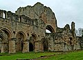
 Buildings at Buildwas Abbey - geograph.org.uk - 1311538.jpg 640 × 411; 72 KB
-
 Buildings at Elmsted Court Farm - geograph.org.uk - 1246037.jpg 640 × 480; 145 KB
-
 Buildings on Stelling Lodge Farm - geograph.org.uk - 1244828.jpg 640 × 480; 111 KB
-
 Buildwas Abbey (detail) - geograph.org.uk - 1311685.jpg 427 × 640; 82 KB
-
 Buildwas Abbey (detail) - geograph.org.uk - 1311695.jpg 640 × 492; 105 KB
-
 Buildwas Abbey - arch and gate - geograph.org.uk - 1313071.jpg 416 × 640; 64 KB
-

-

-
-
 Buildwas Abbey - remains of the tower - geograph.org.uk - 1311672.jpg 423 × 640; 103 KB
-

-
-

-
 Buildwas Abbey - west end of nave - geograph.org.uk - 1311647.jpg 491 × 640; 113 KB
-
 Buildwas Abbey Chapter House - geograph.org.uk - 1311450.jpg 410 × 640; 65 KB
-
 Buildwas Abbey Chapter House roof - geograph.org.uk - 1311471.jpg 429 × 640; 74 KB
-
 Buildwas Abbey Chapter House roof - geograph.org.uk - 1311483.jpg 640 × 427; 75 KB
-
-
 Buildwas Abbey Crypt (interior) - geograph.org.uk - 1311565.jpg 521 × 640; 103 KB
-
 Buildwas Abbey Crypt (interior) - geograph.org.uk - 1311597.jpg 419 × 640; 89 KB
-
 Buildwas Abbey nave (interior) - geograph.org.uk - 1311629.jpg 452 × 640; 91 KB
-
 Buildwas Abbey nave - geograph.org.uk - 1311615.jpg 640 × 427; 70 KB


_Early_Thorn_(Selenia_dentaria)_(3438336380).jpg)
_Dotted_Chestnut_(Conistra_rubiginea)_(3437518871).jpg)
_Dotted_Chestnut_(Conistra_rubiginea)_(3438326866).jpg)


.jpg)


,_Inverness_-_geograph.org.uk_-_1247058.jpg)


_-_geograph.org.uk_-_1311685.jpg)
_-_geograph.org.uk_-_1311695.jpg)

_-_geograph.org.uk_-_1244947.jpg)


_-_geograph.org.uk_-_1311565.jpg)
_-_geograph.org.uk_-_1311597.jpg)
_-_geograph.org.uk_-_1311629.jpg)
