Category:United Kingdom photographs taken on 2009-02-24
Jump to navigation
Jump to search
| ← | Tuesday 24 February 2009 | → | ||
| ← | February 2009 | → | ||

United Kingdom photographs taken on 24 February 2009.
Image files should be categorized here automatically using {{taken on}} template. Direct categorisation is also possible, if automatic is impossible.
Subcategories
This category has only the following subcategory.
Media in category "United Kingdom photographs taken on 2009-02-24"
The following 200 files are in this category, out of 577 total.
(previous page) (next page)-
 (1025) Tortricodes alternella (3307840642).jpg 2,848 × 2,136; 1.47 MB
-
 (1932) Spring Usher (Agriopis leucophaearia) (3307841866).jpg 2,848 × 2,136; 1.49 MB
-
 392m top on ridge to Patie's Hill - geograph.org.uk - 1177972.jpg 640 × 480; 94 KB
-

-

-
 A hill view near Soutra - geograph.org.uk - 1177438.jpg 640 × 480; 42 KB
-
 A scene at Crichton Mains Farm - geograph.org.uk - 1177519.jpg 640 × 480; 56 KB
-
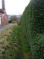
 A tree tunnel - geograph.org.uk - 1177409.jpg 640 × 480; 123 KB
-
 A winter scene in Western Road - geograph.org.uk - 1177476.jpg 640 × 480; 62 KB
-
 A winter's day in Northharbour Road - geograph.org.uk - 1177484.jpg 640 × 480; 66 KB
-
 Abandoned Barn, Grane - geograph.org.uk - 1177753.jpg 640 × 480; 68 KB
-
 Allen's Lock, Upper Heyford - geograph.org.uk - 1181716.jpg 480 × 640; 90 KB
-
 Allotments - Myers Croft - geograph.org.uk - 1178887.jpg 640 × 480; 272 KB
-
 Allt Saigh entering Head Pond at Dam - geograph.org.uk - 1179730.jpg 640 × 480; 55 KB
-
 Alpacas at Lower Mullacott Farm. - geograph.org.uk - 1177118.jpg 640 × 427; 48 KB
-
 Approaching cars in Western Road - geograph.org.uk - 1177493.jpg 640 × 480; 80 KB
-

-

-
 Arcade near the bus station - geograph.org.uk - 1182497.jpg 427 × 640; 76 KB
-

-
-
 Athelstan Lane - Farnley Lane - geograph.org.uk - 1177195.jpg 640 × 455; 178 KB
-
 Athelstan Lane - The Crossways - geograph.org.uk - 1177239.jpg 640 × 480; 220 KB
-
 Audenshaw Reservoir - geograph.org.uk - 1176921.jpg 640 × 480; 121 KB
-
 Balanced Beach Boulders - geograph.org.uk - 1724486.jpg 3,072 × 2,304; 1.53 MB
-
 Bandit (3306121271).jpg 3,534 × 2,586; 5.89 MB
-
 Base for new sub-station - geograph.org.uk - 1178638.jpg 640 × 460; 73 KB
-
 Beck - Weston Ridge - geograph.org.uk - 1177914.jpg 480 × 640; 347 KB
-
 Beck - Weston Ridge - geograph.org.uk - 1177915.jpg 480 × 640; 336 KB
-
 Beetham - geograph.org.uk - 1177102.jpg 480 × 640; 54 KB
-
 Belmont Grove - Weston Lane - geograph.org.uk - 1178616.jpg 640 × 431; 161 KB
-
 Belney House in Woofferton Road - geograph.org.uk - 1177320.jpg 640 × 480; 47 KB
-
 Bethel Church Hall - Myers Croft - geograph.org.uk - 1178878.jpg 640 × 453; 202 KB
-
 Bickerton Way - Meagill Rise - geograph.org.uk - 1178536.jpg 640 × 425; 148 KB
-
 Bickerton Way - Weston Drive - geograph.org.uk - 1178572.jpg 640 × 450; 170 KB
-
 Billams Hill - geograph.org.uk - 1177178.jpg 640 × 480; 257 KB
-
 Black Horse Stables - Westgate - geograph.org.uk - 1178786.jpg 640 × 556; 280 KB
-
 Blenheim Close, Ross-on-Wye - geograph.org.uk - 1176947.jpg 640 × 481; 202 KB
-
 Blind Jack Metcalf 1717 -1810 - geograph.org.uk - 1177364.jpg 640 × 480; 91 KB
-
 Bog near Bogeney - geograph.org.uk - 1177847.jpg 640 × 427; 365 KB
-
 Bog pond near Ty Mawr - geograph.org.uk - 1177197.jpg 640 × 480; 122 KB
-
 Bogeney Farm - geograph.org.uk - 1177850.jpg 640 × 427; 288 KB
-
 Boggy Moorland on Cairn Eney - geograph.org.uk - 1177829.jpg 640 × 427; 291 KB
-
 Bondgate - geograph.org.uk - 1178822.jpg 640 × 441; 165 KB
-

-
 Bridge 200A, Oxford Canal - geograph.org.uk - 1181741.jpg 640 × 480; 83 KB
-
 Bridge Avenue - Bridge Street - geograph.org.uk - 1178765.jpg 640 × 480; 241 KB
-
 Bridge Over Dean Brook - geograph.org.uk - 1177022.jpg 640 × 480; 140 KB
-
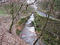
 Bridge over the Fairliehope Burn - geograph.org.uk - 1178008.jpg 640 × 480; 102 KB
-
 Bridleway from road into Kings Wood - geograph.org.uk - 1189305.jpg 640 × 481; 132 KB
-
 Bridleway junction in King's Wood - geograph.org.uk - 1189258.jpg 640 × 481; 136 KB
-
 Bridleway near Magpie Hall Farm - geograph.org.uk - 1177426.jpg 640 × 475; 68 KB
-
 Bridleway on Lenham Road - geograph.org.uk - 1189266.jpg 481 × 640; 116 KB
-
 Brooklea and university buildings - geograph.org.uk - 1189783.jpg 640 × 480; 69 KB
-
 Burn Airfield. Eastern end of cross runway. - geograph.org.uk - 1727016.jpg 2,816 × 2,112; 2.52 MB
-
 Burn Airfield. From Northeast Corner. - geograph.org.uk - 1727027.jpg 2,816 × 2,112; 2.49 MB
-
 Burn Airfield. Southern End of Main Runway. - geograph.org.uk - 1727009.jpg 2,816 × 2,112; 2.48 MB
-
 Burn Gliding Club HQ. - geograph.org.uk - 1727040.jpg 2,816 × 2,112; 2.62 MB
-
 Burras Lane - viewed from Kirkgate - geograph.org.uk - 1178834.jpg 640 × 480; 272 KB
-
 Bus in Ludlow Road - geograph.org.uk - 1177361.jpg 480 × 640; 54 KB
-
-
 Cairn above the bunker - geograph.org.uk - 1188115.jpg 640 × 512; 51 KB
-

-
 Cairncroft house - geograph.org.uk - 1189295.jpg 640 × 480; 83 KB
-
 Capel a Ty Capel Gosen, Llangwyllog - geograph.org.uk - 1360934.jpg 640 × 480; 63 KB
-
 Car dealer on Ponthir Road - geograph.org.uk - 1189793.jpg 640 × 480; 119 KB
-
-

-
-
 Carn Coire Rainich across Allt Saigh - geograph.org.uk - 1177454.jpg 640 × 480; 64 KB
-
 Carn Mòr across Allt Saigh - geograph.org.uk - 1178745.jpg 640 × 480; 70 KB
-
 Carn Mòr across Allt Saigh - geograph.org.uk - 1178750.jpg 640 × 480; 62 KB
-
 Carn na Caorach across Hydro track - geograph.org.uk - 1178799.jpg 640 × 480; 73 KB
-
 Carrot's under wraps - geograph.org.uk - 1727078.jpg 2,816 × 2,112; 2.88 MB
-
 Catholic Church of the Good Shepherd - geograph.org.uk - 1189188.jpg 640 × 481; 86 KB
-
 Cattle Grid near Whinhowe Gill - geograph.org.uk - 1177033.jpg 640 × 480; 60 KB
-
 Cattle Market Street - Bridge Street - geograph.org.uk - 1177175.jpg 640 × 467; 189 KB
-
 Chapel in Chapel Haddlesey - geograph.org.uk - 1726922.jpg 2,816 × 2,112; 2.59 MB
-
 Chatsworth Close, Ross-on-Wye - geograph.org.uk - 1176953.jpg 640 × 480; 186 KB
-
 Chegworth Barn - geograph.org.uk - 1189363.jpg 640 × 481; 67 KB
-
 Chippendale Rise - Farnley Lane - geograph.org.uk - 1177192.jpg 640 × 446; 169 KB
-
 Chippendale Rise - The Crossways - geograph.org.uk - 1177243.jpg 640 × 443; 168 KB
-
 Church Entrance - geograph.org.uk - 1177091.jpg 480 × 640; 80 KB
-
 Church on Church Lane, Lenham - geograph.org.uk - 1189180.jpg 640 × 481; 93 KB
-
 Church on the hill - geograph.org.uk - 1177059.jpg 640 × 427; 58 KB
-
 Clapgate - geograph.org.uk - 1178771.jpg 640 × 449; 204 KB
-
 Cleared Woodland alongside Lenham Road - geograph.org.uk - 1189284.jpg 640 × 481; 111 KB
-
-
 Cocklaw Fell - geograph.org.uk - 1177097.jpg 640 × 480; 68 KB
-

-
-
 Compstall Road, Romiley - geograph.org.uk - 1183601.jpg 640 × 457; 93 KB
-
 Corner of Fence on Cairn Eney - geograph.org.uk - 1177837.jpg 640 × 427; 282 KB
-
 Cors Fochno - geograph.org.uk - 1177146.jpg 1,000 × 750; 1.06 MB
-
 Cors Fochno - geograph.org.uk - 1177149.jpg 640 × 471; 132 KB
-
 Cors Fochno - geograph.org.uk - 1177155.jpg 1,000 × 750; 1.13 MB
-
 Cors Fochno south of Ty Mawr - geograph.org.uk - 1177191.jpg 640 × 480; 116 KB
-
 Cors Fochno west of Llancynfelyn - geograph.org.uk - 1177129.jpg 640 × 480; 110 KB
-

-
 Cottage near Lount - geograph.org.uk - 1177631.jpg 640 × 480; 66 KB
-
 Cottages at Burnside - geograph.org.uk - 1177515.jpg 640 × 480; 71 KB
-
 Courthouse Street - geograph.org.uk - 1178773.jpg 640 × 477; 178 KB
-
 CPD in Southampton Road - geograph.org.uk - 1177389.jpg 640 × 480; 65 KB
-
 Crichton Church - geograph.org.uk - 1178304.jpg 640 × 480; 75 KB
-
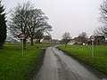
 Crichton Village road. - geograph.org.uk - 1177527.jpg 640 × 585; 113 KB
-
 Croft Avenue - Newall Carr Road - geograph.org.uk - 1177442.jpg 640 × 480; 252 KB
-
 Croft House Drive - Newall Carr Road - geograph.org.uk - 1177425.jpg 640 × 425; 196 KB
-
 Crossroads - geograph.org.uk - 1177053.jpg 640 × 480; 52 KB
-
 Crossroads, Hopcroft's Holt - geograph.org.uk - 1181681.jpg 640 × 480; 66 KB
-
 Crowfield Baptist Church - geograph.org.uk - 1177132.jpg 3,072 × 2,304; 1.35 MB
-
 Crowfield Sports Ground - geograph.org.uk - 1177145.jpg 3,072 × 2,304; 1.36 MB
-
 Crowfield Village Hall - geograph.org.uk - 1177139.jpg 640 × 480; 64 KB
-
 Cul-de-sac off Blenheim Close - geograph.org.uk - 1176949.jpg 640 × 481; 206 KB
-

-
-
 Dean Brook - geograph.org.uk - 1177034.jpg 640 × 480; 142 KB
-
 Decorative stonework - geograph.org.uk - 1189112.jpg 640 × 480; 113 KB
-
 Deer Fencing across new Track - geograph.org.uk - 1178093.jpg 640 × 480; 69 KB
-
 Den Lane - geograph.org.uk - 1177889.jpg 480 × 640; 94 KB
-

-
 Denton Mast - geograph.org.uk - 1176942.jpg 478 × 640; 117 KB
-
 Directional roadsign in Lamphey - geograph.org.uk - 1176810.jpg 640 × 480; 108 KB
-
 Down towards the Earne - geograph.org.uk - 1189274.jpg 640 × 480; 86 KB
-
 Driveway to Staunton Harold Hall - geograph.org.uk - 1177635.jpg 640 × 480; 50 KB
-
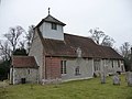
 Dummer - All Saints Church - geograph.org.uk - 1216151.jpg 640 × 480; 73 KB
-
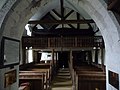
 Dummer - All Saints Church - geograph.org.uk - 1216202.jpg 640 × 480; 60 KB
-
 Dummer - All Saints Church - geograph.org.uk - 1216236.jpg 640 × 480; 71 KB
-
 Dummer - All Saints Church - geograph.org.uk - 1216274.jpg 640 × 480; 57 KB
-
 Dummer - All Saints Church - geograph.org.uk - 1216293.jpg 640 × 480; 48 KB
-
 Dummer - Chapel - geograph.org.uk - 1216434.jpg 640 × 480; 107 KB
-
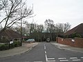
 Dummer - Down Street - geograph.org.uk - 1216516.jpg 640 × 480; 62 KB
-
 Dummer - Down Street - geograph.org.uk - 1216535.jpg 640 × 480; 97 KB
-
 Dummer - Graveyard - geograph.org.uk - 1216079.jpg 640 × 480; 111 KB
-
 Dummer - Iron Gravestone - geograph.org.uk - 1216254.jpg 480 × 640; 114 KB
-
 Dummer - Ivy Cottages - geograph.org.uk - 1216129.jpg 640 × 480; 68 KB
-
 Dummer - Path - geograph.org.uk - 1216582.jpg 640 × 480; 82 KB
-
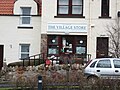
 Dummer - Stores - geograph.org.uk - 1216388.jpg 640 × 480; 58 KB
-
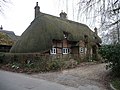 Dummer - Thatched Cottage - geograph.org.uk - 1216341.jpg 640 × 480; 93 KB
-
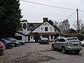 Dummer - The Queen Inn - geograph.org.uk - 1216316.jpg 640 × 480; 62 KB
-
 Dummer - Village Pond - geograph.org.uk - 1216606.jpg 640 × 480; 117 KB
-
 Dummer - Village Seat - geograph.org.uk - 1216457.jpg 640 × 480; 66 KB
-
 Dunge Booth Lock - geograph.org.uk - 1177888.jpg 640 × 480; 91 KB
-
 Early Spring flowers in Hempsted Road - geograph.org.uk - 1177369.jpg 640 × 480; 116 KB
-
 East Saltoun has a shop^ - geograph.org.uk - 1178294.jpg 640 × 480; 80 KB
-
 Eastern carriageway of Western Road - geograph.org.uk - 1177440.jpg 480 × 640; 81 KB
-
 Edgcumbe Arms, Cremyll - geograph.org.uk - 1312877.jpg 640 × 426; 55 KB
-
 Edwards Close - geograph.org.uk - 1177358.jpg 640 × 480; 71 KB
-
 Egerton Gardens - geograph.org.uk - 1179217.jpg 480 × 640; 120 KB
-
 Egger factory at night - geograph.org.uk - 1177884.jpg 430 × 640; 26 KB
-
 Egton Road - geograph.org.uk - 1177965.jpg 640 × 480; 239 KB
-

-
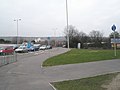
 Empty car park just off Western Road - geograph.org.uk - 1177468.jpg 640 × 480; 62 KB
-

-

-
 Entrance to Watergate Farm - geograph.org.uk - 1177933.jpg 640 × 485; 184 KB
-

-
 Fairbourne Manor - geograph.org.uk - 1189241.jpg 640 × 481; 80 KB
-
 Fairbourne Manor Oast House - geograph.org.uk - 1189244.jpg 640 × 481; 94 KB
-
 Fairbourne Mill Barn - geograph.org.uk - 1189225.jpg 640 × 481; 90 KB
-
 Fallen Tree in King's Wood - geograph.org.uk - 1189252.jpg 640 × 481; 127 KB
-
 Farnley Lane - Billams Hill - geograph.org.uk - 1177183.jpg 640 × 420; 179 KB
-
 Fence and track on Cairn Eney - geograph.org.uk - 1177826.jpg 640 × 427; 296 KB
-
 Ferrers Centre - geograph.org.uk - 1177629.jpg 640 × 484; 55 KB
-

-
 Field edge near Burn Lane - geograph.org.uk - 1726981.jpg 2,816 × 2,112; 2.77 MB
-
 Field south of Burn Lane - geograph.org.uk - 1726986.jpg 2,816 × 2,112; 2.9 MB
-
 Flood Ponds - geograph.org.uk - 1177063.jpg 640 × 480; 87 KB
-
-

-
 Footpath - geograph.org.uk - 1177876.jpg 640 × 480; 118 KB
-
 Footpath - Weston Lane - geograph.org.uk - 1178614.jpg 480 × 640; 276 KB
-

-
 Footpath crosses Blind Mary's Lane - geograph.org.uk - 1189174.jpg 640 × 481; 77 KB
-
 Footpath crosses Chegworth Road - geograph.org.uk - 1189360.jpg 640 × 481; 64 KB
-

-
 Footpath crossroads on Water lane - geograph.org.uk - 1189353.jpg 640 × 481; 100 KB
-

-

-

-

-

-
 Footpath junction in Kings Wood - geograph.org.uk - 1189310.jpg 640 × 481; 137 KB
-
 Footpath junction near Spion Kop Farm - geograph.org.uk - 1190606.jpg 640 × 481; 117 KB
-
 Footpath on Water Lane - geograph.org.uk - 1189344.jpg 640 × 481; 137 KB
-
 Footpath over Grane - geograph.org.uk - 1177793.jpg 640 × 480; 88 KB
-
 Footpath over Grane - geograph.org.uk - 1177796.jpg 480 × 640; 73 KB
-
 Footpath to Mary's Wood - geograph.org.uk - 1177812.jpg 640 × 480; 97 KB
-
 Freshly cut timber - geograph.org.uk - 1189283.jpg 640 × 480; 95 KB
-
 Friendly pony in Spion Kop Farm - geograph.org.uk - 1190613.jpg 640 × 481; 62 KB
-
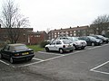
 Full car park just off Western Road - geograph.org.uk - 1177469.jpg 640 × 480; 101 KB
-

-
 Gateforth from the north - geograph.org.uk - 1726370.jpg 2,816 × 2,112; 2.52 MB
-
 Gateforth village green - geograph.org.uk - 1726379.jpg 2,816 × 2,112; 2.85 MB
-

-
 George V postbox, Stratford sub Castle - geograph.org.uk - 1177544.jpg 479 × 640; 164 KB
-
 Gleneagles Hotel - geograph.org.uk - 1188089.jpg 640 × 480; 57 KB
-
 Goalmouth at Paulsgrove F.C. - geograph.org.uk - 1177157.jpg 480 × 640; 54 KB
-
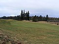 Golf fairway - geograph.org.uk - 1188137.jpg 640 × 480; 51 KB
-
 Golfers on the green - geograph.org.uk - 1188349.jpg 640 × 480; 105 KB
-
 Gorge and River Nethy - geograph.org.uk - 1177011.jpg 640 × 480; 112 KB
_Tortricodes_alternella_(3307840642).jpg)
_Spring_Usher_(Agriopis_leucophaearia)_(3307841866).jpg)


.jpg)


.jpg)


