Category:United Kingdom photographs taken on 2008-09-24
Jump to navigation
Jump to search
| ← | Wednesday 24 September 2008 | → | ||
| ← | September 2008 | → | ||

United Kingdom photographs taken on 24 September 2008.
Image files should be categorized here automatically using {{taken on}} template. Direct categorisation is also possible, if automatic is impossible.
Subcategories
This category has the following 2 subcategories, out of 2 total.
S
Media in category "United Kingdom photographs taken on 2008-09-24"
The following 200 files are in this category, out of 731 total.
(previous page) (next page)-

-
 "......OK, OK, I'm going......." - geograph.org.uk - 984216.jpg 640 × 456; 212 KB
-

-
 "Roman Wall" at Hare Hill - geograph.org.uk - 983233.jpg 640 × 480; 88 KB
-
 'Torm Sara' in dry dock, Belfast - geograph.org.uk - 978787.jpg 640 × 459; 343 KB
-
 'Torm Sara' in dry dock, Belfast - geograph.org.uk - 978793.jpg 474 × 640; 316 KB
-
 'Torm Sara' in dry dock, Belfast - geograph.org.uk - 978794.jpg 640 × 586; 404 KB
-
 15 lane motorway - geograph.org.uk - 977823.jpg 640 × 359; 76 KB
-
 A Back Lane in Ramsbottom - geograph.org.uk - 990000.jpg 640 × 480; 88 KB
-
 A chunk of beach is missing - geograph.org.uk - 978592.jpg 640 × 480; 118 KB
-
 A Corner of Squabmoor Reservoir - geograph.org.uk - 977644.jpg 640 × 480; 78 KB
-
-
 A good day for jet skiing - geograph.org.uk - 978298.jpg 640 × 448; 124 KB
-

-

-
 A holiday retreat by the beach - geograph.org.uk - 978652.jpg 640 × 480; 135 KB
-
 A home by the beach - geograph.org.uk - 978648.jpg 640 × 462; 116 KB
-
 A memorial drinking fountain in Barr - geograph.org.uk - 1004924.jpg 421 × 640; 139 KB
-
 A ruined building beside Cart Gap Road - geograph.org.uk - 978238.jpg 640 × 480; 177 KB
-
 A section of Vallum near Irthington - geograph.org.uk - 983221.jpg 640 × 480; 86 KB
-

-
 A Standing Stone in Bandirran Woods - geograph.org.uk - 977888.jpg 620 × 421; 69 KB
-
 A view from the path - geograph.org.uk - 980066.jpg 480 × 640; 107 KB
-

-
 A1(M) Motorway near Water End - geograph.org.uk - 1037146.jpg 640 × 480; 90 KB
-
 Access Ramp onto the beach - geograph.org.uk - 978271.jpg 640 × 480; 128 KB
-
 Access road down to the Gazelle Hotel - geograph.org.uk - 1002341.jpg 640 × 480; 114 KB
-
 Adlingfleet Drain - geograph.org.uk - 1049836.jpg 640 × 480; 55 KB
-
 Aerial view Ruthin - geograph.org.uk - 1189892.jpg 640 × 427; 94 KB
-
 Afternoon at Outfitting Wharf, Belfast - geograph.org.uk - 978845.jpg 640 × 465; 335 KB
-

-
 Ancient Cannon - geograph.org.uk - 1012387.jpg 640 × 428; 115 KB
-

-

-
 Approaching Cart Gap - geograph.org.uk - 978256.jpg 640 × 480; 121 KB
-
 Approaching Low Light - geograph.org.uk - 978579.jpg 640 × 428; 98 KB
-
 Approaching Ty Slaters, Llandegfan - geograph.org.uk - 1003710.jpg 640 × 480; 75 KB
-
 Arable hillside - geograph.org.uk - 977626.jpg 640 × 471; 138 KB
-
 Arable land around Llanwarne Court - geograph.org.uk - 978739.jpg 640 × 480; 198 KB
-
 Autumn colours above Dunvegan - geograph.org.uk - 980069.jpg 640 × 480; 191 KB
-
 Awaiting collection - geograph.org.uk - 978684.jpg 480 × 640; 121 KB
-
 B4348 approaching Wormelow Tump - geograph.org.uk - 978720.jpg 640 × 480; 151 KB
-
 BAe 146 - geograph.org.uk - 996665.jpg 640 × 480; 241 KB
-
 Barlby Gardens - geograph.org.uk - 981000.jpg 640 × 480; 92 KB
-
 Barlby Road - geograph.org.uk - 981006.jpg 640 × 480; 105 KB
-
 Beach access - geograph.org.uk - 978576.jpg 480 × 640; 106 KB
-
 Beach below holiday homes - geograph.org.uk - 978560.jpg 480 × 640; 86 KB
-
 Beach car park - geograph.org.uk - 978207.jpg 640 × 455; 98 KB
-
-

-

-
 Beaumaris Cemetery - geograph.org.uk - 1005447.jpg 640 × 480; 90 KB
-
 Beaumaris from the south - geograph.org.uk - 1005461.jpg 640 × 480; 85 KB
-
 Beaumaris Golf Course - geograph.org.uk - 1003932.jpg 640 × 401; 44 KB
-
 Beaumaris' foreshore at low tide - geograph.org.uk - 1005472.jpg 640 × 480; 56 KB
-

-
 Bell Street - geograph.org.uk - 977393.jpg 640 × 480; 61 KB
-
 Bend in the road by Siop y Lon - geograph.org.uk - 1003901.jpg 640 × 480; 145 KB
-
 Bend in the road near Bryn Meurig - geograph.org.uk - 1003762.jpg 640 × 430; 67 KB
-

-
 Beneath the bridge on Allt Goch Bach - geograph.org.uk - 1004844.jpg 640 × 480; 112 KB
-
 Beyond the edge - geograph.org.uk - 996614.jpg 640 × 480; 46 KB
-
 Big chunks missing - geograph.org.uk - 978607.jpg 480 × 640; 160 KB
-
 Big waves rolling in - geograph.org.uk - 978571.jpg 640 × 480; 109 KB
-
 Big wheel, Blackpool - geograph.org.uk - 983247.jpg 480 × 640; 81 KB
-
 Bigland Street - geograph.org.uk - 984676.jpg 640 × 480; 75 KB
-
 Black and White - geograph.org.uk - 978015.jpg 640 × 457; 146 KB
-
 Black Hill Quarry - geograph.org.uk - 977672.jpg 640 × 299; 39 KB
-
 Blackpool Tower - geograph.org.uk - 982238.jpg 480 × 640; 63 KB
-
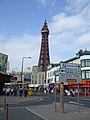 Blackpool Tower - geograph.org.uk - 982247.jpg 480 × 640; 71 KB
-
 Blea Tarn - geograph.org.uk - 983218.jpg 640 × 480; 80 KB
-
 Boardwalk south of Derwent Water - geograph.org.uk - 989425.jpg 640 × 480; 101 KB
-
 Boats at Keswick - geograph.org.uk - 989431.jpg 640 × 480; 101 KB
-
 St Mary's and St Michael's Church, Bonds.jpg 640 × 480; 161 KB
-
 Boundary wall - geograph.org.uk - 978726.jpg 640 × 480; 119 KB
-
 Bowling green Victoria park - geograph.org.uk - 986396.jpg 640 × 480; 63 KB
-
 Bramley Lane - View of Back Dale Mine - geograph.org.uk - 977703.jpg 640 × 480; 97 KB
-
 Brewery Island - geograph.org.uk - 978427.jpg 640 × 480; 62 KB
-

-
 Bridge over Allt Goch Bach - geograph.org.uk - 1004828.jpg 640 × 480; 141 KB
-
 Broad St, Denny - geograph.org.uk - 986187.jpg 640 × 480; 41 KB
-
 Broken revetments - geograph.org.uk - 978601.jpg 640 × 480; 121 KB
-
 Brookmans Park railway station - geograph.org.uk - 986666.jpg 640 × 480; 103 KB
-
 Brookmans Park United Reformed Church - geograph.org.uk - 986960.jpg 640 × 446; 57 KB
-
 Brookmans Park, Bradmore Green - geograph.org.uk - 986812.jpg 640 × 480; 79 KB
-
 Brookmans Park, The estate office - geograph.org.uk - 986914.jpg 640 × 488; 99 KB
-
 Bryn Llyn Egnant - geograph.org.uk - 978300.jpg 640 × 404; 104 KB
-
 Bryn Mel Manor - geograph.org.uk - 1003664.jpg 640 × 423; 57 KB
-
 Brynhyfryd Farm - geograph.org.uk - 985701.jpg 640 × 480; 112 KB
-
 Leaving Bubnell on a Hulleys Bus - geograph.org.uk - 977652.jpg 640 × 480; 98 KB
-
 Buildings in Upper King Street - geograph.org.uk - 977532.jpg 640 × 480; 73 KB
-
 Bungalow on Cart Gap Road - geograph.org.uk - 978263.jpg 640 × 451; 87 KB
-
 Burnstones Viaduct - geograph.org.uk - 982252.jpg 640 × 172; 42 KB
-
 Burnstones, Knarsdale Hall - geograph.org.uk - 982275.jpg 640 × 480; 66 KB
-
 Burnstones, Knarsdale Hall - geograph.org.uk - 982293.jpg 640 × 480; 93 KB
-
 Burry Pill - geograph.org.uk - 977163.jpg 640 × 480; 76 KB
-
 Bus Station Entrance - geograph.org.uk - 977970.jpg 640 × 480; 71 KB
-
 Bush road - geograph.org.uk - 986450.jpg 640 × 480; 72 KB
-
 Cae Mair bungalow estate - geograph.org.uk - 1005468.jpg 640 × 480; 51 KB
-
 Canal scene - geograph.org.uk - 978737.jpg 640 × 480; 65 KB
-
 Canal View - geograph.org.uk - 977893.jpg 640 × 480; 93 KB
-
 Car wash by the railway arches - geograph.org.uk - 986480.jpg 640 × 480; 77 KB
-
 Cardiff Road - geograph.org.uk - 986645.jpg 640 × 480; 115 KB
-
 Carlisle Airport - geograph.org.uk - 983220.jpg 640 × 480; 69 KB
-
 Carn Gorm-Loch - geograph.org.uk - 989606.jpg 500 × 375; 89 KB
-
 Carn Scathe - geograph.org.uk - 1054461.jpg 640 × 480; 142 KB
-
 Castle Street - geograph.org.uk - 977957.jpg 640 × 480; 78 KB
-

-
-
 Cattle viewed through a balistraria - geograph.org.uk - 1006350.jpg 480 × 640; 45 KB
-
 Central Pier, Blackpool - geograph.org.uk - 983250.jpg 640 × 480; 63 KB
-
 Centurion Inn, Walton - geograph.org.uk - 983227.jpg 640 × 480; 64 KB
-

-
 Child's Farm - geograph.org.uk - 977680.jpg 640 × 427; 60 KB
-
 Claerddu farmhouse - geograph.org.uk - 978211.jpg 1,000 × 669; 487 KB
-
 Clay outcrops at Low Light - geograph.org.uk - 978609.jpg 480 × 640; 153 KB
-
 Cleveland Passage - geograph.org.uk - 977395.jpg 640 × 480; 62 KB
-
 Clifftop path to Happisburgh - geograph.org.uk - 978635.jpg 640 × 480; 112 KB
-
 Clifftop view - geograph.org.uk - 978604.jpg 640 × 480; 128 KB
-
 Coastal erosion - geograph.org.uk - 978599.jpg 480 × 640; 119 KB
-
 Coed Allt Goch woodland - geograph.org.uk - 1004889.jpg 640 × 480; 144 KB
-
 Coed Llyn Pen-y-parc woodland - geograph.org.uk - 1004939.jpg 640 × 480; 140 KB
-
 Coldwell House - geograph.org.uk - 1054895.jpg 640 × 462; 176 KB
-

-
 Come to the tower^ - geograph.org.uk - 983260.jpg 640 × 480; 66 KB
-
 Copse in the field - geograph.org.uk - 977545.jpg 640 × 436; 78 KB
-
 Corporation Street - geograph.org.uk - 977424.jpg 640 × 480; 72 KB
-
 Cotehele House - geograph.org.uk - 977753.jpg 640 × 480; 89 KB
-
 Cotehele Quay - geograph.org.uk - 978374.jpg 640 × 480; 107 KB
-
 Cottage near Rydal Mount - geograph.org.uk - 989265.jpg 640 × 453; 96 KB
-
 Creag Rainich - geograph.org.uk - 992915.jpg 640 × 480; 91 KB
-
 Creag Rainich - geograph.org.uk - 992917.jpg 640 × 480; 88 KB
-
 Croft House - geograph.org.uk - 978662.jpg 640 × 474; 68 KB
-
 Crops, Northdale - geograph.org.uk - 978259.jpg 640 × 426; 203 KB
-
 Croquet anyone ^ - geograph.org.uk - 978466.jpg 640 × 319; 78 KB
-
 Crossroads in the lanes - geograph.org.uk - 978744.jpg 640 × 440; 139 KB
-
 Crown Hotel, High Street, Garstang - geograph.org.uk - 995645.jpg 640 × 480; 173 KB
-
 Dairy cows near Radwood - geograph.org.uk - 985209.jpg 640 × 457; 174 KB
-
 Damaged sea defences - geograph.org.uk - 978575.jpg 480 × 640; 121 KB
-
 Darlington Street Post Office - geograph.org.uk - 978421.jpg 480 × 640; 77 KB
-
 Davington Priory Cricket Club ground - geograph.org.uk - 977442.jpg 640 × 480; 51 KB
-
 Dead and alive - geograph.org.uk - 980075.jpg 480 × 640; 210 KB
-
 Decorative flotsam - geograph.org.uk - 978589.jpg 480 × 640; 120 KB
-
 Defenceless sea defences - geograph.org.uk - 978564.jpg 480 × 640; 100 KB
-
 Derwent Water from the south - geograph.org.uk - 989416.jpg 640 × 480; 99 KB
-
 Derwentwater launch - geograph.org.uk - 986979.jpg 640 × 480; 106 KB
-
 Development at "The Moorings" - geograph.org.uk - 1001340.jpg 640 × 518; 96 KB
-
 Disused brickworks, near Slamannan - geograph.org.uk - 985465.jpg 640 × 480; 72 KB
-
 DIY tearoom at Haytongate Farm - geograph.org.uk - 983230.jpg 480 × 640; 96 KB
-
 DIY tearoom at Haytongate Farm - geograph.org.uk - 983231.jpg 480 × 640; 86 KB
-
 DIY tearoom at High Crosby Farm - geograph.org.uk - 983216.jpg 640 × 480; 112 KB
-
 Dock access gate at Beaumaris Castle - geograph.org.uk - 979519.jpg 484 × 640; 96 KB
-
 Dove Cottage - geograph.org.uk - 1265870.jpg 480 × 640; 107 KB
-

-

-
 DrillHallLondon.JPG 1,200 × 1,600; 982 KB
-
 Driveway near Dalebrook House - geograph.org.uk - 978037.jpg 640 × 480; 116 KB
-
 Driveway to Bryn-mel Manor - geograph.org.uk - 1003641.jpg 640 × 480; 147 KB
-
 Driveway to Pen-y-parc House - geograph.org.uk - 1003937.jpg 640 × 480; 73 KB
-
 Driveway to Tyddyn Hen - geograph.org.uk - 1003778.jpg 640 × 480; 134 KB
-
 Drystane Dyke - geograph.org.uk - 978265.jpg 640 × 480; 150 KB
-
 Dumbreck railway station in 2008.jpg 640 × 359; 107 KB
-
 Eagle and Child, High Street, Garstang - geograph.org.uk - 995652.jpg 640 × 480; 222 KB
-
 East Coast Main Line at Brookmans Park - geograph.org.uk - 986690.jpg 640 × 480; 105 KB
-
 Eastbound out of Lossiemouth harbour - geograph.org.uk - 977960.jpg 640 × 475; 59 KB
-
 Eastern Promenade, Lytham - geograph.org.uk - 996647.jpg 640 × 480; 57 KB
-
 Ecstatic Tamworth Pig - geograph.org.uk - 1136868.jpg 640 × 480; 111 KB
-
 Electric Tram, Blackpool - geograph.org.uk - 983257.jpg 640 × 480; 58 KB
-
 Elvastone Farm - geograph.org.uk - 977549.jpg 640 × 480; 73 KB
-

-

-
 Entrance to Donathan Farm - geograph.org.uk - 978717.jpg 640 × 480; 146 KB
-
 Entrance to Llanwarne Court - geograph.org.uk - 978730.jpg 640 × 480; 177 KB
-
 Entrance to New Farm, Hilton - geograph.org.uk - 977658.jpg 640 × 427; 102 KB
-
 Eroding cliff face - geograph.org.uk - 978605.jpg 480 × 640; 139 KB
-
 Evidence of erosion - geograph.org.uk - 978600.jpg 640 × 480; 159 KB
-

-
 Fallen tree on the Trail - geograph.org.uk - 983225.jpg 640 × 480; 95 KB
-
 Farm road to the Buccleuch Farm - geograph.org.uk - 978553.jpg 640 × 480; 51 KB
-
 Farm track at Kirkbride farm - geograph.org.uk - 1387854.jpg 640 × 480; 72 KB
-
 Farm track crosses The Gamber - geograph.org.uk - 977835.jpg 640 × 480; 133 KB
-
 Farm track opposite Child's Farm - geograph.org.uk - 977673.jpg 640 × 427; 65 KB
-
 Farmer's Fold - geograph.org.uk - 978445.jpg 480 × 640; 54 KB
-
 Farmhouse, Child's Farm - geograph.org.uk - 977677.jpg 640 × 427; 78 KB
-
 Farmhouse, Stonehouse Farm - geograph.org.uk - 986034.jpg 640 × 480; 76 KB
-
 Farmland near Madeley Park - geograph.org.uk - 985181.jpg 640 × 457; 166 KB
-

-
 Felton United Reformed Church - geograph.org.uk - 981034.jpg 640 × 427; 69 KB
-
 Field below Howards Hill - geograph.org.uk - 978675.jpg 640 × 480; 160 KB
-
 Field boundary near Llanwarne - geograph.org.uk - 978741.jpg 640 × 480; 160 KB
-
 Fields beside Howards Hill Road - geograph.org.uk - 978663.jpg 480 × 640; 130 KB
-
 Firpark Stadium001.jpg 2,592 × 1,944; 725 KB
-
 Fish and Chips, Blackpool - geograph.org.uk - 983251.jpg 640 × 480; 62 KB
-
 Fishing Cobles in the Harbour, Amble - geograph.org.uk - 980059.jpg 640 × 427; 65 KB
-
 Fly tipping - geograph.org.uk - 978659.jpg 486 × 640; 154 KB
-
 Foot passenger Ferry - geograph.org.uk - 1022189.jpg 640 × 428; 56 KB
-
 Footbridge below Grasmere outfall - geograph.org.uk - 988693.jpg 640 × 428; 126 KB
-

-

-
 Footbridge, Downpatrick - geograph.org.uk - 977583.jpg 640 × 403; 102 KB


_Motorway_near_Water_End_-_geograph.org.uk_-_1037146.jpg)


