Category:United Kingdom photographs taken on 2008-08-01
Jump to navigation
Jump to search
| ← | Friday 1 August 2008 | → | ||
| ← | August 2008 | → | ||

United Kingdom photographs taken on 1 August 2008.
Image files should be categorized here automatically using {{taken on}} template. Direct categorisation is also possible, if automatic is impossible.
Subcategories
This category has the following 3 subcategories, out of 3 total.
L
S
Media in category "United Kingdom photographs taken on 2008-08-01"
The following 200 files are in this category, out of 882 total.
(previous page) (next page)-
 (Part of) the 14th C town walls - geograph.org.uk - 911878.jpg 640 × 480; 123 KB
-
-

-

-
 14th C town walls (2) - geograph.org.uk - 911881.jpg 480 × 640; 98 KB
-
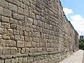 14th C town walls (3) - geograph.org.uk - 911883.jpg 640 × 480; 124 KB
-
 14th C town walls - geograph.org.uk - 911871.jpg 640 × 480; 88 KB
-
 31 Grove End Road - geograph.org.uk - 905888.jpg 640 × 427; 175 KB
-
 60074 , a class in decline (3372557515).jpg 2,000 × 1,333; 1.56 MB
-
 A colourful set-aside - geograph.org.uk - 907183.jpg 480 × 640; 184 KB
-

-
 A Decade of Horses - geograph.org.uk - 905415.jpg 640 × 480; 128 KB
-
 A Friendly Station - geograph.org.uk - 905600.jpg 640 × 480; 113 KB
-
 A large barley field - geograph.org.uk - 907197.jpg 640 × 442; 191 KB
-
 A large field of peas - geograph.org.uk - 905771.jpg 640 × 480; 174 KB
-
 A narrow street in Mousehole - geograph.org.uk - 912903.jpg 640 × 480; 263 KB
-
 A rural view - geograph.org.uk - 906795.jpg 640 × 480; 158 KB
-
 A sea of ripe wheat - geograph.org.uk - 905835.jpg 640 × 480; 189 KB
-

-
 A stony shore - geograph.org.uk - 921989.jpg 640 × 480; 81 KB
-
 A track junction - geograph.org.uk - 905787.jpg 640 × 480; 151 KB
-
 A very rural road - geograph.org.uk - 906792.jpg 480 × 640; 157 KB
-
 A woodland bench with views of the sea - geograph.org.uk - 928007.jpg 640 × 537; 205 KB
-
 A' Mhoine - geograph.org.uk - 908270.jpg 640 × 480; 71 KB
-
 Abbey Farm - geograph.org.uk - 906649.jpg 640 × 480; 141 KB
-

-
 Affpuddle Church - geograph.org.uk - 905956.jpg 640 × 487; 97 KB
-
 Affpuddle Church - geograph.org.uk - 905957.jpg 501 × 640; 65 KB
-
 Airedale Centre - Queen's Park Drive - geograph.org.uk - 906273.jpg 640 × 413; 197 KB
-
 Airedale Health Centre - Fryston Road - geograph.org.uk - 906269.jpg 640 × 429; 171 KB
-
 Airedale Post Office - Airedale Road - geograph.org.uk - 906279.jpg 591 × 640; 267 KB
-
 Alder Trees near Arnaboll - geograph.org.uk - 908287.jpg 640 × 480; 114 KB
-
 All Saints church, Marazion - geograph.org.uk - 923225.jpg 640 × 427; 238 KB
-
 All Saints, Alburgh - geograph.org.uk - 906355.jpg 640 × 480; 84 KB
-
 All Saints, Carleton Rode - geograph.org.uk - 906373.jpg 640 × 480; 87 KB
-
 Almost Ready to Harvest - geograph.org.uk - 906501.jpg 640 × 480; 148 KB
-
 Amphibious vehicle, St. Michael's Mount - geograph.org.uk - 923175.jpg 640 × 427; 233 KB
-
 An ancient landscape - geograph.org.uk - 922024.jpg 640 × 280; 30 KB
-
 An ancient path overtaken by nature - geograph.org.uk - 907273.jpg 640 × 480; 142 KB
-
 Ancient and modern - geograph.org.uk - 910749.jpg 480 × 640; 76 KB
-
 Anglian Water Sewage Pumping Station - geograph.org.uk - 906551.jpg 640 × 425; 135 KB
-
 Another view of Horncliffe Shiel - geograph.org.uk - 908678.jpg 640 × 480; 40 KB
-
 Approach to Crowe Hill Methodist Church - geograph.org.uk - 905458.jpg 598 × 640; 191 KB
-
 Approaching the Green Wheel Millennium bridge - panoramio.jpg 2,592 × 1,944; 810 KB
-
 Approaching Tufton - geograph.org.uk - 919519.jpg 427 × 640; 84 KB
-
 Approaching Tufton - geograph.org.uk - 919524.jpg 640 × 427; 88 KB
-
 Arable crops nr Cossington - geograph.org.uk - 918725.jpg 640 × 427; 97 KB
-
 Arnaboll House - geograph.org.uk - 908296.jpg 640 × 480; 95 KB
-
 Aspens near Arnaboll - geograph.org.uk - 909289.jpg 640 × 480; 100 KB
-
 Aultbea Fire Station - geograph.org.uk - 922062.jpg 640 × 480; 56 KB
-
 Backlit Grass - geograph.org.uk - 908088.jpg 640 × 427; 165 KB
-
 Bakerloo Line Train at Embankment - geograph.org.uk - 906388.jpg 640 × 444; 135 KB
-
 Balmoral Road, Helmshore - geograph.org.uk - 905282.jpg 640 × 480; 66 KB
-
 Baosbheinn - geograph.org.uk - 922033.jpg 640 × 390; 23 KB
-
 Barley, Hannington - geograph.org.uk - 910883.jpg 640 × 480; 126 KB
-
 Barmouth Bridge from Borthwen Terrace - geograph.org.uk - 917012.jpg 640 × 480; 88 KB
-
 Barn End at Burton - geograph.org.uk - 907364.jpg 640 × 479; 74 KB
-
 Beach at Holywell - geograph.org.uk - 905707.jpg 640 × 479; 104 KB
-
 Beck Lane, Barrow Upon Humber - geograph.org.uk - 906073.jpg 640 × 425; 105 KB
-
 Below the weir on the Ericht after rain - geograph.org.uk - 910670.jpg 640 × 480; 143 KB
-
 Belsay Castle - geograph.org.uk - 968941.jpg 480 × 640; 113 KB
-
 Belsay Castle - geograph.org.uk - 968969.jpg 640 × 480; 102 KB
-
 Belsay Castle courtyard - geograph.org.uk - 968950.jpg 640 × 490; 110 KB
-
 Belsay Hall - geograph.org.uk - 966923.jpg 640 × 480; 130 KB
-
 Belsay Hall - geograph.org.uk - 966930.jpg 480 × 640; 97 KB
-
 Belsay Hall - geograph.org.uk - 966960.jpg 640 × 480; 93 KB
-
 Belsay Hall - geograph.org.uk - 967023.jpg 640 × 480; 111 KB
-
 Belsay Hall forecourt - geograph.org.uk - 966978.jpg 640 × 480; 112 KB
-
 Belsay Hall grounds - geograph.org.uk - 968904.jpg 640 × 480; 164 KB
-
 Belsay Hall grounds - geograph.org.uk - 968914.jpg 640 × 480; 141 KB
-
 Belsay Hall grounds - geograph.org.uk - 968918.jpg 640 × 480; 170 KB
-
 Belsay Hall grounds - geograph.org.uk - 968922.jpg 640 × 480; 159 KB
-
 Belsay Hall Ha Ha - geograph.org.uk - 966992.jpg 640 × 480; 142 KB
-
 Belsay Hall Ha Ha - geograph.org.uk - 967001.jpg 640 × 480; 147 KB
-
 Belsay Hall looking east - geograph.org.uk - 966945.jpg 640 × 480; 97 KB
-
 Beside the track - geograph.org.uk - 907232.jpg 480 × 640; 194 KB
-
 Between two fields of mature grain crops - geograph.org.uk - 905807.jpg 640 × 480; 189 KB
-
 Bewick Square - geograph.org.uk - 910534.jpg 640 × 480; 87 KB
-
 Bewick Street - geograph.org.uk - 910522.jpg 640 × 480; 92 KB
-
 Big Ben (2732874889).jpg 3,456 × 2,304; 4.26 MB
-
 Big pebbles at St Loy - geograph.org.uk - 912754.jpg 640 × 480; 281 KB
-
 Bikes Left at Own Risk - geograph.org.uk - 906334.jpg 640 × 467; 222 KB
-
 Bird hide at Broad Water - geograph.org.uk - 908610.jpg 640 × 427; 85 KB
-
 Birtwistle's Mill - geograph.org.uk - 905286.jpg 640 × 480; 67 KB
-
 Birtwistle's Mill - geograph.org.uk - 905289.jpg 640 × 480; 75 KB
-
 Bishop Wilsons cottage at Burton - geograph.org.uk - 907373.jpg 640 × 479; 92 KB
-

-

-
 Bog Garden - geograph.org.uk - 908978.jpg 640 × 480; 77 KB
-
 Boscawen Point - geograph.org.uk - 912774.jpg 640 × 480; 268 KB
-
 Bostock Road - geograph.org.uk - 905641.jpg 640 × 480; 174 KB
-
 Bournemouth - panoramio - Dawid Glawdzin (1).jpg 640 × 480; 97 KB
-
 Bournemouth - panoramio - Dawid Glawdzin.jpg 640 × 480; 48 KB
-
 Bowmore - the Post Bus - geograph.org.uk - 920012.jpg 640 × 480; 142 KB
-
 Bowmore, looking down Main Street - geograph.org.uk - 920022.jpg 640 × 480; 125 KB
-
 Bowmore, Main Street - geograph.org.uk - 920020.jpg 640 × 480; 118 KB
-
 Bowmore, the harbour - geograph.org.uk - 920029.jpg 640 × 480; 134 KB
-
 Bowmore, the pier - geograph.org.uk - 920034.jpg 640 × 480; 132 KB
-
 Bowmore, the round church - gallery - geograph.org.uk - 920028.jpg 480 × 640; 105 KB
-
 Bowmore, the round church - geograph.org.uk - 920019.jpg 640 × 480; 98 KB
-
 Bowmore, the round church - interior - geograph.org.uk - 920026.jpg 480 × 640; 121 KB
-
 Brantwood Drive, Paignton - geograph.org.uk - 909079.jpg 640 × 429; 82 KB
-
 Breaston Cemetery Chapel - geograph.org.uk - 909539.jpg 640 × 427; 219 KB
-
 Brewers Arms at Neston - geograph.org.uk - 907305.jpg 640 × 479; 73 KB
-
 Bridge on Roselands Road - geograph.org.uk - 909213.jpg 480 × 640; 134 KB
-
 Bridge over Ampton Water - geograph.org.uk - 908732.jpg 427 × 640; 110 KB
-
 Bridge over Ampton Water - geograph.org.uk - 908741.jpg 640 × 427; 104 KB
-
 Bridge Over River Tas, Forncett - geograph.org.uk - 906597.jpg 640 × 480; 85 KB
-
 Brighouse Cricket Pitch - geograph.org.uk - 905602.jpg 640 × 480; 112 KB
-
 Brighouse Sports Club - geograph.org.uk - 905605.jpg 640 × 480; 111 KB
-
 Bristol Parkway platform view from east.jpg 2,816 × 2,112; 1.36 MB
-
 Britannia Way, Helmshore - geograph.org.uk - 905267.jpg 640 × 339; 45 KB
-
 British Oak Pub - geograph.org.uk - 905291.jpg 640 × 480; 70 KB
-
 Broad Mills Pond - geograph.org.uk - 905617.jpg 640 × 480; 144 KB
-
 Broad Water inlet - geograph.org.uk - 908752.jpg 640 × 427; 68 KB
-
 Broad Water inlet - geograph.org.uk - 908757.jpg 410 × 640; 64 KB
-
 Broad Water shoreline - geograph.org.uk - 908734.jpg 427 × 640; 95 KB
-
 Broad Water shoreline - geograph.org.uk - 908737.jpg 640 × 427; 103 KB
-
 Broad Water, Great Livermere - geograph.org.uk - 908593.jpg 640 × 427; 119 KB
-
 Broadbottom Bottom - geograph.org.uk - 905484.jpg 640 × 480; 162 KB
-
 Broadbottom Viaduct - geograph.org.uk - 905661.jpg 640 × 480; 152 KB
-
 Broadbottom Village - geograph.org.uk - 905648.jpg 640 × 480; 121 KB
-
 Broch near Heilam - geograph.org.uk - 909491.jpg 640 × 480; 107 KB
-
 Buckingham Close, Helmshore - geograph.org.uk - 905277.jpg 640 × 480; 81 KB
-
 Bullington Cross Inn - geograph.org.uk - 919493.jpg 640 × 427; 55 KB
-
 Bunwell church.jpg 640 × 480; 67 KB
-
 Bunwell Primary School - geograph.org.uk - 906402.jpg 640 × 480; 61 KB
-
 Burgate Street - panoramio.jpg 2,304 × 3,072; 1.26 MB
-
 Burial Chapel - geograph.org.uk - 951497.jpg 640 × 480; 92 KB
-
 CADGWITH CHURCH - panoramio.jpg 3,648 × 2,736; 4.29 MB
-
 Caernarvon Road, Helmshore - geograph.org.uk - 905268.jpg 640 × 322; 49 KB
-
 Cairn at Arnaboll - geograph.org.uk - 908307.jpg 640 × 480; 68 KB
-
 Camms View, Helmshore - geograph.org.uk - 905262.jpg 640 × 290; 43 KB
-

-
 Canterbury castle - panoramio.jpg 3,072 × 2,304; 3.33 MB
-
 Cardinal Newman High School - geograph.org.uk - 1044602.jpg 640 × 480; 66 KB
-
 Carlisle Road Londonderry - geograph.org.uk - 910842.jpg 640 × 504; 91 KB
-
 Carlton Village rooftops - geograph.org.uk - 1211362.jpg 640 × 480; 60 KB
-
 Carn-du from the SWC path - geograph.org.uk - 912845.jpg 640 × 480; 285 KB
-
 Cartbridge Lane South - geograph.org.uk - 905390.jpg 640 × 449; 85 KB
-
 Castle Gates, Shrewsbury - geograph.org.uk - 915616.jpg 640 × 480; 68 KB
-
 Castle in Wressle - geograph.org.uk - 905305.jpg 640 × 480; 51 KB
-
 Catherine Crescent, Paignton - geograph.org.uk - 909091.jpg 640 × 480; 101 KB
-
 Cattle grid, Liddesdale - geograph.org.uk - 909763.jpg 640 × 480; 84 KB
-
 Causeway to St. Michaels Mount - geograph.org.uk - 920523.jpg 640 × 404; 208 KB
-
 Celtic cross beside the SWC path - geograph.org.uk - 912844.jpg 480 × 640; 87 KB
-
 Chapel Rock near St. Michael's Mount - geograph.org.uk - 920550.jpg 640 × 427; 215 KB
-
 Church and Chimney - geograph.org.uk - 905446.jpg 640 × 480; 140 KB
-
 Church of the Immaculate Conception - geograph.org.uk - 905435.jpg 480 × 640; 117 KB
-
 Church of the Immaculate Conception - geograph.org.uk - 905440.jpg 640 × 480; 144 KB
-
 Church designed by Thomas Telford - geograph.org.uk - 921429.jpg 640 × 427; 114 KB
-
 Church of Scotland, Aultbea - geograph.org.uk - 922043.jpg 640 × 480; 56 KB
-
 Churchyard Cross, Welsh Newton - geograph.org.uk - 906029.jpg 640 × 480; 146 KB
-
 Clearing the Rubbish - geograph.org.uk - 905950.jpg 640 × 427; 215 KB
-
 Clennon Ponds - geograph.org.uk - 909449.jpg 640 × 480; 122 KB
-
 Cliffs at Holywell - geograph.org.uk - 905681.jpg 479 × 640; 120 KB
-
 Cliffs at Holywell - geograph.org.uk - 905695.jpg 640 × 479; 151 KB
-
 Cliffs below Whitbread Hole - geograph.org.uk - 905737.jpg 479 × 640; 118 KB
-
 Closed railway station at Burton - geograph.org.uk - 907353.jpg 640 × 479; 113 KB
-
 Coach Office, Woburn Safari Park - geograph.org.uk - 908984.jpg 640 × 256; 28 KB
-
 Coastal defences, Mounts Bay - geograph.org.uk - 930528.jpg 640 × 427; 268 KB
-
 Cobbled alley behind the West Walls - geograph.org.uk - 911348.jpg 480 × 640; 94 KB
-
 Coed Nercwys - geograph.org.uk - 1049143.jpg 640 × 480; 82 KB
-
 Coedcanlas at dawn - geograph.org.uk - 905048.jpg 640 × 469; 51 KB
-
 Coes Faen from Borthwen Terrace - geograph.org.uk - 917037.jpg 640 × 480; 103 KB
-
 Coleshill Parkway.jpg 640 × 480; 82 KB
-
 Coleton Fishacre - geograph.org.uk - 928003.jpg 640 × 480; 166 KB
-
 Coleton Fishacre - geograph.org.uk - 928013.jpg 640 × 427; 124 KB
-
 Common figwort - geograph.org.uk - 909238.jpg 640 × 439; 37 KB
-
 COMPTON ACRES - panoramio - Dawid Glawdzin (1).jpg 640 × 480; 121 KB
-
 COMPTON ACRES - panoramio - Dawid Glawdzin (2).jpg 640 × 480; 108 KB
-
 COMPTON ACRES - panoramio - Dawid Glawdzin.jpg 640 × 480; 108 KB
-
 COMPTON ACRES - panoramio.jpg 640 × 480; 109 KB
-

-
 Cottages in Affpuddle - geograph.org.uk - 905954.jpg 640 × 440; 70 KB
-
 Countryside south of East Bierley - geograph.org.uk - 905542.jpg 640 × 480; 110 KB
-
 Creative recycling - geograph.org.uk - 909946.jpg 640 × 480; 62 KB
-
 Crown Wood - geograph.org.uk - 909506.jpg 480 × 640; 131 KB
-
 Culzean Castle - geograph.org.uk - 954737.jpg 640 × 426; 61 KB
-
 Deception Crack - geograph.org.uk - 909789.jpg 480 × 640; 105 KB
-
-
 Deer-stalking Norfolk-style - geograph.org.uk - 905832.jpg 640 × 465; 196 KB
-

-
 Derby Hall - geograph.org.uk - 909522.jpg 427 × 640; 154 KB
-
 Derelict farm building - geograph.org.uk - 905775.jpg 480 × 640; 181 KB
-
 Derelict Methodist Church, Walsall - geograph.org.uk - 905376.jpg 640 × 480; 63 KB
-
 Diptera (2722137609).jpg 612 × 800; 123 KB
-
 Diptera (2723115939).jpg 800 × 573; 130 KB
-
 Diptera (2723116079).jpg 800 × 438; 84 KB
-
 Diptera (2723116283).jpg 800 × 662; 135 KB
-
 Diptera (2723116877).jpg 434 × 338; 246 KB
-
 Diptera (2723119235).jpg 648 × 714; 449 KB
-
 Diptera (2723119623).jpg 333 × 461; 243 KB
-
 Diptera (2723734906).jpg 638 × 548; 487 KB
-
 Diptera (2723938702).jpg 724 × 700; 709 KB
-
 Diptera (2723939462).jpg 238 × 370; 176 KB
-
 Diptera (2723940874).jpg 790 × 695; 744 KB
-
 Diptera (2723941062).jpg 800 × 581; 120 KB
-
 Diptera (2723941216).jpg 631 × 800; 97 KB
-
 Diptera (2723941436).jpg 363 × 303; 162 KB
_the_14th_C_town_walls_-_geograph.org.uk_-_911878.jpg)
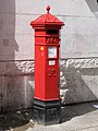
_Penfold_postbox,_Stowell_Street_-_geograph.org.uk_-_911759.jpg)
_Penfold_postbox,_Stowell_Street_-_royal_cipher_and_crest_-_geograph.org.uk_-_911769.jpg)
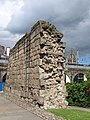
_Hadrian%27s_Wall_-_Westgate_Road_(2)_-_geograph.org.uk_-_911792.jpg)
_-_geograph.org.uk_-_911881.jpg)
_-_geograph.org.uk_-_911883.jpg)


.jpg)

_-_geograph.org.uk_-_905769.jpg)


.jpg)


.jpg)


.jpg)
.jpg)


_-_geograph.org.uk_-_917021.jpg)


.jpg)
.jpg)
.jpg)
.jpg)
.jpg)
.jpg)
.jpg)
.jpg)
.jpg)
.jpg)
.jpg)
.jpg)
.jpg)
.jpg)