Category:United Kingdom photographs taken on 2008-06-08
Jump to navigation
Jump to search

Subcategories
This category has only the following subcategory.
Media in category "United Kingdom photographs taken on 2008-06-08"
The following 200 files are in this category, out of 2,087 total.
(previous page) (next page)-
 200 yds to the summit - geograph.org.uk - 836355.jpg 640 × 378; 51 KB
-
 A breather switch for the continuous welded rail.jpg 1,024 × 768; 528 KB
-
 A Busy Road Junction - geograph.org.uk - 839265.jpg 640 × 427; 121 KB
-
 A clear message - geograph.org.uk - 837268.jpg 640 × 480; 181 KB
-
 A country road at Greenwells - geograph.org.uk - 854814.jpg 640 × 427; 137 KB
-
 A country road near Fellside - geograph.org.uk - 854762.jpg 640 × 427; 136 KB
-
 A country track near Bowden - geograph.org.uk - 854804.jpg 640 × 427; 135 KB
-
 A distant view of Ingleborough - geograph.org.uk - 1115147.jpg 640 × 427; 339 KB
-
 A forest ride on Crink Law - geograph.org.uk - 854832.jpg 640 × 427; 143 KB
-

-

-
 A Sunset in Fishponds - panoramio.jpg 2,272 × 1,704; 631 KB
-
 Aarondale House Care Home Hornsea.jpg 640 × 449; 109 KB
-
 Abbey Square - geograph.org.uk - 841242.jpg 640 × 457; 328 KB
-
 Abbey Square - geograph.org.uk - 841243.jpg 640 × 457; 359 KB
-
 Abbot's Drive - geograph.org.uk - 881112.jpg 640 × 457; 277 KB
-
 Abbot's Grange - geograph.org.uk - 859465.jpg 640 × 457; 388 KB
-
 Abbot's Park - geograph.org.uk - 838539.jpg 640 × 457; 339 KB
-
 Abbot's Park - geograph.org.uk - 838544.jpg 640 × 457; 344 KB
-
 Abercorn Street - geograph.org.uk - 844499.jpg 640 × 480; 87 KB
-
 Above Woodcombe Sand - geograph.org.uk - 844077.jpg 640 × 480; 125 KB
-
 Access road to beach car park - geograph.org.uk - 837277.jpg 640 × 480; 157 KB
-
 Access roads on Ellingham Drove - geograph.org.uk - 838421.jpg 640 × 427; 124 KB
-
 Access to Park Farm - geograph.org.uk - 837487.jpg 480 × 640; 71 KB
-

-
 African War Memorial - geograph.org.uk - 836517.jpg 345 × 640; 32 KB
-
 Ailsa Craig Nature Reserve - geograph.org.uk - 1363831.jpg 640 × 480; 80 KB
-

-
 Albert Square, Belfast - geograph.org.uk - 836215.jpg 640 × 345; 76 KB
-
 Albion Road Volkswagen - geograph.org.uk - 923009.jpg 640 × 480; 122 KB
-
 All Saints Honington - geograph.org.uk - 836474.jpg 640 × 480; 97 KB
-
 Allescholes Road, Walsden - geograph.org.uk - 837182.jpg 640 × 480; 88 KB
-
 Altar of St Thomas, Bedhampton - geograph.org.uk - 836212.jpg 640 × 474; 64 KB
-
 Am Binnean - Ben A'an.JPG 2,272 × 1,704; 858 KB
-
 Amphitheatre behind the Synagogue - geograph.org.uk - 847517.jpg 640 × 426; 59 KB
-

-
 An empty M23 - geograph.org.uk - 873363.jpg 640 × 428; 72 KB
-
 Apartments - geograph.org.uk - 836816.jpg 640 × 457; 282 KB
-

-

-
 Approaching West Summerleaze - geograph.org.uk - 839406.jpg 640 × 480; 56 KB
-
 Arkleston Junction - geograph.org.uk - 844465.jpg 640 × 480; 102 KB
-
 Arkleston railway bridge - geograph.org.uk - 844448.jpg 640 × 480; 87 KB
-
 Arminger Road, W12 - geograph.org.uk - 836822.jpg 640 × 480; 78 KB
-
 Arundel and Elgin Communal Gardens - geograph.org.uk - 837157.jpg 480 × 640; 130 KB
-
 Arundel Ladbroke gardens - geograph.org.uk - 837152.jpg 480 × 640; 169 KB
-
 Ashcourt Drive - geograph.org.uk - 841304.jpg 640 × 480; 111 KB
-
 Aspley Lane - geograph.org.uk - 836094.jpg 480 × 640; 61 KB
-
 Aspley Lane Junction - geograph.org.uk - 836072.jpg 640 × 480; 126 KB
-
 Astleton East Junction signal box 59 signal.jpg 768 × 1,024; 199 KB
-
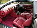
 Aston Martin DB7 V12 Vantage - Flickr - The Car Spy (10).jpg 1,600 × 1,200; 266 KB
-
 Aston Martin DB7 V12 Vantage - Flickr - The Car Spy (11).jpg 1,600 × 1,200; 208 KB
-
 Aston Martin DB7 V12 Vantage - Flickr - The Car Spy (12).jpg 1,600 × 1,200; 206 KB
-
 Aston Martin DB7 V12 Vantage - Flickr - The Car Spy (13).jpg 1,600 × 1,200; 176 KB
-
 Aston Martin DB7 V12 Vantage - Flickr - The Car Spy (14).jpg 1,600 × 1,200; 235 KB
-
 Aston Martin DB7 V12 Vantage - Flickr - The Car Spy (15).jpg 1,600 × 1,200; 180 KB
-
 Aston Martin DB7 V12 Vantage - Flickr - The Car Spy (16).jpg 1,600 × 1,200; 174 KB
-
 Aston Martin DB7 V12 Vantage - Flickr - The Car Spy (17).jpg 1,600 × 1,200; 213 KB
-
 Aston Martin DB7 V12 Vantage - Flickr - The Car Spy (18).jpg 1,600 × 1,200; 215 KB
-
 Aston Martin DB7 V12 Vantage - Flickr - The Car Spy (19).jpg 1,600 × 1,200; 215 KB
-
 Aston Martin DB7 V12 Vantage - Flickr - The Car Spy (20).jpg 1,600 × 1,200; 213 KB
-
 Aston Martin DB7 V12 Vantage - Flickr - The Car Spy (21).jpg 1,600 × 1,200; 219 KB
-
 Aston Martin DB7 V12 Vantage - Flickr - The Car Spy (22).jpg 1,600 × 1,200; 209 KB
-
 Aston Martin DB7 V12 Vantage - Flickr - The Car Spy (23).jpg 1,600 × 1,200; 187 KB
-
 Aston Martin DB7 V12 Vantage - Flickr - The Car Spy (24).jpg 1,600 × 1,200; 178 KB
-
 Aston Martin DB7 V12 Vantage - Flickr - The Car Spy (6).jpg 1,600 × 1,200; 145 KB
-
 Aston Martin DB7 V12 Vantage - Flickr - The Car Spy (7).jpg 1,600 × 1,200; 228 KB
-
 Aston Martin DB7 V12 Vantage - Flickr - The Car Spy (8).jpg 1,600 × 1,200; 167 KB
-
 Aston Martin Vantage V8 - Flickr - The Car Spy (1).jpg 1,600 × 1,200; 176 KB
-
 Aston Martin Vantage V8 - Flickr - The Car Spy (10).jpg 1,600 × 1,200; 197 KB
-
 Aston Martin Vantage V8 - Flickr - The Car Spy (11).jpg 1,600 × 1,200; 181 KB
-
 Aston Martin Vantage V8 - Flickr - The Car Spy (12).jpg 1,600 × 1,200; 370 KB
-
 Aston Martin Vantage V8 - Flickr - The Car Spy (13).jpg 1,600 × 1,200; 248 KB
-
 Aston Martin Vantage V8 - Flickr - The Car Spy (14).jpg 1,600 × 1,200; 157 KB
-
 Aston Martin Vantage V8 - Flickr - The Car Spy (15).jpg 1,600 × 1,200; 490 KB
-
 Aston Martin Vantage V8 - Flickr - The Car Spy (16).jpg 1,600 × 1,200; 193 KB
-
 Aston Martin Vantage V8 - Flickr - The Car Spy (17).jpg 1,509 × 552; 160 KB
-
 Aston Martin Vantage V8 - Flickr - The Car Spy (18).jpg 1,600 × 1,200; 178 KB
-
 Aston Martin Vantage V8 - Flickr - The Car Spy (19).jpg 1,600 × 1,200; 144 KB
-
 Aston Martin Vantage V8 - Flickr - The Car Spy (2).jpg 1,600 × 1,200; 125 KB
-
 Aston Martin Vantage V8 - Flickr - The Car Spy (20).jpg 1,600 × 1,200; 287 KB
-
 Aston Martin Vantage V8 - Flickr - The Car Spy (21).jpg 1,600 × 1,200; 135 KB
-
 Aston Martin Vantage V8 - Flickr - The Car Spy (22).jpg 1,600 × 1,200; 258 KB
-
 Aston Martin Vantage V8 - Flickr - The Car Spy (23).jpg 1,600 × 1,200; 395 KB
-
 Aston Martin Vantage V8 - Flickr - The Car Spy (24).jpg 1,527 × 861; 269 KB
-
 Aston Martin Vantage V8 - Flickr - The Car Spy (3).jpg 1,600 × 1,200; 164 KB
-
 Aston Martin Vantage V8 - Flickr - The Car Spy (5).jpg 1,600 × 1,200; 181 KB
-
 Aston Martin Vantage V8 - Flickr - The Car Spy (6).jpg 1,600 × 1,200; 169 KB
-
 Aston Martin Vantage V8 - Flickr - The Car Spy (7).jpg 1,600 × 1,200; 178 KB
-
 Aston Martin Vantage V8 - Flickr - The Car Spy (8).jpg 1,600 × 1,200; 189 KB
-
 Aston Martin Vantage V8 - Flickr - The Car Spy (9).jpg 1,600 × 1,200; 170 KB
-
 Aston Martin Vantage V8 - Flickr - The Car Spy.jpg 1,600 × 1,200; 139 KB
-
 Avebury - geograph.org.uk - 841088.jpg 640 × 480; 110 KB
-
 Avebury - geograph.org.uk - 841911.jpg 640 × 480; 74 KB
-
 Avebury - geograph.org.uk - 841924.jpg 640 × 480; 145 KB
-
 Avebury - geograph.org.uk - 841932.jpg 640 × 480; 121 KB
-
 Avebury - geograph.org.uk - 841939.jpg 640 × 480; 107 KB
-
 Avebury - geograph.org.uk - 841969.jpg 640 × 480; 121 KB
-
 Avebury cricket pavilion - geograph.org.uk - 841980.jpg 640 × 480; 102 KB
-
 Avebury Henge - geograph.org.uk - 841050.jpg 640 × 480; 106 KB
-
 Avebury Henge - geograph.org.uk - 841072.jpg 640 × 480; 125 KB
-
 Avebury Henge - geograph.org.uk - 841100.jpg 640 × 480; 114 KB
-
 Avebury Henge - geograph.org.uk - 841112.jpg 640 × 480; 144 KB
-
 Avebury Henge - geograph.org.uk - 841174.jpg 640 × 480; 141 KB
-
 Avebury Manor 02.jpg 640 × 480; 116 KB
-
 Avebury Manor 03.jpg 640 × 480; 153 KB
-
 Avebury Stones - geograph.org.uk - 841065.jpg 524 × 640; 134 KB
-
 Avebury Stones - geograph.org.uk - 841181.jpg 640 × 480; 93 KB
-
 Avebury Stones - geograph.org.uk - 842019.jpg 640 × 398; 94 KB
-
 Avebury trees - geograph.org.uk - 841124.jpg 640 × 559; 110 KB
-
 Azure damselfly at Morralee Tarn - geograph.org.uk - 878292.jpg 640 × 480; 82 KB
-
 Back Canal Street - geograph.org.uk - 836770.jpg 640 × 457; 358 KB
-
 Back street - geograph.org.uk - 838559.jpg 640 × 457; 327 KB
-
 Badger-faced sheep - geograph.org.uk - 842705.jpg 640 × 452; 86 KB
-
 Bailey Lane End Methodist Church - geograph.org.uk - 836350.jpg 640 × 480; 163 KB
-

-
 Balmoral Castle 2.jpg 2,714 × 2,035; 3.95 MB
-
 Bank of the River Ouse - geograph.org.uk - 835826.jpg 640 × 427; 120 KB
-
 Bank of the River Ouse - geograph.org.uk - 835827.jpg 640 × 427; 109 KB
-
 Banksy on Park St - geograph.org.uk - 1367756.jpg 424 × 640; 48 KB
-
 Barley and poppies - geograph.org.uk - 854157.jpg 640 × 426; 130 KB
-
 Barley, Chaldon Herring - geograph.org.uk - 848122.jpg 640 × 480; 128 KB
-
 Barley, Chaldon Herring - geograph.org.uk - 848156.jpg 640 × 480; 189 KB
-
 Barley, Chaldon Herring - geograph.org.uk - 848205.jpg 640 × 480; 156 KB
-
 Barley, Chaldon Herring - geograph.org.uk - 848218.jpg 640 × 480; 157 KB
-
 Barley, Whitcombe - geograph.org.uk - 847933.jpg 640 × 480; 149 KB
-
 Barmouth Close, Hull - geograph.org.uk - 835893.jpg 640 × 416; 210 KB
-
 Barn, Cringley Bottom - geograph.org.uk - 839481.jpg 640 × 427; 279 KB
-
 Barn, Near Healaugh - geograph.org.uk - 838558.jpg 640 × 427; 314 KB
-
 Barns, pylon and wheat above Broadmayne - geograph.org.uk - 847776.jpg 640 × 480; 108 KB
-
 Barons Court - geograph.org.uk - 881101.jpg 640 × 457; 342 KB
-
 The Old Footpath to South Ferriby - geograph.org.uk - 836793.jpg 640 × 427; 93 KB
-
 Bateman Street - geograph.org.uk - 836435.jpg 640 × 480; 81 KB
-
 Baughton - ancient barn - geograph.org.uk - 836196.jpg 640 × 480; 82 KB
-

-
 Baughton - public call box - geograph.org.uk - 836175.jpg 640 × 480; 87 KB
-
 Baynhall Farm near Abberton - geograph.org.uk - 848077.jpg 640 × 480; 75 KB
-
 BBQ time - geograph.org.uk - 836348.jpg 640 × 439; 64 KB
-
 Beach and beach huts - geograph.org.uk - 837213.jpg 640 × 480; 196 KB
-
 Beachcroft reservoir - geograph.org.uk - 839979.jpg 640 × 480; 105 KB
-
 Beacon At The Heritage Motor Centre - geograph.org.uk - 1014252.jpg 480 × 640; 58 KB
-

-
 Beddau Church - geograph.org.uk - 841852.jpg 640 × 480; 57 KB
-
-
 Behind the street - geograph.org.uk - 850436.jpg 640 × 457; 376 KB
-
 Bell Green Redevelopment Phase 2 (B) - geograph.org.uk - 840990.jpg 640 × 480; 56 KB
-
 Best place to be on a hot day, Avebury - geograph.org.uk - 842013.jpg 640 × 480; 162 KB
-
 Betchton - Bridge 148.jpg 640 × 480; 332 KB
-
 Bhac Path - geograph.org.uk - 890887.jpg 640 × 375; 147 KB
-
 Birchington-on-Sea Station - geograph.org.uk - 837194.jpg 640 × 480; 83 KB
-
 Birdsfoot trefoil by the coast path - geograph.org.uk - 844921.jpg 640 × 480; 165 KB
-
 Black Diamond Street - geograph.org.uk - 838584.jpg 640 × 457; 295 KB
-
 Black Diamond Street - geograph.org.uk - 838614.jpg 640 × 457; 283 KB
-
 Blashford Lakes Education Centre - geograph.org.uk - 838437.jpg 640 × 427; 140 KB
-
 Bleaberry Beck ford - geograph.org.uk - 849261.jpg 480 × 640; 97 KB
-
 Bleaberry Gill - geograph.org.uk - 838534.jpg 640 × 427; 338 KB
-
 Bleaberry Gill - geograph.org.uk - 848206.jpg 640 × 480; 80 KB
-
 Blenheim and Elgin Crescent Garden - geograph.org.uk - 837191.jpg 480 × 640; 343 KB
-

-

-
 Bloody cranesbill above Elender Cove - geograph.org.uk - 845856.jpg 640 × 480; 132 KB
-
 Blue Coat Hospital railings - geograph.org.uk - 837019.jpg 480 × 640; 77 KB
-
 Blue plaque on the Blue Coat Hospital - geograph.org.uk - 837009.jpg 640 × 480; 206 KB
-
 Bluecoat School - geograph.org.uk - 850449.jpg 640 × 457; 324 KB
-
 Boat lift - geograph.org.uk - 855174.jpg 640 × 480; 103 KB
-
 Boat yard - panoramio.jpg 3,888 × 2,592; 4.3 MB
-
 Boathouse in the flood - geograph.org.uk - 847409.jpg 640 × 426; 86 KB
-
 Boathouse, Loch Farr, Strathnairn - geograph.org.uk - 906834.jpg 640 × 427; 84 KB
-
 Boats in the shelter of Gammon Head - geograph.org.uk - 845880.jpg 480 × 640; 86 KB
-
 Boden Hall - geograph.org.uk - 848061.jpg 640 × 480; 284 KB
-
 Bodiam Castle - geograph.org.uk - 954616.jpg 640 × 480; 81 KB
-
 Boggle Hole - geograph.org.uk - 837398.jpg 499 × 640; 87 KB
-
 Borders barley field - geograph.org.uk - 854811.jpg 628 × 425; 125 KB
-
 Borders farmland - geograph.org.uk - 854778.jpg 637 × 414; 122 KB
-
-
 Boulder clay cliffs - geograph.org.uk - 836428.jpg 640 × 480; 125 KB
-
 Boulder, Surrender Moss - geograph.org.uk - 838917.jpg 640 × 427; 345 KB
-

-
 Bourne House, Lesbourne Road, Reigate - geograph.org.uk - 876935.jpg 640 × 426; 70 KB
-
 Bracken on top of Fraoch Eilean Mòr - geograph.org.uk - 836902.jpg 640 × 480; 133 KB
-

-
 Brancaster Staithe - the new quay - geograph.org.uk - 838434.jpg 640 × 480; 164 KB
-
 Brancaster Staithe - the old quay - geograph.org.uk - 838416.jpg 640 × 480; 178 KB
-

-

-

-

-
-
-

-

-

-

-

-
 Braunston Tunnel, Northamptonshire - geograph.org.uk - 868963.jpg 480 × 640; 167 KB
-
 Braunston Tunnel, Northamptonshire - geograph.org.uk - 870738.jpg 640 × 442; 151 KB
-
 Breaking waves, Berneray - geograph.org.uk - 840843.jpg 640 × 360; 51 KB
-
 Breather switches for the continuous welded rail.jpg 1,024 × 768; 587 KB
-
 Brecklands Road - geograph.org.uk - 855110.jpg 640 × 480; 83 KB
-
 Brenchley Gardens (road) - geograph.org.uk - 839988.jpg 640 × 480; 113 KB


_-_f._decempunctata_-_Flickr_-_S._Rae_(3).jpg)


_-_geograph.org.uk_-_845190.jpg)


.jpg)
.jpg)
.jpg)
.jpg)
.jpg)
.jpg)
.jpg)
.jpg)
.jpg)
.jpg)
.jpg)
.jpg)
.jpg)
.jpg)
.jpg)
.jpg)
.jpg)
.jpg)
.jpg)
.jpg)
.jpg)
.jpg)
.jpg)
.jpg)
.jpg)
.jpg)
.jpg)
.jpg)
.jpg)
.jpg)
.jpg)
.jpg)
.jpg)
.jpg)
.jpg)
.jpg)
.jpg)
.jpg)
.jpg)
.jpg)


_-_geograph.org.uk_-_840990.jpg)


_-_geograph.org.uk_-_839988.jpg)
.jpg)