Category:United Kingdom photographs taken on 2008-02-04
Jump to navigation
Jump to search
| ← | Monday 4 February 2008 | → | ||
| ← | February 2008 | → | ||

United Kingdom photographs taken on 4 February 2008.
Image files should be categorized here automatically using {{taken on}} template. Direct categorisation is also possible, if automatic is impossible.
Subcategories
This category has the following 3 subcategories, out of 3 total.
Media in category "United Kingdom photographs taken on 2008-02-04"
The following 200 files are in this category, out of 678 total.
(previous page) (next page)-
 'Irish' bridge at Thornthwaite - geograph.org.uk - 678188.jpg 480 × 640; 139 KB
-
 167 steps down to Huncote - geograph.org.uk - 681321.jpg 640 × 486; 96 KB
-
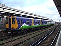
 319012 at St Pancras.jpg 3,648 × 2,736; 4.06 MB
-
 319363 at St Pancras 1.jpg 3,648 × 2,736; 4.23 MB
-
 319363 at St Pancras 2.jpg 3,648 × 2,736; 4.44 MB
-
 319370 at St Pancras 1.jpg 3,648 × 2,736; 4.35 MB
-
 319370 at St Pancras 2.jpg 3,648 × 2,736; 4.18 MB
-
 319445 at St Pancras 1.jpg 3,648 × 2,736; 4.03 MB
-
 319445 at St Pancras 2.jpg 3,648 × 2,736; 4.25 MB
-
 365523 at Kings Cross.jpg 3,648 × 2,736; 4.66 MB
-
 66184 Castleton East Junction.jpg 1,024 × 768; 584 KB
-
 985 Hedon Road, Hull - geograph.org.uk - 678163.jpg 380 × 640; 70 KB
-
-
 A Plethora of Gates - geograph.org.uk - 677932.jpg 640 × 427; 297 KB
-
-
 Access tunnel - geograph.org.uk - 678940.jpg 640 × 541; 71 KB
-

-
 Adoration of the Magi - geograph.org.uk - 677836.jpg 640 × 427; 71 KB
-
 Albaston-by-Jonathan-Billinger.jpg 640 × 324; 54 KB
-
 Albert Mill Chimney - geograph.org.uk - 678476.jpg 480 × 640; 46 KB
-
 Alder Root Bridge - geograph.org.uk - 1538980.jpg 640 × 428; 48 KB
-
 Alehousehillock - geograph.org.uk - 677506.jpg 640 × 427; 266 KB
-

-
 All Saints Church, Thurlaston - geograph.org.uk - 681304.jpg 640 × 465; 83 KB
-
 Allotments, Swanland - geograph.org.uk - 677449.jpg 640 × 423; 177 KB
-

-
 AnotherTermination - geograph.org.uk - 678450.jpg 640 × 480; 70 KB
-
 Church cross - geograph.org.uk - 678852.jpg 427 × 640; 105 KB
-
 Approaching Southernhay - geograph.org.uk - 684665.jpg 640 × 460; 90 KB
-
 Arches in an old bridge near South Cerney - geograph.org.uk - 677497.jpg 480 × 640; 335 KB
-
 Ardonald - geograph.org.uk - 677549.jpg 640 × 427; 242 KB
-
 Ardonald Lime Kiln - geograph.org.uk - 677518.jpg 640 × 427; 277 KB
-
 Argyle Street and St Pancras Station - geograph.org.uk - 678539.jpg 480 × 640; 114 KB
-
 Ascending Branstree - geograph.org.uk - 677409.jpg 640 × 480; 106 KB
-
 In Commemoration - geograph.org.uk - 678236.jpg 640 × 440; 95 KB
-
 Atworth Village Hall - geograph.org.uk - 678233.jpg 640 × 440; 80 KB
-
 Avebury - St James Church - geograph.org.uk - 711685.jpg 430 × 640; 86 KB
-
 Be my valentine^ - geograph.org.uk - 680373.jpg 640 × 480; 151 KB
-
 Bernithan Court Farm - geograph.org.uk - 678220.jpg 640 × 485; 177 KB
-
 Beverley - panoramio (1).jpg 1,200 × 900; 392 KB
-

-
 Blackhillock - geograph.org.uk - 677571.jpg 640 × 427; 282 KB
-
 Boundary Stone, Branstree - geograph.org.uk - 677411.jpg 640 × 480; 38 KB
-
 Braesburn Hall - geograph.org.uk - 677700.jpg 640 × 480; 66 KB
-
 Breaking the waves - geograph.org.uk - 677470.jpg 480 × 640; 167 KB
-
 Ffynnon Maen Du - Maen Du Well - geograph.org.uk - 683002.jpg 640 × 480; 153 KB
-
 Bridge over Garren Brook at Llangarron - geograph.org.uk - 678228.jpg 640 × 415; 140 KB
-
-
 Bridstow Bridge crossing the River Wye - geograph.org.uk - 678291.jpg 640 × 480; 116 KB
-
 Britannia Mill, Haslingden - geograph.org.uk - 678480.jpg 640 × 379; 35 KB
-
 Brunshaw Methodist Church, Burnley - geograph.org.uk - 680197.jpg 640 × 480; 149 KB
-
 Burn of Cairnie - geograph.org.uk - 677880.jpg 640 × 427; 250 KB
-
 Burnley Road Cliviger - geograph.org.uk - 678413.jpg 640 × 427; 66 KB
-
 Burnley Road Cliviger - geograph.org.uk - 678418.jpg 640 × 427; 45 KB
-
 Burntisland Cemetery - geograph.org.uk - 682156.jpg 460 × 480; 41 KB
-
 Burton Agnes railway station (site), Yorkshire (geograph 3256489).jpg 1,024 × 567; 117 KB
-
 By Skiftings Clump - geograph.org.uk - 677275.jpg 640 × 480; 208 KB
-

-
 Cadogan Fire Station, Belfast - geograph.org.uk - 677306.jpg 640 × 527; 101 KB
-
 Cairds Hill - geograph.org.uk - 677887.jpg 640 × 427; 266 KB
-
 Cairds Hill - geograph.org.uk - 677899.jpg 640 × 427; 298 KB
-
 Cairds Hill - geograph.org.uk - 677919.jpg 640 × 427; 283 KB
-
 Cairds Woods - geograph.org.uk - 677906.jpg 640 × 507; 342 KB
-
 Cairn and Trig Ring Branstree - geograph.org.uk - 677420.jpg 640 × 480; 34 KB
-
 Camastianavaig Postbox - geograph.org.uk - 677668.jpg 640 × 480; 117 KB
-
 Captain Brook X roadsign - geograph.org.uk - 677397.jpg 640 × 480; 51 KB
-
 Carnaby railway station (site), Yorkshire (geograph 3256495).jpg 1,024 × 683; 189 KB
-
 Carnbee housing estate - geograph.org.uk - 678874.jpg 640 × 398; 64 KB
-

-
 Castle Howard railway station (site), Yorkshire (geograph 3255385).jpg 1,024 × 768; 269 KB
-
 Chandlers Ford - Zionshill Copse - geograph.org.uk - 677810.jpg 640 × 480; 157 KB
-

-
 Children's playground, Charterhouse Road - geograph.org.uk - 678764.jpg 640 × 426; 110 KB
-
 Church Farm - geograph.org.uk - 677350.jpg 640 × 480; 178 KB
-
 Church Lane, Kirk Ella - geograph.org.uk - 677288.jpg 640 × 480; 200 KB
-
-
 Church, castle and graveyard - geograph.org.uk - 679574.jpg 640 × 463; 93 KB
-
 Convent of Poor Clares, Crossbush - geograph.org.uk - 725978.jpg 640 × 480; 85 KB
-
 Cottages at the crossroads - geograph.org.uk - 677405.jpg 640 × 480; 66 KB
-

-
 Countryside around Sourton - geograph.org.uk - 677680.jpg 640 × 480; 86 KB
-
 Cranford - geograph.org.uk - 701129.jpg 640 × 480; 70 KB
-
 Cranford, North Devon - geograph.org.uk - 677348.jpg 640 × 480; 84 KB
-
 Craven Road, Reading - geograph.org.uk - 686725.jpg 640 × 480; 159 KB
-
 Crescent Way - geograph.org.uk - 678724.jpg 640 × 426; 101 KB
-
 Croft Road enters Thurlaston - geograph.org.uk - 681309.jpg 640 × 420; 63 KB
-
 Cullen Bay - geograph.org.uk - 712262.jpg 640 × 480; 96 KB
-
 Darley post office and stores - geograph.org.uk - 677654.jpg 640 × 429; 66 KB
-
 Darley Primary School - geograph.org.uk - 677634.jpg 640 × 413; 62 KB
-

-
 Davidston - geograph.org.uk - 677843.jpg 640 × 427; 272 KB
-
 Davidston - geograph.org.uk - 677850.jpg 640 × 427; 261 KB
-
 Deerpark Road - geograph.org.uk - 678531.jpg 640 × 427; 63 KB
-
 Demolished building on Cleaver, Burnley - geograph.org.uk - 679014.jpg 640 × 480; 187 KB
-

-
 Descending Selside Pike - geograph.org.uk - 677426.jpg 640 × 480; 54 KB
-
 Desperate measures - geograph.org.uk - 678217.jpg 640 × 422; 103 KB
-
 Disused Lock at the East end of Tag Cut - geograph.org.uk - 677388.jpg 640 × 427; 123 KB
-
 Driveway to Hill Farm - geograph.org.uk - 678102.jpg 640 × 433; 72 KB
-
 Duke of York, Colne Road, Burnley - geograph.org.uk - 680179.jpg 640 × 480; 219 KB
-

-
 Earl Shilton Road towards Thurlaston - geograph.org.uk - 678104.jpg 640 × 482; 115 KB
-
 Earl Shilton Road towards Thurlaston - geograph.org.uk - 681302.jpg 640 × 448; 99 KB
-
 Early morning car park - geograph.org.uk - 759876.jpg 640 × 480; 46 KB
-
 East Kirkby War Memorial - geograph.org.uk - 700451.jpg 640 × 427; 108 KB
-

-
 Easter Auchairn - geograph.org.uk - 677487.jpg 640 × 427; 257 KB
-
 Ellen's Glen House - geograph.org.uk - 678893.jpg 640 × 377; 64 KB
-
 Elm Street Mill, Burnley - geograph.org.uk - 680173.jpg 480 × 640; 147 KB
-
 Embleton Hall - geograph.org.uk - 677477.jpg 423 × 640; 81 KB
-

-
 Entrance to Bridgford Park - geograph.org.uk - 678011.jpg 640 × 427; 112 KB
-
 Entrance to Scott Park, Burnley - geograph.org.uk - 678989.jpg 640 × 480; 197 KB
-
 Entrance to Trumpington Park and Ride - geograph.org.uk - 677267.jpg 640 × 480; 59 KB
-
 Exeter Community Centre - geograph.org.uk - 684327.jpg 480 × 640; 80 KB
-

-

-
 Fading Away - Bewdley Bypass Plaque - geograph.org.uk - 687013.jpg 640 × 480; 132 KB
-
 Farm Track - geograph.org.uk - 677396.jpg 480 × 640; 83 KB
-
 Farmer's flourish - geograph.org.uk - 678283.jpg 640 × 459; 175 KB
-
 Farmland View - geograph.org.uk - 677391.jpg 640 × 480; 57 KB
-

-
-

-

-
 Fettykil Paper Mill Lade - geograph.org.uk - 1103261.jpg 640 × 480; 85 KB
-

-
 Flamborough Head railway station (site), Yorkshire (geograph 3256609).jpg 1,024 × 768; 183 KB
-
 Flip Road Haslingden - geograph.org.uk - 678457.jpg 640 × 480; 72 KB
-
 Floating Wall, Branstree - geograph.org.uk - 677417.jpg 640 × 480; 21 KB
-
 Flood gauge on the Cam at Hauxton - geograph.org.uk - 677361.jpg 480 × 640; 149 KB
-
 Flower bed, Haven Green - geograph.org.uk - 680383.jpg 480 × 640; 105 KB
-
 Fly tipping - geograph.org.uk - 680178.jpg 640 × 480; 204 KB
-

-
 Foraging Mallard - geograph.org.uk - 677670.jpg 640 × 560; 137 KB
-
 Ford above Edintore - geograph.org.uk - 677896.jpg 640 × 442; 288 KB
-
 Forest Gap - geograph.org.uk - 677787.jpg 427 × 640; 290 KB
-
 Forest Operations - geograph.org.uk - 677736.jpg 640 × 427; 266 KB
-
 Former Norfolk County Cricket Ground - geograph.org.uk - 677696.jpg 640 × 480; 67 KB
-
 Foster Beck Mill - geograph.org.uk - 678200.jpg 640 × 419; 64 KB
-
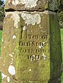
 Foundation stone, Robert Owen museum - geograph.org.uk - 757850.jpg 640 × 481; 75 KB
-
 Fringill dam (2) - geograph.org.uk - 677641.jpg 640 × 405; 58 KB
-
 Fringill dam - geograph.org.uk - 677638.jpg 640 × 480; 57 KB
-
 Fringill Mill - geograph.org.uk - 677651.jpg 640 × 480; 94 KB
-
 Frozen peat haggs on Middlehope Moor - geograph.org.uk - 683259.jpg 640 × 480; 54 KB
-
 Gap in the Shelter Belt - geograph.org.uk - 677565.jpg 640 × 427; 278 KB
-
 Garren Brook - upstream from the bridge - geograph.org.uk - 678232.jpg 480 × 640; 177 KB
-
 Garren Brook at Llangarron - geograph.org.uk - 678229.jpg 640 × 480; 184 KB
-
 Garton railway station (site), Yorkshire (geograph 3491228).jpg 1,024 × 768; 148 KB
-
 Gates Old and New. - geograph.org.uk - 677912.jpg 640 × 427; 310 KB
-
 Glasshouse - geograph.org.uk - 678791.jpg 640 × 427; 75 KB
-
 Glenshee Croft - geograph.org.uk - 677763.jpg 640 × 427; 223 KB
-
 Glimpse of the Tamar - geograph.org.uk - 677808.jpg 480 × 640; 136 KB
-

-
 Gracemount High School - geograph.org.uk - 678858.jpg 640 × 275; 56 KB
-
 Grays Inn Road, King's Cross - geograph.org.uk - 679651.jpg 640 × 480; 108 KB
-
 St Mary's Church, Green Street Green - geograph.org.uk - 678818.jpg 640 × 426; 105 KB
-
 Groyne at Walcott Gap - geograph.org.uk - 677468.jpg 640 × 480; 188 KB
-
 Hardings House X - geograph.org.uk - 677371.jpg 640 × 480; 104 KB
-
 Hay Waggon - geograph.org.uk - 677557.jpg 640 × 427; 265 KB
-
 Hewett School - geograph.org.uk - 677592.jpg 640 × 480; 117 KB
-
 Hewett Yard - geograph.org.uk - 677598.jpg 640 × 480; 87 KB
-
 Horses in a field - geograph.org.uk - 677312.jpg 640 × 480; 53 KB
-
 Houses on Old Tiverton Road, Exeter - geograph.org.uk - 686481.jpg 640 × 448; 89 KB
-
-
 Hugh llewelyn 313 112 (6336761651).jpg 2,592 × 1,944; 1.24 MB
-
 Hugh llewelyn 313 134 (6337517536).jpg 2,592 × 1,944; 1.24 MB
-
 Hull Golf Club, Kirk Ella - geograph.org.uk - 677285.jpg 640 × 480; 164 KB
-
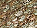 Ingleton. Pénzes fa. - panoramio.jpg 1,600 × 1,200; 596 KB
-
-
 Jacob Smith Park, Scriven - geograph.org.uk - 682998.jpg 640 × 480; 106 KB
-
 Jubilee Terrace, New Lakenham - geograph.org.uk - 677684.jpg 640 × 480; 93 KB
-
 Kennerland Cross - geograph.org.uk - 677335.jpg 640 × 480; 71 KB
-
 St Nicholas's Chapel - geograph.org.uk - 681603.jpg 480 × 640; 248 KB
-
 St Nicholas's Chapel - geograph.org.uk - 681616.jpg 480 × 640; 51 KB
-
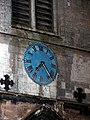 St Nicholas's Chapel clock - geograph.org.uk - 681604.jpg 480 × 640; 286 KB
-
 King's Road, Reading - geograph.org.uk - 686727.jpg 640 × 480; 119 KB
-
 King's Road, Reading - geograph.org.uk - 687822.jpg 640 × 480; 113 KB
-
 Lakenham Primary School - geograph.org.uk - 677679.jpg 640 × 480; 48 KB
-
 Leaving Shaw on the A365 - geograph.org.uk - 678294.jpg 640 × 453; 119 KB
-
 Leeds and Liverpool Canal - geograph.org.uk - 680159.jpg 640 × 480; 228 KB
-
 Lew valley floor - geograph.org.uk - 677697.jpg 640 × 480; 81 KB
-
 Linden Hall Hotel - geograph.org.uk - 677463.jpg 480 × 640; 67 KB
-
 Linden Hall Hotel - geograph.org.uk - 677467.jpg 640 × 442; 73 KB
-
 Llandysul bridge.jpg 640 × 480; 131 KB
-
-
 Loch Leven's Larder - geograph.org.uk - 681157.jpg 640 × 480; 71 KB
-
 Lockerby cottages - geograph.org.uk - 678871.jpg 600 × 450; 120 KB
-
 Long Cross - geograph.org.uk - 677735.jpg 480 × 640; 91 KB
-
 Looking from Davidston towards Edintore - geograph.org.uk - 677861.jpg 640 × 427; 246 KB
-
 Looking out from underneath a groyne - geograph.org.uk - 677532.jpg 480 × 640; 156 KB
-
 Looking Towards The Duelties - geograph.org.uk - 677481.jpg 640 × 427; 272 KB
-

-
 Lowthorpe railway station (site), Yorkshire (geograph 3256486).jpg 800 × 336; 68 KB
-
 M69 motorway from Croft Lane bridge.jpg 640 × 442; 55 KB
-
-

-
 Former chapel, Tokers Green - geograph.org.uk - 701906.jpg 640 × 482; 340 KB
-
 Churchyard Cross - geograph.org.uk - 700389.jpg 427 × 640; 85 KB
-
 Mayors and City of London Court 1.jpg 1,536 × 2,048; 1.2 MB


.jpg)


,_Yorkshire_(geograph_3256489).jpg)


,_Yorkshire_(geograph_3256495).jpg)


,_Yorkshire_(geograph_3255385).jpg)


,_Yorkshire_(geograph_3256609).jpg)


_-_geograph.org.uk_-_677641.jpg)


,_Yorkshire_(geograph_3491228).jpg)


.jpg)
.jpg)


,_Yorkshire_(geograph_3256486).jpg)


