Category:United Kingdom photographs taken on 2007-12-21
Jump to navigation
Jump to search
| ← | Friday 21 December 2007 | → | ||
| ← | December 2007 | → | ||

United Kingdom photographs taken on 21 December 2007.
Image files should be categorized here automatically using {{taken on}} template. Direct categorisation is also possible, if automatic is impossible.
Subcategories
This category has the following 2 subcategories, out of 2 total.
S
Media in category "United Kingdom photographs taken on 2007-12-21"
The following 200 files are in this category, out of 621 total.
(previous page) (next page)-
 15th Century Dornoch Castle Hotel - geograph.org.uk - 640619.jpg 640 × 480; 428 KB
-

-
 A rounded view at Henllys Vale - geograph.org.uk - 637630.jpg 640 × 480; 69 KB
-
 A Sheep Posing for the Camera - geograph.org.uk - 638658.jpg 640 × 480; 228 KB
-

-
 Abersoch Watersports, Lon Engan - geograph.org.uk - 638766.jpg 640 × 602; 84 KB
-
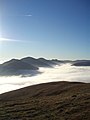 Above the Clouds and Firing Range - geograph.org.uk - 637981.jpg 480 × 640; 36 KB
-
-
 Afon Soch below Pont Towyn - geograph.org.uk - 640118.jpg 640 × 392; 58 KB
-
 Afon Soch upstream of Pont Towyn - geograph.org.uk - 640120.jpg 640 × 384; 71 KB
-
 Almost dry channel, Drumbridge - geograph.org.uk - 637493.jpg 640 × 429; 111 KB
-
 Amberley Church - geograph.org.uk - 1525331.jpg 640 × 480; 86 KB
-
 Amberley Church from Graveyard Opposite - geograph.org.uk - 1525338.jpg 640 × 480; 117 KB
-
 Amberley Graveyard - geograph.org.uk - 1525353.jpg 640 × 480; 135 KB
-

-
 Animal Feeding Area Near Killyleoch - geograph.org.uk - 638405.jpg 640 × 480; 200 KB
-

-

-
 Auchmannoch Muir - geograph.org.uk - 637718.jpg 640 × 480; 60 KB
-
 Avenue Leading to Rigghead - geograph.org.uk - 638712.jpg 640 × 480; 170 KB
-
 Bakehouse Square - geograph.org.uk - 638132.jpg 640 × 427; 331 KB
-
 Bank of Trees Near Meikle Barncleugh - geograph.org.uk - 638738.jpg 640 × 480; 167 KB
-
 Barnshalloch Burn - geograph.org.uk - 638089.jpg 640 × 480; 218 KB
-
 Barnsoul Wood After Some Felling - geograph.org.uk - 638636.jpg 640 × 480; 217 KB
-

-
 Baysgarth Park, Barton-upon-Humber - geograph.org.uk - 637433.jpg 640 × 480; 104 KB
-

-
 Beeston Town Hall (detail) - geograph.org.uk - 637722.jpg 640 × 581; 112 KB
-
 Beeston Lads Club - 21st Dec 2007 - geograph.org.uk - 637468.jpg 640 × 427; 63 KB
-
 Beeston Town Hall - geograph.org.uk - 637488.jpg 640 × 418; 59 KB
-
 Boathouse West of Hampton Court - geograph.org.uk - 637564.jpg 640 × 480; 103 KB
-
 Boats and floats in Abersoch Harbour - geograph.org.uk - 645539.jpg 640 × 480; 116 KB
-
 Boats at night (7) - geograph.org.uk - 637899.jpg 640 × 582; 97 KB
-
 Boghall Burn, Winter - geograph.org.uk - 637948.jpg 480 × 640; 105 KB
-

-
 Breaking Through The Clouds - geograph.org.uk - 637952.jpg 640 × 480; 29 KB
-
 Sir John Nelthorpe School, Brigg - geograph.org.uk - 637410.jpg 640 × 480; 82 KB
-
 Burn and Fields Near Drummond House - geograph.org.uk - 638749.jpg 640 × 480; 224 KB
-
 Buzzard. - geograph.org.uk - 638495.jpg 640 × 458; 310 KB
-
 Caerketton Cloud Inversion - geograph.org.uk - 637955.jpg 640 × 480; 57 KB
-
 Caerketton from Allermuir - geograph.org.uk - 637967.jpg 640 × 480; 60 KB
-
 Cairn Water - geograph.org.uk - 638419.jpg 640 × 480; 171 KB
-
 Cairn Water - geograph.org.uk - 638430.jpg 640 × 480; 214 KB
-
 Cairn Water from Dalgonar Bridge - geograph.org.uk - 638411.jpg 480 × 640; 137 KB
-
 Cairn Water from Drumpark Bridge - geograph.org.uk - 638098.jpg 480 × 640; 209 KB
-
 Cairn Water from Drumpark Bridge - geograph.org.uk - 638425.jpg 480 × 640; 215 KB
-
 Cairn Water Near Stepford - geograph.org.uk - 638401.jpg 640 × 480; 209 KB
-
 Caledonian Macbrayne Ferry - geograph.org.uk - 658923.jpg 640 × 480; 78 KB
-
 Canongate Church - geograph.org.uk - 637783.jpg 640 × 480; 68 KB
-

-
 Canons Park, The Temple - geograph.org.uk - 638421.jpg 640 × 480; 107 KB
-
 Capel Aber-soch, Capel yr Annibynwyr - geograph.org.uk - 638777.jpg 640 × 480; 63 KB
-

-
 Car Park Ramp - geograph.org.uk - 652158.jpg 480 × 640; 72 KB
-
 Carnforth Station - geograph.org.uk - 642313.jpg 429 × 640; 62 KB
-
 Carnforth Station - geograph.org.uk - 642327.jpg 640 × 428; 86 KB
-
 Carnforth Station - geograph.org.uk - 642332.jpg 640 × 428; 86 KB
-
 Carnforth Station Clock - geograph.org.uk - 642321.jpg 640 × 428; 75 KB
-
 Castellmarch - geograph.org.uk - 645552.jpg 640 × 366; 88 KB
-

-
 Castlelaw View of the Clouds - geograph.org.uk - 637986.jpg 640 × 480; 57 KB
-
 Cattle at Knockshinnoch - geograph.org.uk - 638086.jpg 640 × 480; 194 KB
-
 Cattle Feeding in Frosty Field - geograph.org.uk - 638413.jpg 640 × 480; 166 KB
-
 Cattle Near Barnsoul - geograph.org.uk - 638641.jpg 640 × 480; 170 KB
-
 Christ's Lane - geograph.org.uk - 652070.jpg 640 × 480; 63 KB
-
 Christmas lights - geograph.org.uk - 637588.jpg 480 × 640; 50 KB
-

-
 Church Street - geograph.org.uk - 637590.jpg 640 × 480; 74 KB
-
 Cloud Level - geograph.org.uk - 637975.jpg 640 × 480; 41 KB
-
 Cluden Water Near Cairnryan - geograph.org.uk - 638617.jpg 640 × 480; 195 KB
-
 Conder Mill Bridge, Scotforth - geograph.org.uk - 644231.jpg 640 × 465; 109 KB
-
 Conder Mill Farm, Scotforth - geograph.org.uk - 644236.jpg 640 × 470; 93 KB
-
-

-
 Cottages on Thames Street - geograph.org.uk - 637527.jpg 640 × 480; 82 KB
-

-
 Cottages, Low Road, Halton - geograph.org.uk - 641079.jpg 640 × 480; 72 KB
-
 Cross, Edenhall - geograph.org.uk - 640931.jpg 640 × 480; 124 KB
-
 Cullompton , High Street - geograph.org.uk - 1133353.jpg 640 × 480; 68 KB
-
 Cullompton , Knightswood - geograph.org.uk - 1133354.jpg 640 × 480; 64 KB
-
 Den's fish and chip shop - geograph.org.uk - 637403.jpg 640 × 480; 58 KB
-
 Dentibert Well - geograph.org.uk - 637529.jpg 480 × 640; 105 KB
-
 Descending Into the Clouds - geograph.org.uk - 637991.jpg 640 × 480; 67 KB
-
 Detail of Halton Cross - geograph.org.uk - 641029.jpg 475 × 640; 87 KB
-
 Detail of Ribblehead viaduct - geograph.org.uk - 640276.jpg 480 × 640; 45 KB
-
 Dirleton Castle - geograph.org.uk - 637732.jpg 640 × 480; 82 KB
-
 Dirleton Church of Scotland - geograph.org.uk - 637724.jpg 640 × 480; 88 KB
-
 Disused Railway Embankment - geograph.org.uk - 638611.jpg 640 × 480; 158 KB
-
 Doorway to Town End Farm, Halton - geograph.org.uk - 641695.jpg 504 × 640; 80 KB
-
 Down signal on Settle-Carlisle line - geograph.org.uk - 640267.jpg 480 × 640; 56 KB
-
 Drainage ditch leading to Afon Soch - geograph.org.uk - 646350.jpg 640 × 287; 53 KB
-
-
 Drinking fountain, Rosslyn Hill - geograph.org.uk - 639246.jpg 640 × 480; 67 KB
-

-
 Dry pond - geograph.org.uk - 637409.jpg 640 × 480; 80 KB
-
 Dwylan - geograph.org.uk - 641225.jpg 640 × 480; 148 KB
-
 East Road, Lancaster - geograph.org.uk - 652139.jpg 640 × 473; 108 KB
-
 Eden Bridge, Temple Sowerby - geograph.org.uk - 641034.jpg 640 × 480; 136 KB
-
 Edenhall - geograph.org.uk - 640937.jpg 640 × 480; 135 KB
-

-
-
 Eyemouth Lifeboat Station - geograph.org.uk - 637683.jpg 640 × 480; 70 KB
-
 Eyemouth Parish Church - geograph.org.uk - 637686.jpg 640 × 480; 48 KB
-
 Falls at Routin Bridge - geograph.org.uk - 638432.jpg 480 × 640; 187 KB
-

-
 Farm access under the railway - geograph.org.uk - 640256.jpg 640 × 480; 65 KB
-
 Farm track to Oerddwr - geograph.org.uk - 643037.jpg 640 × 480; 124 KB
-
 Field Beside Old Water - geograph.org.uk - 638638.jpg 640 × 480; 189 KB
-
 Fields and Trees - geograph.org.uk - 638427.jpg 640 × 480; 171 KB
-
 Fields and Wall Near Birkbush - geograph.org.uk - 638424.jpg 640 × 480; 138 KB
-
 Fields Below Killyleoch Hill - geograph.org.uk - 638429.jpg 640 × 480; 180 KB
-
 Fields in Early Morning Mist - geograph.org.uk - 638746.jpg 640 × 480; 140 KB
-
 Fields Near Meikle Barncleugh - geograph.org.uk - 638727.jpg 480 × 640; 195 KB
-

-
 Figurehead close-up - geograph.org.uk - 639716.jpg 480 × 640; 70 KB
-
 Figurehead, Pilgrim's Lane - geograph.org.uk - 639690.jpg 640 × 480; 85 KB
-
 Filter House, Scotforth - geograph.org.uk - 643231.jpg 640 × 461; 66 KB
-
 First Omagh Presbyterian Church - geograph.org.uk - 637827.jpg 640 × 480; 107 KB
-
 Fisher Hall and Fisher Square - geograph.org.uk - 652164.jpg 640 × 480; 94 KB
-
 Fishmonger, Hampstead - geograph.org.uk - 639241.jpg 640 × 480; 87 KB
-
 Footpath Junction, Booth Lane - geograph.org.uk - 637660.jpg 640 × 480; 132 KB
-
 Former Chapel, Hampton - geograph.org.uk - 637594.jpg 480 × 640; 138 KB
-
 Frost Covered Conifers in White Hill Wood - geograph.org.uk - 638743.jpg 480 × 640; 216 KB
-
 Frost Covered Road at Old Cluden - geograph.org.uk - 638629.jpg 480 × 640; 183 KB
-
 Frosty Field Near Birkbush - geograph.org.uk - 638100.jpg 640 × 480; 205 KB
-
 Frosty Fields - geograph.org.uk - 638718.jpg 640 × 283; 303 KB
-
 Frosty Fields at Knockshinnoch - geograph.org.uk - 638709.jpg 640 × 480; 212 KB
-
 Frosty Fields at Lower Stepford - geograph.org.uk - 638422.jpg 640 × 480; 162 KB
-
 Frosty Fields Near Nether Yett - geograph.org.uk - 638614.jpg 640 × 480; 174 KB
-
 Frosty Hillside Near Riddingshill - geograph.org.uk - 638077.jpg 640 × 480; 183 KB
-
 Garrick House, Hampton - geograph.org.uk - 637544.jpg 640 × 480; 96 KB
-
 Garrick's Temple Porch - geograph.org.uk - 637534.jpg 640 × 480; 82 KB
-
 Garrick's Temple, Hampton - geograph.org.uk - 637537.jpg 640 × 480; 72 KB
-
 Gatehouse, Hornby Castle - geograph.org.uk - 640220.jpg 480 × 640; 84 KB
-
 George Square, Glasgow, Christmas.JPG 1,664 × 432; 205 KB
-
 Grey Seals in the Harbour, Eyemouth - geograph.org.uk - 637695.jpg 480 × 640; 55 KB
-
 Halton Cross - geograph.org.uk - 641040.jpg 509 × 640; 125 KB
-
 Hampstead Christmas tree - geograph.org.uk - 639603.jpg 480 × 640; 82 KB
-
 Hampton Ferry - geograph.org.uk - 637512.jpg 480 × 640; 58 KB
-
 Enfield House farmyard - geograph.org.uk - 637460.jpg 640 × 427; 61 KB
-
 Glebe Field - geograph.org.uk - 637462.jpg 640 × 427; 78 KB
-
 Harby Mill - geograph.org.uk - 637464.jpg 427 × 640; 49 KB
-
 Unlit and deflated - geograph.org.uk - 637455.jpg 640 × 427; 100 KB
-
 Hell's Mouth from the Llanengan road - geograph.org.uk - 640943.jpg 640 × 459; 32 KB
-
 High Street, Hampton - geograph.org.uk - 637497.jpg 640 × 480; 107 KB
-
 Hillside at Ingleston - geograph.org.uk - 638754.jpg 640 × 480; 202 KB
-
 Hillside Near Old Cluden - geograph.org.uk - 638082.jpg 640 × 480; 198 KB
-

-
 Hobson Street - geograph.org.uk - 652099.jpg 480 × 640; 72 KB
-
 St. Margaret's Church - geograph.org.uk - 640228.jpg 480 × 640; 56 KB
-
 St. Margaret's Church tower - geograph.org.uk - 640223.jpg 480 × 640; 71 KB
-
 Hornby Bridge - geograph.org.uk - 640213.jpg 480 × 640; 83 KB
-
 Hornby Bridge - geograph.org.uk - 640215.jpg 640 × 480; 77 KB
-
 Hornby Castle - geograph.org.uk - 640200.jpg 640 × 480; 74 KB
-
 Houses in Pilgrim's Lane - geograph.org.uk - 639679.jpg 640 × 480; 73 KB
-
 Houses, High Road, Halton - geograph.org.uk - 641078.jpg 640 × 460; 75 KB
-
 Ice skating on the Glenelg peat cuttings - geograph.org.uk - 944896.jpg 640 × 480; 107 KB
-
 Icy Field - geograph.org.uk - 638747.jpg 640 × 480; 209 KB
-
 Icy Fields Near Meikle Barncleugh - geograph.org.uk - 638736.jpg 640 × 480; 200 KB
-

-
 Irogray Parish Church - geograph.org.uk - 638757.jpg 640 × 480; 145 KB
-
 Irongray Parish Church - geograph.org.uk - 638759.jpg 640 × 480; 161 KB
-
 Ivy House - Turing Home and Plaque - geograph.org.uk - 637597.jpg 480 × 640; 59 KB
-

-

-
 King Street - geograph.org.uk - 652094.jpg 640 × 499; 63 KB
-
 Left hand bank of the River Wenning - geograph.org.uk - 640194.jpg 480 × 640; 85 KB
-

-
 Lissenden Gardens mansions - geograph.org.uk - 639215.jpg 640 × 480; 111 KB
-
 Lissenden Gardens, service balconies - geograph.org.uk - 639230.jpg 480 × 640; 95 KB
-
 Longford River Outflow - geograph.org.uk - 637550.jpg 480 × 640; 138 KB
-
 Looking towards Cairn Guish - geograph.org.uk - 637457.jpg 640 × 480; 84 KB
-
 Low tide at Abersoch Harbour - geograph.org.uk - 645543.jpg 640 × 381; 76 KB
-
 Manor House, Halton.jpg 640 × 457; 94 KB
-
 Melin Foel Fawr, Mynytho.jpg 640 × 480; 53 KB
-
 Mid Devon , Country Road - geograph.org.uk - 1133360.jpg 640 × 480; 70 KB
-
 Mid Devon , Country Road - geograph.org.uk - 1133361.jpg 640 × 480; 40 KB
-
 Mid Devon , Country Road - geograph.org.uk - 1133363.jpg 640 × 480; 36 KB
-
 Mid Devon , Country Road Junction - geograph.org.uk - 1134855.jpg 640 × 480; 73 KB
-
 Mid Devon , Country Roads - geograph.org.uk - 1133359.jpg 640 × 480; 62 KB
-
 Mid Devon , Road Junction - geograph.org.uk - 1133362.jpg 640 × 480; 23 KB
-
 Mid Devon , The M5 Motorway - geograph.org.uk - 1133356.jpg 640 × 480; 29 KB
-
 Miekle Barncleugh Hill - geograph.org.uk - 638080.jpg 480 × 640; 184 KB
-
 Millburn cottage 1.JPG 2,288 × 1,712; 1.29 MB
-
 Millburn cottage front.JPG 1,712 × 2,288; 1.31 MB
-
 Millburn cottage pigsty.JPG 2,288 × 1,712; 1.39 MB
-
 Millburn cottage window.JPG 1,712 × 2,288; 1.29 MB
-
 Millennium House - geograph.org.uk - 637505.jpg 640 × 480; 96 KB
-
 Minor access road - geograph.org.uk - 642702.jpg 640 × 480; 83 KB
-

-

-
-
 Minor Road Near Ingleston Cottages - geograph.org.uk - 638751.jpg 480 × 640; 167 KB
-

-

-
 Moored craft at Abersoch Harbour - geograph.org.uk - 645545.jpg 640 × 346; 55 KB
-
 Moorings, Hampton - geograph.org.uk - 637552.jpg 640 × 480; 105 KB
-

-
-
 St Mark's Church, Nether Kellet - geograph.org.uk - 644254.jpg 640 × 450; 71 KB


_-_geograph.org.uk_-_637722.jpg)


_-_geograph.org.uk_-_637899.jpg)


