Category:United Kingdom photographs taken on 2007-10-30
Jump to navigation
Jump to search
| ← | Tuesday 30 October 2007 | → | ||
| ← | October 2007 | → | ||

United Kingdom photographs taken on 30 October 2007.
Image files should be categorized here automatically using {{taken on}} template. Direct categorisation is also possible, if automatic is impossible.
Subcategories
This category has the following 3 subcategories, out of 3 total.
Media in category "United Kingdom photographs taken on 2007-10-30"
The following 200 files are in this category, out of 856 total.
(previous page) (next page)-
 "Golden Gates", Clandon Park - geograph.org.uk - 598558.jpg 480 × 640; 123 KB
-
 1st Class Accommodation^ - geograph.org.uk - 861919.jpg 640 × 426; 66 KB
-
 1st Class Accommodation^-02 - geograph.org.uk - 861928.jpg 426 × 640; 75 KB
-
 42 Cricklade Street, Swindon - geograph.org.uk - 598850.jpg 640 × 479; 285 KB
-
 A 458(T) - geograph.org.uk - 601150.jpg 640 × 480; 118 KB
-
 A wee house at Aughnacloy - geograph.org.uk - 598414.jpg 640 × 480; 68 KB
-
 A4136 enters the Forest of Dean - geograph.org.uk - 598607.jpg 640 × 480; 144 KB
-
 A458 (T) - geograph.org.uk - 601024.jpg 640 × 480; 84 KB
-
 A470 - geograph.org.uk - 601199.jpg 480 × 640; 127 KB
-

-
 Access track beside the winter barley - geograph.org.uk - 598872.jpg 640 × 480; 76 KB
-
 Adder at Walberswick Suffolk - geograph.org.uk - 1104514.jpg 640 × 512; 141 KB
-
 Additional car park for Skyspace - geograph.org.uk - 599201.jpg 640 × 480; 117 KB
-
 Agecroft fire station - geograph.org.uk - 607168.jpg 640 × 427; 183 KB
-

-
 All Oaks Wood - geograph.org.uk - 605496.jpg 640 × 480; 108 KB
-
 All Souls Church, Langham Place - geograph.org.uk - 606687.jpg 480 × 640; 52 KB
-
 Altrincham fire station - geograph.org.uk - 607235.jpg 640 × 427; 212 KB
-
 American Forces Church RAF West Ruislip.jpg 2,016 × 1,512; 797 KB
-

-
 Antiques centre, Bideford - geograph.org.uk - 601431.jpg 480 × 640; 94 KB
-
 Apple Grove Recreation Ground, Bilton - geograph.org.uk - 601026.jpg 640 × 428; 145 KB
-
 Ash tree in the afternoon sun - geograph.org.uk - 598866.jpg 640 × 480; 48 KB
-
 Ash Tree near Turton's Covert - geograph.org.uk - 599563.jpg 640 × 463; 84 KB
-
 Ashe Mill - geograph.org.uk - 598703.jpg 579 × 640; 165 KB
-
 Autumn Colours - geograph.org.uk - 606099.jpg 640 × 480; 73 KB
-
 Autumn Colours - geograph.org.uk - 606100.jpg 640 × 480; 38 KB
-
 Autumn Colours - geograph.org.uk - 606101.jpg 640 × 480; 38 KB
-
 Autumn in Dixon Park near Belfast - geograph.org.uk - 598742.jpg 640 × 425; 128 KB
-
 B3232 at Stonyland Bridge - geograph.org.uk - 601134.jpg 640 × 476; 53 KB
-
 Back Lane Cottage - geograph.org.uk - 598681.jpg 640 × 480; 101 KB
-
 Banksy Pollard Street.jpg 600 × 800; 119 KB
-
 Barking Park - geograph.org.uk - 600864.jpg 640 × 480; 173 KB
-
 Barking Park, The Lake - geograph.org.uk - 601621.jpg 640 × 480; 118 KB
-
 Barking Park, The Lake - geograph.org.uk - 601635.jpg 640 × 480; 89 KB
-
 Barking, Al-Madina Mosque - geograph.org.uk - 600909.jpg 640 × 451; 50 KB
-
 Barking, Tanner Street - geograph.org.uk - 602920.jpg 640 × 480; 83 KB
-
 Barton Stacey - Dever Springs - geograph.org.uk - 603266.jpg 640 × 499; 167 KB
-
 Barton Stacey - Granary Cottage - geograph.org.uk - 603395.jpg 640 × 512; 121 KB
-
 Bartridge Common - geograph.org.uk - 600739.jpg 640 × 448; 68 KB
-
 Beach Front - geograph.org.uk - 603617.jpg 640 × 480; 97 KB
-
 Beaumont Mews - geograph.org.uk - 606627.jpg 640 × 480; 65 KB
-
 Beauty Shops on Atlantic Road, SW9 - geograph.org.uk - 599182.jpg 640 × 480; 94 KB
-
 Beckhill Social Club - Manorley Lane - geograph.org.uk - 598492.jpg 640 × 380; 24 KB
-
 Bell Hotel, High Street, Swindon - geograph.org.uk - 598505.jpg 640 × 480; 80 KB
-

-
 Belladown Hill - geograph.org.uk - 599134.jpg 640 × 480; 58 KB
-
 Belladown Hill - geograph.org.uk - 600210.jpg 640 × 411; 45 KB
-
 Bend in lane near Litchardon - geograph.org.uk - 601231.jpg 640 × 480; 117 KB
-
 Bettisfield Windmill - geograph.org.uk - 598775.jpg 640 × 480; 56 KB
-
 Bewick Hall - geograph.org.uk - 600402.jpg 640 × 399; 59 KB
-
 Bewick Hall Farm - geograph.org.uk - 600396.jpg 516 × 640; 104 KB
-

-

-
 Birch and alder scrub on Fenn's Moss - geograph.org.uk - 598657.jpg 640 × 480; 91 KB
-
 Bishopdale Court, Settle - geograph.org.uk - 600090.jpg 480 × 640; 171 KB
-
 Bishopdale Court, Settle - geograph.org.uk - 600092.jpg 472 × 630; 182 KB
-
 Black Horse Inn, Clifton - geograph.org.uk - 598810.jpg 640 × 451; 79 KB
-
 Black Horse Inn, Clifton - geograph.org.uk - 598834.jpg 640 × 483; 65 KB
-
 Black sheep of the family - geograph.org.uk - 600030.jpg 640 × 480; 80 KB
-

-
 Blue Boar Farm - geograph.org.uk - 598498.jpg 640 × 480; 85 KB
-
-
 Bolton Priory - geograph.org.uk - 603128.jpg 640 × 480; 116 KB
-
 Border fence near Black Knowe - geograph.org.uk - 599153.jpg 640 × 480; 160 KB
-
 Bottomley Street - geograph.org.uk - 598483.jpg 640 × 436; 88 KB
-
 Bradford Road, Brighouse - geograph.org.uk - 599974.jpg 640 × 480; 120 KB
-
 Bradford Road, Brighouse - geograph.org.uk - 599983.jpg 640 × 480; 87 KB
-
 Bradford Road, Brighouse - geograph.org.uk - 600029.jpg 640 × 475; 68 KB
-
 Bradford Road, Hipperholme - geograph.org.uk - 600855.jpg 640 × 472; 58 KB
-

-
-
 Bridge End railway station in 2007.jpg 640 × 392; 68 KB
-
 Bridge End station, Belfast (1) - geograph.org.uk - 598611.jpg 640 × 426; 72 KB
-
 Bridge Street Row west - geograph.org.uk - 605996.jpg 640 × 480; 132 KB
-
 Bridleway near Welshampton - geograph.org.uk - 598676.jpg 640 × 480; 93 KB
-
 Bridleway to Scosthrop Lane - geograph.org.uk - 599929.jpg 640 × 480; 74 KB
-
 Bridlington Harbour - geograph.org.uk - 754517.jpg 640 × 480; 47 KB
-
 Broadcasting House - geograph.org.uk - 606696.jpg 480 × 640; 56 KB
-
 Broughton fire station - geograph.org.uk - 607174.jpg 640 × 427; 203 KB
-
 Buck Burn - geograph.org.uk - 599159.jpg 640 × 480; 158 KB
-
 Buckley old fire station - geograph.org.uk - 607214.jpg 640 × 427; 203 KB
-
 Buckstones - geograph.org.uk - 1543190.jpg 480 × 640; 68 KB
-
 Butcher's Lane, Withernwick - geograph.org.uk - 602945.jpg 464 × 640; 128 KB
-
 Butchers Row, Bideford Market - geograph.org.uk - 601437.jpg 480 × 640; 80 KB
-
 By the lane to Stonyland - geograph.org.uk - 600986.jpg 640 × 480; 114 KB
-
 Cakeham Manor from the beach - geograph.org.uk - 603601.jpg 640 × 480; 88 KB
-
 Capstan, Thompson Graving Dock - geograph.org.uk - 599223.jpg 640 × 480; 62 KB
-
 Car Park at Harts Barn Craft Centre - geograph.org.uk - 598613.jpg 640 × 480; 127 KB
-
 Carn Galver Mine - geograph.org.uk - 613353.jpg 640 × 422; 177 KB
-
 Carn Galver Mine - geograph.org.uk - 613354.jpg 640 × 639; 246 KB
-
 Carnteel Road, Aughnacloy - geograph.org.uk - 598413.jpg 640 × 294; 30 KB
-
 Carved figures, Aughnacloy - geograph.org.uk - 598435.jpg 640 × 480; 49 KB
-
 Carved stones, Aughnacloy - geograph.org.uk - 598434.jpg 640 × 480; 77 KB
-

-
 Cattle near St John's Chapel - geograph.org.uk - 601155.jpg 640 × 474; 91 KB
-
 Cattle near Tennacott - geograph.org.uk - 600240.jpg 640 × 437; 57 KB
-

-
 Charlacott - geograph.org.uk - 599146.jpg 640 × 480; 76 KB
-
 Charlacott Cross - geograph.org.uk - 600972.jpg 640 × 480; 67 KB
-
 Cheadle Hulme fire station - geograph.org.uk - 607271.jpg 640 × 427; 211 KB
-
 Cheadle Hulme Fire Station.jpg 640 × 427; 207 KB
-
 Chester old fire station - geograph.org.uk - 607218.jpg 640 × 427; 272 KB
-

-
 Children's play area, Belle Vue Park - geograph.org.uk - 600765.jpg 640 × 480; 159 KB
-
 Chiltern Street - geograph.org.uk - 606278.jpg 640 × 480; 86 KB
-
 Chiltern Street car park - geograph.org.uk - 606273.jpg 640 × 480; 69 KB
-
 Chopped maize - geograph.org.uk - 598699.jpg 640 × 480; 102 KB
-

-
 Church Lawford - geograph.org.uk - 599252.jpg 640 × 480; 67 KB
-
 Church Lawford - geograph.org.uk - 600012.jpg 640 × 480; 98 KB
-
 Church Lawford - geograph.org.uk - 603231.jpg 640 × 480; 92 KB
-
 Church Lawford - geograph.org.uk - 603245.jpg 640 × 480; 61 KB
-
 Church Lawford-Limestone Hall Lane - geograph.org.uk - 599251.jpg 480 × 640; 106 KB
-
 Church Lawford-Railway Bridge - geograph.org.uk - 600031.jpg 640 × 480; 113 KB
-
-
 Church Porch - St. Nicholas' West Thorney - geograph.org.uk - 604077.jpg 425 × 640; 100 KB
-
 Churchyard, Newton Tracey - geograph.org.uk - 600748.jpg 480 × 640; 110 KB
-
 City of London's skyscrapers from St. Paul.jpg 3,008 × 2,000; 1.29 MB
-
 Clandon House 01.jpg 640 × 480; 146 KB
-
 Clandon Park - geograph.org.uk - 598627.jpg 640 × 480; 135 KB
-
 Clandon Regis Gateway - geograph.org.uk - 598579.jpg 640 × 480; 96 KB
-
 Clough House millpond, Slaithwaite - geograph.org.uk - 1544823.jpg 480 × 640; 176 KB
-
 Clydebank Retail Park - geograph.org.uk - 602279.jpg 640 × 480; 79 KB
-
 Coco Momo - geograph.org.uk - 606288.jpg 640 × 480; 99 KB
-
 Coley Avenue, Reading - geograph.org.uk - 604116.jpg 640 × 480; 192 KB
-
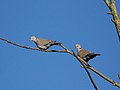 Collared Dove (Streptopelia decaocto) - geograph.org.uk - 599740.jpg 640 × 480; 38 KB
-
 Commemorative Bench - geograph.org.uk - 599222.jpg 640 × 434; 150 KB
-
 Conwy Valley - geograph.org.uk - 1097533.jpg 640 × 427; 69 KB
-
 Cotehele in Autumn - geograph.org.uk - 613282.jpg 604 × 452; 121 KB
-
 Cottage - Buttershaw Lane - geograph.org.uk - 598515.jpg 640 × 561; 39 KB
-
 Cottage at Pikes End - geograph.org.uk - 598855.jpg 640 × 480; 81 KB
-
 Cottages at Cadney Bank - geograph.org.uk - 598752.jpg 640 × 480; 82 KB
-
 Countryside east of Grabbishaw - geograph.org.uk - 600709.jpg 640 × 413; 78 KB
-
 Cow and calf grazing Cadney Moss - geograph.org.uk - 598765.jpg 640 × 480; 156 KB
-
 Cowden Lane, Withernwick - geograph.org.uk - 602987.jpg 640 × 446; 81 KB
-
 Cranes, Harland and Wolff - geograph.org.uk - 599238.jpg 640 × 498; 49 KB
-
 Crop spraying contractor moves on - geograph.org.uk - 598812.jpg 640 × 480; 86 KB
-
 Crosemere Hall - geograph.org.uk - 599029.jpg 640 × 480; 87 KB
-
 Cross symbol, Aughnacloy - geograph.org.uk - 598438.jpg 640 × 480; 89 KB
-
 Cry me a river - geograph.org.uk - 598773.jpg 497 × 640; 112 KB
-

-
 Day room, Copperfields Nursing Home - geograph.org.uk - 598445.jpg 480 × 640; 118 KB
-
 Deer proof fence near Shielsike Crags - geograph.org.uk - 599163.jpg 640 × 480; 129 KB
-
 Dellwood Hospital, Reading - geograph.org.uk - 604119.jpg 640 × 480; 127 KB
-
 Detail to St Mary (Old Church) Wilton - geograph.org.uk - 599815.jpg 640 × 480; 149 KB
-
 Detail, 42 Cricklade Street, Swindon (1) - geograph.org.uk - 598895.jpg 640 × 479; 297 KB
-
 Detail, 42 Cricklade Street, Swindon (2) - geograph.org.uk - 598896.jpg 640 × 479; 301 KB
-
 Detail, 42 Cricklade Street, Swindon (3) - geograph.org.uk - 600360.jpg 640 × 480; 300 KB
-
 Devonshire Mews South - geograph.org.uk - 606635.jpg 480 × 640; 50 KB
-
 Dial a Roti, Bradford - geograph.org.uk - 598734.jpg 640 × 464; 112 KB
-
 Diglis Lock, Worcester - geograph.org.uk - 613692.jpg 640 × 426; 59 KB
-
 Disused farm west of Garn-yr-erw - geograph.org.uk - 598672.jpg 640 × 480; 112 KB
-
 Downs View Road, Swindon - geograph.org.uk - 599067.jpg 640 × 479; 308 KB
-
 Dredging at the Victoria Channel - geograph.org.uk - 599244.jpg 640 × 472; 39 KB
-

-
 Dyffryn Arms sign - geograph.org.uk - 621720.jpg 480 × 640; 89 KB
-
 Saint Thomas of Canterbury, East Clandon - geograph.org.uk - 598583.jpg 640 × 480; 104 KB
-
 Saint Thomas' Tower - geograph.org.uk - 598584.jpg 480 × 640; 98 KB
-
 East Clandon Downland - geograph.org.uk - 598589.jpg 640 × 480; 160 KB
-
 East Hill, Charminster - geograph.org.uk - 629393.jpg 640 × 480; 97 KB
-
 East of Withernwick - geograph.org.uk - 602918.jpg 640 × 453; 108 KB
-
 Eccles fire station - geograph.org.uk - 607232.jpg 640 × 427; 206 KB
-
 Ellwood Lodge, Bradford Road, Brighouse - geograph.org.uk - 599986.jpg 640 × 480; 130 KB
-
 Entrance to Grosvenor Shopping Centre - geograph.org.uk - 606000.jpg 480 × 640; 214 KB
-
 Euroclydon Nursing Home - geograph.org.uk - 598578.jpg 640 × 480; 105 KB
-
 Fairlop Waters - geograph.org.uk - 602222.jpg 640 × 480; 94 KB
-
 Fairlop Waters - geograph.org.uk - 602232.jpg 640 × 480; 64 KB
-
 Fairlop Waters, Cycle circuit - geograph.org.uk - 602263.jpg 640 × 480; 99 KB
-
 Farm buildings at Lyneal Hall - geograph.org.uk - 598804.jpg 640 × 480; 106 KB
-
 Farm buildings at Pikes End Farm - geograph.org.uk - 598848.jpg 640 × 480; 60 KB
-
 Farm Track to Birch Hall Farm - geograph.org.uk - 598732.jpg 640 × 427; 53 KB
-
 Farringdon 3rd rail AC overhead.JPG 1,280 × 960; 337 KB
-
 Fence by Hele Lane - geograph.org.uk - 601368.jpg 640 × 471; 63 KB
-
 Fiddes Court, Aughnacloy - geograph.org.uk - 598450.jpg 640 × 480; 39 KB
-
 Field at Newton Tracey - geograph.org.uk - 600816.jpg 488 × 640; 122 KB
-
 Field at Newton Tracey - geograph.org.uk - 600856.jpg 640 × 480; 92 KB
-
 Field at Rowden Thorn - geograph.org.uk - 600209.jpg 640 × 480; 49 KB
-
 Field beside Mill Hill - geograph.org.uk - 598876.jpg 640 × 480; 110 KB
-
 Field by the A386 - geograph.org.uk - 598769.jpg 640 × 480; 87 KB
-
 Field east of Newton Tracey - geograph.org.uk - 600717.jpg 640 × 480; 111 KB
-

-
 Field near Newton Tracey - geograph.org.uk - 600725.jpg 640 × 480; 85 KB
-
 Field near Pristacott - geograph.org.uk - 600720.jpg 640 × 480; 103 KB
-
 Field near Rook's Bridge - geograph.org.uk - 598998.jpg 640 × 480; 76 KB
-
 Field north of Charlacott Cross - geograph.org.uk - 600995.jpg 640 × 480; 62 KB
-
 Fields and trees looking good - geograph.org.uk - 598947.jpg 640 × 480; 67 KB
-
 Fields by the Orange Hayes - geograph.org.uk - 598760.jpg 640 × 427; 69 KB
-

-
 Foel Dugeod - geograph.org.uk - 601169.jpg 640 × 480; 92 KB
-
 Footpath down farm access track - geograph.org.uk - 598962.jpg 640 × 480; 93 KB
-
 Footpath to Kirk Sykes - geograph.org.uk - 599944.jpg 640 × 480; 68 KB
-
 Footpath, Westgate, Cleckheaton - geograph.org.uk - 599769.jpg 640 × 480; 154 KB
-
 Forest road near Drowning Sike - geograph.org.uk - 599156.jpg 640 × 480; 162 KB
-
-

-

-
 Freshly ploughed field - geograph.org.uk - 598824.jpg 640 × 480; 85 KB
-
 Garage in Argyle Street - geograph.org.uk - 607287.jpg 640 × 427; 230 KB
-


_-_geograph.org.uk_-_601150.jpg)


_-_geograph.org.uk_-_601024.jpg)


_Roundabout_-_geograph.org.uk_-_598738.jpg)

_-_geograph.org.uk_-_598611.jpg)


_-_geograph.org.uk_-_599740.jpg)


_Wilton_-_geograph.org.uk_-_599815.jpg)
_-_geograph.org.uk_-_598895.jpg)
_-_geograph.org.uk_-_598896.jpg)
_-_geograph.org.uk_-_600360.jpg)


_-_geograph.org.uk_-_598758.jpg)


_-_geograph.org.uk_-_599219.jpg)


