Category:United Kingdom photographs taken on 2007-10-19
Jump to navigation
Jump to search
| ← | Friday 19 October 2007 | → | ||
| ← | October 2007 | → | ||

United Kingdom photographs taken on 19 October 2007.
Image files should be categorized here automatically using {{taken on}} template. Direct categorisation is also possible, if automatic is impossible.
Subcategories
This category has the following 2 subcategories, out of 2 total.
Media in category "United Kingdom photographs taken on 2007-10-19"
The following 200 files are in this category, out of 851 total.
(previous page) (next page)-
 "Anybody at home" - geograph.org.uk - 588326.jpg 640 × 480; 78 KB
-
 A slightly different view of the moat - geograph.org.uk - 1768260.jpg 2,136 × 2,848; 1.49 MB
-
 A148 Into Cromer.JPG 2,560 × 1,920; 1.18 MB
-
 A148 Road sign.JPG 2,560 × 1,920; 777 KB
-

-
 Aberdeen, city skyline - geograph.org.uk - 598124.jpg 640 × 369; 47 KB
-
 Across Presont Hill - geograph.org.uk - 588798.jpg 640 × 430; 201 KB
-
 Across the fields to Brynsifiog - geograph.org.uk - 589880.jpg 640 × 295; 46 KB
-

-
 Airy Hope - geograph.org.uk - 588367.jpg 640 × 382; 101 KB
-
 Alberta Terrace - geograph.org.uk - 592734.jpg 640 × 459; 110 KB
-
 An autumn day at Froggatt Edge - geograph.org.uk - 589768.jpg 640 × 482; 106 KB
-
 An autumn scene at Froggatt Edge - geograph.org.uk - 589333.jpg 640 × 482; 127 KB
-
 Antrim Castle (ruin) - geograph.org.uk - 588779.jpg 640 × 427; 90 KB
-
 Arable fields and the Black Mountains - geograph.org.uk - 588242.jpg 640 × 480; 114 KB
-
 Ash tree near Glas-waen - geograph.org.uk - 588301.jpg 640 × 480; 90 KB
-
 Ash trees in Cwm Sorgwm - geograph.org.uk - 588549.jpg 480 × 640; 188 KB
-
 Ashfield Approach - geograph.org.uk - 591291.jpg 640 × 480; 100 KB
-
 Ashfield Junction - geograph.org.uk - 591295.jpg 640 × 480; 105 KB
-
 Ashford High Street - geograph.org.uk - 1194393.jpg 480 × 640; 96 KB
-
 Ashgrove Farm - geograph.org.uk - 589323.jpg 640 × 430; 178 KB
-
 Audley Brow - geograph.org.uk - 588156.jpg 640 × 480; 96 KB
-
 Autumn colours at Batsford - geograph.org.uk - 599945.jpg 640 × 480; 94 KB
-
 Autumn colours in Coed Mawr Quarry - geograph.org.uk - 592951.jpg 640 × 445; 168 KB
-
 Autumn crocus, Painswick - geograph.org.uk - 592850.jpg 525 × 640; 84 KB
-
 Autumn foliage - geograph.org.uk - 1014796.jpg 480 × 640; 111 KB
-
 Autumn Leaves - geograph.org.uk - 591918.jpg 427 × 640; 124 KB
-
 Autumn Moss - geograph.org.uk - 588824.jpg 640 × 480; 276 KB
-
 Autumn on the Sixmilewater, Antrim - geograph.org.uk - 588856.jpg 640 × 427; 126 KB
-
 Avenue Road - geograph.org.uk - 592745.jpg 640 × 480; 156 KB
-
 Avenue Road - geograph.org.uk - 592759.jpg 640 × 480; 175 KB
-
-
-
 Bamboo at Batsford - geograph.org.uk - 599941.jpg 480 × 640; 125 KB
-
 Barn at Stroud Slad Farm - geograph.org.uk - 592287.jpg 640 × 465; 92 KB
-
 Bath Spa Station - geograph.org.uk - 588776.jpg 640 × 426; 111 KB
-
 Beacons panorama - geograph.org.uk - 588578.jpg 640 × 243; 46 KB
-
 Beautiful Marlow - panoramio.jpg 3,456 × 2,304; 2.53 MB
-
 Belby Cottage.jpg 640 × 443; 78 KB
-

-
 Benches at Newbiggin - geograph.org.uk - 590886.jpg 640 × 399; 66 KB
-
 Beneath London Bridge - geograph.org.uk - 895821.jpg 640 × 479; 72 KB
-
 Bisham Abbey at sunrise - panoramio.jpg 3,456 × 2,304; 2.55 MB
-
 Bisham Church - panoramio.jpg 3,456 × 2,304; 2.52 MB
-
 Bisham church - panoramio.jpg 2,304 × 3,456; 2.85 MB
-
 Bishop Dale, Thringstone - geograph.org.uk - 615816.jpg 640 × 482; 128 KB
-
 Bishop's Stortford Post Office - geograph.org.uk - 592658.jpg 640 × 474; 87 KB
-
 Bishop's Stortford sidings - geograph.org.uk - 592795.jpg 640 × 482; 109 KB
-
 Bishop's Stortford signal box - geograph.org.uk - 592791.jpg 640 × 480; 108 KB
-
 Bishop's Stortford station - geograph.org.uk - 593386.jpg 640 × 480; 85 KB
-
 Bishop's Stortford Working Men's Club - geograph.org.uk - 592653.jpg 640 × 480; 100 KB
-
 Black Books... - geograph.org.uk - 595452.jpg 640 × 480; 83 KB
-
 Black Boy, Stroud - geograph.org.uk - 591616.jpg 515 × 640; 94 KB
-
 Black Mountains view - geograph.org.uk - 589145.jpg 640 × 340; 56 KB
-
 Blane Valley - geograph.org.uk - 1565590.jpg 640 × 428; 93 KB
-
 Blue Plaque, 13 Bedford Square - geograph.org.uk - 602909.jpg 584 × 640; 71 KB
-
 Blue Plaque, St Woolos Cemetery lodge - geograph.org.uk - 601691.jpg 480 × 640; 189 KB
-
 BMA House, Tavistock Square - geograph.org.uk - 588822.jpg 480 × 640; 124 KB
-
 Brandon Grove - geograph.org.uk - 588054.jpg 640 × 480; 116 KB
-
 Briar Street Rochdale - geograph.org.uk - 589007.jpg 640 × 480; 113 KB
-

-
 Bridges, Antrim town (1) - geograph.org.uk - 588755.jpg 640 × 427; 65 KB
-
 Bridges, Antrim town (2) - geograph.org.uk - 588762.jpg 640 × 427; 94 KB
-
 Bridges, Antrim town (3) - geograph.org.uk - 588769.jpg 636 × 423; 111 KB
-
 Bridges, Antrim town (4) - geograph.org.uk - 588775.jpg 640 × 427; 106 KB
-
 Bridleway heading towards Keyson - geograph.org.uk - 719962.jpg 640 × 425; 80 KB
-
 Bridleway to Covington - geograph.org.uk - 588523.jpg 640 × 425; 100 KB
-
 Bryncrug Village - geograph.org.uk - 1013453.jpg 640 × 480; 85 KB
-
 Budle Bay, Northumberland - geograph.org.uk - 746397.jpg 640 × 426; 51 KB
-
 Building site by the Stort - geograph.org.uk - 593369.jpg 640 × 480; 80 KB
-
 Building site by the Stort - geograph.org.uk - 593373.jpg 480 × 640; 85 KB
-
 Burland Common - geograph.org.uk - 593025.jpg 478 × 640; 141 KB
-
 Burland Lane - geograph.org.uk - 593003.jpg 640 × 477; 144 KB
-
 Burland Lane - geograph.org.uk - 593026.jpg 451 × 640; 142 KB
-
 Burland Lane Crossing - geograph.org.uk - 593009.jpg 523 × 640; 138 KB
-
 Buxhall village sign - geograph.org.uk - 588168.jpg 418 × 640; 60 KB
-
 Bwlch y Cwm and the southern airshaft - geograph.org.uk - 595749.jpg 480 × 640; 100 KB
-
 Cant Clough Reservoir - geograph.org.uk - 588817.jpg 640 × 480; 72 KB
-
 Carr Pond - geograph.org.uk - 588073.jpg 640 × 480; 100 KB
-
 Cattle at Prees in Shropshire, England.jpg 640 × 480; 136 KB
-
 Causeway End Derelict Farmhouse - geograph.org.uk - 687665.jpg 640 × 479; 86 KB
-
 Caville Bridge - geograph.org.uk - 593032.jpg 461 × 640; 85 KB
-
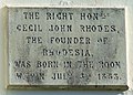 Cecil Rhodes Plaque - geograph.org.uk - 592547.jpg 640 × 460; 126 KB
-
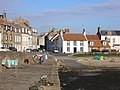 Cellardyke Harbour - geograph.org.uk - 598256.jpg 640 × 480; 80 KB
-
 Cerne Abbey guest house - geograph.org.uk - 1403434.jpg 640 × 480; 353 KB
-
 Flying the flag - geograph.org.uk - 1007506.jpg 640 × 480; 14 KB
-
 Flying the flag - geograph.org.uk - 1007514.jpg 640 × 480; 23 KB
-
 Christmas display, Omagh - geograph.org.uk - 588201.jpg 480 × 640; 102 KB
-
 Church and parsonage, Buxhall - geograph.org.uk - 588170.jpg 640 × 503; 120 KB
-

-
 Clotworthy House, Antrim (1) - geograph.org.uk - 588816.jpg 640 × 427; 94 KB
-
 Clotworthy House, Antrim (2) - geograph.org.uk - 588819.jpg 640 × 426; 106 KB
-
 Clotworthy House, Antrim (3) - geograph.org.uk - 588825.jpg 640 × 505; 136 KB
-
 Clotworthy House, Antrim (4) - geograph.org.uk - 588849.jpg 640 × 503; 150 KB
-
 Commandery, Worcester - geograph.org.uk - 603324.jpg 640 × 480; 83 KB
-

-
 Coppice Lane near Steel Heath - geograph.org.uk - 588285.jpg 640 × 480; 124 KB
-
 Coton Methodist Chapel - geograph.org.uk - 588219.jpg 640 × 480; 122 KB
-
 Coton Methodist Chapel - geograph.org.uk - 588452.jpg 640 × 480; 117 KB
-
 Cottage, Low Barness - geograph.org.uk - 588286.jpg 640 × 480; 82 KB
-
 Council Offices - geograph.org.uk - 588599.jpg 640 × 424; 53 KB
-
 Cow, Pond and Castle - geograph.org.uk - 619942.jpg 5,888 × 3,925; 4.06 MB
-
 Craft area at Eyam Hall - geograph.org.uk - 588616.jpg 640 × 409; 227 KB
-
 Crescent Road - geograph.org.uk - 592723.jpg 599 × 640; 186 KB
-
 Crossing Helvellyn Gill - geograph.org.uk - 588740.jpg 640 × 479; 190 KB
-
 Crumble Manor Bennetland.jpg 640 × 413; 96 KB
-
 Curved Ditch - geograph.org.uk - 588297.jpg 640 × 480; 128 KB
-
 Dane Street - geograph.org.uk - 592799.jpg 640 × 439; 82 KB
-
 Dane Street - geograph.org.uk - 592809.jpg 640 × 435; 69 KB
-
 Date stone - geograph.org.uk - 592740.jpg 640 × 512; 123 KB
-
 David Douglas Memorial - geograph.org.uk - 588489.jpg 640 × 604; 73 KB
-
 Derelict Farmhouse - geograph.org.uk - 588332.jpg 640 × 480; 106 KB
-
 Derelict Farmhouse - geograph.org.uk - 588334.jpg 640 × 480; 103 KB
-
 Derwent-side beech - geograph.org.uk - 591662.jpg 422 × 640; 165 KB
-
 Descending Lower Man - geograph.org.uk - 588742.jpg 640 × 480; 137 KB
-
 Devil's Dyke - geograph.org.uk - 751645.jpg 620 × 465; 77 KB
-
 Dismantled Railway Line - geograph.org.uk - 605159.jpg 640 × 480; 77 KB
-
 Disused buildings - geograph.org.uk - 588110.jpg 640 × 425; 103 KB
-
 Disused Swimming Pool - geograph.org.uk - 596607.jpg 640 × 480; 68 KB
-
 Door at Holy Trinity Church - geograph.org.uk - 592631.jpg 480 × 640; 114 KB
-
 Drain Lane - geograph.org.uk - 593169.jpg 640 × 501; 134 KB
-
 Drive to Half Moon Stud - geograph.org.uk - 588965.jpg 640 × 430; 235 KB
-
 Ducketts Wharf - geograph.org.uk - 592611.jpg 640 × 480; 98 KB
-
 Ducketts Wharf - geograph.org.uk - 592614.jpg 424 × 640; 90 KB
-
 Early morning on the Glaslyn Estuary - geograph.org.uk - 594679.jpg 640 × 333; 51 KB
-
 Earthworks, Eston Nab - geograph.org.uk - 588079.jpg 640 × 480; 85 KB
-
 Eastern Edge of Pittenweem from the Coast - geograph.org.uk - 600715.jpg 640 × 480; 110 KB
-
 Eastrington Bridge - geograph.org.uk - 592996.jpg 640 × 474; 121 KB
-
 Eastrington Methodist Church.jpg 640 × 436; 73 KB
-
 Eastrington Ponds Nature Reserve - geograph.org.uk - 592955.jpg 443 × 640; 164 KB
-
 Eastrington Ponds Nature Reserve - geograph.org.uk - 592962.jpg 640 × 413; 108 KB
-
 Eastrington Ponds Nature Reserve - geograph.org.uk - 592974.jpg 640 × 447; 53 KB
-
 Eastrington Ponds Nature Reserve.jpg 640 × 461; 77 KB
-
 Eastrington Station - geograph.org.uk - 592000.jpg 640 × 440; 72 KB
-

-
 Elevated Sea Cave - geograph.org.uk - 596583.jpg 640 × 480; 96 KB
-
 Emmerdale Village - panoramio - ianpudsey.jpg 450 × 337; 55 KB
-
 Eston Nab Monument-by-Stephen-McCulloch.jpg 480 × 640; 84 KB
-
 Eyam Edge - geograph.org.uk - 588594.jpg 640 × 428; 242 KB
-
 Farm road up to Manor Farm - geograph.org.uk - 588514.jpg 640 × 425; 73 KB
-
 Farm Track - geograph.org.uk - 596600.jpg 640 × 480; 62 KB
-
 Farmland alongside Lighteach Lane - geograph.org.uk - 588436.jpg 640 × 480; 92 KB
-
 Farmland near Mossley Well Farm - geograph.org.uk - 588352.jpg 640 × 480; 120 KB
-
 Farmland north of Rack Lane - geograph.org.uk - 588346.jpg 640 × 480; 123 KB
-
 Field beside Slad Lane - geograph.org.uk - 592244.jpg 640 × 480; 100 KB
-
 Field boundary - geograph.org.uk - 588314.jpg 640 × 480; 116 KB
-
 Field edge path - geograph.org.uk - 588322.jpg 640 × 480; 139 KB
-
 Field edge path - geograph.org.uk - 588323.jpg 640 × 480; 143 KB
-
 Field side path - geograph.org.uk - 588304.jpg 640 × 480; 133 KB
-
 Fife Coastal Path - geograph.org.uk - 596596.jpg 640 × 480; 59 KB
-
 Fife Coastal Path - geograph.org.uk - 605157.jpg 640 × 480; 60 KB
-

-
 Fife Coastal Path bridges a burn - geograph.org.uk - 596570.jpg 640 × 480; 117 KB
-
 FirstGroup Bath bus depot in Somerset 19 October 2007.jpg 640 × 426; 65 KB
-
 Fishermen's Bothy, Potarch - geograph.org.uk - 1014803.jpg 640 × 480; 115 KB
-
 Fishing off Lynemouth beach - geograph.org.uk - 590895.jpg 640 × 421; 79 KB
-
 Flats on Onslow Road, Drumry - geograph.org.uk - 588272.jpg 640 × 480; 52 KB
-
 Flower pottys - geograph.org.uk - 592456.jpg 640 × 480; 152 KB
-
 Flowing by - geograph.org.uk - 588109.jpg 640 × 425; 127 KB
-
 Footbridge and field side path - geograph.org.uk - 588311.jpg 640 × 480; 102 KB
-
 Footpath - geograph.org.uk - 588058.jpg 640 × 480; 169 KB
-
 Footpath across Stowmarket golf course - geograph.org.uk - 588197.jpg 640 × 474; 102 KB
-
 Footpath To Leinthall Starkes Church - geograph.org.uk - 590648.jpg 640 × 480; 101 KB
-
 Former Black Boy School, Stroud - geograph.org.uk - 591598.jpg 640 × 480; 87 KB
-
 Former Stroud Methodist Church - geograph.org.uk - 591558.jpg 640 × 480; 110 KB
-

-
 Frodingham Depot - geograph.org.uk - 1402585.jpg 640 × 482; 98 KB
-
 Gardens at Rowsley - geograph.org.uk - 596368.jpg 640 × 427; 196 KB
-

-
 Gas Pipeline - geograph.org.uk - 588298.jpg 640 × 409; 96 KB
-
 Gelert House - geograph.org.uk - 594586.jpg 640 × 480; 63 KB
-
 George V postbox, Uplands - geograph.org.uk - 591784.jpg 480 × 640; 122 KB
-
 Ghostly Apparation, Omagh - geograph.org.uk - 588195.jpg 480 × 640; 89 KB
-
 Glacial bumps and lumps at Redmire - geograph.org.uk - 605975.jpg 640 × 480; 58 KB
-
 Glengarnock - geograph.org.uk - 601341.jpg 640 × 480; 63 KB
-
 Glennridding Beck - geograph.org.uk - 649013.jpg 640 × 480; 68 KB
-
 Gloucester Street, Painswick - geograph.org.uk - 592739.jpg 640 × 480; 99 KB
-
 Good Housekeeping - 1 - geograph.org.uk - 588302.jpg 640 × 480; 140 KB
-
 Good Housekeeping - 2 - geograph.org.uk - 588306.jpg 640 × 480; 133 KB
-

-
 GrantRail 105.78 tonne heavy duty diesel-hydraulic crane.jpg 1,024 × 768; 597 KB
-
 Grass bank, Stroud police station - geograph.org.uk - 591645.jpg 640 × 480; 164 KB
-
 Tall church spire, Great Finborough - geograph.org.uk - 588209.jpg 420 × 640; 58 KB
-

-
 Grove Cottage - geograph.org.uk - 592476.jpg 640 × 480; 74 KB
-
 Halloween display, STAKS, Omagh - geograph.org.uk - 588190.jpg 480 × 640; 113 KB
-
 Harby car-boot sale - geograph.org.uk - 588648.jpg 640 × 427; 58 KB
-
 Harby car-boot sale - geograph.org.uk - 588651.jpg 640 × 427; 80 KB
-
 Hare Stones - geograph.org.uk - 1115912.jpg 640 × 480; 106 KB
-
 Heavy duty hedge-trimming - geograph.org.uk - 589358.jpg 640 × 480; 132 KB
-
 Heron decoration - geograph.org.uk - 592444.jpg 640 × 419; 78 KB
-
 Higginson Park - panoramio.jpg 3,456 × 2,304; 3.16 MB
-
 Highland cow. - geograph.org.uk - 765942.jpg 640 × 426; 64 KB
-
 Hockerill Fountain - geograph.org.uk - 593341.jpg 480 × 640; 121 KB
-
 Holme Farm, Bilsdale - geograph.org.uk - 589897.jpg 640 × 427; 71 KB
-
 Holy Trinity Church - geograph.org.uk - 592642.jpg 640 × 480; 108 KB
-
 Horse Chestnut tree - geograph.org.uk - 592753.jpg 480 × 640; 150 KB
-
 House in Cheltenham Road, Painswick - geograph.org.uk - 592833.jpg 474 × 640; 67 KB
-
 House with heron decoration - geograph.org.uk - 592430.jpg 640 × 480; 93 KB
-
 Houses in Anstruther - geograph.org.uk - 598267.jpg 640 × 480; 73 KB


_-_geograph.org.uk_-_596548.jpg)


_-_geograph.org.uk_-_588779.jpg)


_-_geograph.org.uk_-_588755.jpg)
_-_geograph.org.uk_-_588762.jpg)
_-_geograph.org.uk_-_588769.jpg)
_-_geograph.org.uk_-_588775.jpg)


_-_geograph.org.uk_-_588816.jpg)
_-_geograph.org.uk_-_588819.jpg)
_-_geograph.org.uk_-_588825.jpg)
_-_geograph.org.uk_-_588849.jpg)


