Category:United Kingdom photographs taken on 2007-07-13
Jump to navigation
Jump to search

Subcategories
This category has only the following subcategory.
S
Media in category "United Kingdom photographs taken on 2007-07-13"
The following 200 files are in this category, out of 354 total.
(previous page) (next page)-
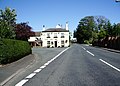
 'The Bull' public house - geograph.org.uk - 819635.jpg 640 × 463; 66 KB
-
 A derelict Site - geograph.org.uk - 493837.jpg 640 × 374; 74 KB
-
 A Disused Railway Station - geograph.org.uk - 494155.jpg 640 × 426; 136 KB
-
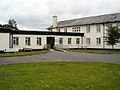
 Allerston Village Hall - geograph.org.uk - 495657.jpg 640 × 480; 82 KB
-
 Altar, St John the Evangelist, Lund - geograph.org.uk - 496865.jpg 640 × 480; 184 KB
-
 Altar, St John the Evangelist, Lund - geograph.org.uk - 496866.jpg 480 × 640; 193 KB
-

-

-
 Approaching B1145 from Tungate Road - geograph.org.uk - 493631.jpg 640 × 480; 91 KB
-
 B1145 (Greens Road), looking south - geograph.org.uk - 493612.jpg 640 × 480; 121 KB
-
 Bagh Hogha Glan - geograph.org.uk - 506717.jpg 640 × 359; 48 KB
-
 Baleshare Croft.jpg 640 × 359; 61 KB
-
 Ballynasollus National School - geograph.org.uk - 493577.jpg 640 × 479; 51 KB
-
 Ballynasollus Townland - geograph.org.uk - 493560.jpg 640 × 479; 64 KB
-
 Ballynasollus Townland - geograph.org.uk - 493564.jpg 640 × 479; 88 KB
-
 Ballynasollus Townland - geograph.org.uk - 493569.jpg 640 × 479; 68 KB
-
 Humber Bridge Water Ski Club - geograph.org.uk - 493675.jpg 640 × 524; 124 KB
-
 Bay of Swartmill, Westray - geograph.org.uk - 493476.jpg 640 × 473; 71 KB
-
 Beltonanean - geograph.org.uk - 493558.jpg 640 × 479; 63 KB
-
 Beltonanean - geograph.org.uk - 493574.jpg 640 × 479; 52 KB
-
 Beltonanean Lane - geograph.org.uk - 493551.jpg 640 × 479; 83 KB
-
 Beltonanean Mountain - geograph.org.uk - 493554.jpg 640 × 479; 90 KB
-
 Beltonanean Townland - geograph.org.uk - 493556.jpg 640 × 479; 67 KB
-
 Beltonanean Townland - geograph.org.uk - 493571.jpg 640 × 479; 55 KB
-
 Beltonanean Townland - geograph.org.uk - 493582.jpg 640 × 479; 67 KB
-
 Bicycles at the British Museum - geograph.org.uk - 512340.jpg 640 × 480; 105 KB
-

-
 Bridge over Great Blowing Gill Beck - geograph.org.uk - 495217.jpg 640 × 480; 102 KB
-
 Bridge over River Kent at Kendal - geograph.org.uk - 525871.jpg 640 × 480; 71 KB
-
 Bridgefoot Cumbia - geograph.org.uk - 1082738.jpg 640 × 480; 73 KB
-
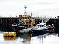
 Bridlington Harbour. - geograph.org.uk - 493681.jpg 640 × 297; 49 KB
-
 Bridlington quay entrance light. - geograph.org.uk - 493677.jpg 438 × 640; 42 KB
-

-
 Canal - geograph.org.uk - 494264.jpg 640 × 424; 59 KB
-
 Chalk tower lighthouse b1669. - geograph.org.uk - 493692.jpg 640 × 416; 42 KB
-

-

-
 Church House, Church Street, Kirkham - geograph.org.uk - 495928.jpg 640 × 480; 208 KB
-
 Church of Scotland, Westray - geograph.org.uk - 493488.jpg 640 × 473; 60 KB
-
 Church of St. Mary Magdelene, Monkton.jpg 602 × 640; 118 KB
-
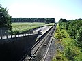
 City Union Railway Bridge.jpg 640 × 424; 53 KB
-
 Cluntyganny Townland - geograph.org.uk - 493626.jpg 640 × 479; 51 KB
-
 Coolreaghs Townland - geograph.org.uk - 493644.jpg 640 × 479; 58 KB
-
 Coolreaghs Townland - geograph.org.uk - 493646.jpg 640 × 479; 66 KB
-
 Coot - geograph.org.uk - 493688.jpg 640 × 410; 112 KB
-
 Corvanaghan Mountain - geograph.org.uk - 493548.jpg 640 × 479; 50 KB
-
 Court entrance - geograph.org.uk - 495852.jpg 640 × 506; 52 KB
-
 Creevagh Road - geograph.org.uk - 493607.jpg 640 × 479; 71 KB
-
 Crossroads at Muntober - geograph.org.uk - 493600.jpg 640 × 479; 53 KB
-
 Donkey Rides - geograph.org.uk - 495006.jpg 640 × 480; 77 KB
-
 Donkeys on the beach at Scarborough - geograph.org.uk - 495003.jpg 640 × 480; 45 KB
-
 Dragonfly (809371809).jpg 3,072 × 2,304; 4.77 MB
-
 Dry Stone wall - geograph.org.uk - 495237.jpg 640 × 480; 99 KB
-
 Dunchurch - geograph.org.uk - 493402.jpg 640 × 480; 105 KB
-
 Dunchurch - geograph.org.uk - 494380.jpg 640 × 480; 109 KB
-
 Dunchurch - geograph.org.uk - 494425.jpg 640 × 480; 90 KB
-
 Dunchurch - geograph.org.uk - 494440.jpg 640 × 480; 89 KB
-
 Dunchurch-Vicarage Lane - geograph.org.uk - 494377.jpg 640 × 480; 168 KB
-
 Dunloe Street - geograph.org.uk - 510035.jpg 640 × 480; 105 KB
-
 Eurostar at Waterloo (988490078).jpg 1,920 × 2,560; 1.51 MB
-
 Factory on Cromer Road - geograph.org.uk - 493618.jpg 640 × 480; 102 KB
-
 Fallow Deer - geograph.org.uk - 495232.jpg 640 × 480; 90 KB
-
 Feegarran Townland - geograph.org.uk - 493630.jpg 640 × 479; 61 KB
-
 Flamborough lighthouse. - geograph.org.uk - 493696.jpg 640 × 506; 53 KB
-
 Flodaigh Eaval.jpg 640 × 359; 50 KB
-
 Floday Landscape Ronay.jpg 640 × 359; 43 KB
-
 Floday Landscape Ruabhal.jpg 640 × 359; 59 KB
-
 Font, St John the Evangelist, Lund - geograph.org.uk - 496862.jpg 480 × 640; 141 KB
-

-

-
 Fordhams Row, Orsett - geograph.org.uk - 493964.jpg 640 × 480; 106 KB
-
 Forth Rail Bridge mosaic - geograph.org.uk - 493741.jpg 640 × 480; 110 KB
-
 Gate to St Mary the Virgin, Ebberston - geograph.org.uk - 495646.jpg 640 × 480; 131 KB
-
 GCNS.jpg 640 × 487; 47 KB
-
 Getting up steam - geograph.org.uk - 554043.jpg 640 × 480; 83 KB
-
 Glasgow Central Station (987588929).jpg 2,560 × 1,920; 2.07 MB
-
 Glasgow Central Station (987588983).jpg 2,560 × 1,920; 1.62 MB
-
 Glasgow Central Station (987589133).jpg 2,560 × 1,920; 1.74 MB
-
 Glasgow Central Station (987589217).jpg 2,560 × 1,920; 2.04 MB
-
 Glasgow Cross - geograph.org.uk - 495752.jpg 640 × 424; 67 KB
-
 Gransha Lake - geograph.org.uk - 496967.jpg 640 × 480; 150 KB
-
 Great Blowing Gill Beck - geograph.org.uk - 495202.jpg 640 × 480; 120 KB
-
 Grove of alders - geograph.org.uk - 496970.jpg 640 × 480; 141 KB
-
 Hand and Dagger - geograph.org.uk - 496851.jpg 640 × 480; 216 KB
-
 Harbour at Kyle of Lochalsh - geograph.org.uk - 509599.jpg 640 × 480; 81 KB
-
 Harbour at Kyle of Lochalsh - geograph.org.uk - 509615.jpg 640 × 480; 70 KB
-
 Harvesters Station - geograph.org.uk - 554048.jpg 640 × 480; 100 KB
-
 Head of Steel - geograph.org.uk - 554054.jpg 640 × 480; 89 KB
-
 Henham Park, Latitude Festival - geograph.org.uk - 497005.jpg 640 × 480; 74 KB
-
 High Road, Orsett - geograph.org.uk - 493945.jpg 640 × 480; 121 KB
-
 House and telephone box on Baleshare.jpg 640 × 359; 59 KB
-

-
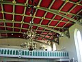
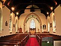 Interior of St John the Evangelist, Lund - geograph.org.uk - 496863.jpg 640 × 480; 194 KB
-
 Interior of St John the Evangelist, Lund - geograph.org.uk - 496864.jpg 466 × 622; 178 KB
-
 Interior of St John the Evangelist, Lund - geograph.org.uk - 496867.jpg 626 × 468; 137 KB
-
 Interior of St John the Evangelist, Lund - geograph.org.uk - 496868.jpg 620 × 464; 171 KB
-

-

-

-

-

-
-
 Ivy covered door at St John's Church - geograph.org.uk - 495707.jpg 477 × 640; 144 KB
-
 July - geograph.org.uk - 495098.jpg 640 × 480; 66 KB
-
 Keil Caves - geograph.org.uk - 503999.jpg 640 × 479; 145 KB
-
 Kettle hole lake at Gransha - geograph.org.uk - 496968.jpg 640 × 480; 166 KB
-
 Kingsland Road - geograph.org.uk - 512382.jpg 640 × 480; 101 KB
-
 Kingsland Road - geograph.org.uk - 513859.jpg 640 × 480; 82 KB
-
 Kirkham United Reformed Church - geograph.org.uk - 495922.jpg 612 × 460; 129 KB
-
 Lancaster1 (809386469).jpg 2,850 × 1,971; 5.04 MB
-
 Leisure Centre - geograph.org.uk - 493640.jpg 640 × 480; 90 KB
-
 Little Orchids school - geograph.org.uk - 496969.jpg 640 × 408; 107 KB
-
 Little Russell Street - geograph.org.uk - 512334.jpg 640 × 480; 111 KB
-
 Loch Broom narrows - geograph.org.uk - 1007018.jpg 640 × 480; 42 KB
-
 Loch Garry near Invergarry - geograph.org.uk - 509524.jpg 640 × 480; 59 KB
-
 Loch of Swartmill, Skelwick - geograph.org.uk - 493469.jpg 640 × 473; 77 KB
-
 London Bridge - geograph.org.uk - 494020.jpg 640 × 480; 103 KB
-
 London Waterloo (988489710).jpg 1,920 × 2,560; 1.86 MB
-
 St John the Evangelist, Lund - geograph.org.uk - 496861.jpg 640 × 480; 205 KB
-
 St John the Evangelist, Lund - geograph.org.uk - 496869.jpg 480 × 640; 167 KB
-
 St John the Evangelist, Lund - geograph.org.uk - 496871.jpg 480 × 640; 184 KB
-
 Lychgate, St John the Evangelist, Lund - geograph.org.uk - 496859.jpg 640 × 480; 225 KB
-
 Market - geograph.org.uk - 494635.jpg 640 × 424; 69 KB
-
 Minster Roundabout, Thanet, Kent - geograph.org.uk - 493893.jpg 640 × 525; 81 KB
-
 A row of cottages, Monkton, Thanet, Kent - geograph.org.uk - 493880.jpg 594 × 640; 123 KB
-

-
 Moody's jetty - geograph.org.uk - 1412165.jpg 640 × 427; 80 KB
-
 Mouse - geograph.org.uk - 495168.jpg 640 × 480; 68 KB
-
 Muntober - geograph.org.uk - 493595.jpg 640 × 479; 80 KB
-
 Muntober - geograph.org.uk - 493610.jpg 640 × 479; 57 KB
-
 Muntober Orange Hall.jpg 640 × 479; 49 KB
-
 Muntober Road - geograph.org.uk - 493602.jpg 640 × 479; 94 KB
-
 Muntober Townland - geograph.org.uk - 493592.jpg 640 × 479; 68 KB
-
 Muntober Townland - geograph.org.uk - 493606.jpg 640 × 479; 56 KB
-
 Museum Street - geograph.org.uk - 512360.jpg 640 × 480; 97 KB
-
 Neighbours. - geograph.org.uk - 496404.jpg 640 × 284; 89 KB
-
 Nell's Pike Quarry - geograph.org.uk - 496118.jpg 640 × 480; 95 KB
-
 Newby Hall (geograph 1693860).jpg 1,600 × 1,200; 330 KB
-
 North Queensferry railway station in 2007.jpg 640 × 480; 74 KB
-

-
 Notting Hill Gate Station - geograph.org.uk - 530753.jpg 640 × 480; 117 KB
-
 Office building - geograph.org.uk - 494018.jpg 640 × 424; 66 KB
-
 Old Railway Bridge at Rodbridge - geograph.org.uk - 542306.jpg 640 × 480; 140 KB
-
 Old Sheds - geograph.org.uk - 493682.jpg 640 × 480; 114 KB
-
 Orford - Church of St Bartholomew.jpg 640 × 424; 146 KB
-
 Orsett Stores, Orsett - geograph.org.uk - 493933.jpg 640 × 480; 127 KB
-
 Perth Crematorium - geograph.org.uk - 496164.jpg 640 × 480; 72 KB
-
 Perth Crematorium - geograph.org.uk - 496166.jpg 640 × 480; 78 KB
-
 Picnic Junction - geograph.org.uk - 554052.jpg 640 × 480; 99 KB
-

-
 Playing in the surf - geograph.org.uk - 1120269.jpg 640 × 480; 59 KB
-

-
 Point of Ness - geograph.org.uk - 531612.jpg 640 × 426; 89 KB
-

-
 Port Dundas - geograph.org.uk - 494597.jpg 640 × 424; 51 KB
-

-
 Quarry Road - geograph.org.uk - 494563.jpg 640 × 480; 104 KB
-

-
 Railway Embankment on Ballachulish Line - geograph.org.uk - 496045.jpg 640 × 426; 104 KB
-
 Railway Station, Fort William - geograph.org.uk - 508567.jpg 640 × 480; 82 KB
-
 Railway Station, Fort William - geograph.org.uk - 508571.jpg 640 × 480; 70 KB
-
 Railway Station, Fort William - geograph.org.uk - 508577.jpg 640 × 480; 117 KB
-
 Red Cross building Gransha - geograph.org.uk - 496973.jpg 640 × 480; 127 KB
-
 Reed bed in Gransha lake - geograph.org.uk - 496997.jpg 640 × 480; 172 KB
-
 Reeds like Japanese calligraphy - geograph.org.uk - 905264.jpg 640 × 480; 89 KB
-
 Road at Beltonanean - geograph.org.uk - 493580.jpg 640 × 479; 75 KB
-
 Road at Cluntyganny - geograph.org.uk - 493628.jpg 640 × 479; 57 KB
-
 Road at Muntober - geograph.org.uk - 493611.jpg 640 × 479; 89 KB
-
 Road at Unagh - geograph.org.uk - 493643.jpg 640 × 479; 72 KB
-
 Road junction - geograph.org.uk - 496032.jpg 640 × 459; 185 KB
-
 Rock houses - geograph.org.uk - 496096.jpg 582 × 640; 188 KB
-
 Roundabout on the A134 - geograph.org.uk - 499179.jpg 640 × 480; 83 KB
-
 Ruislip Northwood Cottage Hospital - geograph.org.uk - 493649.jpg 640 × 480; 99 KB
-
 Salwick railway station.jpg 640 × 480; 185 KB
-
 Scarborough Donkeys - geograph.org.uk - 495020.jpg 640 × 480; 73 KB
-
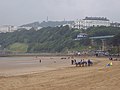
 Scarborough North Beach - geograph.org.uk - 495033.jpg 640 × 480; 53 KB
-
 Scarborough South Beach in July - geograph.org.uk - 495009.jpg 640 × 480; 61 KB
-
 Sewage works - geograph.org.uk - 496763.jpg 640 × 480; 233 KB
-
 Sheep - geograph.org.uk - 496870.jpg 640 × 480; 221 KB
-

-
 St John's Church, Allerston - Door - geograph.org.uk - 495785.jpg 480 × 640; 108 KB
-
 St John's Church, Allerston - Font - geograph.org.uk - 495722.jpg 480 × 640; 51 KB
-

-

-

-
 St John's Church, Allerston - Tower - geograph.org.uk - 495693.jpg 477 × 640; 69 KB
-
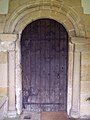 St Mary the Virgin, Ebberston - Door - geograph.org.uk - 495591.jpg 480 × 640; 74 KB
-
 St Mary the Virgin, Ebberston - Font - geograph.org.uk - 495596.jpg 480 × 640; 59 KB
-
 St Mary the Virgin, Ebberston - geograph.org.uk - 495245.jpg 640 × 510; 102 KB
-

-
 St Mary the Virgin, Ebberston - geograph.org.uk - 495256.jpg 640 × 480; 97 KB
-

-

-

-

-

-

-

-

-


,_looking_south_-_geograph.org.uk_-_493612.jpg)


_-_geograph.org.uk_-_1137253.jpg)


.jpg)


.jpg)


.jpg)
.jpg)
.jpg)
.jpg)


.jpg)


.jpg)


.jpg)


.jpg)


