Category:United Kingdom photographs taken on 2007-07-01
Jump to navigation
Jump to search
Countries of Europe: Austria · Belgium · Bulgaria · Czech Republic · Estonia · Finland · France‡ · Georgia‡ · Germany · Greece · Hungary · Iceland · Republic of Ireland · Italy · Kazakhstan‡ · Netherlands‡ · Norway · Poland · Portugal‡ · Romania · Russia‡ · Serbia · Slovakia · Spain‡ · Sweden · Switzerland · Turkey‡ · Ukraine · United Kingdom
Specific status: Isle of Man
‡: partly located in Europe
Specific status: Isle of Man
‡: partly located in Europe
| ← | 1 July 2007 | → | ||
| ← | July 2007 | → | ||

United Kingdom photographs taken on 1 July 2007.
Image files should be categorized here automatically using {{taken on}} template. Direct categorisation is also possible, if automatic is impossible.
Subcategories
This category has only the following subcategory.
Media in category "United Kingdom photographs taken on 2007-07-01"
The following 200 files are in this category, out of 535 total.
(previous page) (next page)-
 "Duck Island" footbridge - geograph.org.uk - 768649.jpg 640 × 480; 72 KB
-
 "Paddy Line" bridge. - geograph.org.uk - 512381.jpg 640 × 480; 152 KB
-
 14 Main Street, Scarva - geograph.org.uk - 482691.jpg 640 × 427; 92 KB
-
 4 wheel drive track beside Allt Mor - geograph.org.uk - 482780.jpg 640 × 480; 78 KB
-
-
 Aberglaslyn Pass - geograph.org.uk - 1670930.jpg 517 × 227; 67 KB
-
 Above the locks at Fort Augustus - geograph.org.uk - 489120.jpg 423 × 640; 224 KB
-
 Adelphi Hotel - Dock Street - geograph.org.uk - 483487.jpg 640 × 610; 73 KB
-
-

-
 Annie - geograph.org.uk - 485285.jpg 640 × 480; 111 KB
-
 Asda, Hessle Road - geograph.org.uk - 481979.jpg 640 × 511; 161 KB
-
 Ashworth Moor Reservoir - geograph.org.uk - 483261.jpg 640 × 480; 75 KB
-
 Auchencloy Monument. - geograph.org.uk - 512394.jpg 640 × 480; 91 KB
-
 Auchleand Moor - geograph.org.uk - 482379.jpg 640 × 480; 77 KB
-
 Balcomie Green - geograph.org.uk - 483106.jpg 640 × 437; 84 KB
-
 Balcomie Links Hotel - geograph.org.uk - 487051.jpg 640 × 424; 60 KB
-
 Balmeg - geograph.org.uk - 483891.jpg 640 × 444; 163 KB
-
 Bambrick Terrace, Banbridge - geograph.org.uk - 482638.jpg 640 × 427; 94 KB
-
 Barley fields, Nether Wallop - geograph.org.uk - 483174.jpg 640 × 480; 121 KB
-
 Barns, Clarendon Park - geograph.org.uk - 484722.jpg 640 × 480; 109 KB
-
 Barry railway station.jpg 640 × 421; 133 KB
-
 Benbecula Airport Buildings.jpg 640 × 304; 75 KB
-
 Benbecula Beach Airport.jpg 640 × 426; 136 KB
-
 Benbecula Golf club - geograph.org.uk - 483072.jpg 640 × 404; 114 KB
-
 Benbecula Longest Airfield.jpg 640 × 388; 84 KB
-
 Benbecula Shortest Airfield.jpg 640 × 426; 106 KB
-
 Beza Street Bridge TJC 3-254 - geograph.org.uk - 483126.jpg 640 × 395; 54 KB
-
 Bike stand, Cranny, Omagh - geograph.org.uk - 483168.jpg 640 × 480; 104 KB
-
 Bilston Urban Village - geograph.org.uk - 482369.jpg 640 × 480; 266 KB
-
 Black Postbox in Ilkley. - geograph.org.uk - 482516.jpg 427 × 640; 194 KB
-
 Bole Corner - geograph.org.uk - 483344.jpg 640 × 427; 86 KB
-
 Booth Wood Reservoir - geograph.org.uk - 482708.jpg 640 × 480; 82 KB
-
 Boulderand heather slope - geograph.org.uk - 484596.jpg 480 × 640; 133 KB
-
 Briggate from Boar Lane - geograph.org.uk - 483512.jpg 640 × 439; 41 KB
-
 Bristol to Bath Cycle Path - geograph.org.uk - 483428.jpg 480 × 640; 107 KB
-
 A building at the former RAF Binbrook - geograph.org.uk - 563377.jpg 640 × 427; 72 KB
-
 Brookfield Hotel - Brookfield Terrace - geograph.org.uk - 483155.jpg 640 × 545; 52 KB
-
 Brooklands Metrolink Station - geograph.org.uk - 526331.jpg 640 × 353; 91 KB
-
 Building site - geograph.org.uk - 483105.jpg 640 × 466; 106 KB
-
 Burghley House - panoramio (1).jpg 2,373 × 1,669; 1.37 MB
-
 Burghley House - panoramio (10).jpg 2,816 × 2,112; 2.22 MB
-
 Burghley House - panoramio (11).jpg 2,642 × 1,982; 2.27 MB
-
 Burghley House - panoramio (12).jpg 2,816 × 2,112; 2.24 MB
-
 Burghley House - panoramio (13).jpg 2,816 × 2,112; 2.43 MB
-
 Burghley House - panoramio (2).jpg 2,816 × 2,112; 2.21 MB
-
 Burghley House - panoramio (3).jpg 2,816 × 2,112; 2.43 MB
-
 Burghley House - panoramio (4).jpg 2,816 × 2,112; 2.38 MB
-
 Burghley House - panoramio (5).jpg 2,816 × 2,112; 2.03 MB
-
 Burghley House - panoramio (6).jpg 2,816 × 2,112; 2.47 MB
-
 Burghley House - panoramio (7).jpg 2,816 × 2,112; 2.37 MB
-
 Burghley House - panoramio (8).jpg 2,816 × 2,112; 2.4 MB
-
 Burghley House - panoramio (9).jpg 2,816 × 2,112; 2.52 MB
-
 Burghley Sculpture Garden - panoramio.jpg 2,816 × 2,112; 2.71 MB
-
 Burley Branch Library. - geograph.org.uk - 482533.jpg 640 × 426; 259 KB
-
 Burton Round - geograph.org.uk - 484915.jpg 640 × 427; 119 KB
-
 Burway Bridge collapse - geograph.org.uk - 1192494.jpg 640 × 426; 89 KB
-
 Burway Bridge collapse - geograph.org.uk - 1192655.jpg 640 × 426; 85 KB
-
 Byway near Barrow Vale - geograph.org.uk - 482460.jpg 640 × 426; 105 KB
-
 Caledonian Canal at Fort Augustus - geograph.org.uk - 489078.jpg 640 × 425; 291 KB
-
 Caledonian Canal at Fort Augustus - geograph.org.uk - 489114.jpg 640 × 425; 278 KB
-
 Canal Basin to Cox's Yard - geograph.org.uk - 570118.jpg 640 × 480; 110 KB
-
 Castleshaw Lower Reservoir - geograph.org.uk - 483305.jpg 640 × 480; 97 KB
-
 Chaluim Chille Causeway.jpg 640 × 479; 143 KB
-
 Chimney and cooling towers - geograph.org.uk - 484904.jpg 640 × 427; 66 KB
-
 Clouds, cooling towers and thistles - geograph.org.uk - 484911.jpg 640 × 427; 93 KB
-
 Colonel Linskill - geograph.org.uk - 1049338.jpg 640 × 427; 38 KB
-
 Concrete blocks - geograph.org.uk - 484923.jpg 640 × 427; 74 KB
-
 Coniferous woodland, Clarendon Park - geograph.org.uk - 483710.jpg 640 × 480; 186 KB
-
 Construction of Hunslet Road Bridge - geograph.org.uk - 483146.jpg 640 × 357; 28 KB
-
 Copse and wheat, Nether Wallop - geograph.org.uk - 483175.jpg 640 × 480; 142 KB
-
 Cottage And Footpath Sign - geograph.org.uk - 482777.jpg 640 × 480; 111 KB
-
 Cottage Bank - geograph.org.uk - 568020.jpg 640 × 480; 89 KB
-
 Crail Doocot - geograph.org.uk - 482806.jpg 640 × 455; 54 KB
-
 Crail grave yard - geograph.org.uk - 482846.jpg 640 × 462; 98 KB
-
 Crail Parish Church - geograph.org.uk - 483102.jpg 416 × 640; 60 KB
-
 Crail, new housing - geograph.org.uk - 483104.jpg 640 × 451; 66 KB
-
 Crooks Barn Lane - geograph.org.uk - 482728.jpg 640 × 480; 77 KB
-
 Crooksbarn Housing estate - geograph.org.uk - 482730.jpg 640 × 480; 72 KB
-
 Crop field from the footpath - geograph.org.uk - 482311.jpg 455 × 640; 399 KB
-

-
 Crown Point Retail Park - geograph.org.uk - 483477.jpg 640 × 472; 47 KB
-
 Crown Point Retail Park - geograph.org.uk - 483479.jpg 640 × 433; 51 KB
-
 Cruise booking booth, Torquay - geograph.org.uk - 482999.jpg 480 × 640; 122 KB
-
 Dairycoates Inn - geograph.org.uk - 481981.jpg 629 × 486; 148 KB
-
 Derelict building - geograph.org.uk - 482376.jpg 640 × 480; 493 KB
-
 Derelict croft, Torhousemuir - geograph.org.uk - 482308.jpg 640 × 480; 112 KB
-
 Derelict Croft, Torhousemuir - geograph.org.uk - 483873.jpg 480 × 640; 160 KB
-
 Disused canal lock, Terryhoogan, Scarva - geograph.org.uk - 482775.jpg 640 × 427; 112 KB
-
 Disused Lock at Welches Dam - geograph.org.uk - 482537.jpg 640 × 480; 107 KB
-
 Down and forest, Pitton - geograph.org.uk - 483626.jpg 640 × 480; 152 KB
-
 Downland, Pitton - geograph.org.uk - 484718.jpg 640 × 480; 141 KB
-
 Drumfrochar(1).jpg 510 × 480; 76 KB
-
 Dunchurch - geograph.org.uk - 482478.jpg 640 × 480; 101 KB
-
 Dunrobin Castle, North Front - geograph.org.uk - 486903.jpg 640 × 480; 98 KB
-
 East bank of Lochan Oisinneach - geograph.org.uk - 484590.jpg 640 × 480; 52 KB
-
 Eccleshill Mechanics' Institute - geograph.org.uk - 482128.jpg 640 × 490; 124 KB
-
 Edwardian Post Box - geograph.org.uk - 483271.jpg 480 × 640; 105 KB
-
 Eilean Chaluim Chille - geograph.org.uk - 497326.jpg 640 × 478; 150 KB
-

-
 Navigation light off Faxfleet Ness - geograph.org.uk - 482817.jpg 640 × 427; 96 KB
-
 Entrance to Living Coasts - geograph.org.uk - 485293.jpg 640 × 480; 90 KB
-

-
 Ex RAF Binbrook - geograph.org.uk - 560172.jpg 640 × 427; 63 KB
-
 Farmhouse, Grantchester - geograph.org.uk - 492523.jpg 640 × 426; 132 KB
-
 Farmland, Clarendon Park - geograph.org.uk - 483730.jpg 640 × 480; 165 KB
-
 Farmland, Clarendon Park - geograph.org.uk - 483756.jpg 640 × 480; 128 KB
-
 Farmland, Clarendon Park - geograph.org.uk - 483793.jpg 640 × 480; 136 KB
-
 Farmland, Clarendon Park - geograph.org.uk - 483808.jpg 640 × 480; 140 KB
-
 Farmland, Clarendon Park - geograph.org.uk - 483845.jpg 640 × 480; 120 KB
-
 Farmland, Clarendon Park - geograph.org.uk - 484720.jpg 640 × 480; 152 KB
-
 Farmland, Pitton - geograph.org.uk - 483637.jpg 640 × 480; 157 KB
-
 Farmland, Torhousemuir - geograph.org.uk - 482374.jpg 640 × 480; 62 KB
-
 Fast flowing Wye downstream from Wilton - geograph.org.uk - 482300.jpg 640 × 452; 284 KB
-
 Ferry Lane on Sturton Upper Ings - geograph.org.uk - 483362.jpg 640 × 427; 78 KB
-
 Filey Brigg taken from the beach - geograph.org.uk - 754532.jpg 640 × 186; 25 KB
-
 Fire bell at Mere - geograph.org.uk - 486545.jpg 480 × 640; 131 KB
-
 Fire hydrant - geograph.org.uk - 483819.jpg 480 × 640; 172 KB
-
 Fire Station at Mere - geograph.org.uk - 486544.jpg 640 × 480; 112 KB
-
 First Avenue - Eastern Side - geograph.org.uk - 484290.jpg 479 × 640; 125 KB
-
 First Avenue - Western Side - geograph.org.uk - 484293.jpg 479 × 640; 139 KB
-

-
 Flood damage in Oughtibridge - geograph.org.uk - 715982.jpg 640 × 480; 142 KB
-
 Floodwater near Bole. - geograph.org.uk - 483358.jpg 640 × 427; 72 KB
-
 Flower beds, Scarva (2) - geograph.org.uk - 482676.jpg 640 × 427; 122 KB
-
 Footpath by the Wye - geograph.org.uk - 482304.jpg 450 × 640; 411 KB
-
 Footpath junction - geograph.org.uk - 482322.jpg 640 × 508; 424 KB
-
 Footpath junction - geograph.org.uk - 482381.jpg 389 × 640; 445 KB
-
 Footpath marker - geograph.org.uk - 482319.jpg 401 × 640; 411 KB
-
 Footpath near Archenfield - geograph.org.uk - 482363.jpg 480 × 640; 460 KB
-
 Former ash disposal area - geograph.org.uk - 483376.jpg 640 × 427; 79 KB
-
 Foyers Hydro Electric power station - geograph.org.uk - 488665.jpg 640 × 480; 254 KB
-

-
 Fron Farm - geograph.org.uk - 488987.jpg 640 × 426; 85 KB
-
 Gainsborough Bridge (Geograph 484925).jpg 640 × 427; 88 KB
-
 Garden Gate - Walton Street - geograph.org.uk - 483136.jpg 556 × 640; 78 KB
-
 George VI Postbox in Ilkley. - geograph.org.uk - 482479.jpg 427 × 640; 263 KB
-
 Giant hogweed, Gilford - geograph.org.uk - 482747.jpg 640 × 428; 115 KB
-
 Glacial drainage channel - geograph.org.uk - 482811.jpg 640 × 480; 111 KB
-
 Golden Lion Hotel - Swinegate - geograph.org.uk - 483503.jpg 640 × 429; 59 KB
-
 Grown up beech hedge - geograph.org.uk - 568033.jpg 640 × 480; 94 KB
-
 Ha' Hill - geograph.org.uk - 482279.jpg 640 × 480; 86 KB
-
 Ha' Hill from the northeast. - geograph.org.uk - 482419.jpg 480 × 640; 125 KB
-
 Healthy crop of potatoes - geograph.org.uk - 482331.jpg 640 × 480; 436 KB
-
 Hillview Croft, Torhousemuir - geograph.org.uk - 482386.jpg 640 × 480; 125 KB
-
 HMS Warrior - geograph.org.uk - 1014473.jpg 640 × 480; 64 KB
-
 Horse and Jockey - geograph.org.uk - 483321.jpg 640 × 480; 102 KB
-
 Hospital Road, Omagh - geograph.org.uk - 483166.jpg 640 × 480; 58 KB
-
 St Martin's Church - geograph.org.uk - 482015.jpg 640 × 426; 183 KB
-
 Hunslet Branch Library - geograph.org.uk - 483131.jpg 640 × 326; 26 KB
-
 John Dyson's - Lower Briggate - geograph.org.uk - 483499.jpg 416 × 640; 49 KB
-
 John o' Groats - Signpost and Hotel - geograph.org.uk - 486884.jpg 640 × 480; 84 KB
-

-

-
 King's Lynn skyline - geograph.org.uk - 483022.jpg 640 × 501; 95 KB
-
 Kings Lynn - geograph.org.uk - 659990.jpg 429 × 640; 60 KB
-
 Kings Lynn Old Customs House - geograph.org.uk - 658978.jpg 429 × 640; 68 KB
-
 Kings Lynn, Old Customs House - geograph.org.uk - 659985.jpg 429 × 640; 72 KB
-
 Kings Lynn, Old Customs House - geograph.org.uk - 659986.jpg 640 × 429; 78 KB
-
 Kings Lynn, Old Customs House - geograph.org.uk - 659987.jpg 640 × 429; 67 KB
-
 Kings Lynn, Old Customs House - geograph.org.uk - 659988.jpg 429 × 640; 77 KB
-
 Landscape at Field Farm - geograph.org.uk - 483306.jpg 640 × 427; 56 KB
-
 Landscape with Power Station - geograph.org.uk - 483398.jpg 640 × 423; 66 KB
-
 Langford Mill, Essex (geograph 844390).jpg 640 × 480; 148 KB
-
 Laverstock Down - geograph.org.uk - 483818.jpg 640 × 480; 140 KB
-
 Leeds Bridge - Lower Briggate - geograph.org.uk - 483489.jpg 640 × 395; 43 KB
-
 Lewisian Gneiss - geograph.org.uk - 486896.jpg 480 × 640; 125 KB
-
 Lidl - Church Street - geograph.org.uk - 483128.jpg 640 × 353; 31 KB
-
 Lily ponds at County Hall Worcester - geograph.org.uk - 506310.jpg 640 × 480; 134 KB
-
 Llamas - geograph.org.uk - 568043.jpg 640 × 480; 132 KB
-
 Llyn Dinas - geograph.org.uk - 1025888.jpg 640 × 426; 59 KB
-
 Loch Ness - geograph.org.uk - 488635.jpg 640 × 477; 197 KB
-
 Loch Ness - geograph.org.uk - 488929.jpg 640 × 480; 249 KB
-
 Loch Ness shoreline - geograph.org.uk - 488643.jpg 640 × 480; 309 KB
-
 Lochan Shira - geograph.org.uk - 482997.jpg 640 × 480; 122 KB
-

-
 Lomas Oast, Lomas Lane, Sandhurst - geograph.org.uk - 482897.jpg 480 × 640; 121 KB
-
 Looking down Alpine Road, Easton - geograph.org.uk - 483425.jpg 469 × 640; 109 KB
-
 Ludlow Burway Bridge collapse - geograph.org.uk - 482698.jpg 640 × 428; 80 KB
-
 Memorial to the flood, Woollard - geograph.org.uk - 482604.jpg 640 × 480; 189 KB
-
 Mere Fire Station - geograph.org.uk - 486543.jpg 640 × 480; 73 KB
-
 Mid Wales Airport - geograph.org.uk - 489010.jpg 640 × 426; 98 KB
-
 Miners Memorial - geograph.org.uk - 482207.jpg 480 × 640; 78 KB
-
-

-
 Mouth of Grange Chine - geograph.org.uk - 495580.jpg 640 × 428; 139 KB
-
 Muck heap in the mist^ - geograph.org.uk - 482843.jpg 640 × 480; 51 KB
-
 Muddy footpath - geograph.org.uk - 482341.jpg 476 × 640; 446 KB
-
 Muspit (or Muspitt) Lane - geograph.org.uk - 483294.jpg 640 × 427; 110 KB
-
 Navigation light off Faxfleet Ness - geograph.org.uk - 482814.jpg 640 × 453; 102 KB
-
-

-

-
 Navigation ^ on Blacktoft wharf - geograph.org.uk - 482821.jpg 640 × 480; 81 KB
-

-
 Netherwood - geograph.org.uk - 482340.jpg 640 × 447; 237 KB
-
 Nettles at Cranny, Omagh - geograph.org.uk - 483164.jpg 640 × 480; 77 KB
-
 New Dolphin - geograph.org.uk - 1049332.jpg 640 × 427; 48 KB
-
 New housing development - geograph.org.uk - 482973.jpg 640 × 480; 73 KB
-
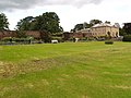 Newbrough Hall and Garden - geograph.org.uk - 726296.jpg 640 × 480; 87 KB


.jpg)
.jpg)
.jpg)
.jpg)
.jpg)
.jpg)
.jpg)
.jpg)
.jpg)
.jpg)
.jpg)
.jpg)
.jpg)


.jpg)


_-_geograph.org.uk_-_482676.jpg)


.jpg)


.jpg)


_Lane_-_geograph.org.uk_-_483294.jpg)


