Category:United Kingdom photographs taken on 2007-03-09
Jump to navigation
Jump to search
| ← | Friday 9 March 2007 | → | ||
| ← | March 2007 | → | ||

United Kingdom photographs taken on 9 March 2007.
Image files should be categorized here automatically using {{taken on}} template. Direct categorisation is also possible, if automatic is impossible.
Subcategories
This category has the following 3 subcategories, out of 3 total.
L
P
S
Media in category "United Kingdom photographs taken on 2007-03-09"
The following 200 files are in this category, out of 680 total.
(previous page) (next page)-
 "Eastfield", Station Road, Brigg - geograph.org.uk - 359318.jpg 640 × 387; 126 KB
-
-
 A fossilised tree trunk? (geograph 359750, high-res).jpg 2,816 × 2,112; 1.14 MB
-
 A fossilised tree trunk^ - geograph.org.uk - 359750.jpg 640 × 480; 76 KB
-
-
 A pony and alpaca at Fonthill Bishop - geograph.org.uk - 360361.jpg 640 × 480; 105 KB
-
 A1 southbound - geograph.org.uk - 359203.jpg 640 × 427; 44 KB
-
 Achterneed Level Crossing - geograph.org.uk - 367212.jpg 640 × 482; 92 KB
-
 Afon Menai and Coed Plas Newydd Woods - geograph.org.uk - 365864.jpg 640 × 480; 76 KB
-

-
 Afon Menai from Ffordd Glyder - geograph.org.uk - 366585.jpg 640 × 480; 54 KB
-

-
-
 All Saints Church, Fonthill Bishop - geograph.org.uk - 360449.jpg 640 × 480; 118 KB
-
 All Saints Church, Fonthill Bishop - geograph.org.uk - 360516.jpg 640 × 480; 140 KB
-

-
 An ornamental lake at Parc Menai - geograph.org.uk - 367138.jpg 640 × 480; 93 KB
-
-
 Barevan Farm - geograph.org.uk - 361176.jpg 640 × 482; 73 KB
-
 Barn in front of Hoop Side - geograph.org.uk - 359007.jpg 640 × 384; 43 KB
-
 Bay House, Portencorkrie - geograph.org.uk - 359032.jpg 640 × 480; 64 KB
-
 Bennington Fen - geograph.org.uk - 359247.jpg 640 × 427; 50 KB
-
 Bigby Street, Brigg - geograph.org.uk - 359084.jpg 640 × 480; 133 KB
-
 Bigby Street, Brigg - geograph.org.uk - 365969.jpg 640 × 580; 140 KB
-
 St Cuthbert's Church, Billingham - geograph.org.uk - 360639.jpg 640 × 480; 52 KB
-
 Birkenhead Dock Gates - geograph.org.uk - 380756.jpg 640 × 480; 69 KB
-
 Black sheep near Horse Shoe Bridge - geograph.org.uk - 360645.jpg 640 × 480; 123 KB
-
 Blockley - geograph.org.uk - 554071.jpg 640 × 480; 58 KB
-
 Boston 8 miles - geograph.org.uk - 358818.jpg 628 × 640; 194 KB
-
 Bridge 33 - geograph.org.uk - 361329.jpg 640 × 480; 121 KB
-
 Brigg Post Office - geograph.org.uk - 359050.jpg 640 × 401; 127 KB
-
 Brigg Preparatory School - geograph.org.uk - 377245.jpg 640 × 443; 109 KB
-
 Brubber Dale - geograph.org.uk - 359502.jpg 640 × 480; 119 KB
-
 Brubber Dale - geograph.org.uk - 359506.jpg 640 × 480; 127 KB
-
 Brubber Dale - geograph.org.uk - 359509.jpg 640 × 480; 100 KB
-
 Bryntirion from the east - geograph.org.uk - 369922.jpg 640 × 429; 109 KB
-
 Burcombe Ivers - geograph.org.uk - 358983.jpg 640 × 430; 91 KB
-
 Burnt out car on the Old Shaston Drove - geograph.org.uk - 359158.jpg 640 × 480; 161 KB
-

-
 Byram Arcade - geograph.org.uk - 358714.jpg 640 × 480; 100 KB
-
 Byram Arcade Interior. - geograph.org.uk - 358718.jpg 480 × 640; 117 KB
-

-
 Castle Hill by Strachan - geograph.org.uk - 359620.jpg 640 × 480; 104 KB
-
 Cattle shed remains - geograph.org.uk - 362584.jpg 640 × 480; 115 KB
-
 Caythorpe Farm, Donington Eaudike - geograph.org.uk - 358795.jpg 640 × 480; 105 KB
-
 Cemetery gates - geograph.org.uk - 359307.jpg 640 × 480; 113 KB
-
 Church of All Saints, Fonthill Bishop - geograph.org.uk - 360503.jpg 640 × 480; 118 KB
-

-
 Cock pheasant near Beacon Hill - geograph.org.uk - 359379.jpg 640 × 480; 163 KB
-
 Converted Church - geograph.org.uk - 361284.jpg 640 × 482; 69 KB
-

-
 Cotswold Motoring Museum.jpg 2,267 × 1,696; 2.78 MB
-
 Cottages at Kinghay - geograph.org.uk - 359444.jpg 640 × 480; 106 KB
-
 Council Offices, Bigby Street, Brigg - geograph.org.uk - 377230.jpg 640 × 385; 121 KB
-
 Countryside NW Of Fimber - geograph.org.uk - 359364.jpg 640 × 480; 83 KB
-

-
 Coventry Cathedral - geograph.org.uk - 534442.jpg 640 × 427; 99 KB
-

-
 Cyfarthfa Iron Works - furnace bank - geograph.org.uk - 1025206.jpg 640 × 480; 100 KB
-

-

-
 Cyfarthfa Retail Park - geograph.org.uk - 1025082.jpg 640 × 450; 63 KB
-
 Dell Grouse Moor - geograph.org.uk - 912904.jpg 640 × 480; 69 KB
-
 Demolition of Cornmill - geograph.org.uk - 362732.jpg 640 × 480; 65 KB
-
 Diamonds and Shadows - geograph.org.uk - 362703.jpg 640 × 480; 121 KB
-
 Dog cart - geograph.org.uk - 359660.jpg 640 × 424; 109 KB
-
 Donington Eaudike - geograph.org.uk - 358798.jpg 640 × 480; 90 KB
-
 Drain and Byway - geograph.org.uk - 359230.jpg 640 × 480; 90 KB
-
 Drapers' Hall, Bayley Lane - geograph.org.uk - 534432.jpg 640 × 427; 63 KB
-
 Electricity Sub Station, Tuckingmill - geograph.org.uk - 359231.jpg 640 × 480; 88 KB
-
 County Boundary - geograph.org.uk - 359466.jpg 640 × 427; 91 KB
-
 Hobba Dyke - geograph.org.uk - 359428.jpg 640 × 427; 70 KB
-
 Englishcombe Lane - geograph.org.uk - 359171.jpg 640 × 480; 64 KB
-
 Eversleigh Rise and Deer - geograph.org.uk - 362687.jpg 640 × 480; 114 KB
-
 Farmland at Perry Hill - geograph.org.uk - 359108.jpg 640 × 480; 109 KB
-
 Farmyard - geograph.org.uk - 362532.jpg 640 × 482; 73 KB
-

-
 St Cuthberts Church- Barnsley Road - geograph.org.uk - 359078.jpg 640 × 480; 75 KB
-
 St Cuthberts Church- Barnsley Road - geograph.org.uk - 359080.jpg 640 × 480; 63 KB
-
 St Cuthberts Church- Firth Park Road - geograph.org.uk - 359079.jpg 640 × 480; 73 KB
-
 Fitzwilliam Street. - geograph.org.uk - 358806.jpg 640 × 480; 90 KB
-

-
 Fonthill Bishop Reading Room - geograph.org.uk - 360406.jpg 640 × 480; 101 KB
-
 Footpath - geograph.org.uk - 359992.jpg 640 × 360; 74 KB
-
 Footpath and Barn - geograph.org.uk - 362654.jpg 480 × 640; 123 KB
-
 Footpath near Newtown - geograph.org.uk - 359352.jpg 640 × 480; 168 KB
-
 Ford at Waterditch Road - geograph.org.uk - 358930.jpg 640 × 480; 121 KB
-
 Former Flour Mill - geograph.org.uk - 362741.jpg 640 × 480; 51 KB
-
 Forton Mill stump.jpg 640 × 480; 36 KB
-
 Foyers Forest Track - geograph.org.uk - 912974.jpg 640 × 480; 57 KB
-
 Fridaythorpe Field - geograph.org.uk - 359411.jpg 640 × 480; 142 KB
-
 From Royal Mail to E-Mail - geograph.org.uk - 358769.jpg 600 × 450; 100 KB
-
 Garvock Church and Churchyard - geograph.org.uk - 436313.jpg 480 × 640; 80 KB
-
 St. Giles at Desborough. - geograph.org.uk - 359373.jpg 483 × 640; 55 KB
-
 Glass Bridge, Millennium Place - geograph.org.uk - 534347.jpg 640 × 427; 50 KB
-
-
 Glassworks Business Park - geograph.org.uk - 359878.jpg 640 × 480; 100 KB
-
 Goonhilly Earth Station - geograph.org.uk - 1138015.jpg 640 × 453; 86 KB
-
 Graffiti and Railway Sign - geograph.org.uk - 362711.jpg 480 × 640; 121 KB
-

-

-
 Grazing sheep near Panters Bridge, Fovant - geograph.org.uk - 359216.jpg 640 × 480; 131 KB
-
 Green Grass Track - geograph.org.uk - 359274.jpg 640 × 480; 116 KB
-
 Green Lane junction with B1397 - geograph.org.uk - 358815.jpg 640 × 480; 127 KB
-
 Green Lane, Holm Field - geograph.org.uk - 359315.jpg 640 × 480; 231 KB
-
 Green Lane, Holm Field - geograph.org.uk - 359323.jpg 640 × 480; 150 KB
-
 Hetty Pegler's Tump - geograph.org.uk - 940263.jpg 640 × 480; 94 KB
-
 Hill Lane, off Hawthorn Road - geograph.org.uk - 365844.jpg 640 × 480; 124 KB
-
 Holmdale Farm, Holm Field - geograph.org.uk - 359303.jpg 640 × 480; 102 KB
-
 Holmfield Farm - geograph.org.uk - 359350.jpg 640 × 480; 180 KB
-
 Holmfield Farmland - geograph.org.uk - 359330.jpg 640 × 480; 126 KB
-
 Holy Trinity Church - geograph.org.uk - 534382.jpg 640 × 427; 119 KB
-
 Holy Trinity Church Little Ouseburn - geograph.org.uk - 360068.jpg 640 × 480; 89 KB
-
 Huddersfield Railway Station - geograph.org.uk - 358727.jpg 640 × 480; 76 KB
-
 Humphries Drive, Brackley - geograph.org.uk - 363864.jpg 640 × 480; 60 KB
-
 Inver Morrison From Across Loch Ness - geograph.org.uk - 912917.jpg 640 × 480; 68 KB
-
 John William Street. - geograph.org.uk - 358820.jpg 640 × 480; 91 KB
-

-
 Keep Off The Grass^ - geograph.org.uk - 358751.jpg 640 × 480; 138 KB
-
 Lady Herbert's Gardens - geograph.org.uk - 534350.jpg 640 × 427; 75 KB
-
 Lakeside Cafe, Roundhay Park, Leeds - panoramio.jpg 1,200 × 1,324; 453 KB
-

-

-
 Level Crossing on Willenhall Lane - geograph.org.uk - 901145.jpg 640 × 480; 83 KB
-
 Limestone Link footpath - geograph.org.uk - 359493.jpg 480 × 640; 107 KB
-
 Limestone Pavement in Eaves Wood - geograph.org.uk - 363067.jpg 480 × 640; 132 KB
-

-
 Little Ouseburn Bridge - geograph.org.uk - 360091.jpg 640 × 480; 145 KB
-
 Loch Ness View Point - geograph.org.uk - 912945.jpg 480 × 640; 126 KB
-
 Lochan Scristan - geograph.org.uk - 912886.jpg 640 × 480; 108 KB
-
 Lone Pine - geograph.org.uk - 359014.jpg 640 × 480; 90 KB
-
 Look Left. - geograph.org.uk - 359066.jpg 640 × 480; 132 KB
-
 Looking along Ridge above Loch Ness - geograph.org.uk - 912966.jpg 640 × 480; 50 KB
-

-
 Lower weir at Ludlow - geograph.org.uk - 452968.jpg 640 × 480; 146 KB
-
 Ludlow Castle and River Teme - geograph.org.uk - 452977.jpg 640 × 480; 156 KB
-
 Ludlow Castle viewed from Whitcliffe - geograph.org.uk - 452916.jpg 640 × 480; 147 KB
-
 Ludlow from the Ludford Bridge - geograph.org.uk - 452966.jpg 640 × 480; 156 KB
-
 Ludlow Town - geograph.org.uk - 452923.jpg 640 × 480; 151 KB
-
 Ludlow town centre market - geograph.org.uk - 452896.jpg 640 × 480; 140 KB
-
 Ludlow town panorama - geograph.org.uk - 452934.jpg 640 × 480; 143 KB
-
 Lych Gate Fridaythorpe.jpg 480 × 640; 98 KB
-
 Market Place, Brigg - geograph.org.uk - 377207.jpg 640 × 426; 114 KB
-
 Medieval Remains, Priory Gardens - geograph.org.uk - 534368.jpg 640 × 427; 103 KB
-
 Memorial seat at Wellow - geograph.org.uk - 359296.jpg 480 × 640; 113 KB
-
 Millbrook Station - geograph.org.uk - 358873.jpg 640 × 427; 88 KB
-
 Millennium Place - geograph.org.uk - 534341.jpg 640 × 427; 57 KB
-
 Minster Lovell - geograph.org.uk - 375648.jpg 640 × 482; 113 KB
-
 Misty Morning 2 - geograph.org.uk - 432046.jpg 640 × 480; 45 KB
-
 Misty Morning 3 - geograph.org.uk - 432050.jpg 640 × 480; 72 KB
-
 Misty morning 4 - geograph.org.uk - 432057.jpg 640 × 480; 43 KB
-
 Misty Morning over Forton - geograph.org.uk - 432033.jpg 640 × 480; 55 KB
-
 Moss and berry - geograph.org.uk - 362590.jpg 640 × 480; 122 KB
-
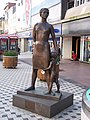 Mother and Son, Cardiff Queen Street - geograph.org.uk - 624476.jpg 480 × 640; 87 KB
-
 Near Burnham Beeches Farm - geograph.org.uk - 359063.jpg 640 × 480; 123 KB
-
 Near Burnham Beeches Farm - geograph.org.uk - 359073.jpg 640 × 375; 91 KB
-
 Near Burnham Beeches Farm - geograph.org.uk - 366906.jpg 640 × 444; 102 KB
-
 Neil Miller Gunn Memorial - geograph.org.uk - 367218.jpg 640 × 482; 71 KB
-
 Neil Miller Gunn Memorial Plaque - geograph.org.uk - 367216.jpg 640 × 482; 74 KB
-
 Netherton, Gatcombe turning - geograph.org.uk - 643313.jpg 640 × 480; 140 KB
-
 New growth in Pond Copse - geograph.org.uk - 358987.jpg 640 × 430; 139 KB
-

-
 Newburn Bridge - geograph.org.uk - 359913.jpg 640 × 480; 85 KB
-
 No Fovant Badge - geograph.org.uk - 358994.jpg 640 × 430; 91 KB
-

-
 North Denes towards Corton - geograph.org.uk - 734824.jpg 640 × 480; 47 KB
-
 Northallerton Creamery - geograph.org.uk - 358813.jpg 640 × 480; 81 KB
-

-

-
 Northumberland Street. - geograph.org.uk - 358824.jpg 640 × 480; 88 KB
-
 Nye Bevan in Cardiff Queen Street - geograph.org.uk - 624472.jpg 480 × 640; 109 KB
-

-
 Old and New Coventry - geograph.org.uk - 534452.jpg 640 × 427; 91 KB
-
 Old Granary, Westwick, Cambridgeshire - geograph.org.uk - 359068.jpg 640 × 480; 106 KB
-
 Old Jaeger factory, Union Street - geograph.org.uk - 359338.jpg 640 × 480; 85 KB
-
 Old Jaeger factory, Union Street.jpg 640 × 480; 62 KB
-
 Old road sign near Danby Beacon - geograph.org.uk - 359252.jpg 640 × 480; 78 KB
-
 Ouse Gill Beck - geograph.org.uk - 360099.jpg 640 × 480; 146 KB
-
 Parc Britannia Motel, Parc Menai - geograph.org.uk - 367043.jpg 640 × 480; 89 KB
-
 Paxton House, Blockley - geograph.org.uk - 554068.jpg 640 × 480; 67 KB
-
 Peacock's Yard, Stanton Mere Way - geograph.org.uk - 661879.jpg 640 × 474; 124 KB
-

-

-
 Plaque on Combe Hay Bridge - geograph.org.uk - 359491.jpg 640 × 480; 90 KB
-
 Plas Llanfair - geograph.org.uk - 365856.jpg 640 × 480; 76 KB
-

-

-
 Pont y Cafnau iron rail bridge and aqueduct.jpg 640 × 480; 140 KB
-
 Pont-y-cafnau.jpg 480 × 640; 118 KB
-
 Post Office. - geograph.org.uk - 359132.jpg 640 × 480; 89 KB
-

-
 Public Bridleway near Rectory Farm - geograph.org.uk - 359474.jpg 640 × 480; 107 KB
-
 Railway above Garsdale - geograph.org.uk - 606477.jpg 640 × 425; 73 KB
-
 Railway Arches - geograph.org.uk - 358816.jpg 640 × 480; 76 KB
-
 Railway Embankment - geograph.org.uk - 359399.jpg 640 × 480; 58 KB
-
 Railway footpath - geograph.org.uk - 362694.jpg 640 × 480; 110 KB
-
 Railway Line near Spendiff - geograph.org.uk - 359103.jpg 640 × 480; 103 KB
-
 Railway Street - geograph.org.uk - 358724.jpg 640 × 480; 84 KB
-
 Railway Viaduct - geograph.org.uk - 358809.jpg 640 × 480; 68 KB
-


.jpg)


_-_geograph.org.uk_-_359189.jpg)


_-_geograph.org.uk_-_1022863.jpg)


