Category:United Kingdom photographs taken on 2007-02-22
Jump to navigation
Jump to search
| ← | Thursday 22 February 2007 | → | ||
| ← | February 2007 | → | ||

United Kingdom photographs taken on 22 February 2007.
Image files should be categorized here automatically using {{taken on}} template. Direct categorisation is also possible, if automatic is impossible.
Subcategories
This category has the following 2 subcategories, out of 2 total.
Media in category "United Kingdom photographs taken on 2007-02-22"
The following 171 files are in this category, out of 171 total.
-
 A Break in the Clouds - geograph.org.uk - 346667.jpg 640 × 480; 88 KB
-
 Agedashi dofu by KateMonkey in Nottingham, UK.jpg 1,632 × 1,224; 444 KB
-
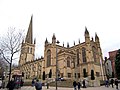 All Saints Wakefield Cathedral - geograph.org.uk - 344712.jpg 640 × 480; 73 KB
-
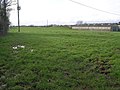
 Big Trees and Farm - geograph.org.uk - 346638.jpg 480 × 640; 107 KB
-
 Bowmere Heath Presbyterian - geograph.org.uk - 351786.jpg 640 × 480; 90 KB
-
 Bridlington Harbour at Low Tide - geograph.org.uk - 345120.jpg 640 × 480; 81 KB
-

-
 Bring Your Wellies - geograph.org.uk - 346656.jpg 640 × 480; 127 KB
-
-
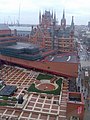
 Broxbourne railway station 1.jpg 2,272 × 1,704; 1.81 MB
-
 Cattle Grid and Trees - geograph.org.uk - 351761.jpg 640 × 480; 125 KB
-
 Cirencester Park Folly - geograph.org.uk - 531407.jpg 640 × 427; 172 KB
-

-
 County Hall Wakefield - geograph.org.uk - 344721.jpg 640 × 480; 76 KB
-
 Crown Inn, Flookburgh - geograph.org.uk - 573350.jpg 640 × 424; 122 KB
-
 Dartmouth Higher Ferry - geograph.org.uk - 1462360.jpg 640 × 480; 47 KB
-
 Devon Culm Subsoil - geograph.org.uk - 344702.jpg 640 × 640; 153 KB
-
 Diagonal gravestone and snowdrops - geograph.org.uk - 345257.jpg 631 × 640; 203 KB
-
 Holy Immanuel - geograph.org.uk - 346589.jpg 480 × 640; 70 KB
-
 Field and Shed - geograph.org.uk - 351754.jpg 640 × 480; 103 KB
-
 SS Peter and Paul, Flitwick - geograph.org.uk - 345256.jpg 640 × 480; 188 KB
-

-
 Floating Harbour, Bristol - geograph.org.uk - 347118.jpg 640 × 427; 99 KB
-
 Floodlit match at St James's Park - geograph.org.uk - 347985.jpg 640 × 480; 75 KB
-

-
 Foresters Tavern, Boney Hay - geograph.org.uk - 716297.jpg 640 × 480; 57 KB
-
 Fountain, Lurgan Park (1) - geograph.org.uk - 344834.jpg 640 × 426; 150 KB
-
 Fountain, Lurgan Park (2) - geograph.org.uk - 344836.jpg 640 × 426; 112 KB
-
 Fountain, Lurgan Park (3) - geograph.org.uk - 344839.jpg 640 × 426; 123 KB
-
 Fountain, Lurgan Park (4) - geograph.org.uk - 344844.jpg 640 × 426; 141 KB
-
 Fountain, Lurgan Park (5) - geograph.org.uk - 344858.jpg 640 × 426; 54 KB
-
 Gillbrook Technology College - geograph.org.uk - 348984.jpg 640 × 384; 61 KB
-
 Grantham Crematorium - geograph.org.uk - 344716.jpg 640 × 480; 55 KB
-
 Gravestones and snowdrops - geograph.org.uk - 345265.jpg 640 × 480; 188 KB
-
 Green Field and Trees - geograph.org.uk - 346691.jpg 640 × 480; 94 KB
-
 Hope Green - geograph.org.uk - 345038.jpg 640 × 480; 74 KB
-
 St Peter and St Leonard Horbury - geograph.org.uk - 344703.jpg 640 × 480; 57 KB
-

-
 Kilennan River - geograph.org.uk - 351817.jpg 640 × 480; 118 KB
-
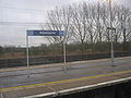
 Kirkgate Railway Station Wakefield - geograph.org.uk - 344772.jpg 640 × 480; 84 KB
-
 Kissing Gate - geograph.org.uk - 345011.jpg 480 × 640; 108 KB
-
 Lincoln Crematorium - geograph.org.uk - 344713.jpg 640 × 480; 117 KB
-
 Llan-wen trig - geograph.org.uk - 347616.jpg 640 × 480; 116 KB
-
 Lunch Time - geograph.org.uk - 346686.jpg 640 × 480; 82 KB
-
 Lych Gate, SS Peter and Paul, Flitwick - geograph.org.uk - 345260.jpg 640 × 527; 203 KB
-
 Lychgate of Tartaraghan Parish Church - geograph.org.uk - 1517949.jpg 640 × 480; 117 KB
-
 MacDuff Aquarium by Bruce McAdam.jpg 3,072 × 2,304; 2.21 MB
-
 Merrington Lane Pump - geograph.org.uk - 351780.jpg 640 × 480; 104 KB
-
 Milton Keynes Crematorium - geograph.org.uk - 344718.jpg 640 × 480; 79 KB
-
 Milton Keynes Crematorium - geograph.org.uk - 344719.jpg 640 × 480; 102 KB
-
 Mini Trig and Route 45 - geograph.org.uk - 346605.jpg 640 × 480; 104 KB
-

-
 Moorland Track - geograph.org.uk - 351815.jpg 640 × 467; 146 KB
-
 Mount Street Flats - geograph.org.uk - 357004.jpg 480 × 640; 82 KB
-
 Old Canal Bank - geograph.org.uk - 346627.jpg 640 × 480; 117 KB
-
 Old lifeboat shed - geograph.org.uk - 734586.jpg 640 × 481; 56 KB
-
 On the lake in Lurgan Park - geograph.org.uk - 344819.jpg 640 × 396; 76 KB
-
 Park Junction Signal Box - geograph.org.uk - 344646.jpg 640 × 480; 90 KB
-
 Park Street and Tower of Uni of Bristol - geograph.org.uk - 347064.jpg 408 × 640; 103 KB
-
 Path and Gate - geograph.org.uk - 351758.jpg 640 × 480; 141 KB
-
 Path and Mud Tracks - geograph.org.uk - 346648.jpg 640 × 480; 153 KB
-
 Path to Newton - geograph.org.uk - 351769.jpg 640 × 480; 175 KB
-
 Path to the Airfield - geograph.org.uk - 346680.jpg 640 × 480; 105 KB
-
 Pope's Seat - Cirencester Park - geograph.org.uk - 531427.jpg 640 × 427; 141 KB
-
 Public footpath from Fordfield Road - geograph.org.uk - 345277.jpg 480 × 640; 168 KB
-
 Puddle Track - geograph.org.uk - 346695.jpg 640 × 480; 112 KB
-
 Pylons to the Sun - geograph.org.uk - 351790.jpg 480 × 640; 80 KB
-
 Queen Street Horbury - geograph.org.uk - 344709.jpg 640 × 480; 72 KB
-
 Railway Bridge over the River Dee - geograph.org.uk - 345456.jpg 640 × 480; 173 KB
-
 Railway Bridge over the River Dee ^2 - geograph.org.uk - 345464.jpg 640 × 480; 229 KB
-
 River Stort in Bishop's Stortford - geograph.org.uk - 350804.jpg 640 × 480; 116 KB
-
 River Stort in Bishop's Stortford - geograph.org.uk - 350831.jpg 640 × 480; 120 KB
-
 River Stort in Bishop's Stortford - geograph.org.uk - 350849.jpg 640 × 480; 141 KB
-
 Road junction - geograph.org.uk - 345024.jpg 640 × 480; 103 KB
-
 Sewer Vent Pipe, Curzon Park North - geograph.org.uk - 345482.jpg 480 × 600; 115 KB
-
 Snowdrops and Bench - geograph.org.uk - 345263.jpg 640 × 480; 185 KB
-
 South Cliff Street - geograph.org.uk - 344973.jpg 640 × 500; 140 KB
-
 Southern General Hospital - geograph.org.uk - 344933.jpg 640 × 480; 80 KB
-
 Southern General Hospital - geograph.org.uk - 344938.jpg 640 × 480; 73 KB
-
 SS Great Britain and Quay side - geograph.org.uk - 347109.jpg 640 × 427; 114 KB
-
 St James's Park, Newcastle - geograph.org.uk - 347981.jpg 640 × 480; 69 KB
-
 St Mary the Virgin - geograph.org.uk - 346633.jpg 640 × 480; 97 KB
-
 St Marys Methodist Church Langtoft.jpg 640 × 480; 58 KB
-
 St. Andrew's Church, Flitwick - geograph.org.uk - 345252.jpg 640 × 480; 172 KB
-
 Stormy day - geograph.org.uk - 734571.jpg 640 × 481; 67 KB
-
 Tartaraghan Church of Ireland - geograph.org.uk - 494232.jpg 640 × 480; 80 KB
-
 That's a Footpath^ - geograph.org.uk - 346645.jpg 640 × 480; 137 KB
-

-
 The Blackbirds P.H., Flitwick - geograph.org.uk - 345251.jpg 640 × 480; 160 KB
-
 The Foxhound Pub, Flixton - geograph.org.uk - 345104.jpg 640 × 480; 46 KB
-
 The lake, Lurgan Park - geograph.org.uk - 344815.jpg 640 × 426; 138 KB
-
 The Old Hospital - geograph.org.uk - 831905.jpg 640 × 482; 61 KB
-
 The Round House - Cirencester Park - geograph.org.uk - 531434.jpg 640 × 427; 189 KB
-
 The Ship Inn, Muston - geograph.org.uk - 345109.jpg 640 × 480; 67 KB
-
 Torcross Village - geograph.org.uk - 1462349.jpg 640 × 480; 48 KB
-
 Town Hall Wakefield - geograph.org.uk - 344720.jpg 640 × 480; 153 KB
-
 Track to Plas-yn-Grove - geograph.org.uk - 351765.jpg 640 × 480; 140 KB
-
 Tullylish old church - geograph.org.uk - 344807.jpg 640 × 426; 115 KB
-
 Vote for ME . . . - geograph.org.uk - 344776.jpg 640 × 426; 161 KB
-

-
 Water under the Bridge - geograph.org.uk - 526511.jpg 640 × 480; 54 KB
-
 Well and Pump - geograph.org.uk - 351785.jpg 640 × 480; 118 KB
-
 Westgate Railway Station Wakefield - geograph.org.uk - 344782.jpg 640 × 480; 86 KB
-
 Westgate Wakefield - geograph.org.uk - 344793.jpg 640 × 480; 94 KB
-
 Wood Street Wakefield - geograph.org.uk - 344715.jpg 640 × 480; 90 KB
-

-
-
 Alton Lane - Fabrick Service Reservoir - geograph.org.uk - 349121.jpg 640 × 480; 117 KB
-
 Appersett Pasture, Appersett, Hawes - geograph.org.uk - 344594.jpg 576 × 432; 39 KB
-
 Behind the Dunes - geograph.org.uk - 353129.jpg 640 × 448; 113 KB
-
 Brook and Banking - geograph.org.uk - 346572.jpg 640 × 480; 112 KB
-

-
 Byway near Steppingley Copse - geograph.org.uk - 345290.jpg 640 × 406; 173 KB
-
 Byway to Millbrook Warren - geograph.org.uk - 345285.jpg 635 × 640; 198 KB
-
 Cattle by the Kilennan River - geograph.org.uk - 351820.jpg 640 × 480; 113 KB
-
 Cemetery Road - Hall - geograph.org.uk - 357006.jpg 640 × 480; 63 KB
-
 Cheshire farmland - geograph.org.uk - 345014.jpg 640 × 480; 118 KB
-
 Chester to Holyhead Main Line - geograph.org.uk - 345474.jpg 480 × 640; 235 KB
-
 Crossing House - geograph.org.uk - 351792.jpg 640 × 480; 99 KB
-
 Crow Trap - geograph.org.uk - 353137.jpg 640 × 480; 124 KB
-
 Double Path - geograph.org.uk - 346580.jpg 640 × 480; 96 KB
-
 Entering Foxholes from the North - geograph.org.uk - 345092.jpg 640 × 480; 95 KB
-
 Farhill - Triangulation Pillar - geograph.org.uk - 349126.jpg 640 × 480; 102 KB
-
 Field Trees and Coiled Fence - geograph.org.uk - 351773.jpg 640 × 480; 121 KB
-
 Footpath and Hedge - geograph.org.uk - 351798.jpg 640 × 480; 145 KB
-
 Footpath to the B5063 - geograph.org.uk - 346643.jpg 640 × 480; 141 KB
-
 Going Nowhere - geograph.org.uk - 346662.jpg 640 × 480; 96 KB
-
 Hithercroft - geograph.org.uk - 344812.jpg 640 × 425; 184 KB
-
 Hope and Anchor, Flookburgh - geograph.org.uk - 573361.jpg 424 × 640; 120 KB
-
 King George V Place, Bristol - geograph.org.uk - 347070.jpg 427 × 640; 104 KB
-
 Lamp post replacement on the A4174 - geograph.org.uk - 345224.jpg 640 × 480; 54 KB
-

-

-
 Milken Lane - Farhill Summit - geograph.org.uk - 349558.jpg 640 × 480; 97 KB
-
 Milken Lane - geograph.org.uk - 345262.jpg 640 × 480; 140 KB
-
 Milken Lane - geograph.org.uk - 349112.jpg 640 × 480; 121 KB
-

-
 Milken Lane view across fields - geograph.org.uk - 345269.jpg 640 × 480; 111 KB
-
 Mini Trig - geograph.org.uk - 346600.jpg 640 × 480; 152 KB
-
 Moor and Hills - geograph.org.uk - 353133.jpg 640 × 480; 123 KB
-
 Moorland View - geograph.org.uk - 351844.jpg 640 × 480; 105 KB
-
 Moorland Woods - geograph.org.uk - 351845.jpg 640 × 480; 102 KB
-
 Mud Gate and a View - geograph.org.uk - 346585.jpg 640 × 480; 96 KB
-
 Neriby Road-End - geograph.org.uk - 351828.jpg 640 × 480; 126 KB
-
 On the Shore - geograph.org.uk - 353146.jpg 498 × 640; 152 KB
-
 Paddy Fields - geograph.org.uk - 346575.jpg 640 × 480; 82 KB
-
 Path and Paddock - geograph.org.uk - 346582.jpg 640 × 480; 97 KB
-
 Path to Loppington - geograph.org.uk - 346658.jpg 640 × 480; 119 KB
-
 Path to Prees - geograph.org.uk - 346616.jpg 640 × 480; 134 KB
-
 Portland Works - Randall Street - geograph.org.uk - 356997.jpg 640 × 480; 81 KB
-
 Puddle or Pond^ - geograph.org.uk - 351795.jpg 640 × 480; 79 KB
-
 Railway to Wem - geograph.org.uk - 346617.jpg 640 × 480; 103 KB
-
 Right a bit, left a bit - geograph.org.uk - 345225.jpg 606 × 640; 61 KB
-
 River Mouth - geograph.org.uk - 353141.jpg 640 × 480; 117 KB
-
 Road to Huffley - geograph.org.uk - 351800.jpg 640 × 480; 86 KB
-
 Shian Wildlife Reserve - low tide - geograph.org.uk - 346128.jpg 480 × 640; 96 KB
-
-
-

-
 The Moor Head - geograph.org.uk - 346620.jpg 640 × 480; 99 KB
-
 The Union Bridge, Lisburn (2) - geograph.org.uk - 344783.jpg 640 × 426; 116 KB
-
 The Village Street, Folkton - geograph.org.uk - 345098.jpg 640 × 480; 86 KB
-
 Tiffany`s - London Road-Cemetery Road - geograph.org.uk - 357013.jpg 640 × 480; 60 KB
-
 To the Bank - geograph.org.uk - 346610.jpg 640 × 480; 98 KB
-
 Towards Maol na Coille - geograph.org.uk - 351840.jpg 640 × 480; 130 KB
-
 Wet Ground - geograph.org.uk - 351854.jpg 640 × 469; 99 KB
-
 Wet Moor - geograph.org.uk - 351851.jpg 640 × 480; 141 KB
-
 Wet Walking Conditions - geograph.org.uk - 351848.jpg 480 × 640; 116 KB
-

-
 Windmill Road, Flitwick - geograph.org.uk - 345253.jpg 640 × 480; 164 KB
-
 Woods - geograph.org.uk - 345035.jpg 640 × 480; 98 KB


_-_geograph.org.uk_-_344834.jpg)
_-_geograph.org.uk_-_344836.jpg)
_-_geograph.org.uk_-_344839.jpg)
_-_geograph.org.uk_-_344844.jpg)
_-_geograph.org.uk_-_344858.jpg)


_in_Round_Coppice,_Hatfield_Forest_-_geograph.org.uk_-_365615.jpg)


_-_geograph.org.uk_-_346354.jpg)


_-_geograph.org.uk_-_344783.jpg)


