Category:United Kingdom photographs taken on 2007-01-31
Jump to navigation
Jump to search
Countries of Europe: Austria · Belarus · Belgium · Bulgaria · Czech Republic · France‡ · Germany · Hungary · Republic of Ireland · Italy · Netherlands‡ · Poland · Portugal‡ · Russia‡ · Slovakia · Spain‡ · Switzerland · Ukraine · United Kingdom
‡: partly located in Europe
‡: partly located in Europe
| ← | 31 January 2007 | → | ||
| ← | January 2007 | → | ||

United Kingdom photographs taken on 31 January 2007.
Image files should be categorized here automatically using {{taken on}} template. Direct categorisation is also possible, if automatic is impossible.
Subcategories
This category has the following 4 subcategories, out of 4 total.
Media in category "United Kingdom photographs taken on 2007-01-31"
The following 200 files are in this category, out of 494 total.
(previous page) (next page)-
 153321 Peterborough.JPG 1,979 × 1,403; 818 KB
-
 A Camellia out in January^ - geograph.org.uk - 325495.jpg 640 × 480; 139 KB
-
 A lichen - Physcia aipolia - geograph.org.uk - 1066763.jpg 640 × 480; 102 KB
-
 A Meeting of Streams, Duddleswell - geograph.org.uk - 325435.jpg 640 × 428; 172 KB
-
 A15 north towards the M180 - geograph.org.uk - 326757.jpg 640 × 480; 78 KB
-
 A159 Thonock Road - geograph.org.uk - 326701.jpg 640 × 480; 76 KB
-
 Alderholt Congretational Church - geograph.org.uk - 325491.jpg 640 × 480; 92 KB
-
 All Saints Church, Marsworth - geograph.org.uk - 325892.jpg 640 × 480; 127 KB
-
 All Saints, Ridgmont , North Porch - geograph.org.uk - 326624.jpg 640 × 416; 101 KB
-

-

-

-
 Back street in lower Kirton - geograph.org.uk - 339273.jpg 640 × 480; 78 KB
-
 Baldies Burn - geograph.org.uk - 325767.jpg 640 × 480; 174 KB
-
 Barn conversion, Silver Street - geograph.org.uk - 326379.jpg 640 × 484; 86 KB
-

-
 Battisborough Cove and Bugle Hole - geograph.org.uk - 326298.jpg 640 × 475; 105 KB
-
 Beds Bucks Boundary Post - geograph.org.uk - 326107.jpg 416 × 640; 120 KB
-
 Bell Farm - geograph.org.uk - 326741.jpg 640 × 480; 65 KB
-
 Belle Vue Farm - geograph.org.uk - 325678.jpg 640 × 480; 103 KB
-

-
 Black Bank Farm - geograph.org.uk - 326390.jpg 640 × 480; 72 KB
-
 Black Bank Lane - geograph.org.uk - 337391.jpg 640 × 480; 121 KB
-
 Blackaterry Point - geograph.org.uk - 332642.jpg 640 × 480; 98 KB
-
 Boathouse at Meadowsfoot Beach - geograph.org.uk - 332779.jpg 640 × 480; 93 KB
-
 Bournemouth cliff top walk - geograph.org.uk - 498203.jpg 640 × 428; 112 KB
-
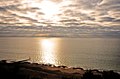 Bournemouth sunrise - geograph.org.uk - 497303.jpg 640 × 423; 66 KB
-
 Bridleway by Mendle Farm - geograph.org.uk - 327486.jpg 640 × 480; 123 KB
-
 British Pilot TQ8478 327.jpg 2,048 × 1,536; 652 KB
-
 Brook farm - geograph.org.uk - 325562.jpg 640 × 480; 70 KB
-
 Brook on North Kelsey Moor - geograph.org.uk - 327457.jpg 640 × 480; 86 KB
-
 Broughton Vale Farm - geograph.org.uk - 327481.jpg 640 × 480; 111 KB
-
 Broughton Infants School - geograph.org.uk - 339499.jpg 640 × 480; 84 KB
-
 Junction on the B1208 - geograph.org.uk - 327478.jpg 640 × 480; 64 KB
-
 BT communications station - geograph.org.uk - 327449.jpg 640 × 480; 55 KB
-
 Butcher's Cove - geograph.org.uk - 326312.jpg 480 × 640; 122 KB
-
 Butcher's Cove and Gull Cove - geograph.org.uk - 332722.jpg 640 × 480; 111 KB
-
 Caistor Road - geograph.org.uk - 327458.jpg 640 × 480; 79 KB
-
 Canalside back gardens of Hornmead Road - geograph.org.uk - 325898.jpg 640 × 480; 106 KB
-

-
 Cattle shed on Cock Road - geograph.org.uk - 325832.jpg 640 × 480; 26 KB
-
 Chalgrave Parish Sign 326088 c8494e07-by-Rob-Farrow.jpg 331 × 332; 44 KB
-
 China Town - geograph.org.uk - 919828.jpg 640 × 480; 118 KB
-
 Christ Church at Rhydycroesau - geograph.org.uk - 325803.jpg 640 × 480; 54 KB
-

-
 St Chad's Church, Claughton.jpg 640 × 480; 213 KB
-
 Cliff Farm - geograph.org.uk - 326749.jpg 640 × 480; 85 KB
-
 Cliff scramble at Hilsea Point - geograph.org.uk - 332592.jpg 480 × 640; 137 KB
-
 Clwb Peldroed - geograph.org.uk - 369575.jpg 640 × 480; 67 KB
-
 Coast at Bugle Hole - geograph.org.uk - 332710.jpg 640 × 480; 126 KB
-
 Cock Road - geograph.org.uk - 325835.jpg 640 × 480; 33 KB
-
 Cockshot Barn, Highgate Hill, Hawkhurst - geograph.org.uk - 325828.jpg 640 × 480; 156 KB
-
 Communications Mast - geograph.org.uk - 326746.jpg 640 × 480; 59 KB
-
 Cottage near Cauldron Linn - geograph.org.uk - 325769.jpg 640 × 480; 118 KB
-
 Cottages on Watery Lane, Marsworth - geograph.org.uk - 325982.jpg 640 × 480; 89 KB
-
 Crafton Hamlet - geograph.org.uk - 326022.jpg 604 × 640; 130 KB
-
 Craigie - geograph.org.uk - 325672.jpg 640 × 426; 47 KB
-
 Craigie to Pickletillem right of way - geograph.org.uk - 325658.jpg 640 × 426; 64 KB
-
 Craigie to Pickletillem right of way - geograph.org.uk - 325666.jpg 640 × 426; 61 KB
-
 Converted chapel at Craignant - geograph.org.uk - 325766.jpg 640 × 480; 68 KB
-
 Crossing point, Craigie - geograph.org.uk - 325662.jpg 511 × 640; 53 KB
-
 Cutting Hill Farm - geograph.org.uk - 325391.jpg 640 × 480; 187 KB
-
 Derelict glasshouses off Wangfield Lane - geograph.org.uk - 325724.jpg 640 × 427; 132 KB
-
 Devon Way crossing the Dollar Burn - geograph.org.uk - 325779.jpg 640 × 480; 195 KB
-
 Doctor's Wood and the Avon Estuary - geograph.org.uk - 326492.jpg 640 × 480; 79 KB
-
 Drain on the Black Bank - geograph.org.uk - 326394.jpg 640 × 480; 89 KB
-
 Due west from the A15 - geograph.org.uk - 339362.jpg 480 × 640; 109 KB
-
 Durley Mill - geograph.org.uk - 325762.jpg 640 × 427; 139 KB
-
 Early evening Oxford Road - geograph.org.uk - 919830.jpg 640 × 480; 115 KB
-
 Laughton Forest - geograph.org.uk - 326417.jpg 640 × 480; 101 KB
-
 East Ferry Road - geograph.org.uk - 326423.jpg 640 × 480; 108 KB
-
 Edge of the forest - geograph.org.uk - 326421.jpg 640 × 480; 92 KB
-
 Entrance to Park Farm - geograph.org.uk - 325861.jpg 640 × 480; 25 KB
-
 Entrance to the Orchardleigh estate - geograph.org.uk - 325957.jpg 640 × 480; 98 KB
-
 Farm Buildings, River Rib Valley - geograph.org.uk - 325466.jpg 640 × 480; 113 KB
-
 Farm near Bedwlwyn 1 - geograph.org.uk - 325712.jpg 640 × 480; 58 KB
-
 Farm near Bedwlwyn 2 - geograph.org.uk - 325719.jpg 640 × 480; 82 KB
-
 Farmhouse, Ledburn - geograph.org.uk - 325499.jpg 640 × 483; 107 KB
-
 Fault east of Saddle Cove - geograph.org.uk - 326538.jpg 480 × 640; 104 KB
-
 Fields bordering the A5 - geograph.org.uk - 325790.jpg 640 × 480; 116 KB
-
 Fields west of the A15 - geograph.org.uk - 326759.jpg 640 × 480; 100 KB
-
 Flats by Grand Union Canal, Maida Vale - geograph.org.uk - 325875.jpg 640 × 480; 130 KB
-
 Flats in Senior Street - geograph.org.uk - 325871.jpg 640 × 480; 105 KB
-

-
 Flowering Cherry - geograph.org.uk - 325276.jpg 640 × 480; 96 KB
-
 Folded rocks near Hilsea Point - geograph.org.uk - 326530.jpg 480 × 640; 147 KB
-

-
 Former Ram Cider House.jpg 2,560 × 1,920; 2.23 MB
-
 Freight train - geograph.org.uk - 339481.jpg 640 × 480; 59 KB
-
 Frogmill Farm seen from footpath - geograph.org.uk - 325737.jpg 640 × 427; 153 KB
-
 Frome library - geograph.org.uk - 325979.jpg 640 × 480; 69 KB
-
 Frome market - geograph.org.uk - 325968.jpg 640 × 480; 83 KB
-
-
 Gates to Peart Farm - geograph.org.uk - 325857.jpg 640 × 480; 54 KB
-
 Gloucester Lodge - geograph.org.uk - 325959.jpg 640 × 480; 87 KB
-
 Graham Park.JPG 2,272 × 1,704; 2.47 MB
-
 Grain Crossing - geograph.org.uk - 325702.jpg 640 × 480; 96 KB
-
 Grain Marsh - geograph.org.uk - 325693.jpg 2,048 × 1,536; 735 KB
-
 Grange Farm - geograph.org.uk - 326731.jpg 640 × 480; 106 KB
-
 Grayingham Lodge Farm - geograph.org.uk - 326737.jpg 640 × 480; 118 KB
-
 The former Grove Church - geograph.org.uk - 326068.jpg 640 × 480; 93 KB
-
 Grove Church Lock from the bridge. - geograph.org.uk - 326073.jpg 502 × 640; 72 KB
-

-
 Harome - geograph.org.uk - 330851.jpg 640 × 480; 80 KB
-
 Hawthorn Tree in marshy field - geograph.org.uk - 326087.jpg 640 × 527; 117 KB
-
 Hay and sheep - geograph.org.uk - 325677.jpg 640 × 480; 98 KB
-
 Heath and Reach - Lane's End - geograph.org.uk - 326090.jpg 640 × 480; 80 KB
-
 St Jude's Church, Hexthorpe - geograph.org.uk - 325373.jpg 640 × 480; 66 KB
-
 Hexthorpe House Pub. - geograph.org.uk - 325378.jpg 640 × 480; 36 KB
-
 Hexthorpe Methodist Church - geograph.org.uk - 325372.jpg 640 × 480; 45 KB
-
 Highfield Farm - geograph.org.uk - 325674.jpg 640 × 480; 66 KB
-
 Hogbarn Holiday Village - geograph.org.uk - 326813.jpg 640 × 482; 96 KB
-
 Holme Lane - geograph.org.uk - 327482.jpg 640 × 480; 110 KB
-
 Houses in Crafton - geograph.org.uk - 326046.jpg 640 × 554; 102 KB
-
 Huntcliff Secondary School - geograph.org.uk - 339352.jpg 640 × 480; 71 KB
-
 Ings Farm - geograph.org.uk - 326405.jpg 640 × 480; 83 KB
-
 Ings Lane - geograph.org.uk - 326745.jpg 640 × 480; 73 KB
-

-
 St. Leonard's, Heath and Reach - geograph.org.uk - 325785.jpg 640 × 480; 79 KB
-
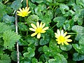 Lesser Celandine (Ranunculus ficaria) - geograph.org.uk - 326901.jpg 640 × 480; 102 KB
-
 Lidl Supermarket - geograph.org.uk - 325481.jpg 640 × 277; 90 KB
-
 North Kelsey Beck - geograph.org.uk - 327464.jpg 640 × 480; 83 KB
-
 Little wood across the A5 - geograph.org.uk - 325791.jpg 640 × 448; 83 KB
-
 Lockkeepers Cottage - geograph.org.uk - 326077.jpg 621 × 640; 106 KB
-
 Lode Mill - geograph.org.uk - 326243.jpg 640 × 518; 186 KB
-
 London Stone, Yantlet 338.jpg 1,200 × 1,600; 257 KB
-
 Looking into King's Wood - geograph.org.uk - 325788.jpg 480 × 640; 105 KB
-
 Lullington Mill - geograph.org.uk - 325930.jpg 640 × 480; 113 KB
-

-

-
 Main Street, Sprotbrough - geograph.org.uk - 325394.jpg 640 × 480; 46 KB
-
 Manor Farm, Sturton - geograph.org.uk - 327472.jpg 640 × 480; 66 KB
-
 Manton Lane railway bridge - geograph.org.uk - 327470.jpg 640 × 480; 77 KB
-
 Marrow Pole Lane - geograph.org.uk - 325844.jpg 640 × 480; 50 KB
-
 Marshy field near Grand Union Canal - geograph.org.uk - 325750.jpg 640 × 480; 89 KB
-
 Meadowsfoot Beach - geograph.org.uk - 332765.jpg 640 × 480; 88 KB
-
 Mellow's Beck - geograph.org.uk - 326955.jpg 640 × 480; 142 KB
-
 Mells River reflections - geograph.org.uk - 325941.jpg 480 × 640; 96 KB
-
 Highfield Farm - geograph.org.uk - 326385.jpg 640 × 480; 110 KB
-
 West Grange Farm - geograph.org.uk - 337396.jpg 640 × 480; 67 KB
-

-
 St John's Church - geograph.org.uk - 568420.jpg 640 × 427; 113 KB
-
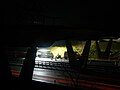
 Moon and pillbox - geograph.org.uk - 325948 crop.jpg 467 × 284; 41 KB
-
 Moon and pillbox - geograph.org.uk - 325948.jpg 640 × 480; 86 KB
-
 Moortown House junction - geograph.org.uk - 327455.jpg 640 × 480; 64 KB
-
 Moortown Park - geograph.org.uk - 327454.jpg 640 × 480; 84 KB
-
-
 Mount Pleasant Mill - geograph.org.uk - 339285.jpg 640 × 480; 80 KB
-
 Muddy track - geograph.org.uk - 326789.jpg 640 × 480; 75 KB
-
 National Grid Compressor Station - geograph.org.uk - 325688.jpg 640 × 480; 119 KB
-
 Near King's Wood, looking north - geograph.org.uk - 326102.jpg 640 × 402; 91 KB
-

-
 New Poultry Farm - geograph.org.uk - 326735.jpg 640 × 480; 77 KB
-
 Northwood Farm - geograph.org.uk - 339366.jpg 640 × 480; 96 KB
-
 Oak Cottage, Caton - geograph.org.uk - 325781.jpg 640 × 480; 191 KB
-
 Obsolete office off Wangfield Lane - geograph.org.uk - 325756.jpg 417 × 640; 194 KB
-
 Old Chapel House - geograph.org.uk - 325847.jpg 640 × 480; 32 KB
-
 Open farmland west of the B1208 - geograph.org.uk - 327477.jpg 640 × 480; 89 KB
-
 Open fields north of the A631 - geograph.org.uk - 326953.jpg 640 × 480; 74 KB
-
 Ornate gatehouse, Redbourne Hall - geograph.org.uk - 339383.jpg 640 × 480; 98 KB
-
 Osborne Newton - geograph.org.uk - 326503.jpg 640 × 480; 95 KB
-
 Osborne Newton - geograph.org.uk - 326508.jpg 640 × 480; 81 KB
-
 Path from Pitgober toward Muckhart Mill - geograph.org.uk - 325761.jpg 640 × 480; 152 KB
-
 Path towards West Pitgober - geograph.org.uk - 325793.jpg 640 × 480; 134 KB
-
 Peacock Cottages - geograph.org.uk - 326625.jpg 640 × 480; 71 KB
-
 Peart Farm - geograph.org.uk - 325856.jpg 640 × 480; 54 KB
-
 Phoenix Arts Centre - geograph.org.uk - 325729.jpg 640 × 480; 90 KB
-
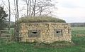
 Pillbox at Lullington - geograph.org.uk - 325945.jpg 640 × 480; 31 KB
-
 Pillbox at Lullington - geograph.org.uk - 325952.jpg 640 × 480; 99 KB
-
 Plassey Road - geograph.org.uk - 326801.jpg 640 × 480; 74 KB
-
 Ploughed field at Osborne Newton - geograph.org.uk - 326513.jpg 640 × 480; 102 KB
-
 Poyntz Road, Battersea - geograph.org.uk - 325237.jpg 640 × 480; 45 KB
-
 Pyewipe Garth - geograph.org.uk - 326766.jpg 640 × 480; 87 KB
-

-
 Reedbed - geograph.org.uk - 325464.jpg 640 × 480; 147 KB
-
 Reedbed - geograph.org.uk - 325468.jpg 640 × 480; 107 KB
-
 Reedbed - geograph.org.uk - 325472.jpg 640 × 480; 148 KB
-
 Reedbed - geograph.org.uk - 325477.jpg 640 × 480; 127 KB
-
 Reedbed in January - geograph.org.uk - 544822.jpg 640 × 480; 146 KB
-
 Reflections on the Mells River - geograph.org.uk - 325937.jpg 640 × 480; 107 KB
-
 Renton Lane - geograph.org.uk - 326376.jpg 640 × 480; 96 KB
-
 Reservoir embankment - geograph.org.uk - 325881.jpg 640 × 364; 86 KB
-
 Ribston Park - geograph.org.uk - 325456.jpg 640 × 480; 190 KB
-
 Ribston Park House - geograph.org.uk - 325452.jpg 640 × 480; 143 KB
-
 All Saints, Ridgmont - geograph.org.uk - 326623.jpg 480 × 640; 82 KB
-
 Ringmore - geograph.org.uk - 326470.jpg 640 × 480; 116 KB
-
 River Frome - geograph.org.uk - 325977.jpg 640 × 480; 101 KB
-
 River Ouzel & pollarded trees - geograph.org.uk - 325763.jpg 640 × 480; 86 KB
-
 River Ouzel near Northall - geograph.org.uk - 325765.jpg 480 × 640; 80 KB
-
 River Trent near Susworth - geograph.org.uk - 337401.jpg 640 × 480; 94 KB
-
 River Trent south of Susworth - geograph.org.uk - 326401.jpg 640 × 480; 98 KB
-
 Road to Brigg Power Station - geograph.org.uk - 327467.jpg 640 × 480; 71 KB
-
 Rocks at Hilsea Point - geograph.org.uk - 326254.jpg 640 × 494; 121 KB
-
 Rocks east of Saddle Cove - geograph.org.uk - 327237.jpg 480 × 640; 96 KB
-
 Rocks west of Hilsea Point - geograph.org.uk - 327230.jpg 640 × 480; 110 KB
-
 Roman Road - geograph.org.uk - 325858.jpg 640 × 480; 32 KB
-
 Roman road by Airfield Farm - geograph.org.uk - 339474.jpg 640 × 480; 117 KB
-
 Row of birches off the Black Bank - geograph.org.uk - 325685.jpg 640 × 480; 86 KB
-
 Rural rubbish - geograph.org.uk - 327324.jpg 640 × 483; 160 KB
-
 Saddle Cove and Blackstone Point - geograph.org.uk - 327253.jpg 640 × 472; 96 KB


_-_geograph.org.uk_-_326901.jpg)


_-_geograph.org.uk_-_325813.jpg)
_-_geograph.org.uk_-_325814.jpg)


