Category:United Kingdom photographs taken on 2007-01-12
Jump to navigation
Jump to search
| ← | Friday 12 January 2007 | → | ||
| ← | January 2007 | → | ||

United Kingdom photographs taken on 12 January 2007.
Image files should be categorized here automatically using {{taken on}} template. Direct categorisation is also possible, if automatic is impossible.
Subcategories
This category has only the following subcategory.
S
Media in category "United Kingdom photographs taken on 2007-01-12"
The following 200 files are in this category, out of 328 total.
(previous page) (next page)-
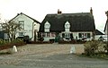 'The White Horse Inn' at Withersfield - geograph.org.uk - 311017.jpg 640 × 407; 64 KB
-
 A dirty ditch - geograph.org.uk - 309860.jpg 640 × 480; 117 KB
-
 A gaggle of geese - geograph.org.uk - 310245.jpg 640 × 480; 79 KB
-
 A house known as Pakes - geograph.org.uk - 310059.jpg 640 × 480; 113 KB
-
 A50 Bridge - geograph.org.uk - 312329.jpg 640 × 480; 117 KB
-
 Abandoned sleepers - geograph.org.uk - 312436.jpg 640 × 480; 118 KB
-

-
 Across the fields - geograph.org.uk - 310003.jpg 640 × 480; 115 KB
-
 Arable Crop and Egginton Road Bridge - geograph.org.uk - 309996.jpg 640 × 480; 117 KB
-
 Arable Field - geograph.org.uk - 309991.jpg 640 × 480; 116 KB
-
 Arable field - geograph.org.uk - 312462.jpg 640 × 480; 116 KB
-
 Barn at Manor farm - geograph.org.uk - 310425.jpg 640 × 480; 90 KB
-
 Battery farm - geograph.org.uk - 310406.jpg 640 × 480; 66 KB
-
 Between Twinhoe and Midford - geograph.org.uk - 309960.jpg 640 × 481; 76 KB
-
 Between Wellow and Twinhoe - geograph.org.uk - 309964.jpg 640 × 481; 88 KB
-
 Black Wood - geograph.org.uk - 312405.jpg 640 × 480; 114 KB
-
 Blakeley Farm Entrance - geograph.org.uk - 312337.jpg 640 × 480; 117 KB
-
 Blakeley Lodge - geograph.org.uk - 312344.jpg 640 × 480; 117 KB
-
 Blakeley Lodge Farm - geograph.org.uk - 312351.jpg 640 × 480; 112 KB
-
 Blue Plaque for the Drill Hall - geograph.org.uk - 309978.jpg 640 × 457; 168 KB
-
 Boltby Village Hall - geograph.org.uk - 311973.jpg 640 × 426; 69 KB
-

-

-
 Bottom Moor - geograph.org.uk - 309932.jpg 640 × 480; 107 KB
-
 Bowls Club - geograph.org.uk - 313354.jpg 640 × 480; 114 KB
-
 Bridge End Farm - geograph.org.uk - 311000.jpg 640 × 480; 120 KB
-
 Bridge over the Cerdin - Tregroes - geograph.org.uk - 309767.jpg 640 × 480; 156 KB
-
 Britoutside.jpg 1,024 × 768; 155 KB
-
 Bromley Mill Farm - geograph.org.uk - 335821.jpg 640 × 428; 135 KB
-
 Broomhill Cottages at Etwall - geograph.org.uk - 309930.jpg 640 × 480; 118 KB
-
 Broomhill Stream - geograph.org.uk - 312341.jpg 640 × 480; 117 KB
-
 Buckingham Road Industrial Estate - geograph.org.uk - 312059.jpg 640 × 480; 66 KB
-
 Disused church at the Pastures. - geograph.org.uk - 309906.jpg 640 × 480; 117 KB
-
 Burnaston 309925 28909fae.jpg 640 × 480; 115 KB
-
 Burnaston road junction - geograph.org.uk - 313382.jpg 640 × 480; 113 KB
-
 Bus shelter - geograph.org.uk - 309910.jpg 640 × 360; 73 KB
-
 Bushy Cottage Garden - geograph.org.uk - 312702.jpg 640 × 480; 115 KB
-
 Cadenham Manor - geograph.org.uk - 310221.jpg 640 × 480; 99 KB
-
 Christ Church, Carrowdore - geograph.org.uk - 309974.jpg 640 × 426; 160 KB
-
 Catkins - geograph.org.uk - 312675.jpg 640 × 480; 109 KB
-
 Causeway arches - geograph.org.uk - 309958.jpg 640 × 480; 73 KB
-
 Chalke Valley Sports Centre - geograph.org.uk - 309773.jpg 640 × 480; 58 KB
-
 Chapple bridge - granite tramway - geograph.org.uk - 410056.jpg 640 × 480; 144 KB
-
 Church Street - geograph.org.uk - 311902.jpg 426 × 640; 88 KB
-
 Cleaveswood.jpg 640 × 516; 40 KB
-
 Coping Stone - geograph.org.uk - 312429.jpg 640 × 480; 113 KB
-
 Copse - geograph.org.uk - 310969.jpg 640 × 480; 117 KB
-
 Country Cottage - geograph.org.uk - 312697.jpg 640 × 480; 113 KB
-
 Craigroy Farm. - geograph.org.uk - 310066.jpg 640 × 462; 139 KB
-
 Cross Inn - Llanfihangel-ar-arth - geograph.org.uk - 309756.jpg 640 × 480; 123 KB
-
 Cyclists - geograph.org.uk - 312419.jpg 640 × 480; 116 KB
-
 Date stone - geograph.org.uk - 313349.jpg 640 × 480; 112 KB
-
 Dauntsey cottage - geograph.org.uk - 310416.jpg 633 × 473; 110 KB
-
 Diglis lock levelled by the floods - geograph.org.uk - 311813.jpg 640 × 405; 148 KB
-
 Disused Underpass Under Railway - geograph.org.uk - 312914.jpg 640 × 426; 116 KB
-
 Down the lane - geograph.org.uk - 312601.jpg 640 × 480; 121 KB
-
 Dunes around Kilkenneth Chapel - geograph.org.uk - 315702.jpg 640 × 480; 69 KB
-
 Moravian church - geograph.org.uk - 309993.jpg 640 × 480; 111 KB
-
 East Tytherton cottages - geograph.org.uk - 309989.jpg 590 × 395; 82 KB
-
 Egginton Common - geograph.org.uk - 312346.jpg 640 × 480; 115 KB
-
 End of the road - geograph.org.uk - 312502.jpg 640 × 480; 115 KB
-
 Entrance to Little Jack Horners - geograph.org.uk - 312334.jpg 640 × 480; 117 KB
-

-
 Falls of Falloch - geograph.org.uk - 312252.jpg 640 × 426; 109 KB
-
 Farm buildings at Swan Farm, Blackbrook - geograph.org.uk - 310074.jpg 640 × 428; 132 KB
-
 Farmhouse conversion - geograph.org.uk - 313375.jpg 640 × 480; 114 KB
-
 Farmland near Dunsters Plantation - geograph.org.uk - 312414.jpg 640 × 480; 115 KB
-
 Farmland opposite Green Bank Farm - geograph.org.uk - 312473.jpg 640 × 480; 115 KB
-
 Farmland View - geograph.org.uk - 312686.jpg 640 × 480; 115 KB
-
 Feasant Pheeder, Near Gurtof Wood - geograph.org.uk - 310968.jpg 640 × 426; 98 KB
-
 Fence post - geograph.org.uk - 312425.jpg 640 × 480; 118 KB
-
 Field track - geograph.org.uk - 310000.jpg 640 × 480; 114 KB
-
 Field with pond near Mickleover - geograph.org.uk - 309899.jpg 640 × 480; 114 KB
-
 Field, Near Moor House - geograph.org.uk - 310972.jpg 640 × 426; 90 KB
-
 Fields Along Eller Beck - geograph.org.uk - 312398.jpg 640 × 426; 78 KB
-
 Fieldside and wood - geograph.org.uk - 312610.jpg 640 × 480; 114 KB
-
 Fire Pond, Boltby Forest - geograph.org.uk - 310954.jpg 640 × 426; 96 KB
-
 Footbridge over the stream - geograph.org.uk - 312508.jpg 640 × 480; 114 KB
-
 Footpath at the rear of Toyota. - geograph.org.uk - 312504.jpg 640 × 480; 112 KB
-
 Footpath from Burnaston - geograph.org.uk - 309911.jpg 640 × 480; 113 KB
-
 Footpath to New Gorse Fox Covert. - geograph.org.uk - 312669.jpg 640 × 480; 117 KB
-
 Forest of Dean Heritage Centre - geograph.org.uk - 552243.jpg 639 × 479; 78 KB
-
 Good Monday's farm - geograph.org.uk - 310412.jpg 595 × 426; 99 KB
-
 Green Farm at Burnaston - geograph.org.uk - 309914.jpg 640 × 480; 117 KB
-
 Green lane to Burnaston - geograph.org.uk - 312470.jpg 640 × 480; 115 KB
-
 Green lane to Sandypits - geograph.org.uk - 309919.jpg 640 × 480; 117 KB
-
 Grove farm - geograph.org.uk - 309948.jpg 640 × 480; 70 KB
-

-
 Hardware Store - Llanllwni - geograph.org.uk - 309763.jpg 640 × 480; 118 KB
-
 Hare Street farm - geograph.org.uk - 310011.jpg 640 × 480; 89 KB
-
 Hartlepool Docks - geograph.org.uk - 311928.jpg 640 × 426; 78 KB
-
 Hedgerow nursery, Sutton Lane - geograph.org.uk - 309935.jpg 640 × 480; 58 KB
-
 Heming Avenue - geograph.org.uk - 310508.jpg 640 × 360; 64 KB
-
 Highleas, Old Court Hill, Nonington. - geograph.org.uk - 310674.jpg 640 × 480; 226 KB
-
 Hinton Road - geograph.org.uk - 312063.jpg 640 × 480; 60 KB
-
-
 Inverkirkaig - geograph.org.uk - 993592.jpg 640 × 480; 69 KB
-
 It's cold out there^^ - geograph.org.uk - 310867.jpg 434 × 640; 127 KB
-
 Ivy House, Spirthill - geograph.org.uk - 310606.jpg 640 × 480; 77 KB
-
 Kellaways farm - geograph.org.uk - 309961.jpg 428 × 573; 186 KB
-
 Lifeboat station, Donaghadee - geograph.org.uk - 309984.jpg 640 × 426; 126 KB
-

-
 Little Jack Horners Childrens Nursery - geograph.org.uk - 312348.jpg 640 × 480; 112 KB
-
 Lock farm - geograph.org.uk - 310208.jpg 640 × 445; 70 KB
-
 Long Dale - geograph.org.uk - 310983.jpg 640 × 480; 114 KB
-
 Looking eastwards towards Burntack. - geograph.org.uk - 310852.jpg 640 × 426; 121 KB
-
 Main line to Paddington - geograph.org.uk - 310239.jpg 602 × 438; 129 KB
-
 Main road through Llanllwni - geograph.org.uk - 309759.jpg 640 × 480; 115 KB
-
 Manor house, East Tytherton - geograph.org.uk - 309987.jpg 640 × 480; 87 KB
-
 Manor Street, Donaghadee - geograph.org.uk - 309952.jpg 640 × 426; 123 KB
-
 Maud Heath's causeway - geograph.org.uk - 309955.jpg 606 × 448; 139 KB
-
 Merlin way - geograph.org.uk - 313343.jpg 640 × 480; 116 KB
-
 Millway Farm - geograph.org.uk - 313390.jpg 640 × 480; 116 KB
-
 Millway House - geograph.org.uk - 313385.jpg 640 × 480; 114 KB
-
 Moulton Church - geograph.org.uk - 394435.jpg 640 × 364; 121 KB
-
 Mud, glorious mud - geograph.org.uk - 309941.jpg 640 × 480; 75 KB
-
 Muddy path over the stream - geograph.org.uk - 312412.jpg 640 × 480; 118 KB
-
 National trail route sign. - geograph.org.uk - 312397.jpg 480 × 640; 120 KB
-
 New housing estate - geograph.org.uk - 313341.jpg 640 × 480; 114 KB
-

-
 New Years storm 2007 at sundown - geograph.org.uk - 310804.jpg 640 × 166; 17 KB
-
 Oast House at Claypits - geograph.org.uk - 310688.jpg 625 × 442; 220 KB
-
 Off home at the end of the Altyre shoot. - geograph.org.uk - 310846.jpg 640 × 426; 110 KB
-
 Old Brick Chimney - geograph.org.uk - 316985.jpg 640 × 480; 73 KB
-
 Old Dovecote - geograph.org.uk - 312706.jpg 480 × 640; 111 KB
-
 Old Railway Signal - geograph.org.uk - 312434.jpg 480 × 640; 119 KB
-
 Osierbed Wood - geograph.org.uk - 312422.jpg 640 × 480; 119 KB
-
 Overgrown Mere - geograph.org.uk - 310007.jpg 640 × 480; 112 KB
-
 Park Farm - geograph.org.uk - 313368.jpg 640 × 480; 115 KB
-
 Pasture Above Lunshaw Beck - geograph.org.uk - 312965.jpg 640 × 426; 82 KB
-
 Pastures Hospital at Etwall - geograph.org.uk - 313348.jpg 640 × 480; 116 KB
-
-
 Pinnigers farm - geograph.org.uk - 309997.jpg 635 × 425; 140 KB
-
 Pinnigers House - geograph.org.uk - 309985.jpg 623 × 424; 147 KB
-
 Play Area in Recreation Field - geograph.org.uk - 309779.jpg 640 × 480; 144 KB
-
 Playing fields - geograph.org.uk - 313345.jpg 640 × 480; 116 KB
-
 Potlocks Farm - geograph.org.uk - 312401.jpg 640 × 480; 114 KB
-
 Pre-Worboys, Donaghadee - geograph.org.uk - 309937.jpg 640 × 426; 123 KB
-

-
 Purples Farm - geograph.org.uk - 310054.jpg 640 × 480; 75 KB
-
 Raglan A40 Roundabout - monument - geograph.org.uk - 310070.jpg 640 × 428; 158 KB
-
 Railway bridge on National cycle route 45 - geograph.org.uk - 309855.jpg 640 × 480; 106 KB
-

-
 Road leading to Nonington Court. - geograph.org.uk - 310701.jpg 640 × 480; 219 KB
-
 Road name sign - geograph.org.uk - 311376.jpg 640 × 360; 88 KB
-
 Royal Terrace - geograph.org.uk - 309917.jpg 600 × 450; 38 KB
-
 Royal Terrace footpath - geograph.org.uk - 309965.jpg 450 × 600; 47 KB
-
 Rubha Tràigh an Dùin - geograph.org.uk - 315681.jpg 640 × 480; 89 KB
-
 Sandypits Farm - geograph.org.uk - 312494.jpg 640 × 480; 116 KB
-
 Sandypits Lane near Etwall - geograph.org.uk - 312482.jpg 640 × 480; 117 KB
-
 Selstead farm - geograph.org.uk - 310596.jpg 640 × 480; 67 KB
-
 Send for the "Duke Boys" - geograph.org.uk - 656592.jpg 640 × 401; 103 KB
-
 Small pond near Springbank Farm - geograph.org.uk - 310753.jpg 640 × 432; 96 KB
-
 Southstoke Bath - geograph.org.uk - 309957.jpg 640 × 481; 84 KB
-
 Spirthill - geograph.org.uk - 310161.jpg 631 × 441; 102 KB
-
 St Briavels - geograph.org.uk - 552246.jpg 640 × 520; 95 KB
-
 St. John's - geograph.org.uk - 309947.jpg 600 × 450; 31 KB
-
 Staff Houses - geograph.org.uk - 313364.jpg 640 × 480; 114 KB
-
 Stowmarket Railway Station - geograph.org.uk - 309903.jpg 640 × 480; 66 KB
-
 Sutton Lane farm - geograph.org.uk - 309945.jpg 640 × 474; 62 KB
-
 Swan Farm, Blackbrook - geograph.org.uk - 310078.jpg 640 × 428; 122 KB
-
 Thames floods - geograph.org.uk - 309863.jpg 640 × 480; 68 KB
-
 The driveway to Hempstead Hall - geograph.org.uk - 310122.jpg 640 × 480; 134 KB
-
 The End of the Drive. - geograph.org.uk - 310842.jpg 640 × 454; 104 KB
-
 The footbridge over the A50. - geograph.org.uk - 309940.jpg 640 × 480; 116 KB
-
 The Grange - geograph.org.uk - 313362.jpg 640 × 480; 117 KB
-
 The Haverhill Roundabout Sculpture - geograph.org.uk - 310921.jpg 640 × 480; 57 KB
-

-
 The M4 near Dodford farm - geograph.org.uk - 310397.jpg 640 × 480; 57 KB
-
 The Millway - geograph.org.uk - 313393.jpg 640 × 480; 117 KB
-

-
 The Oceanic bar, Donaghadee - geograph.org.uk - 309963.jpg 640 × 426; 122 KB
-
 The Old Hall - geograph.org.uk - 313370.jpg 640 × 480; 115 KB
-
 The Old Lodge Nursing Home - geograph.org.uk - 312489.jpg 640 × 480; 113 KB
-
 The old school and schoolhouse. - geograph.org.uk - 310947.jpg 611 × 437; 103 KB
-
 The Pembroke Centre - geograph.org.uk - 309867.jpg 640 × 480; 78 KB
-
-
 Timber - geograph.org.uk - 310632.jpg 640 × 480; 65 KB
-
 Timber framed cottage - geograph.org.uk - 313379.jpg 640 × 480; 116 KB
-
 Towards Pilsbury - geograph.org.uk - 310992.jpg 640 × 480; 126 KB
-
 Track and ditch - geograph.org.uk - 312692.jpg 640 × 480; 114 KB
-
 Trees on a limestone outcrop. - geograph.org.uk - 310975.jpg 640 × 480; 94 KB
-
 Tregroes Saw Mill - geograph.org.uk - 309772.jpg 640 × 480; 132 KB
-
 Tràigh an Dùin - geograph.org.uk - 315686.jpg 640 × 480; 41 KB
-
 Tràigh Chornaig - geograph.org.uk - 315695.jpg 640 × 480; 60 KB
-
 Tràigh Shorobaidh - geograph.org.uk - 315228.jpg 640 × 480; 34 KB
-
 Tumbledown Shed - geograph.org.uk - 313387.jpg 640 × 480; 117 KB
-
 Twinhoe - geograph.org.uk - 309962.jpg 640 × 481; 66 KB
-
 Upper Falls Foyers - geograph.org.uk - 788058.jpg 480 × 640; 81 KB
-
 View across a sheep field to Chillenden - geograph.org.uk - 310695.jpg 640 × 480; 256 KB
-
 Village sign - geograph.org.uk - 335808.jpg 640 × 428; 142 KB
-
 Washed ashore - geograph.org.uk - 323446.jpg 640 × 480; 96 KB
-
 Water Trough, Boltby - geograph.org.uk - 311981.jpg 640 × 426; 118 KB
-
 Wet field - geograph.org.uk - 312681.jpg 640 × 480; 116 KB
-
 Wilton Baptist Church-Town Hall - geograph.org.uk - 309862.jpg 640 × 480; 89 KB
-
 Wilton Health Centre - geograph.org.uk - 309859.jpg 640 × 480; 98 KB
-
 Woodland Pond - geograph.org.uk - 312616.jpg 640 × 480; 116 KB
-
 A private track - geograph.org.uk - 309868.jpg 640 × 480; 111 KB
-
 A road junction on the B.1054 - geograph.org.uk - 310128.jpg 640 × 417; 50 KB
-
 A very muddy public footpath - geograph.org.uk - 311013.jpg 640 × 480; 89 KB


_-_geograph.org.uk_-_309954.jpg)
_-_geograph.org.uk_-_309950.jpg)


