Category:United Kingdom photographs taken on 2006-09-10
Jump to navigation
Jump to search
| ← | Sunday 10 September 2006 | → | ||
| ← | September 2006 | → | ||

United Kingdom photographs taken on 10 September 2006.
Image files should be categorized here automatically using {{taken on}} template. Direct categorisation is also possible, if automatic is impossible.
Subcategories
This category has the following 2 subcategories, out of 2 total.
Media in category "United Kingdom photographs taken on 2006-09-10"
The following 200 files are in this category, out of 913 total.
(previous page) (next page)-
 "Forest dreaming, motherhood revisited" - geograph.org.uk - 239565.jpg 480 × 640; 165 KB
-
 1.5 Men Gragareth - geograph.org.uk - 236693.jpg 640 × 480; 89 KB
-
 8.0 Metre Tide - Barton Haven - geograph.org.uk - 237656.jpg 640 × 480; 68 KB
-
 A cobbled road in South Queensferry - geograph.org.uk - 556272.jpg 640 × 481; 61 KB
-
 A Newly Constructed Private Dock - geograph.org.uk - 237739.jpg 640 × 480; 64 KB
-
 A sandy bank. - geograph.org.uk - 238367.jpg 477 × 607; 104 KB
-
 A Weak Roadbridge - geograph.org.uk - 237243.jpg 640 × 480; 133 KB
-
 A Welsh Chinese Restaurant on Y Maes - geograph.org.uk - 237754.jpg 640 × 480; 77 KB
-
 A1079 Looking to Hayton - geograph.org.uk - 236835.jpg 640 × 426; 123 KB
-
 A171 on Fylingdales Moor - geograph.org.uk - 237103.jpg 640 × 480; 130 KB
-
 A614 Passing High Plantation - geograph.org.uk - 236889.jpg 640 × 426; 117 KB
-
 A9 - geograph.org.uk - 236966.jpg 640 × 480; 105 KB
-
 A9 - Pass of Birnam - geograph.org.uk - 237696.jpg 640 × 480; 85 KB
-
 A9, Muir of Thorn - geograph.org.uk - 237071.jpg 640 × 480; 83 KB
-
 Above Cautley Crag - geograph.org.uk - 243680.jpg 640 × 479; 66 KB
-

-

-

-
 Afon Dyfrdwy near Rhydonnen - geograph.org.uk - 237133.jpg 640 × 480; 156 KB
-
 Afon Menai, near Moel-y-don - geograph.org.uk - 237319.jpg 600 × 450; 68 KB
-
 Afon Sawdde - geograph.org.uk - 300953.jpg 640 × 481; 159 KB
-
 Afon Seiont from the Railway Bridge - geograph.org.uk - 237240.jpg 640 × 480; 132 KB
-
 Albert Dock - geograph.org.uk - 237429.jpg 640 × 480; 169 KB
-
 Alfred Schofield House - geograph.org.uk - 237248.jpg 425 × 640; 113 KB
-
 Allerthorpe Lakeland Park - geograph.org.uk - 744287.jpg 640 × 381; 58 KB
-
 Allt Ceitlein - geograph.org.uk - 241324.jpg 640 × 480; 267 KB
-
 Alluvial fan, Allt Ceitlein - geograph.org.uk - 241320.jpg 640 × 480; 245 KB
-
-
 Apple tree at Poltimore - geograph.org.uk - 238595.jpg 480 × 640; 198 KB
-
 Approaching Ledwell - geograph.org.uk - 236973.jpg 640 × 480; 61 KB
-
 Archery in Kensington Gardens - geograph.org.uk - 237784.jpg 640 × 480; 103 KB
-
 Are you looking at me^ - geograph.org.uk - 239040.jpg 640 × 482; 140 KB
-
 Arlington Reservoir - East Sussex - geograph.org.uk - 237960.jpg 640 × 480; 91 KB
-
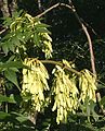 Ash Keys - geograph.org.uk - 237357.jpg 518 × 640; 319 KB
-
 Aslockton sewage works - geograph.org.uk - 237181.jpg 640 × 427; 76 KB
-
 At Bothan Gleann Ghòinean - geograph.org.uk - 404024.jpg 640 × 480; 52 KB
-
-
 Athenaeum Centre, Warminster - geograph.org.uk - 239905.jpg 480 × 640; 91 KB
-
 Auchope Cairn - geograph.org.uk - 240180.jpg 640 × 480; 249 KB
-
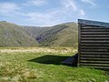 Auchope Mountain Refuge Hut - geograph.org.uk - 240776.jpg 640 × 479; 192 KB
-
 Autumn crocuses at Killerton - geograph.org.uk - 239436.jpg 640 × 480; 127 KB
-
 Avoiding Action Was Taken^ - geograph.org.uk - 237414.jpg 546 × 640; 346 KB
-
 Balhennie - geograph.org.uk - 237391.jpg 427 × 640; 266 KB
-

-
 Banbury School - geograph.org.uk - 238414.jpg 640 × 480; 55 KB
-
 St Hugh's Church, Banbury - geograph.org.uk - 236878.jpg 640 × 480; 57 KB
-
 Barmouth Harbour main slipway - geograph.org.uk - 608943.jpg 640 × 480; 71 KB
-
 Barn at Cowside - geograph.org.uk - 236791.jpg 640 × 480; 127 KB
-

-
 Manby House - geograph.org.uk - 236588.jpg 640 × 480; 136 KB
-
 Barrow, Pearsons Mill.jpg 480 × 640; 160 KB
-
 Residential Care Facility - geograph.org.uk - 239378.jpg 640 × 480; 93 KB
-
 Bath house at high tide - geograph.org.uk - 686306.jpg 640 × 480; 58 KB
-

-
 Beach at Hoylake - geograph.org.uk - 237278.jpg 640 × 480; 50 KB
-
 Beech, Buller's Hill - geograph.org.uk - 239577.jpg 640 × 480; 136 KB
-
 Beehives in Borage Crop Near Easthorpe - geograph.org.uk - 236895.jpg 640 × 426; 114 KB
-

-
 Bertha Loch - geograph.org.uk - 237203.jpg 640 × 480; 101 KB
-
 Bird of Prey viewpoint, Haldon - geograph.org.uk - 238843.jpg 480 × 640; 126 KB
-
 Bishop Auckland Town Hall.jpg 1,600 × 1,200; 1.06 MB
-
 Norton Place - geograph.org.uk - 252640.jpg 640 × 479; 94 KB
-
 Black and White - geograph.org.uk - 237404.jpg 425 × 640; 251 KB
-
 Blackwell Community Hall - geograph.org.uk - 237004.jpg 640 × 480; 62 KB
-
 Blair Atholl - geograph.org.uk - 238370.jpg 640 × 474; 86 KB
-
 Bloxham - geograph.org.uk - 238446.jpg 640 × 480; 54 KB
-
 Bloxham Village Museum - geograph.org.uk - 238459.jpg 640 × 480; 94 KB
-
 Bloxham Village Museum - geograph.org.uk - 238466.jpg 640 × 480; 121 KB
-
 Boardwalk on Auchope Cairn - geograph.org.uk - 240157.jpg 640 × 481; 203 KB
-
 Boat Storage at Ty Calch - geograph.org.uk - 237716.jpg 640 × 480; 67 KB
-
 Bogland and glacial deposits - geograph.org.uk - 236705.jpg 640 × 427; 87 KB
-
 Border fence - geograph.org.uk - 239572.jpg 640 × 479; 234 KB
-
 Borders farmland - geograph.org.uk - 237800.jpg 640 × 479; 311 KB
-
 Born Last Week - geograph.org.uk - 237400.jpg 640 × 618; 396 KB
-
 Boulder clay at East Hoyle Bank - geograph.org.uk - 237270.jpg 640 × 480; 89 KB
-
 Bowmont Water and The Castles - geograph.org.uk - 238500.jpg 640 × 479; 306 KB
-
 Bowmont Water Valley near Swindon - geograph.org.uk - 238528.jpg 640 × 479; 228 KB
-
 BradwellAqueduct-GUC.JPG 1,024 × 768; 147 KB
-
 Bridge over the River Perry - geograph.org.uk - 238128.jpg 640 × 426; 114 KB
-
 Bridge remains (2) - geograph.org.uk - 236631.jpg 640 × 427; 116 KB
-
 Bridge remains - geograph.org.uk - 236630.jpg 640 × 427; 122 KB
-
 Brook Farm - geograph.org.uk - 236948.jpg 640 × 480; 24 KB
-
 Broughton castle garden.jpg 640 × 480; 106 KB
-
 Broughton castle1.jpg 640 × 480; 59 KB
-
 Broughton castle2.jpg 640 × 485; 46 KB
-
 Buller's Hill - geograph.org.uk - 239571.jpg 640 × 480; 120 KB
-

-
 Buttresses and towers above Coire Dearg - geograph.org.uk - 238845.jpg 640 × 478; 186 KB
-
 Caernarfon WHR Station - geograph.org.uk - 237225.jpg 640 × 553; 129 KB
-
 Cambusmore - geograph.org.uk - 236907.jpg 640 × 480; 149 KB
-
 Cambusmore - to become Aviemore^ - geograph.org.uk - 236918.jpg 640 × 480; 111 KB
-
 Candie brickwork - geograph.org.uk - 241064.jpg 480 × 640; 85 KB
-
 Canley Ford - geograph.org.uk - 246390.jpg 640 × 480; 123 KB
-
 Canley Ford - geograph.org.uk - 246391.jpg 640 × 388; 93 KB
-
 Capel a Ty Capel Pen-y-Graig - geograph.org.uk - 236813.jpg 640 × 454; 81 KB
-
 Capel Engedi Chapel - geograph.org.uk - 236876.jpg 480 × 640; 92 KB
-
 Car park, Killerton House - geograph.org.uk - 239420.jpg 480 × 640; 163 KB
-
 Carn Liath - geograph.org.uk - 236730.jpg 640 × 480; 50 KB
-
 Carr Farm Pocklington Common - geograph.org.uk - 236838.jpg 640 × 426; 115 KB
-
 Carved fence post - geograph.org.uk - 239543.jpg 640 × 480; 87 KB
-
 Cathedral of the Downs - Alfriston - geograph.org.uk - 237910.jpg 640 × 480; 127 KB
-
 Cattle at Mere Down - geograph.org.uk - 260016.jpg 640 × 480; 206 KB
-
 Cattle grazing near Town Yetholm - geograph.org.uk - 237837.jpg 603 × 452; 253 KB
-
 Caution Teenagers 4889126077.jpg 1,922 × 1,281; 1.86 MB
-
 Cautley Spout - geograph.org.uk - 243597.jpg 480 × 640; 75 KB
-
 Cautley Spout - geograph.org.uk - 243601.jpg 480 × 640; 87 KB
-
 Cedar House Hotel - geograph.org.uk - 819757.jpg 640 × 480; 102 KB
-
 Cedars at Poltimore - geograph.org.uk - 238631.jpg 640 × 480; 111 KB
-

-
 Chalk land in Kent - geograph.org.uk - 239528.jpg 640 × 480; 121 KB
-
 Channel in East Hoyle Bank - geograph.org.uk - 237260.jpg 640 × 480; 65 KB
-
 Chapel at Mount Stuart House - geograph.org.uk - 1184093.jpg 480 × 640; 87 KB
-
 Chapel of St Lawrence, Warminster - geograph.org.uk - 239681.jpg 480 × 640; 100 KB
-
 Cheviot peat bog - geograph.org.uk - 239590.jpg 640 × 479; 271 KB
-
 Chicheley - geograph.org.uk - 237095.jpg 640 × 480; 88 KB
-
 Church Farm - geograph.org.uk - 238493.jpg 640 × 480; 56 KB
-
 Church of St. Mary - geograph.org.uk - 237648.jpg 502 × 640; 146 KB
-

-
 City Hotel - geograph.org.uk - 241104.jpg 640 × 473; 141 KB
-
 Coilintuie - geograph.org.uk - 237711.jpg 640 × 480; 159 KB
-
 Coire Glas, Stob Coir an Albannaich - geograph.org.uk - 237957.jpg 640 × 480; 222 KB
-
 Coire Sgorach - geograph.org.uk - 238891.jpg 640 × 478; 172 KB
-
 Collecting Straw Bales - geograph.org.uk - 237394.jpg 640 × 373; 213 KB
-
 Colourful garden - geograph.org.uk - 238451.jpg 480 × 640; 121 KB
-
 Columbia Wharf - geograph.org.uk - 237666.jpg 640 × 480; 73 KB
-
 Combined Court Centre - geograph.org.uk - 241088.jpg 425 × 640; 147 KB
-
 Corgarff Castle - geograph.org.uk - 1040758.jpg 426 × 640; 62 KB
-
 Cornmarket sculpture, Warminster - geograph.org.uk - 239502.jpg 480 × 640; 96 KB
-
 Cottage and haystack - geograph.org.uk - 237215.jpg 480 × 640; 93 KB
-
 Cottages by Frog Lane, Bloxham - geograph.org.uk - 236928.jpg 640 × 480; 76 KB
-
 Covent Garden Market - geograph.org.uk - 236852.jpg 640 × 423; 90 KB
-
 Crag, Mullach nan Coirean - geograph.org.uk - 238820.jpg 640 × 480; 153 KB
-
 Crag, Mullach nan Coirean - geograph.org.uk - 238821.jpg 640 × 480; 155 KB
-
 Craig Arthur - geograph.org.uk - 237138.jpg 640 × 480; 118 KB
-
 Craigend brick work - geograph.org.uk - 242332.jpg 480 × 640; 75 KB
-
 Craigend brick work - geograph.org.uk - 242338.jpg 480 × 640; 44 KB
-
 Cramlington St Nicholas - geograph.org.uk - 454294.jpg 480 × 640; 84 KB
-
 Craster Harbour. - geograph.org.uk - 284723.jpg 640 × 480; 93 KB
-
 Craster Harbour. - geograph.org.uk - 284728.jpg 640 × 480; 93 KB
-
 Cromar - geograph.org.uk - 237393.jpg 640 × 427; 269 KB
-
 Crummock Water from Hause Point - geograph.org.uk - 367607.jpg 640 × 480; 52 KB
-
 Cup and Ring marked rock - geograph.org.uk - 603139.jpg 640 × 480; 124 KB
-
 Cushlachie - geograph.org.uk - 237427.jpg 640 × 427; 286 KB
-
 Cycle trail crossing road, Haldon - geograph.org.uk - 238832.jpg 640 × 480; 89 KB
-
 Dalnavert - Compare and contrast. - geograph.org.uk - 238477.jpg 480 × 640; 165 KB
-
 Dalnavert - geograph.org.uk - 238352.jpg 640 × 480; 119 KB
-
 Dalnavert - geograph.org.uk - 238354.jpg 480 × 640; 151 KB
-
 Dalnavert letterboxes - geograph.org.uk - 238356.jpg 640 × 430; 120 KB
-
 Dalton Gates Cottage - geograph.org.uk - 236940.jpg 640 × 426; 134 KB
-

-
 Dawn in Great Yarmouth Harbour - geograph.org.uk - 270980.jpg 640 × 481; 30 KB
-
 Deer running across farmland - geograph.org.uk - 237774.jpg 640 × 437; 78 KB
-
 DEFRA information board - geograph.org.uk - 239392.jpg 640 × 427; 75 KB
-
 Derelict Cottage, Darley - geograph.org.uk - 321856.jpg 640 × 426; 142 KB
-
 Dew pond, Battlesbury Hill, Warminster - geograph.org.uk - 240387.jpg 640 × 480; 132 KB
-
 Didcot power station.jpg 3,072 × 2,304; 3.04 MB
-

-
 Disused windpump near Ingestone - geograph.org.uk - 245170.jpg 480 × 640; 189 KB
-
 Door - Ye Olde White Harte - geograph.org.uk - 236957.jpg 425 × 640; 180 KB
-
 Doorway - Wilberforce House - geograph.org.uk - 241503.jpg 466 × 640; 135 KB
-
 Downs south of Cheesefoot Head - geograph.org.uk - 252005.jpg 640 × 480; 333 KB
-
 Drumnanoich - geograph.org.uk - 237708.jpg 640 × 480; 94 KB
-
 Drypool Bridge - geograph.org.uk - 237198.jpg 640 × 426; 107 KB
-
 Dunin Cleuch and Glenim cottage - geograph.org.uk - 237351.jpg 640 × 480; 115 KB
-
 Dunstanburgh Castle at Dawn - geograph.org.uk - 1546271.jpg 640 × 426; 46 KB
-
 E Ridge, Stob Coir an Albannaich - geograph.org.uk - 238706.jpg 640 × 480; 238 KB
-
 Early Morning Mist on Burstwick Drain - geograph.org.uk - 275121.jpg 640 × 480; 53 KB
-
 East ridge, Stob Ban, Mamores - geograph.org.uk - 238859.jpg 640 × 478; 150 KB
-

-
 Edinburgh Castle - geograph.org.uk - 697043.jpg 500 × 376; 61 KB
-

-
 Eglwyseg rocks - geograph.org.uk - 237157.jpg 640 × 480; 127 KB
-
 Eileanshonaoldschool.jpg 640 × 480; 142 KB
-

-
 Elton Flashes.jpg 640 × 480; 23 KB
-
 Entering Surfleet on Stockhouse Lane - geograph.org.uk - 237756.jpg 640 × 480; 95 KB
-
 Entrance to Hill Farm - geograph.org.uk - 237021.jpg 640 × 480; 132 KB
-
 Entrance to Kensington Palace Gardens - geograph.org.uk - 237797.jpg 640 × 480; 152 KB
-
 Exeter canal basin - geograph.org.uk - 238682.jpg 640 × 480; 80 KB
-
 Exeter Canal Basin - geograph.org.uk - 238695.jpg 640 × 480; 92 KB
-

-
 Family cycle trail, Tower Wood, Haldon - geograph.org.uk - 238723.jpg 480 × 640; 152 KB
-
 Farm at Tomdhu - geograph.org.uk - 236701.jpg 640 × 427; 76 KB
-
 Farm Buildings in Old Quarry - geograph.org.uk - 237537.jpg 640 × 426; 114 KB
-
 Farm Machinery at Middleton Wold - geograph.org.uk - 236930.jpg 640 × 426; 142 KB
-
 Farmhouse at Rotsea.jpg 640 × 449; 125 KB
-
 Farmland and Strathspey Steam Railway - geograph.org.uk - 236634.jpg 640 × 427; 51 KB
-
 Farmland near Porthamel Hall - geograph.org.uk - 237314.jpg 600 × 450; 97 KB
-
 Farmland off Longmoor Lane - geograph.org.uk - 237199.jpg 640 × 427; 104 KB
-
 Farmland Opposite Kipling House - geograph.org.uk - 237125.jpg 640 × 426; 105 KB
-
 Fawley Chapel - geograph.org.uk - 245158.jpg 640 × 480; 151 KB
-
 Field at Fawley - geograph.org.uk - 245071.jpg 640 × 480; 172 KB
-
 Field of cabbages - geograph.org.uk - 237085.jpg 640 × 480; 83 KB
-
 Field of stubble near Hawksworth - geograph.org.uk - 237211.jpg 640 × 427; 86 KB
-
 Fire Station Tower - geograph.org.uk - 274140.jpg 640 × 480; 48 KB
-
 Flint Town Hall.jpg 640 × 480; 105 KB
-
 Flood level measure - geograph.org.uk - 237954.jpg 640 × 479; 298 KB
-
 Fly agaric - geograph.org.uk - 238795.jpg 640 × 480; 208 KB
-
 Footbridge over Forty Foot Drain - geograph.org.uk - 237016.jpg 640 × 480; 88 KB
-
 Footbridge over Scurf Dike - geograph.org.uk - 236739.jpg 640 × 482; 161 KB


_-_geograph.org.uk_-_236631.jpg)


_-_geograph.org.uk_-_247179.jpg)


