Category:United Kingdom photographs taken on 2006-09-02
Jump to navigation
Jump to search
| ← | Saturday 2 September 2006 | → | ||
| ← | September 2006 | → | ||

United Kingdom photographs taken on 2 September 2006.
Image files should be categorized here automatically using {{taken on}} template. Direct categorisation is also possible, if automatic is impossible.
Subcategories
This category has only the following subcategory.
Media in category "United Kingdom photographs taken on 2006-09-02"
The following 191 files are in this category, out of 191 total.
-
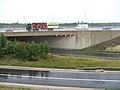 A1 - A64 junction. - geograph.org.uk - 231321.jpg 640 × 480; 77 KB
-
 A4 Bath Road at Heathrow - geograph.org.uk - 231472.jpg 640 × 480; 157 KB
-
 A40 at Denham - geograph.org.uk - 232121.jpg 640 × 480; 77 KB
-
 A40 at Denham - geograph.org.uk - 232129.jpg 640 × 480; 77 KB
-

-
 Area used as car park near taxi rank - geograph.org.uk - 1270221.jpg 640 × 480; 62 KB
-
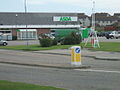 ASDA supermarket, Peterhead - geograph.org.uk - 232038.jpg 640 × 480; 75 KB
-
 Barry Docks - geograph.org.uk - 232370.jpg 480 × 640; 77 KB
-
 The Fleetgate Glass Co. - geograph.org.uk - 239956.jpg 640 × 498; 102 KB
-
 Beauly Firth and Kessock Bridge - geograph.org.uk - 867887.jpg 640 × 480; 53 KB
-
 Beinn Dronaig summit trigpoint - geograph.org.uk - 831567.jpg 640 × 481; 71 KB
-
 Black Water against the tide - geograph.org.uk - 388575.jpg 640 × 451; 96 KB
-
 Black Water flows into Loch na Croic - geograph.org.uk - 388579.jpg 640 × 434; 66 KB
-

-
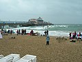 Bournemouth Pier - geograph.org.uk - 234996.jpg 640 × 480; 104 KB
-
 Branksome Chine Beach - geograph.org.uk - 236497.jpg 640 × 480; 86 KB
-
 Brick detail Moulsford Bridge - geograph.org.uk - 231630.jpg 640 × 480; 102 KB
-
 Building works - geograph.org.uk - 232667.jpg 640 × 480; 58 KB
-
 Bunchrew House Hotel - geograph.org.uk - 867885.jpg 640 × 480; 72 KB
-

-
 Church of St Mary Interior.jpg 1,280 × 960; 585 KB
-
 Church of St Mary Stained Glass.jpg 960 × 1,280; 591 KB
-
 Cloverly Hall - geograph.org.uk - 1104576.jpg 640 × 480; 91 KB
-
 Commemoration of the Battle of Gower - geograph.org.uk - 232603.jpg 480 × 640; 127 KB
-
 Commercial Road sign in Jarrow - geograph.org.uk - 1597058.jpg 640 × 480; 84 KB
-
 Council School, Machen - geograph.org.uk - 333289.jpg 640 × 477; 88 KB
-
 Coventry Climax ET 199 fork lift truck.jpg 1,664 × 1,626; 383 KB
-

-
 Dalrhiw lead mines - geograph.org.uk - 247028.jpg 640 × 482; 168 KB
-
 Dalton Road - geograph.org.uk - 484957.jpg 640 × 480; 89 KB
-
 Dean Gallery - geograph.org.uk - 251633.jpg 480 × 640; 84 KB
-
 Denham, Village Road - geograph.org.uk - 232173.jpg 640 × 480; 106 KB
-
 East of Wheldrake - geograph.org.uk - 271561.jpg 640 × 480; 52 KB
-
 Ellen Court in Jarrow - geograph.org.uk - 1597158.jpg 480 × 640; 60 KB
-
 Emptying the Litter Bins - geograph.org.uk - 1077211.jpg 640 × 481; 141 KB
-
 Entering Peterhead from the north - geograph.org.uk - 231095.jpg 640 × 480; 75 KB
-

-
 Farmland W of Bramham Park. - geograph.org.uk - 231298.jpg 640 × 480; 90 KB
-
 Follow the path - geograph.org.uk - 388549.jpg 640 × 401; 48 KB
-
 Folly Corner. - geograph.org.uk - 231328.jpg 640 × 480; 89 KB
-
 Footbridge - geograph.org.uk - 232128.jpg 640 × 480; 113 KB
-
 Forest road - geograph.org.uk - 251513.jpg 640 × 480; 92 KB
-
 Forum 28 Alley.jpg 480 × 640; 71 KB
-
 Gas Light Public House in Jarrow - geograph.org.uk - 1597052.jpg 640 × 480; 53 KB
-

-
 Girvan - geograph.org.uk - 439907.jpg 640 × 427; 68 KB
-
 Girvan harbour - geograph.org.uk - 439898.jpg 640 × 427; 68 KB
-
 Grouse country. - geograph.org.uk - 1457198.jpg 640 × 480; 72 KB
-
 Groynes at Bunchrew - geograph.org.uk - 867886.jpg 640 × 480; 51 KB
-
 Harmondsworth Baptist Church - geograph.org.uk - 231957.jpg 640 × 480; 82 KB
-
 Heavens Wood - geograph.org.uk - 231721.jpg 640 × 446; 134 KB
-
 Laburnum General Store, Viewpark - geograph.org.uk - 231528.jpg 640 × 477; 82 KB
-
 Leaving Omagh on the throughpass - geograph.org.uk - 231435.jpg 640 × 198; 24 KB
-
 Leven Bridge. - geograph.org.uk - 232150.jpg 640 × 479; 110 KB
-
 Little Roseberry, Evening Sun - geograph.org.uk - 233567.jpg 640 × 384; 73 KB
-
 Loch Ussie - geograph.org.uk - 388568.jpg 640 × 358; 64 KB
-
 London Bridge view from Thames cruise.jpg 2,816 × 2,112; 2.11 MB
-
 M2 near Templepatrick (1) - geograph.org.uk - 231524.jpg 640 × 426; 114 KB
-
 M4 Motorway (Heathrow Spur) - geograph.org.uk - 231943.jpg 640 × 480; 91 KB
-
 Machen Church - geograph.org.uk - 333296.jpg 640 × 477; 79 KB
-
 Make way - geograph.org.uk - 700379.jpg 640 × 264; 51 KB
-
 Market Place-Beverley - geograph.org.uk - 719685.jpg 640 × 419; 58 KB
-
 Nestles Factory, Beltany Road,Omagh - geograph.org.uk - 231419.jpg 359 × 480; 21 KB
-
 New flats - geograph.org.uk - 232656.jpg 640 × 480; 68 KB
-
 New flats - geograph.org.uk - 232659.jpg 640 × 480; 50 KB
-
 New roundabout at Crevenagh Road - geograph.org.uk - 231448.jpg 640 × 213; 20 KB
-
 New Track - geograph.org.uk - 244841.jpg 640 × 480; 91 KB
-
 No Climbing - geograph.org.uk - 231806.jpg 640 × 480; 79 KB
-
 Oban railway - geograph.org.uk - 251528.jpg 640 × 480; 159 KB
-
 Off Willow Drive, Handsworth - geograph.org.uk - 231314.jpg 640 × 427; 85 KB
-
 On the bank of Black Water - geograph.org.uk - 388574.jpg 640 × 433; 98 KB
-

-
 Peaceful Memorial Garden-Beverley - geograph.org.uk - 696357.jpg 640 × 405; 84 KB
-
 Pepperstock - Downlands Park - geograph.org.uk - 231731.jpg 640 × 482; 126 KB
-
 Polperro Harbour - geograph.org.uk - 250358.jpg 640 × 480; 161 KB
-
 Poole Road, Branksome - geograph.org.uk - 236488.jpg 640 × 480; 99 KB
-
 Portland Walk - geograph.org.uk - 484951.jpg 640 × 480; 124 KB
-
 Pulling into Bury.jpg 640 × 480; 145 KB
-
 Race to the finish - geograph.org.uk - 700372.jpg 640 × 438; 78 KB
-
 Rainbow over Loch Ussie - geograph.org.uk - 388570.jpg 484 × 640; 61 KB
-
 Ridge Road Farm - geograph.org.uk - 240716.jpg 640 × 427; 27 KB
-
 River Misbourne, Denham Place lake - geograph.org.uk - 232248.jpg 640 × 480; 119 KB
-
 Rolls Royce Cricket Ground, Sinfin - geograph.org.uk - 232746.jpg 640 × 480; 79 KB
-

-
 Saint Oswalds Church, Filey.jpg 432 × 285; 16 KB
-

-
 Seafield Crematorium - geograph.org.uk - 305539.jpg 600 × 450; 61 KB
-
 Sipson Lane Chapel - geograph.org.uk - 231936.jpg 640 × 480; 78 KB
-
 Sipson, King William IV pub - geograph.org.uk - 231517.jpg 640 × 480; 80 KB
-
 South Barrule mill.jpg 506 × 640; 107 KB
-
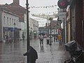
 South Parade - geograph.org.uk - 233015.jpg 640 × 479; 92 KB
-
 South Petherwin Chapel - geograph.org.uk - 325652.jpg 640 × 480; 99 KB
-
 South Petherwin Church - geograph.org.uk - 325647.jpg 640 × 480; 98 KB
-

-
 Spiggie Loch - geograph.org.uk - 687853.jpg 640 × 480; 61 KB
-
 St. Helens Church - geograph.org.uk - 271721.jpg 640 × 480; 68 KB
-
 Sunset - geograph.org.uk - 687838.jpg 640 × 480; 29 KB
-
 Sunset at Fintry Bay - geograph.org.uk - 268655.jpg 640 × 480; 49 KB
-
 TANGMERE at Salisbury Platform 4.jpg 640 × 482; 100 KB
-
 Tentsmuir Forest - geograph.org.uk - 686860.jpg 640 × 418; 128 KB
-
 The Ballyhone Road, Beltoy (1) - geograph.org.uk - 231309.jpg 640 × 426; 168 KB
-
 The Chock Stone - geograph.org.uk - 234292.jpg 480 × 640; 127 KB
-
 The Coronation Tree, Scholes. - geograph.org.uk - 231361.jpg 640 × 480; 115 KB
-
 The Jarrow Crusaders in Jarrow - geograph.org.uk - 1393437.jpg 640 × 480; 71 KB
-
 The Newton Rose (Ex The Tilesheds) - geograph.org.uk - 233560.jpg 640 × 384; 54 KB
-
 The Rookery in Tower of London.jpg 2,816 × 2,112; 2.73 MB
-
 Access track to Thorganby Lodge. - geograph.org.uk - 271731.jpg 640 × 427; 44 KB
-
 Tinsley Park Cemetery - geograph.org.uk - 231322.jpg 640 × 427; 69 KB
-
 Tower Bridge from Tower of London.jpg 2,816 × 2,112; 2.21 MB
-
 Tower Bridge London with Red Double Decker Bus.jpg 2,816 × 2,112; 1.99 MB
-
 Tower of London onshore.jpg 2,816 × 2,112; 2.59 MB
-
 Track and Field - geograph.org.uk - 271716.jpg 640 × 480; 59 KB
-
 Trotting race - geograph.org.uk - 664358.jpg 640 × 427; 75 KB
-
 View of London's St Pauls and Gherkin from The Thames.jpg 2,816 × 2,112; 2.48 MB
-
 Village Road, Denham, Buckinghamshire.jpg 636 × 347; 77 KB
-
 War Memorial, Tinsley Park Cemetery - geograph.org.uk - 231327.jpg 320 × 480; 35 KB
-
 Waterfront, Barry Docks - geograph.org.uk - 232377.jpg 480 × 640; 63 KB
-
 Wet Country Road - geograph.org.uk - 244847.jpg 640 × 480; 61 KB
-
-
 Wick River - geograph.org.uk - 232131.jpg 640 × 480; 88 KB
-
 Willow Drive, Handsworth - geograph.org.uk - 231310.jpg 640 × 427; 65 KB
-
 Willow House, Strathclyde Business Park - geograph.org.uk - 231533.jpg 640 × 480; 119 KB
-
 Wolseley saloon 1975.jpg 2,177 × 1,246; 575 KB
-
 Allt Maestir trig - geograph.org.uk - 310900.jpg 640 × 480; 119 KB
-
 Almost a forest - geograph.org.uk - 231956.jpg 640 × 480; 93 KB
-
 Approaching Toll o'Birness - geograph.org.uk - 232004.jpg 640 × 480; 60 KB
-
 Beinn Bhalgairean - geograph.org.uk - 251445.jpg 640 × 480; 99 KB
-
 Beinn Bhalgairean - geograph.org.uk - 251447.jpg 640 × 480; 83 KB
-
 Beinn Bhalgairean - geograph.org.uk - 251448.jpg 640 × 480; 67 KB
-
 Branksome Chine - geograph.org.uk - 236494.jpg 640 × 480; 130 KB
-
 Broken Bridge - geograph.org.uk - 234289.jpg 640 × 480; 125 KB
-

-

-
 Cattle creep - geograph.org.uk - 251523.jpg 640 × 480; 143 KB
-
 Creag a Chaoruinn - geograph.org.uk - 388581.jpg 640 × 354; 57 KB
-
 Devastation - geograph.org.uk - 231803.jpg 640 × 480; 108 KB
-
 Drainage channel - geograph.org.uk - 237651.jpg 480 × 640; 138 KB
-
 Easterton of Barnyards - geograph.org.uk - 231108.jpg 640 × 480; 54 KB
-
 Farmland near Bramham. - geograph.org.uk - 231293.jpg 640 × 480; 81 KB
-
 Felled area, Glen Orchy - geograph.org.uk - 251608.jpg 640 × 480; 106 KB
-
 Firebreak - geograph.org.uk - 231952.jpg 640 × 480; 113 KB
-
 Firemore Cliffs - geograph.org.uk - 234297.jpg 640 × 480; 81 KB
-
 Forest track - geograph.org.uk - 231951.jpg 640 × 480; 98 KB
-
 Forest view - geograph.org.uk - 237654.jpg 640 × 480; 109 KB
-
 Fraserburgh Beach - geograph.org.uk - 235028.jpg 640 × 481; 56 KB
-
 Fron Hill trig - geograph.org.uk - 246989.jpg 640 × 480; 117 KB
-
 High Moorland near to Loch Kinellan - geograph.org.uk - 388572.jpg 640 × 299; 62 KB
-
 Highfield Lane, Barwick-in-Elmet. - geograph.org.uk - 231344.jpg 640 × 480; 74 KB
-
 Huts - geograph.org.uk - 231947.jpg 640 × 480; 104 KB
-
 Jetty near Sgeir Chreagag - geograph.org.uk - 607440.jpg 640 × 426; 61 KB
-
 Late evening on the Ythan Estuary - geograph.org.uk - 232014.jpg 640 × 245; 52 KB
-
 Leeds Road, Barwick-in-Elmet. - geograph.org.uk - 231349.jpg 640 × 480; 71 KB
-
 Lendrick Hill cairn - geograph.org.uk - 231953.jpg 640 × 480; 80 KB
-
 Lendrick Hill path - geograph.org.uk - 237652.jpg 640 × 480; 107 KB
-
 Livestock at Norwood House Farm. - geograph.org.uk - 231287.jpg 640 × 480; 141 KB
-
 Loch Braigh a Bhaile - geograph.org.uk - 306956.jpg 640 × 427; 164 KB
-
 Motte near Inverugie - geograph.org.uk - 231103.jpg 640 × 480; 48 KB
-
 Mouth of the river Ythan at sunset. - geograph.org.uk - 232022.jpg 640 × 282; 52 KB
-
 New forest road - geograph.org.uk - 251506.jpg 640 × 480; 115 KB
-
 No Vehicular Access - geograph.org.uk - 231799.jpg 480 × 640; 85 KB
-
 North side of Knock Farril - geograph.org.uk - 388562.jpg 640 × 427; 74 KB
-
 Norwood House Farm, Thorner. - geograph.org.uk - 231284.jpg 640 × 480; 83 KB
-
 Nova Scotia. - geograph.org.uk - 231290.jpg 640 × 480; 81 KB
-
 Open ground - geograph.org.uk - 231949.jpg 640 × 480; 97 KB
-
 Pen Moel Dihewid trig - geograph.org.uk - 310888.jpg 640 × 480; 106 KB
-
 Rakehill Road. - geograph.org.uk - 231337.jpg 640 × 480; 137 KB
-
 Sandhill. - geograph.org.uk - 231280.jpg 640 × 480; 88 KB
-
 Scar Water from Southern Upland Way - geograph.org.uk - 232867.jpg 640 × 480; 61 KB
-
 Smiddyhill Farm - geograph.org.uk - 231126.jpg 640 × 480; 77 KB
-
 Soaking Sheep - geograph.org.uk - 244852.jpg 640 × 480; 62 KB
-
 Southern Upland Way - geograph.org.uk - 232868.jpg 640 × 480; 101 KB
-
 Southern Upland Way at Whing Head - geograph.org.uk - 232857.jpg 640 × 480; 72 KB
-

-
 Southern Upland Way near Cloud Hill - geograph.org.uk - 232866.jpg 640 × 480; 67 KB
-
 Southern Upland Way near Ulzieside - geograph.org.uk - 232847.jpg 640 × 480; 108 KB
-
 Southern Upland Way on Whing - geograph.org.uk - 232855.jpg 640 × 480; 79 KB
-
 Southern Upland Way Polgown - geograph.org.uk - 232876.jpg 640 × 480; 89 KB
-
 Southern Upland Way towards Polgown - geograph.org.uk - 232871.jpg 640 × 480; 79 KB
-
 Sunny bank of Loch Garve - geograph.org.uk - 388583.jpg 640 × 327; 68 KB
-
 Sycamore - geograph.org.uk - 231960.jpg 640 × 480; 110 KB
-
 Touchstone Maze - geograph.org.uk - 388537.jpg 640 × 397; 81 KB
-
 Track end - geograph.org.uk - 237653.jpg 640 × 480; 94 KB
-
 Trig Point on Smearsett Scar - geograph.org.uk - 232482.jpg 640 × 480; 77 KB
-
 Undercliffe From Rye Hill - geograph.org.uk - 233569.jpg 640 × 384; 65 KB
-
 Unplanted area - geograph.org.uk - 251519.jpg 640 × 480; 110 KB
-
 View to Cnoc na h-lolaire - geograph.org.uk - 388584.jpg 640 × 288; 41 KB
-
 View to Quinag from Loch Braigh a Bhaile - geograph.org.uk - 306970.jpg 640 × 427; 161 KB
-
 Waterfall on the Lambley Dumble - geograph.org.uk - 231704.jpg 640 × 480; 112 KB
-
 Welltrees Tappin trig point S5983 - geograph.org.uk - 232861.jpg 640 × 480; 70 KB
-
 Westerton of Barnyards - geograph.org.uk - 231118.jpg 640 × 480; 78 KB
-
 Wet Delivery - geograph.org.uk - 231813.jpg 640 × 480; 107 KB


_Beverley_-_geograph.org.uk_-_696381.jpg)


_-_geograph.org.uk_-_231524.jpg)
_-_geograph.org.uk_-_231943.jpg)


_-_geograph.org.uk_-_231309.jpg)


_-_geograph.org.uk_-_233560.jpg)


