Category:United Kingdom photographs taken on 2006-06-06
Jump to navigation
Jump to search
Countries of Europe: Austria · Belarus · Belgium · Bulgaria · Finland · France‡ · Germany · Greece · Hungary · Republic of Ireland · Italy · Malta · Montenegro · Netherlands‡ · Norway · Russia‡ · Slovakia · Spain‡ · Sweden · Switzerland · Turkey‡ · United Kingdom
‡: partly located in Europe
‡: partly located in Europe
| ← | 6 June 2006 | → | ||
| ← | June 2006 | → | ||

United Kingdom photographs taken on 6 June 2006.
Image files should be categorized here automatically using {{taken on}} template. Direct categorisation is also possible, if automatic is impossible.
Subcategories
This category has the following 2 subcategories, out of 2 total.
Media in category "United Kingdom photographs taken on 2006-06-06"
The following 200 files are in this category, out of 510 total.
(previous page) (next page)-
 'The Robin Hood', Common Road, Burham - geograph.org.uk - 182290.jpg 640 × 480; 134 KB
-
 66407 Castleton (3).jpg 1,024 × 768; 662 KB
-

-
 A busy pavement on Harrow Road - geograph.org.uk - 187478.jpg 640 × 480; 132 KB
-
 A foretaste of what is to come - geograph.org.uk - 307239.jpg 640 × 480; 79 KB
-
 A hawthorn tree and view of Ullswater - geograph.org.uk - 292445.jpg 480 × 640; 103 KB
-
-
 A828 Looking North - geograph.org.uk - 182232.jpg 640 × 389; 274 KB
-
 Aberaeron Quay - June 2006 - panoramio.jpg 2,288 × 1,712; 836 KB
-
 ADAS, Terrington St Clement - geograph.org.uk - 182252.jpg 640 × 480; 65 KB
-
 Afon Dwyfach at Pont y Felin - geograph.org.uk - 182902.jpg 640 × 480; 123 KB
-
 Albany Street, Regent's Park - geograph.org.uk - 183122.jpg 640 × 480; 110 KB
-
-
 All Saints Church Newton - on - Ouse - geograph.org.uk - 183447.jpg 600 × 450; 129 KB
-
 Allotments - geograph.org.uk - 186768.jpg 640 × 386; 76 KB
-

-
 Ashmore Road W9 - geograph.org.uk - 187457.jpg 640 × 480; 121 KB
-
 Backroad from Kintaline toward Benderlock - geograph.org.uk - 182243.jpg 640 × 480; 420 KB
-
 Barley and oats at Westley - geograph.org.uk - 183687.jpg 640 × 480; 107 KB
-
 Barn - geograph.org.uk - 182507.jpg 640 × 480; 218 KB
-
 Barn at Snape Watering Farm - geograph.org.uk - 185018.jpg 640 × 480; 87 KB
-

-
 Beech Farm - geograph.org.uk - 183494.jpg 600 × 450; 291 KB
-
 Benderloch back road - geograph.org.uk - 182172.jpg 640 × 451; 371 KB
-
 Benderloch back road toward Kintaline - geograph.org.uk - 182235.jpg 640 × 458; 471 KB
-
 Biggin Hill - geograph.org.uk - 224124.jpg 640 × 480; 92 KB
-
 Birdingbury - Birdingbury Bridge - geograph.org.uk - 192375.jpg 640 × 480; 157 KB
-
 Birdingbury - geograph.org.uk - 184688.jpg 640 × 480; 126 KB
-
 Blacksmiths Arms at Newton - on- Ouse - geograph.org.uk - 183448.jpg 600 × 450; 110 KB
-
 Bodmin & Wenford Railway 243463.jpg 640 × 480; 176 KB
-
 Bodmin & Wenford Railway 243477.jpg 640 × 480; 152 KB
-
 Bodmin General Station - geograph.org.uk - 781942.jpg 640 × 480; 94 KB
-
 Bodmin Parkway Station - geograph.org.uk - 781958.jpg 640 × 480; 103 KB
-
 Bodmin Parkway Station - geograph.org.uk - 781970.jpg 640 × 480; 103 KB
-
 Bridge in Impney Park - geograph.org.uk - 182444.jpg 640 × 427; 91 KB
-
 Bridleway to Woodsetts - geograph.org.uk - 183055.jpg 640 × 480; 97 KB
-
 All Saints Brixworth1.jpg 640 × 429; 56 KB
-
 Brynford church - geograph.org.uk - 182123.jpg 640 × 480; 113 KB
-
 Cae-mwynen - geograph.org.uk - 183353 (cropped).jpg 640 × 240; 49 KB
-
 Cae-mwynen - geograph.org.uk - 183353.jpg 640 × 480; 70 KB
-
 Caerwys church - geograph.org.uk - 182135.jpg 640 × 480; 111 KB
-
 Campbeltown marina - geograph.org.uk - 1226270.jpg 520 × 342; 39 KB
-
 Cape Cornwall Sentinal - geograph.org.uk - 241830.jpg 640 × 480; 65 KB
-
 Capybara island. - geograph.org.uk - 314584.jpg 640 × 480; 69 KB
-
 Castleton East Junction signal box 47 signal (2).jpg 1,024 × 768; 547 KB
-
 Castleton East Junction signal box 47 signal (3).jpg 1,024 × 768; 593 KB
-
-
 Cawston - geograph.org.uk - 182381.jpg 640 × 480; 112 KB
-
 Cawston - geograph.org.uk - 182913.jpg 640 × 480; 130 KB
-
 Cawston-Potford's Dam - geograph.org.uk - 1700185.jpg 640 × 480; 90 KB
-
-

-
 Chateau Impney - geograph.org.uk - 182447.jpg 640 × 422; 73 KB
-

-
 Church, West Hoathly - geograph.org.uk - 182698.jpg 480 × 640; 65 KB
-
 Class 43 HST 43189, 18.14 to Paddington, Truro, June 2006 P6060019 (9931588003).jpg 2,048 × 1,536; 583 KB
-
 Clint Hill - geograph.org.uk - 183496.jpg 600 × 450; 101 KB
-
 Cobblers Lane - geograph.org.uk - 182233.jpg 640 × 480; 103 KB
-
 Colliery Road - geograph.org.uk - 183047.jpg 640 × 480; 98 KB
-

-
 Cottages on the River Oich - geograph.org.uk - 1112344.jpg 640 × 480; 153 KB
-
 Court Lane, Offenham - geograph.org.uk - 833216.jpg 640 × 427; 78 KB
-
 St Michael's Church, Crewe Green.jpg 640 × 480; 111 KB
-

-
 Crib Goch from the Miners' Track - geograph.org.uk - 307393.jpg 640 × 480; 81 KB
-
 Crimondairfield.jpg 640 × 426; 90 KB
-
 Crockernwell - geograph.org.uk - 186227.jpg 640 × 480; 71 KB
-
 Crookford - geograph.org.uk - 183044.jpg 640 × 480; 149 KB
-
 Croyland Abbey, Wellingborough - geograph.org.uk - 182517.jpg 640 × 480; 83 KB
-
 Culbin Forest Path - geograph.org.uk - 185132.jpg 480 × 640; 213 KB
-
 Culbin Salt Marsh - geograph.org.uk - 185128.jpg 640 × 480; 83 KB
-
 Dawnay Arms at Newton - on- Ouse - geograph.org.uk - 183486.jpg 600 × 450; 263 KB
-
 Detail of the Blackmoor church. - geograph.org.uk - 199762.jpg 640 × 426; 113 KB
-
 Ditch - geograph.org.uk - 183358.jpg 640 × 480; 91 KB
-
 Dolphin Inn, Norwich - geograph.org.uk - 182501.jpg 640 × 480; 108 KB
-
 Drive to Grendon Farm - geograph.org.uk - 186272.jpg 640 × 480; 104 KB
-
 Driveway - geograph.org.uk - 186735.jpg 640 × 411; 106 KB
-
 Driveway to Cottage Farm, Tathwell - geograph.org.uk - 183192.jpg 640 × 427; 130 KB
-
 Driveway to New Ingarsby Farm - geograph.org.uk - 186762.jpg 640 × 480; 78 KB
-
 Dunseverick Castle 1.jpg 2,592 × 1,944; 810 KB
-
 St Anne's, Earlham - geograph.org.uk - 182278.jpg 640 × 477; 98 KB
-
 Earlsferry High Street - Allan Place - geograph.org.uk - 293400.jpg 640 × 480; 99 KB
-
 East Coast Main Line at Shipton - geograph.org.uk - 183441.jpg 600 × 450; 109 KB
-
-
 Edge of Culbin Forest - geograph.org.uk - 185130.jpg 640 × 480; 136 KB
-
 Edge of the Salt Marsh - geograph.org.uk - 185109.jpg 640 × 480; 66 KB
-
 Efail Cenin - geograph.org.uk - 182960.jpg 640 × 480; 96 KB
-
 Embryo Dune - geograph.org.uk - 185111.jpg 640 × 453; 113 KB
-

-
 Entrance to Withyhayes Farm, Lympstone - geograph.org.uk - 183550.jpg 640 × 427; 187 KB
-
 Etchilhampton Hill trig - geograph.org.uk - 185030.jpg 640 × 427; 112 KB
-
 Factory gates - geograph.org.uk - 183365.jpg 640 × 480; 113 KB
-
 Farmland at Acthorpe Farm - geograph.org.uk - 183004.jpg 640 × 427; 117 KB
-
 Farmland at Cefn-cae'r-ferch - geograph.org.uk - 1101721.jpg 640 × 480; 63 KB
-
 Farmland near Bwlch-derwin - geograph.org.uk - 1077799.jpg 640 × 480; 43 KB
-
 Farmland near Cwm farm - geograph.org.uk - 1101700.jpg 640 × 480; 52 KB
-
 Farmland near Whittford - geograph.org.uk - 182119.jpg 640 × 480; 73 KB
-

-
 Felinheli Bypass - geograph.org.uk - 189717.jpg 640 × 480; 66 KB
-

-

-
 Footpath from Sticks Pass - geograph.org.uk - 196635.jpg 640 × 426; 125 KB
-
 Footpath heading North - geograph.org.uk - 182723.jpg 480 × 640; 105 KB
-
 Footpath into the woods - geograph.org.uk - 186766.jpg 640 × 561; 179 KB
-
 Footpath Junction in the woods - geograph.org.uk - 182667.jpg 640 × 480; 173 KB
-
 Footpath to Great Dodd - geograph.org.uk - 196629.jpg 640 × 426; 120 KB
-
 Forestry near Bryncir - geograph.org.uk - 182972.jpg 640 × 480; 74 KB
-
 Former Polharrow Schoolhouse - geograph.org.uk - 963960.jpg 640 × 480; 78 KB
-
 Gate near Wintershall Cottage - geograph.org.uk - 182590.jpg 640 × 480; 119 KB
-
 Geograph-184718-Adrian and Janet Quantock-Dunes at Rattray Head.jpg 640 × 426; 82 KB
-

-
 Gorse and farmland near Haulfron - geograph.org.uk - 1101730.jpg 640 × 480; 74 KB
-
 Goulceby Road, Raithby - geograph.org.uk - 183190.jpg 640 × 427; 120 KB
-
 Gower Ponies - geograph.org.uk - 381858.jpg 640 × 480; 178 KB
-

-
 Greenhouse - geograph.org.uk - 182710.jpg 640 × 480; 152 KB
-
 Grosmont Station - geograph.org.uk - 612098.jpg 640 × 480; 123 KB
-
 Hailes Castle - geograph.org.uk - 183417.jpg 640 × 480; 101 KB
-
 Halstow - geograph.org.uk - 182537.jpg 640 × 480; 133 KB
-
 Harrow Road at Prince of Wales Junction - geograph.org.uk - 187465.jpg 640 × 480; 126 KB
-
 Harrow Road NW10 - geograph.org.uk - 187469.jpg 640 × 480; 130 KB
-
 Harrow Road W9 - geograph.org.uk - 187460.jpg 640 × 480; 132 KB
-
 Haslington Primary School - geograph.org.uk - 184339.jpg 640 × 443; 87 KB
-
 Hay field - geograph.org.uk - 182951.jpg 640 × 480; 92 KB
-
 Hen Reedbeds - geograph.org.uk - 185061.jpg 640 × 480; 101 KB
-
 Heron by lake - geograph.org.uk - 483020.jpg 640 × 429; 81 KB
-
 High Tension Pylon in Deepest Suffolk - geograph.org.uk - 224453.jpg 479 × 640; 179 KB
-
 Higher Eggbeer - geograph.org.uk - 186216.jpg 640 × 480; 87 KB
-

-
 Honey Street, Bodmin - geograph.org.uk - 881389.jpg 640 × 480; 244 KB
-
 Hooperton Cross - geograph.org.uk - 186236.jpg 640 × 480; 84 KB
-
 Houghton on the Hill milestone - geograph.org.uk - 186758.jpg 480 × 640; 122 KB
-
 Ingthorpe Grange - geograph.org.uk - 182508.jpg 640 × 480; 61 KB
-
 Unexpected Memorial - geograph.org.uk - 184420.jpg 640 × 480; 114 KB
-
 Jogger, Stony Lane, Woodbury - geograph.org.uk - 183549.jpg 640 × 427; 315 KB
-
 Junction near Venmore Farm - geograph.org.uk - 183552.jpg 640 × 427; 189 KB
-
-
 Junction on former A30 - geograph.org.uk - 186268.jpg 640 × 480; 137 KB
-

-
 Kidlington old village.jpg 640 × 480; 175 KB
-
 Kirkstall Bridge over the River Aire - geograph.org.uk - 183834.jpg 640 × 318; 56 KB
-
 Lacy's Caves - geograph.org.uk - 1058015.jpg 436 × 640; 61 KB
-
 Lamlash Bay, Arran - geograph.org.uk - 185781.jpg 640 × 424; 50 KB
-
 Lane at Tyddyn-hir - geograph.org.uk - 183344.jpg 640 × 480; 70 KB
-
 Lane near Halstow, Tedburn St Mary - geograph.org.uk - 185344.jpg 480 × 640; 107 KB
-
 Lane to Caer Ferch Uchaf - geograph.org.uk - 1101704.jpg 640 × 480; 123 KB
-
 Lankidden Cove - geograph.org.uk - 411963.jpg 640 × 426; 59 KB
-
 Leeds and Liverpool Canal - geograph.org.uk - 183389.jpg 306 × 640; 67 KB
-
 Lighthouse, Holy Island, Arran - geograph.org.uk - 185791.jpg 640 × 424; 60 KB
-
 Dovendale near Louth, Lincolnshire - geograph.org.uk - 183258.jpg 640 × 427; 112 KB
-
 Lindale Holiday Park - geograph.org.uk - 263824.jpg 640 × 480; 53 KB
-
 Liskeard Main-line Station - geograph.org.uk - 210236.jpg 640 × 480; 155 KB
-
 Liskeard Station - geograph.org.uk - 210255.jpg 640 × 480; 108 KB
-
 Llama paddock at Folly Farm. - geograph.org.uk - 314579.jpg 640 × 480; 93 KB
-
 Llyn Teyrn and the Snowdon Horseshoe - geograph.org.uk - 307319.jpg 640 × 480; 90 KB
-
 Loch a' Mhadaidh - geograph.org.uk - 893783.jpg 640 × 480; 180 KB
-
 Loch Linnhe, Fort William - geograph.org.uk - 275918.jpg 640 × 480; 63 KB
-
 Lochleven Castle ( from cemetery) - geograph.org.uk - 435700.jpg 640 × 412; 48 KB
-
 Lockhouse Farm, Dunsford - geograph.org.uk - 182368.jpg 640 × 480; 92 KB
-
 Looe West River - geograph.org.uk - 210231.jpg 640 × 480; 115 KB
-
 Looe(2).jpg 640 × 480; 106 KB
-
 Looking across the Afon Dwyfach - geograph.org.uk - 1077791.jpg 640 × 480; 97 KB
-
 Looking along shore line SW from A828 - geograph.org.uk - 182170.jpg 640 × 461; 325 KB
-
 Looking over Dean Hill to Bath - geograph.org.uk - 185028.jpg 640 × 427; 101 KB
-

-

-
 Lots of places to go..... - geograph.org.uk - 182499.jpg 640 × 480; 98 KB
-
 Low Barn - geograph.org.uk - 182076.jpg 640 × 480; 105 KB
-
 Low water at Greencastle - geograph.org.uk - 184288.jpg 640 × 426; 139 KB
-
 Lower Hare Farm - geograph.org.uk - 185347.jpg 640 × 480; 82 KB
-
 Lower Lane, Ebford - geograph.org.uk - 183546.jpg 640 × 427; 223 KB
-
 Lower Woodmanton Farm - geograph.org.uk - 183553.jpg 640 × 427; 203 KB
-
 Main Post Office, Midland Road - geograph.org.uk - 182639.jpg 640 × 480; 94 KB
-
 Melin Llecheiddior - geograph.org.uk - 182909.jpg 640 × 480; 97 KB
-
 Misty morning at Kelland Copse - geograph.org.uk - 182534.jpg 640 × 480; 70 KB
-

-

-
 Mosedalebeck - geograph.org.uk - 195556.jpg 640 × 426; 118 KB
-
 MS Riverdance.jpg 640 × 426; 114 KB
-
 New Cottages, Hallington near Louth - geograph.org.uk - 183187.jpg 640 × 427; 105 KB
-
 New Deer, St Kane's Church.jpg 640 × 426; 103 KB
-
 North end of Dunwich Beach - geograph.org.uk - 185066.jpg 640 × 480; 105 KB
-
 Old lifeboathouse at Kilkeel - geograph.org.uk - 251808.jpg 640 × 426; 121 KB
-
 Old railway near Hendy - geograph.org.uk - 182506.jpg 640 × 480; 82 KB
-
 On Kellan Head - geograph.org.uk - 325699.jpg 480 × 640; 90 KB
-

-
 Palace Pier, Brighton - geograph.org.uk - 1623384.jpg 640 × 320; 55 KB
-
 Park Farm near Hampton Lovett - geograph.org.uk - 182438.jpg 640 × 427; 54 KB
-
 Pencaenewydd Post Office - geograph.org.uk - 183318.jpg 640 × 480; 64 KB
-
 Plough Farm - geograph.org.uk - 182567.jpg 640 × 480; 140 KB
-
 Pocket Park - geograph.org.uk - 182502.jpg 640 × 480; 131 KB
-
 Ponies north of Pottern Ford, New Forest - geograph.org.uk - 182788.jpg 640 × 480; 131 KB
-
 Postlake Farm, Clyst St Mary - geograph.org.uk - 183547.jpg 640 × 427; 205 KB
-
 Power lines, Waterlow Road - geograph.org.uk - 182249.jpg 480 × 640; 50 KB
-
 Prince of Wales Junction, W9 - geograph.org.uk - 187468.jpg 640 × 480; 118 KB
-
 Railway Hedge - geograph.org.uk - 182885.jpg 640 × 480; 108 KB
-
 Railway Hut - geograph.org.uk - 182898.jpg 640 × 480; 146 KB
-
 Red phone box near Efail Cenin - geograph.org.uk - 182962.jpg 640 × 480; 151 KB
-
 Regent's Park - geograph.org.uk - 183074.jpg 480 × 640; 108 KB
-
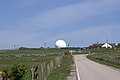 Remote Radar Head Nr Longhaven - geograph.org.uk - 184713.jpg 640 × 426; 97 KB

.jpg)


.jpg)
.jpg)


.jpg)


_with_drive_to_Hullbrook_Court_(centre_right)_-_geograph.org.uk_-_182582.jpg)


_-_geograph.org.uk_-_435700.jpg)


.jpg)


%22_(SH4740)_-_geograph.org.uk_-_182482.jpg)


.jpg)