Category:United Kingdom photographs taken on 2006-05-21
Jump to navigation
Jump to search

Subcategories
This category has the following 3 subcategories, out of 3 total.
Media in category "United Kingdom photographs taken on 2006-05-21"
The following 200 files are in this category, out of 544 total.
(previous page) (next page)-
 "Stairway to heaven" - geograph.org.uk - 174464.jpg 640 × 480; 278 KB
-
 A steam train departing - geograph.org.uk - 344849.jpg 426 × 640; 117 KB
-
 A5 near Poe Bridge - geograph.org.uk - 305925.jpg 640 × 480; 296 KB
-
 A5199 north of Husbands Bosworth - geograph.org.uk - 172890.jpg 640 × 480; 86 KB
-
 Abbey View Lock, Kennet and Avon Canal - geograph.org.uk - 182453.jpg 640 × 424; 145 KB
-
 Agricultural 'activity' at Kinalty Haughs - geograph.org.uk - 172991.jpg 640 × 427; 120 KB
-
 Aird Bhuailtear - geograph.org.uk - 175612.jpg 640 × 480; 94 KB
-
 Airigh Fhionndail - geograph.org.uk - 188676.jpg 640 × 480; 148 KB
-
 Alder trees beaulieu river fawley ford.jpg 2,112 × 2,816; 1.25 MB
-
 Allt Garbh, near Loch Affric - geograph.org.uk - 174469.jpg 640 × 480; 336 KB
-
 Anson Road Wolverton - geograph.org.uk - 173118.jpg 640 × 542; 97 KB
-
 Apple Dene, Bramley - geograph.org.uk - 173390.jpg 640 × 480; 128 KB
-
 Appleby Carrs - geograph.org.uk - 172701.jpg 640 × 426; 104 KB
-
 Armadale Bay. - geograph.org.uk - 173989.jpg 640 × 480; 124 KB
-
 Avon Valley, Warleigh - geograph.org.uk - 182527.jpg 640 × 420; 110 KB
-
 Barley Mow at Milford - geograph.org.uk - 172638.jpg 640 × 480; 75 KB
-
 Barn Conversion - geograph.org.uk - 172705.jpg 640 × 480; 67 KB
-
 Barnhillies - geograph.org.uk - 573275.jpg 640 × 426; 119 KB
-

-
 Bath Deep Lock, Kennet and Avon Canal - geograph.org.uk - 182392.jpg 424 × 640; 91 KB
-
 Bath Top Lock, Kennet and Avon Canal - geograph.org.uk - 182466.jpg 640 × 424; 141 KB
-
 Bathampton Bridge, Kennet and Avon Canal - geograph.org.uk - 182490.jpg 640 × 424; 123 KB
-

-
 Belvue Park, Northolt - geograph.org.uk - 174315.jpg 640 × 480; 71 KB
-
 Berwick upon Tweed, Town Walls - geograph.org.uk - 392207.jpg 640 × 480; 148 KB
-

-
 Bog pool, Carn a' Choire Ghairbh - geograph.org.uk - 174453.jpg 640 × 480; 286 KB
-
 Bog pool, Carn Glas lochdarach - geograph.org.uk - 174457.jpg 480 × 640; 288 KB
-

-
 Brancote Farm - geograph.org.uk - 172648.jpg 640 × 480; 66 KB
-
 Bread Factory - geograph.org.uk - 173839.jpg 640 × 480; 89 KB
-
 Bressay Gunnista Aith Ness.jpg 640 × 480; 64 KB
-
 Bridge across the Grand Union Canal - geograph.org.uk - 173850.jpg 640 × 480; 129 KB
-
 Bridge near Hackwood House - geograph.org.uk - 173829.jpg 640 × 480; 178 KB
-
 Bridge over Afon Gwrysgog - geograph.org.uk - 173077.jpg 640 × 480; 150 KB
-
 Bridge over Sir Rowland Winn's Drain - geograph.org.uk - 172775.jpg 640 × 480; 148 KB
-
 Bridgend - geograph.org.uk - 172888.jpg 640 × 427; 144 KB
-
 Bridleway, Upper Birchwood by Geoff Dunn.jpg 640 × 480; 99 KB
-
 Brissenden - geograph.org.uk - 174499.jpg 640 × 480; 85 KB
-
 Broad Bench, Kimmeridge - geograph.org.uk - 414825.jpg 640 × 480; 89 KB
-
 Broad Bench, Kimmeridge - geograph.org.uk - 414827.jpg 640 × 480; 105 KB
-
 Bull's Hall - geograph.org.uk - 173469.jpg 640 × 480; 109 KB
-
 Buxlow Manor - geograph.org.uk - 173230.jpg 640 × 480; 144 KB
-
 By the Pends, St Andrews - geograph.org.uk - 173100.jpg 443 × 640; 73 KB
-
 Camas Croise - geograph.org.uk - 172828.jpg 640 × 480; 93 KB
-
 Cannon outside Helston Folk Museum - geograph.org.uk - 188684.jpg 640 × 482; 100 KB
-
 Capel Siloam village - geograph.org.uk - 173081.jpg 640 × 480; 71 KB
-
 Car Park, Glen Affric - geograph.org.uk - 174024.jpg 640 × 480; 312 KB
-
 Carnoch River - geograph.org.uk - 188711.jpg 640 × 480; 114 KB
-
 Carr Lane Bridge - geograph.org.uk - 172686.jpg 640 × 458; 110 KB
-
 Carr Lane Bridge - geograph.org.uk - 172780.jpg 640 × 426; 89 KB
-
 Castle Bryher and Gulf Rock - geograph.org.uk - 200381.jpg 640 × 480; 88 KB
-
 Cathedral graveyard, St Andrews - geograph.org.uk - 173104.jpg 640 × 424; 82 KB
-
 Cattle near Kirkhouse - geograph.org.uk - 178215.jpg 640 × 483; 142 KB
-
 Charis Court, Eaton Road - geograph.org.uk - 172708.jpg 479 × 640; 205 KB
-
 Chase Road, Upper Welland - geograph.org.uk - 173367.jpg 640 × 480; 69 KB
-
 China Clay Pool, Hendra Downs - geograph.org.uk - 172934.jpg 640 × 427; 286 KB
-
 China Clay Spoil Tip - geograph.org.uk - 172926.jpg 640 × 427; 240 KB
-
 Church in Dirleton - geograph.org.uk - 618200.jpg 640 × 480; 44 KB
-
 Church of St Peter, Little Ellingham - geograph.org.uk - 172996.jpg 640 × 426; 130 KB
-
 Churchill Barrier no. 3, low tide - geograph.org.uk - 178188.jpg 640 × 480; 111 KB
-

-
 Cloghan jetty, Belfast Lough - geograph.org.uk - 172672.jpg 640 × 426; 126 KB
-
 Coastal defences - geograph.org.uk - 181533.jpg 640 × 389; 258 KB
-
 Coire Cheir - geograph.org.uk - 172792.jpg 640 × 480; 208 KB
-

-
 Corrie, Carn a' Choire Ghairbh - geograph.org.uk - 174451.jpg 640 × 480; 281 KB
-
 Cow Parsley, Hedgerows and Wheat - geograph.org.uk - 173068.jpg 640 × 426; 133 KB
-
 Crab Apple - geograph.org.uk - 172698.jpg 480 × 640; 114 KB
-
 Creagan Dearga - geograph.org.uk - 172795.jpg 640 × 480; 190 KB
-
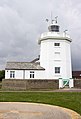 Cromer Lighthouse - geograph.org.uk - 508746.jpg 435 × 640; 94 KB
-
 Cromer Pier and Seafront - geograph.org.uk - 507384.jpg 640 × 427; 121 KB
-
 Culmore-Coolkeeragh Co. Londonderry - geograph.org.uk - 335218.jpg 426 × 640; 93 KB
-
 Daneshill - geograph.org.uk - 173665.jpg 640 × 480; 120 KB
-
 Derelict building, Upper Lanrick - geograph.org.uk - 174127.jpg 640 × 478; 311 KB
-
 Deverell Hall - geograph.org.uk - 173757.jpg 640 × 480; 147 KB
-
 Dismantled Railway, Husbands Bosworth - geograph.org.uk - 172999.jpg 640 × 480; 111 KB
-
 Dismantled Railway, Husbands Bosworth - geograph.org.uk - 173006.jpg 640 × 480; 143 KB
-
 Disused Church - geograph.org.uk - 173960.jpg 640 × 480; 87 KB
-
 Fenland Sunset - geograph.org.uk - 440412.jpg 640 × 480; 40 KB
-
 Dorking Town FC - geograph.org.uk - 172824.jpg 640 × 467; 96 KB
-
 St Paul's Church - geograph.org.uk - 172933.jpg 480 × 640; 152 KB
-
 Elmwood Nurseries - geograph.org.uk - 173486.jpg 640 × 480; 117 KB
-
 Elwin Street E2 - geograph.org.uk - 172822.jpg 640 × 480; 106 KB
-
 End of the track - geograph.org.uk - 175752.jpg 640 × 480; 80 KB
-
 Entrance to Herrington Country Park - geograph.org.uk - 172815.jpg 640 × 480; 41 KB
-
 Entrance to Kennet and Avon Canal, Bath - geograph.org.uk - 182367.jpg 640 × 424; 128 KB
-
 Farmland near Capel Garmon - geograph.org.uk - 173087.jpg 640 × 480; 65 KB
-
 Farmland near Capel Siloam - geograph.org.uk - 173079.jpg 640 × 480; 89 KB
-
 Farmland near Cufaude - geograph.org.uk - 173388.jpg 640 × 480; 160 KB
-
 Farmland near Glasfryn - geograph.org.uk - 173043.jpg 640 × 480; 104 KB
-
 Farmland near Hackwood House - geograph.org.uk - 173370.jpg 640 × 480; 146 KB
-
 Farmland near Pentrefoelas - geograph.org.uk - 173060.jpg 640 × 480; 92 KB
-
 Featherstone Station House - geograph.org.uk - 173080.jpg 640 × 480; 130 KB
-
 Fell Race, Bramm Cragg - geograph.org.uk - 244934.jpg 640 × 480; 72 KB
-
 Fence post, Carn Glas lochdarach - geograph.org.uk - 174459.jpg 640 × 480; 241 KB
-
 Fishing Boat - geograph.org.uk - 173622.jpg 640 × 463; 50 KB
-
 Flat-out twitching - geograph.org.uk - 200200.jpg 640 × 480; 106 KB
-
 Fleming Place, St Andrews - geograph.org.uk - 173408.jpg 589 × 640; 98 KB
-
 Footbridge Remains - geograph.org.uk - 344884.jpg 426 × 640; 98 KB
-
 Footpath to Islip - geograph.org.uk - 173696.jpg 640 × 480; 132 KB
-

-
 Francis Street, Dowlais - geograph.org.uk - 642574.jpg 640 × 480; 67 KB
-

-
 Garbh uisge, Glen Affric - geograph.org.uk - 174730.jpg 640 × 480; 231 KB
-
 Gasholder, Southall Gasworks - geograph.org.uk - 173008.jpg 640 × 480; 128 KB
-
 Giant Haystack - geograph.org.uk - 173022.jpg 640 × 426; 109 KB
-
 Glasserton church - geograph.org.uk - 334889.jpg 480 × 640; 83 KB
-
 Glenborrodale School.jpg 640 × 480; 114 KB
-
 Glenforsa Airfield - geograph.org.uk - 175608.jpg 640 × 480; 65 KB
-
 Glory Wood - geograph.org.uk - 172935.jpg 640 × 480; 172 KB
-
 Greenford Broadway - geograph.org.uk - 175143.jpg 640 × 480; 114 KB
-
 Gregory Lane, St Andrews - geograph.org.uk - 173105.jpg 424 × 640; 70 KB
-
 Gulls at reservoir at Gill Beck. - geograph.org.uk - 172861.jpg 640 × 480; 57 KB
-
 Hafodty-Gwyn farm - geograph.org.uk - 173073.jpg 640 × 480; 71 KB
-
 Hail to the Chief - Flickr - Thunderchild7.jpg 1,280 × 848; 250 KB
-
 Hambledon Road - geograph.org.uk - 173781.jpg 640 × 480; 147 KB
-
 Harbour and Mill Port, St Andrews - geograph.org.uk - 172717.jpg 640 × 424; 63 KB
-
 Harrow on the Hill (1) - geograph.org.uk - 175017.jpg 640 × 480; 111 KB
-
 Harrow on the Hill (2) - geograph.org.uk - 175019.jpg 640 × 480; 96 KB
-
 Hemyock, bluebell walk - geograph.org.uk - 173149.jpg 640 × 427; 312 KB
-
 High St, Barmouth - geograph.org.uk - 684590.jpg 640 × 480; 85 KB
-
 High St. - geograph.org.uk - 684633.jpg 640 × 480; 81 KB
-
 High Street Carshalton.jpg 610 × 813; 147 KB
-
 High Street, Carshalton. - geograph.org.uk - 316808.jpg 480 × 640; 110 KB
-
 Himalaya Palace Cinema, Southall - geograph.org.uk - 173961.jpg 640 × 480; 131 KB
-
 Houses on Watford Road, Kenton - geograph.org.uk - 175005.jpg 640 × 480; 105 KB
-
 Idvies Mill - geograph.org.uk - 172772.jpg 640 × 480; 96 KB
-
 Industrial Estate Omagh - geograph.org.uk - 305936.jpg 640 × 480; 311 KB
-
 Intec Business Park, Basingstoke - geograph.org.uk - 173356.jpg 640 × 480; 116 KB
-
 Jurassic Way - geograph.org.uk - 174162.jpg 640 × 426; 120 KB
-
 Kennet and Avon Canal above Bathampton - geograph.org.uk - 182520.jpg 640 × 424; 126 KB
-
 Kennet and Avon Canal above Claverton - geograph.org.uk - 182579.jpg 640 × 424; 152 KB
-

-
-

-

-
 Kennet and Avon Canal, Conkwell Wood - geograph.org.uk - 182622.jpg 640 × 424; 130 KB
-

-
-

-
 Kennet and Avon Canal, Winsley Bridge - geograph.org.uk - 182609.jpg 640 × 414; 96 KB
-
 Kinness Burn, St Andrews - geograph.org.uk - 173414.jpg 640 × 424; 95 KB
-
 Kip Marina - geograph.org.uk - 173223.jpg 640 × 480; 79 KB
-
 Kip Marina and Kip Village - geograph.org.uk - 173224.jpg 640 × 480; 92 KB
-
 Knock Castle - geograph.org.uk - 172880.jpg 640 × 480; 97 KB
-
 Knockhall Castle, Geograph.jpg 640 × 427; 104 KB
-
 Knodishall Common - geograph.org.uk - 173457.jpg 640 × 480; 103 KB
-
 Knodishall Common - geograph.org.uk - 173463.jpg 640 × 480; 117 KB
-
 Kyles Scalpay slipway - geograph.org.uk - 1035386.jpg 640 × 480; 113 KB
-
 Laga Bay.jpg 640 × 480; 104 KB
-
 Leiston Common - geograph.org.uk - 173519.jpg 640 × 480; 95 KB
-
 Lilburn Tower - geograph.org.uk - 1480533.jpg 640 × 482; 100 KB
-
 Lilleshall hall - geograph.org.uk - 942997.jpg 640 × 480; 90 KB
-
 Limavady Junction - geograph.org.uk - 344871.jpg 640 × 426; 89 KB
-
 Limavady Junction - geograph.org.uk - 344888.jpg 426 × 640; 114 KB
-
 Limavady Junction - geograph.org.uk - 344903.jpg 640 × 426; 85 KB
-
 Limestone Pavement^ - geograph.org.uk - 172984.jpg 640 × 480; 133 KB
-
 Appleby Old River Ancholme (Drain) - geograph.org.uk - 172878.jpg 640 × 426; 97 KB
-
 Lion pub Barmouth - geograph.org.uk - 174650.jpg 640 × 480; 185 KB
-
 Loch an t-Seilg - geograph.org.uk - 831098.jpg 640 × 426; 75 KB
-

-

-
 Looking north from Tregenna Castle - geograph.org.uk - 175440.jpg 640 × 480; 70 KB
-
 Looking South from Carr Lane - geograph.org.uk - 172848.jpg 640 × 426; 111 KB
-
 Looking towards the Cleats - geograph.org.uk - 199878.jpg 640 × 346; 74 KB
-
 Low cliffs at Widewall Bay - geograph.org.uk - 178243.jpg 640 × 480; 179 KB
-
 Lugworm casts on the Oyce of Quindry - geograph.org.uk - 177086.jpg 640 × 480; 79 KB
-
 Maid of the Loch - geograph.org.uk - 173429.jpg 640 × 480; 63 KB
-
 Main drive Glamis Castle - geograph.org.uk - 172864.jpg 640 × 427; 129 KB
-
 Making tyres out of thin air^ - geograph.org.uk - 172811.jpg 640 × 427; 93 KB
-
 Martyrs Monument, St Andrews - geograph.org.uk - 173354.jpg 424 × 640; 38 KB
-
 Men on Powerlines - geograph.org.uk - 173090.jpg 640 × 426; 107 KB
-

-
 Milestone on A6068 - geograph.org.uk - 942480.jpg 640 × 480; 102 KB
-
 Mohammedi Park Masjid Complex - geograph.org.uk - 174311.jpg 640 × 480; 116 KB
-
 Montpelier Rise, Kenton - geograph.org.uk - 174999.jpg 640 × 480; 120 KB
-
 Muddy footpath - geograph.org.uk - 175751.jpg 640 × 480; 161 KB
-
 Music Hill, Harrow - geograph.org.uk - 175015.jpg 640 × 480; 169 KB
-
 Near Browns Bay, Islandmagee - geograph.org.uk - 172680.jpg 640 × 426; 169 KB
-
 Newlands Barn - geograph.org.uk - 173755.jpg 640 × 480; 165 KB
-
 NN2985 Glen Roy & parallel roads.jpg 640 × 480; 79 KB
-
 North end of The Pends, St Andrews - geograph.org.uk - 173101.jpg 640 × 424; 71 KB
-
 North Harbour, Scalpay - geograph.org.uk - 1035377.jpg 640 × 474; 86 KB
-
 Northlink ferry in Scapa Flow - geograph.org.uk - 195810.jpg 640 × 480; 43 KB
-
 Northwest of Basingstoke - geograph.org.uk - 173378.jpg 640 × 480; 98 KB
-
 Old boats at Herston - geograph.org.uk - 178233.jpg 640 × 480; 179 KB
-
 Old Catton War Memorial - geograph.org.uk - 191229.jpg 640 × 427; 77 KB
-
 Oldfield Lane North (2) - geograph.org.uk - 175139.jpg 640 × 480; 97 KB
-
 Oldfield Lane North - geograph.org.uk - 173833.jpg 640 × 480; 104 KB
-
 Oldfield Lane South (2) - geograph.org.uk - 175142.jpg 640 × 480; 146 KB
-
 Oldfield Lane South - geograph.org.uk - 173869.jpg 640 × 480; 99 KB
-
 Pasture near Mapledurwell - geograph.org.uk - 173361.jpg 640 × 480; 90 KB
-
 Pasture near Mapledurwell - geograph.org.uk - 173824.jpg 640 × 480; 91 KB
-
 Peartree Farm - geograph.org.uk - 173227.jpg 640 × 480; 148 KB
-

-
 Perbargus Point West Portholland - geograph.org.uk - 514754.jpg 640 × 480; 77 KB
-
 Perranporth Fire Station - geograph.org.uk - 172914.jpg 640 × 418; 157 KB
-
 Phonebox, Glenborrodale - geograph.org.uk - 175797.jpg 640 × 480; 146 KB
-
 Pilmour Links, St Andrews - geograph.org.uk - 173369.jpg 640 × 424; 79 KB


_-_geograph.org.uk_-_175017.jpg)
_-_geograph.org.uk_-_175019.jpg)


_-_geograph.org.uk_-_172878.jpg)


_-_geograph.org.uk_-_175139.jpg)

_-_geograph.org.uk_-_175142.jpg)


