Category:United Kingdom photographs taken on 2006-05-11
Jump to navigation
Jump to search

Subcategories
This category has the following 2 subcategories, out of 2 total.
S
Media in category "United Kingdom photographs taken on 2006-05-11"
The following 200 files are in this category, out of 515 total.
(previous page) (next page)-
 66054 Castleton East Junction.jpg 1,024 × 768; 648 KB
-
 A 704 - geograph.org.uk - 168314.jpg 640 × 480; 67 KB
-
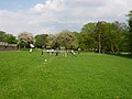 A local park in Herrington, Sunderland - geograph.org.uk - 167884.jpg 640 × 480; 116 KB
-
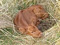 A new-born calf - geograph.org.uk - 168100.jpg 640 × 480; 193 KB
-
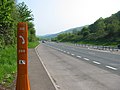
 A Rockfield Summit - geograph.org.uk - 222777.jpg 640 × 480; 56 KB
-

-
 A449 road.jpg 640 × 480; 70 KB
-
 A706, Miller's Moss - geograph.org.uk - 168304.jpg 640 × 455; 78 KB
-

-

-
 New planting - geograph.org.uk - 429585.jpg 640 × 436; 64 KB
-
 Ancient and Modern - geograph.org.uk - 167935.jpg 640 × 480; 98 KB
-
 Anglesey shore at Pwll Fanogl - geograph.org.uk - 170843.jpg 640 × 480; 124 KB
-
 Ashford RailStation 2.jpg 750 × 562; 382 KB
-
 Ashford RailStation.jpg 750 × 562; 355 KB
-
 B788 towards Greenock - geograph.org.uk - 167669.jpg 640 × 480; 71 KB
-
 Balscote pub.jpg 640 × 480; 105 KB
-
 Barn conversion above Kilmartin - geograph.org.uk - 167903.jpg 640 × 480; 188 KB
-
 Barnshake Farmland - geograph.org.uk - 167678.jpg 640 × 480; 103 KB
-
 Beacon Hill - geograph.org.uk - 170794.jpg 640 × 480; 111 KB
-
 Beautiful Cargreen Garden - geograph.org.uk - 890372.jpg 640 × 427; 100 KB
-
 Beeches Lodge, Unthank Road, Norwich - geograph.org.uk - 167764.jpg 640 × 477; 109 KB
-
 Belford Bridge - geograph.org.uk - 188501.jpg 640 × 480; 111 KB
-

-
 Betws-yn-Rhos5113046.JPG 2,048 × 1,536; 559 KB
-
 Bickerton - geograph.org.uk - 168207.jpg 640 × 480; 80 KB
-
 Bilberryhill Copse - geograph.org.uk - 168447.jpg 640 × 480; 174 KB
-
 Bilberryhill Copse - geograph.org.uk - 168451.jpg 480 × 640; 188 KB
-
 Bishopstone - geograph.org.uk - 167929.jpg 640 × 480; 47 KB
-
 Blackburnhall Holdings. - geograph.org.uk - 168192.jpg 640 × 480; 72 KB
-
 Blacklaws - geograph.org.uk - 168206.jpg 640 × 480; 123 KB
-
 Blaeberryhill - geograph.org.uk - 168210.jpg 640 × 480; 74 KB
-
 Blocked ride - geograph.org.uk - 168189.jpg 640 × 480; 131 KB
-
 Bluebells in Launde Big Wood - geograph.org.uk - 168303.jpg 640 × 421; 158 KB
-
 Bluebells on the North Downs Way - geograph.org.uk - 167791.jpg 640 × 480; 171 KB
-

-
 Bottom of Brookfoot Lane, Southowram - geograph.org.uk - 170377.jpg 640 × 480; 110 KB
-
 Boundary wall - geograph.org.uk - 167908.jpg 640 × 480; 193 KB
-
 Boundary wall - geograph.org.uk - 168013.jpg 640 × 480; 196 KB
-
 Breich railway station 1.jpg 640 × 480; 100 KB
-
 Bridge over Blacketty Water - geograph.org.uk - 167667.jpg 640 × 480; 169 KB
-
 Bridge Road Works, Brighouse - geograph.org.uk - 170348.jpg 640 × 480; 110 KB
-
 Brighton and Hove Buses bus.jpg 1,600 × 1,200; 204 KB
-
 Brinsop Court - geograph.org.uk - 167965.jpg 640 × 480; 29 KB
-
 Bristly Ridge from Llyn Caseg Fraith - geograph.org.uk - 223345.jpg 640 × 480; 68 KB
-
 Broad Way on Hexhamshire Common - geograph.org.uk - 168519.jpg 640 × 480; 84 KB
-
 Brookfoot Lake, Southowram - geograph.org.uk - 169891.jpg 640 × 480; 129 KB
-
 Brookfoot Lane, Southowram - geograph.org.uk - 169832.jpg 640 × 475; 105 KB
-
 Bryn Bachau Chapel - geograph.org.uk - 212388.jpg 640 × 479; 93 KB
-
 Bull Hill, Holcombe Moor Range - geograph.org.uk - 167816.jpg 640 × 426; 147 KB
-
 Button - geograph.org.uk - 168086.jpg 640 × 480; 94 KB
-
 Bwlch Tryfan from Drws Nodded - geograph.org.uk - 223321.jpg 640 × 480; 49 KB
-
 Bwlch y Ddwy Glyder - geograph.org.uk - 222752.jpg 640 × 480; 112 KB
-
 Cairnie - geograph.org.uk - 168209.jpg 640 × 480; 64 KB
-
 Car Park - geograph.org.uk - 167688.jpg 640 × 480; 96 KB
-
 Carr Farm - geograph.org.uk - 170740.jpg 640 × 480; 64 KB
-
 Castle Craig - geograph.org.uk - 167681.jpg 640 × 480; 147 KB
-
 Cemetery at Marley Potts, Sunderland - geograph.org.uk - 167857.jpg 640 × 480; 92 KB
-

-
 Chain Bridge - geograph.org.uk - 167776.jpg 640 × 480; 95 KB
-
 Chapelfield Gardens, Norwich - geograph.org.uk - 168062.jpg 640 × 475; 101 KB
-
 Cherry Trees, Coronation Walk - geograph.org.uk - 167692.jpg 640 × 480; 176 KB
-
 Christchurch, Eaton - geograph.org.uk - 168065.jpg 640 × 475; 116 KB
-
 Chwarel Vivian Quarry - geograph.org.uk - 223488.jpg 640 × 396; 81 KB
-
 Collingham Railway Station.jpg 640 × 427; 88 KB
-
 Collingham Station - geograph.org.uk - 167915.jpg 640 × 427; 63 KB
-
 Combe Bridge - geograph.org.uk - 168095.jpg 640 × 480; 164 KB
-

-
 Corrie spout waterfall and Corrie burn - geograph.org.uk - 168140.jpg 640 × 480; 114 KB
-
 Country Road - geograph.org.uk - 168632.jpg 640 × 480; 89 KB
-
 Creigiau'r Gelli - geograph.org.uk - 223355.jpg 640 × 393; 73 KB
-
 Cromwell Wood Lane, Brookfoot, Southowram - geograph.org.uk - 169884.jpg 640 × 480; 151 KB
-
 Cross Lane - geograph.org.uk - 170723.jpg 640 × 480; 109 KB
-
 Crossnamuckley Road, Newtownards - geograph.org.uk - 167774.jpg 640 × 426; 190 KB
-
 Crosswood Burn-Camilty Water - geograph.org.uk - 168183.jpg 640 × 480; 133 KB
-
 Cwm Gwern y Gof - geograph.org.uk - 223525.jpg 640 × 419; 51 KB
-
 Darwin Street, Southwick, Sunderland - geograph.org.uk - 167876.jpg 640 × 480; 46 KB
-
 Derelict military vehicle - geograph.org.uk - 167995.jpg 640 × 480; 192 KB
-
 Disused pumping station Crooked Bank - geograph.org.uk - 170579.jpg 640 × 480; 90 KB
-
 Disused railway, Foulshiels - geograph.org.uk - 168201.jpg 640 × 480; 91 KB
-
 Drumnawhey Road, Newtownards - geograph.org.uk - 167760.jpg 640 × 426; 172 KB
-
 Drws Nodded - geograph.org.uk - 223334.jpg 640 × 476; 37 KB
-
 Dunrod Hill and Loch Thom - geograph.org.uk - 174030.jpg 640 × 480; 57 KB
-
 Eagle Hall - geograph.org.uk - 167839.jpg 640 × 427; 68 KB
-

-
 East Coast Main Line - geograph.org.uk - 168145.jpg 640 × 320; 82 KB
-
 Eastern ridge, Ben Wyvis. - geograph.org.uk - 169394.jpg 640 × 476; 47 KB
-
 Elephant and Castle, Bloxham - geograph.org.uk - 168488.jpg 640 × 480; 89 KB
-
 The Chandlers Arms, Epwell - geograph.org.uk - 168129.jpg 480 × 640; 107 KB
-
 Farm buildings, Cudham Grange, Kent - geograph.org.uk - 167743.jpg 640 × 480; 113 KB
-
 Farm Road to Prospect Farm - geograph.org.uk - 170192.jpg 640 × 261; 49 KB
-
 Fauldhouse - geograph.org.uk - 168215.jpg 640 × 480; 76 KB
-
 Fauldhouse - geograph.org.uk - 168228.jpg 640 × 480; 146 KB
-

-
 Footpath at Burnwell - geograph.org.uk - 168104.jpg 640 × 480; 157 KB
-
 Footpath to Bilberryhill - geograph.org.uk - 168434.jpg 640 × 480; 116 KB
-
 Footpath to Sowton Mill - geograph.org.uk - 1402671.jpg 640 × 480; 154 KB
-
 Ford near Bilberryhill - geograph.org.uk - 168085.jpg 640 × 480; 147 KB
-
 Forestry, Fauldhouse - geograph.org.uk - 168282.jpg 639 × 455; 87 KB
-
 Former Brookfoot Wharf, Rastrick - geograph.org.uk - 170381.jpg 640 × 480; 127 KB
-
 From Cross Lane - geograph.org.uk - 170744.jpg 640 × 480; 62 KB
-
 Ganny Lock, Brighouse - geograph.org.uk - 170355.jpg 640 × 473; 99 KB
-
 Garbat Forest - geograph.org.uk - 183658.jpg 640 × 480; 94 KB
-
 Gardner's Hall - geograph.org.uk - 168181.jpg 640 × 480; 90 KB
-
 Garvock Farm - geograph.org.uk - 167956.jpg 640 × 480; 111 KB
-
 Gate, Leven's Seat landfill. - geograph.org.uk - 168311.jpg 640 × 480; 83 KB
-
 George Hotel, Lower Brailes - geograph.org.uk - 168477.jpg 640 × 480; 81 KB
-

-

-
 Grazing above Essich - geograph.org.uk - 710506.jpg 640 × 296; 40 KB
-
 Greenwall - geograph.org.uk - 168259.jpg 640 × 432; 74 KB
-
 Grendon Quarter Pond - geograph.org.uk - 169452.jpg 640 × 480; 90 KB
-
 Hapstead - geograph.org.uk - 168452.jpg 640 × 480; 98 KB
-
 Sugar Beet - geograph.org.uk - 799888.jpg 640 × 427; 92 KB
-
 Hendry's Corse - geograph.org.uk - 168307.jpg 640 × 480; 102 KB
-
 Holden Street, Mansfield - geograph.org.uk - 1202139.jpg 640 × 424; 62 KB
-
 Holden Street, Mansfield - geograph.org.uk - 1202146.jpg 640 × 427; 75 KB
-
-
 Hop-Yard Lane, Tuxford, Nottinghamshire - geograph.org.uk - 167689.jpg 640 × 480; 162 KB
-
 Horses at Bilberryhill - geograph.org.uk - 168430.jpg 640 × 480; 136 KB
-
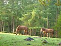
 Horses at pasture - geograph.org.uk - 167790.jpg 640 × 480; 147 KB
-
 Kennington Lane meets Kennington Road - geograph.org.uk - 167814.jpg 640 × 480; 131 KB
-
 Kennington Park Road SE11 - geograph.org.uk - 167810.jpg 640 × 480; 146 KB
-
 Kennington Park, SE11 - geograph.org.uk - 167813.jpg 640 × 480; 170 KB
-
 Kingslaw Plantation - geograph.org.uk - 167824.jpg 640 × 480; 70 KB
-

-
 Kitchen Rig - geograph.org.uk - 168271.jpg 640 × 480; 115 KB
-
 Knedlington Hall Nr Howden East Yorkshire - geograph.org.uk - 167832.jpg 640 × 427; 118 KB
-
 St. Katharine's Church, Knockholt, Kent - geograph.org.uk - 874418.jpg 487 × 640; 108 KB
-
 Landing Stages on the Beaulieu River - geograph.org.uk - 167960.jpg 640 × 480; 72 KB
-
 Lane from Two Crosses - geograph.org.uk - 168099.jpg 480 × 640; 98 KB
-
 Lane past Button - geograph.org.uk - 168454.jpg 640 × 480; 106 KB
-

-

-
 Line of Brook to Engine Pond - geograph.org.uk - 169437.jpg 640 × 480; 118 KB
-
 Loch Glascarnoch - geograph.org.uk - 1302231.jpg 640 × 479; 71 KB
-
 Loch Ravag - geograph.org.uk - 167737.jpg 640 × 426; 127 KB
-
 Loch Ravag - geograph.org.uk - 167739.jpg 640 × 426; 134 KB
-
 Loch Vaich and dam - geograph.org.uk - 178295.jpg 640 × 480; 76 KB
-

-
 Lochan Add - geograph.org.uk - 167963.jpg 640 × 480; 196 KB
-
 London Colney Roundabout - geograph.org.uk - 167854.jpg 640 × 480; 92 KB
-
 Lost fank - geograph.org.uk - 168186.jpg 640 × 480; 96 KB
-
 Lubachlaggan - geograph.org.uk - 177928.jpg 640 × 480; 73 KB
-
 Lubnaclach ruins - geograph.org.uk - 1095299.jpg 640 × 480; 76 KB
-

-
 Main Street, South Scarle - geograph.org.uk - 167866.jpg 640 × 427; 130 KB
-
 Mansel Lacy - geograph.org.uk - 167940.jpg 640 × 480; 63 KB
-
 Mardle valley at Bilberryhill - geograph.org.uk - 168428.jpg 640 × 480; 92 KB
-
 Mardle valley at Brook Mill Bridge - geograph.org.uk - 168089.jpg 640 × 480; 113 KB
-
 May comes to Mere Road - geograph.org.uk - 175364.jpg 640 × 480; 100 KB
-
 McArthur Glen - geograph.org.uk - 168182.jpg 640 × 480; 79 KB
-
 Menhir near Harbourne Head - geograph.org.uk - 168092.jpg 480 × 640; 91 KB
-
 Merryhill Wood - geograph.org.uk - 167958.jpg 640 × 480; 73 KB
-
 Mid Foulshiels - geograph.org.uk - 168197.jpg 640 × 480; 81 KB
-
 Mole Gap Trail - geograph.org.uk - 167785.jpg 640 × 480; 158 KB
-
 Mole Gap Trail - geograph.org.uk - 168110.jpg 640 × 480; 165 KB
-
 Montgomery canal - geograph.org.uk - 169487.jpg 640 × 480; 127 KB
-
 Moorland by Loch Connan - geograph.org.uk - 167756.jpg 640 × 426; 113 KB
-
 Moorland track on Hexhamshire Common - geograph.org.uk - 168521.jpg 640 × 480; 80 KB
-
 Near Moreton on Lugg - geograph.org.uk - 168033.jpg 640 × 480; 49 KB
-
 Near Stretton Sugwas - geograph.org.uk - 167993.jpg 640 × 480; 35 KB
-
 Need a Freezer - geograph.org.uk - 310815.jpg 407 × 640; 157 KB
-
 Nether Poppleton Tithe Barn.jpg 640 × 480; 82 KB
-
 New Farm Estate - geograph.org.uk - 170238.jpg 640 × 480; 111 KB
-
 New Houses - geograph.org.uk - 545090.jpg 640 × 480; 59 KB
-
 New houses, Foulshiels - geograph.org.uk - 168202.jpg 640 × 480; 69 KB
-
 Nigg Church - geograph.org.uk - 607536.jpg 640 × 481; 121 KB
-
 St. James, North Wraxall - geograph.org.uk - 168014.jpg 640 × 480; 89 KB
-
 Of gorse it is - geograph.org.uk - 170517.jpg 640 × 480; 290 KB
-
 Ogwen Valley - geograph.org.uk - 223535.jpg 640 × 417; 56 KB
-
 Old chapel Hutton End - geograph.org.uk - 168759.jpg 640 × 480; 201 KB
-
 Old gateway - geograph.org.uk - 168739.jpg 640 × 480; 105 KB
-
 Old mining area, Fauldhouse - geograph.org.uk - 168219.jpg 640 × 480; 64 KB
-
 Old railway box, Midfoulshiels - geograph.org.uk - 168199.jpg 640 × 480; 70 KB
-
 Old railway, Burnhead - geograph.org.uk - 168284.jpg 640 × 480; 76 KB
-
 Old railway, Foulshiels - geograph.org.uk - 168200.jpg 640 × 480; 123 KB
-
 Old route now a green lane - geograph.org.uk - 167736.jpg 640 × 480; 98 KB
-
 On Black Hill - geograph.org.uk - 168142.jpg 640 × 480; 98 KB
-
 Orchard Icklesham East Sussex - geograph.org.uk - 167891.jpg 640 × 480; 147 KB
-
 Ose River - geograph.org.uk - 167718.jpg 640 × 426; 137 KB
-
 Oval Underground Station - geograph.org.uk - 167804.jpg 640 × 480; 134 KB
-
 Overflow near Ganny Lock, Brighouse - geograph.org.uk - 170393.jpg 640 × 480; 120 KB
-
 Padley Hill, Mansfield - geograph.org.uk - 1202124.jpg 640 × 423; 78 KB
-
 Panorama of Porthmeor Beach, St. Ives - geograph.org.uk - 1212787.jpg 640 × 211; 114 KB
-
 Pate's Hill - geograph.org.uk - 168315.jpg 640 × 480; 89 KB
-
 Pen-y-Pass Bus Station on a Wet Day - geograph.org.uk - 222745.jpg 640 × 472; 44 KB
-

-
 Pitcairn Farm - geograph.org.uk - 167686.jpg 640 × 480; 123 KB
-
 Plantation at Upper Gryffe - geograph.org.uk - 167663.jpg 640 × 480; 98 KB
-
 Poly cultivation at Bishopstone - geograph.org.uk - 167918.jpg 640 × 480; 136 KB
-
 Pond at Blackwater Farm - geograph.org.uk - 167671.jpg 640 × 480; 77 KB
-

-
 Postbox - geograph.org.uk - 167991.jpg 640 × 480; 128 KB
-

-
 Raglan garden centre - geograph.org.uk - 168160.jpg 640 × 480; 80 KB
-
 Raglan service area - geograph.org.uk - 168159.jpg 640 × 480; 63 KB
-
 Raglan Station - geograph.org.uk - 168114.jpg 640 × 480; 61 KB
-
 Railway Bridge by Usk Station - geograph.org.uk - 168111.jpg 640 × 489; 90 KB
-
 Railway Bridge, Bridge End, Rastrick - geograph.org.uk - 170415.jpg 640 × 480; 91 KB


