Category:United Kingdom photographs taken on 2006-03-28
Jump to navigation
Jump to search
| ← | Tuesday 28 March 2006 | → | ||
| ← | March 2006 | → | ||

United Kingdom photographs taken on 28 March 2006.
Image files should be categorized here automatically using {{taken on}} template. Direct categorisation is also possible, if automatic is impossible.
Subcategories
This category has only the following subcategory.
Media in category "United Kingdom photographs taken on 2006-03-28"
The following 192 files are in this category, out of 192 total.
-
 Aithmuir - geograph.org.uk - 143646.jpg 640 × 480; 88 KB
-
 Alexandria - geograph.org.uk - 396544.jpg 640 × 355; 79 KB
-

-
 Ardgaith level crossing - geograph.org.uk - 143626.jpg 640 × 480; 73 KB
-
 Ardgowan Estate - geograph.org.uk - 143359.jpg 640 × 480; 67 KB
-
 Ardgowan Estate - geograph.org.uk - 143362.jpg 640 × 480; 68 KB
-
 Ardgowan Riding Centre - geograph.org.uk - 143355.jpg 640 × 480; 55 KB
-
 Atlantic Coast Line 1.jpg 640 × 415; 111 KB
-

-
 Barn conversion, Lugwardine - geograph.org.uk - 143476.jpg 640 × 426; 115 KB
-
 Barns at Hill End, Weston Beggard - geograph.org.uk - 143469.jpg 640 × 426; 108 KB
-
 BartestreeConvent.jpg 640 × 426; 106 KB
-
 Basic stile - geograph.org.uk - 143705.jpg 640 × 480; 126 KB
-
 Basing Lime Pits - geograph.org.uk - 147379.jpg 640 × 480; 174 KB
-
 Belgrave Flyover - geograph.org.uk - 258917.jpg 640 × 480; 93 KB
-
 Bickham House - geograph.org.uk - 143588.jpg 640 × 480; 93 KB
-
 Birmingham Motorcycle Museum - geograph.org.uk - 143881.jpg 640 × 480; 21 KB
-
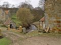
 Bransdale Mill - geograph.org.uk - 659733.jpg 640 × 480; 110 KB
-

-
 Broadclyst Windmill.jpg 640 × 480; 96 KB
-
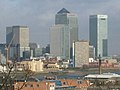 Canary Wharf and the Isle of Dogs - geograph.org.uk - 336148.jpg 640 × 480; 67 KB
-
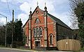
 Holmgate Evangelical Church, Clay Cross, Derbyshire.jpg 640 × 480; 80 KB
-

-

-

-
 Crannaford Crossing - geograph.org.uk - 143553.jpg 640 × 480; 80 KB
-
 Crossroads by Ardgaith - geograph.org.uk - 143625.jpg 640 × 480; 76 KB
-
 Dark Hedge Bregagh Road nr Stranocum - geograph.org.uk - 403433.jpg 640 × 480; 120 KB
-
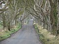 Dark Hedge Looking South-East - geograph.org.uk - 515088.jpg 640 × 480; 119 KB
-

-
 Disused Bible Christian Chapel - geograph.org.uk - 143541.jpg 640 × 401; 102 KB
-
 Dover Docks - geograph.org.uk - 144589.jpg 640 × 581; 105 KB
-
 Easneye - geograph.org.uk - 143411.jpg 640 × 480; 129 KB
-
 Edge Hills, Forest of Dean - geograph.org.uk - 143392.jpg 640 × 480; 139 KB
-
 Elbury Farm - geograph.org.uk - 143547.jpg 640 × 480; 84 KB
-
 Flag Fen, Peterborough - geograph.org.uk - 149002.jpg 640 × 428; 103 KB
-
 Flaring off Natural Gas at Westerdale - geograph.org.uk - 143649.jpg 640 × 427; 70 KB
-

-
 Flats on Maskelyne Avenue, Manor Farm - geograph.org.uk - 143635.jpg 640 × 480; 159 KB
-

-
 HodgeBeck.jpg 640 × 480; 103 KB
-
 House near to the church, Bramley - geograph.org.uk - 146943.jpg 640 × 476; 74 KB
-

-
 Lamba Water, Shetland - geograph.org.uk - 145384.jpg 640 × 391; 72 KB
-
 Land off Redbridge Lane, Old Basing - geograph.org.uk - 147383.jpg 640 × 480; 122 KB
-
 Longney Crib and the River Severn - geograph.org.uk - 143495.jpg 640 × 479; 54 KB
-
 St Peter's Church, Lugwardine - geograph.org.uk - 143473.jpg 426 × 640; 90 KB
-
 St Peter's Church, Lugwardine - geograph.org.uk - 143474.jpg 640 × 426; 91 KB
-
 Lychgate to Sherborne St John Church - geograph.org.uk - 147784.jpg 473 × 640; 131 KB
-
 Mains of Errol - geograph.org.uk - 143634.jpg 640 × 480; 71 KB
-
 Meadow Lane Raunds - geograph.org.uk - 143574.jpg 640 × 480; 90 KB
-

-
 Millbrook Primary School, Grove - geograph.org.uk - 250821.jpg 640 × 480; 112 KB
-
 Milton Keynes Central railway station.jpg 640 × 480; 116 KB
-
 Myreside Farm - geograph.org.uk - 143629.jpg 640 × 478; 44 KB
-
 Neglected vehicle - geograph.org.uk - 143704.jpg 640 × 480; 117 KB
-
 New Inn Sidley Green East Sussex - geograph.org.uk - 143478.jpg 640 × 480; 138 KB
-
 Northern end of the village of St Blazey - geograph.org.uk - 143500.jpg 640 × 492; 115 KB
-
 Once a ferry terminal - geograph.org.uk - 143640.jpg 640 × 480; 83 KB
-
 Penarth Pier - geograph.org.uk - 306201.jpg 640 × 480; 68 KB
-

-
 Priory Church, Pamber - geograph.org.uk - 146956.jpg 640 × 480; 102 KB
-
 Pylon lines near Broadclyst - geograph.org.uk - 143569.jpg 480 × 640; 78 KB
-
 Quaker Cemetery - geograph.org.uk - 143610.jpg 640 × 421; 96 KB
-
 Reed beds - geograph.org.uk - 143638.jpg 640 × 480; 94 KB
-
 Road Junction close to Compton Dando - geograph.org.uk - 146480.jpg 640 × 481; 95 KB
-
 Runway 27R - geograph.org.uk - 144588.jpg 480 × 640; 88 KB
-
 Sacred Heart RC Church, Omagh - geograph.org.uk - 147653.jpg 640 × 479; 134 KB
-
 Seaside - geograph.org.uk - 143647.jpg 640 × 480; 110 KB
-
 Sheep in a sheltered spot - geograph.org.uk - 143589.jpg 640 × 427; 49 KB
-
 Silverlink - geograph.org.uk - 143515.jpg 640 × 480; 116 KB
-
 Snodland Town Centre - geograph.org.uk - 147070.jpg 640 × 480; 84 KB
-
 South Whimple Farm - geograph.org.uk - 143542.jpg 640 × 480; 95 KB
-
 South Wraxall source - geograph.org.uk - 143701.jpg 640 × 480; 140 KB
-
 St Blazey - geograph.org.uk - 143498.jpg 640 × 427; 95 KB
-
 St Blazey Gate - geograph.org.uk - 143486.jpg 640 × 427; 103 KB
-
 St James's Church, Bramley - geograph.org.uk - 146941.jpg 640 × 475; 110 KB
-
 St Lawrence Church, Didmarton - geograph.org.uk - 144731.jpg 640 × 480; 75 KB
-
 St Mary's Church, Biscovey - geograph.org.uk - 143496.jpg 640 × 477; 111 KB
-
 St Mary's Lych gate - geograph.org.uk - 837170.jpg 640 × 480; 123 KB
-
 St Nicholas Church, Bransdale - geograph.org.uk - 659736.jpg 640 × 543; 92 KB
-
 St Peters and St Pauls church Aston - geograph.org.uk - 148650.jpg 640 × 480; 116 KB
-
 St Peters and St Pauls church Aston - geograph.org.uk - 148656.jpg 640 × 480; 103 KB
-
 St. Giles Garrison Church - geograph.org.uk - 143703.jpg 640 × 480; 60 KB
-
 Stanwick Lakes Country Park - geograph.org.uk - 143564.jpg 640 × 480; 77 KB
-
 Stockley Park - geograph.org.uk - 143621.jpg 640 × 480; 86 KB
-
 Street scene, Old Basing - geograph.org.uk - 147390.jpg 640 × 475; 73 KB
-
 Strict Baptist Chapel, Grove - geograph.org.uk - 250827.jpg 640 × 480; 76 KB
-

-
 Swans on the swollen River Lugg - geograph.org.uk - 143479.jpg 640 × 426; 99 KB
-
 Tanglewood - geograph.org.uk - 166542.jpg 640 × 415; 85 KB
-
 Thames Tower and Burleys Flyover - geograph.org.uk - 225416.jpg 640 × 480; 87 KB
-
 The Appeals Centre, Omagh - geograph.org.uk - 143412.jpg 640 × 395; 65 KB
-

-

-

-
 The Cornish Mainline near Treesmill - geograph.org.uk - 143556.jpg 640 × 427; 115 KB
-

-

-
-
 The Spinning Wheel - geograph.org.uk - 143687.jpg 640 × 480; 96 KB
-
 Tile-hung house at Sherborne St John - geograph.org.uk - 147792.jpg 640 × 474; 117 KB
-
 Treesmill - geograph.org.uk - 143549.jpg 640 × 351; 96 KB
-
 Tuddenham village pond - geograph.org.uk - 305873.jpg 640 × 480; 103 KB
-
 Tywardreath Highway - geograph.org.uk - 143537.jpg 640 × 409; 101 KB
-
 View towards Waltham on the Wolds - geograph.org.uk - 144581.jpg 640 × 376; 65 KB
-
 Waiting for Breakfast, Shetland - geograph.org.uk - 145366.jpg 640 × 480; 104 KB
-

-
 War Memorial, Longhope - geograph.org.uk - 143380.jpg 640 × 480; 130 KB
-
 Warehouse off Dawley Road - geograph.org.uk - 143627.jpg 640 × 480; 60 KB
-
 Wesleyan Chapel at Lealholm - geograph.org.uk - 143597.jpg 640 × 427; 62 KB
-
 Weston Beggard Church - geograph.org.uk - 143468.jpg 640 × 426; 99 KB
-
 Whissendine to Stapleford Road - geograph.org.uk - 144582.jpg 640 × 480; 100 KB
-

-

-

-

-
 Barn at Lealholm - geograph.org.uk - 143600.jpg 640 × 427; 96 KB
-
 Batemans Mill - geograph.org.uk - 143679.jpg 640 × 480; 77 KB
-
 Beach in winter, Keynes Country Park - geograph.org.uk - 143427.jpg 640 × 480; 87 KB
-
 Birmingham International Airport - geograph.org.uk - 143876.jpg 640 × 480; 24 KB
-

-
 Brand New Sainsbury's, Bishopston - geograph.org.uk - 143639.jpg 640 × 480; 142 KB
-
 Brick and Tile Works - geograph.org.uk - 143633.jpg 640 × 480; 60 KB
-
 Bridge over the River Loddon, Old Basing - geograph.org.uk - 147394.jpg 640 × 507; 157 KB
-
 Cottage by the moor - Lealholm side. - geograph.org.uk - 143592.jpg 640 × 427; 55 KB
-
 Countryside north of Whissendine - geograph.org.uk - 144583.jpg 640 × 516; 125 KB
-
 Crowhurst Road East Sussex - geograph.org.uk - 143485.jpg 640 × 480; 135 KB
-

-
 Cuckoo Hill - geograph.org.uk - 144569.jpg 640 × 368; 57 KB
-
 Derelict barns - Lealholm side - geograph.org.uk - 143591.jpg 640 × 427; 51 KB
-
 Eckington Bus Station - geograph.org.uk - 161895.jpg 640 × 479; 107 KB
-
 Entrance Road to a Farm - geograph.org.uk - 143545.jpg 640 × 427; 126 KB
-
 Farmhouse and Fields - geograph.org.uk - 143560.jpg 640 × 427; 105 KB
-
 Farmland Nr Crowhurst East Sussex - geograph.org.uk - 143859.jpg 640 × 480; 150 KB
-
 Farmland, Broadoak - geograph.org.uk - 143389.jpg 640 × 480; 105 KB
-
 Farmland, Stanton Wick - geograph.org.uk - 146482.jpg 640 × 481; 103 KB
-
 Forlorn Gannet - geograph.org.uk - 143643.jpg 640 × 480; 56 KB
-
 Gatepost and Field - geograph.org.uk - 143677.jpg 640 × 480; 92 KB
-
 Grange from the west - geograph.org.uk - 143644.jpg 640 × 480; 58 KB
-
 Grange level crossing - geograph.org.uk - 143645.jpg 640 × 480; 71 KB
-
 Green Bottom - geograph.org.uk - 143393.jpg 640 × 480; 122 KB
-
 Green Lane South - geograph.org.uk - 370268.jpg 640 × 480; 129 KB
-
 Grove Library - geograph.org.uk - 250817.jpg 640 × 480; 94 KB
-
 Grovelands Preschool, Grove - geograph.org.uk - 250824.jpg 640 × 480; 107 KB
-
 Handcross Grove, Green Lane, Coventry - geograph.org.uk - 370205.jpg 640 × 480; 71 KB
-
 Handsome beech hedge - geograph.org.uk - 143636.jpg 640 × 480; 87 KB
-
 High Fields - geograph.org.uk - 143676.jpg 640 × 480; 79 KB
-
 Hill House Farm from Rake Lane - geograph.org.uk - 143586.jpg 640 × 427; 50 KB
-
 Hill of Errol Farm Road - geograph.org.uk - 143616.jpg 640 × 480; 86 KB
-
 Hillside below Penpell Farm - geograph.org.uk - 143543.jpg 640 × 427; 107 KB
-
 Hole-i'-th'-Ellers - geograph.org.uk - 143606.jpg 640 × 427; 52 KB
-
 Kenpas Highway (A45) Coventry - geograph.org.uk - 370245.jpg 640 × 480; 85 KB
-
 Lealholm Lawns Farm - geograph.org.uk - 143608.jpg 640 × 427; 56 KB
-
-
 Looking over farmland nr Popes Hill - geograph.org.uk - 143391.jpg 640 × 480; 117 KB
-
 Mains of Murie farm road - geograph.org.uk - 143631.jpg 640 × 480; 68 KB
-

-
 Murie Cemetery - geograph.org.uk - 143632.jpg 640 × 480; 106 KB
-
 Norton Malreward, Somerset - geograph.org.uk - 146477.jpg 640 × 481; 101 KB
-
 Old farm building at New Mains - geograph.org.uk - 143309.jpg 640 × 480; 124 KB
-
 Old Railway Line, towards Longhope - geograph.org.uk - 143384.jpg 640 × 480; 138 KB
-
 Old Railway Line, towards Longhope - geograph.org.uk - 143386.jpg 640 × 480; 160 KB
-
 Padstow Pub - geograph.org.uk - 309934.jpg 480 × 640; 135 KB
-
 Pamber School - geograph.org.uk - 146960.jpg 640 × 468; 97 KB
-
 Park House Farm - geograph.org.uk - 143582.jpg 640 × 427; 56 KB
-
 Pile of Building Waste - geograph.org.uk - 144575.jpg 640 × 394; 87 KB
-
 Recently planted trees - geograph.org.uk - 143602.jpg 640 × 427; 60 KB
-
 Reservoir Nr Hastings East Sussex - geograph.org.uk - 143615.jpg 640 × 480; 143 KB
-
 Riding School, Tanglewood - geograph.org.uk - 166552.jpg 640 × 426; 127 KB
-
 Rock Farm, Lugwardine - geograph.org.uk - 143475.jpg 640 × 426; 128 KB
-
 Running Track, Par - geograph.org.uk - 143484.jpg 640 × 427; 90 KB
-

-

-
 Shorncote Quarry showing cornbrash layers - geograph.org.uk - 143462.jpg 640 × 480; 108 KB
-
 Stilling pond, Shorncote Quarry - geograph.org.uk - 143456.jpg 480 × 640; 134 KB
-
 Stokes Lane, Monk Sherborne - geograph.org.uk - 147361.jpg 640 × 480; 192 KB
-
 Tamlaghtard CI Church - geograph.org.uk - 674770.jpg 640 × 457; 77 KB
-
 Tanglewood - geograph.org.uk - 166546.jpg 640 × 426; 79 KB
-
 The Esk Valley Railway near Lealholm - geograph.org.uk - 143603.jpg 640 × 427; 51 KB
-
 The Gateway Centre, Bartestree - geograph.org.uk - 143470.jpg 640 × 426; 92 KB
-
 The Green - geograph.org.uk - 143688.jpg 640 × 480; 78 KB
-
 The River Loddon, Old Basing - geograph.org.uk - 147395.jpg 640 × 480; 140 KB
-
 Tidnor House Farm - geograph.org.uk - 143477.jpg 640 × 426; 88 KB
-
 Towards Hope Wood - geograph.org.uk - 143382.jpg 640 × 480; 144 KB
-
 Track by the wood - geograph.org.uk - 143624.jpg 640 × 430; 91 KB
-
 Trig Point in the Trees - geograph.org.uk - 143693.jpg 640 × 480; 112 KB
-
 Tucking Mill, Somerset - geograph.org.uk - 146478.jpg 640 × 481; 160 KB
-
 Tunnel Vent - geograph.org.uk - 143683.jpg 640 × 480; 77 KB
-

-
 Tywardreath - geograph.org.uk - 143568.jpg 640 × 365; 82 KB
-


_Coventry_-_geograph.org.uk_-_370245.jpg)


