Category:United Kingdom photographs taken on 2006-03-15
Jump to navigation
Jump to search
| ← | Wednesday 15 March 2006 | → | ||
| ← | March 2006 | → | ||

United Kingdom photographs taken on 15 March 2006.
Image files should be categorized here automatically using {{taken on}} template. Direct categorisation is also possible, if automatic is impossible.
Subcategories
This category has only the following subcategory.
Media in category "United Kingdom photographs taken on 2006-03-15"
The following 200 files are in this category, out of 468 total.
(previous page) (next page)-

-
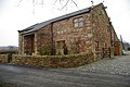
 'One Chimney', Bickley, Kent - geograph.org.uk - 137095.jpg 640 × 480; 109 KB
-
 252 Clifton Drive - geograph.org.uk - 137354.jpg 640 × 426; 117 KB
-
 A2 Shooter's Hill Road - geograph.org.uk - 150728.jpg 640 × 480; 112 KB
-
 Abandoned Cottage - geograph.org.uk - 137205.jpg 640 × 480; 76 KB
-
 Abbot's Court Farm - geograph.org.uk - 137762.jpg 640 × 480; 87 KB
-
 Accountants and Tax Consultants - geograph.org.uk - 137864.jpg 536 × 640; 120 KB
-
 Acton Main Line station - geograph.org.uk - 137846.jpg 640 × 480; 102 KB
-
 Aggregates at Acton goods yard - geograph.org.uk - 138801.jpg 640 × 480; 96 KB
-

-
 Aladdins Kingdom, Omagh - geograph.org.uk - 137863.jpg 503 × 640; 124 KB
-
 All Saints Church, Buckley - geograph.org.uk - 137226.jpg 640 × 446; 71 KB
-
 Allt Bealach nan Cas - geograph.org.uk - 137145.jpg 640 × 480; 117 KB
-
 Allt Fearna - geograph.org.uk - 137129.jpg 640 × 480; 132 KB
-
 Anderson Close, North Acton - geograph.org.uk - 138834.jpg 640 × 480; 101 KB
-
 Arch-Aid Design, Omagh - geograph.org.uk - 137915.jpg 640 × 478; 75 KB
-
 Ardmillan Orange Hall.jpg 640 × 480; 79 KB
-
 Aspley Basin Huddersfield - geograph.org.uk - 174760.jpg 480 × 640; 79 KB
-
 Back gardens of The Approach, North Acton - geograph.org.uk - 138827.jpg 640 × 480; 127 KB
-
 Badby - geograph.org.uk - 137154.jpg 640 × 480; 95 KB
-
 Badby - geograph.org.uk - 139507.jpg 640 × 480; 80 KB
-
 Balallan Post Office - geograph.org.uk - 137426.jpg 640 × 480; 90 KB
-

-
-
 BAR TEN, Omagh - geograph.org.uk - 138182.jpg 640 × 479; 99 KB
-
 Barber Shop, Omagh - geograph.org.uk - 137952.jpg 640 × 479; 125 KB
-
 Barn at Paris Farm - geograph.org.uk - 137312.jpg 640 × 478; 83 KB
-
 Barn by the Muirkirk Road - geograph.org.uk - 137441.jpg 640 × 480; 67 KB
-
 Batch Farm - geograph.org.uk - 137150.jpg 640 × 479; 150 KB
-
 Battlesteads Hotel, Wark - geograph.org.uk - 137299.jpg 640 × 480; 99 KB
-
 Belvidere Road, Exeter - geograph.org.uk - 137160.jpg 640 × 480; 156 KB
-
 Bere Lodge, Lower Hyde Heath - geograph.org.uk - 160887.jpg 600 × 450; 79 KB
-
 Bliss, Omagh - geograph.org.uk - 137976.jpg 640 × 478; 92 KB
-
 Blue and White - geograph.org.uk - 137242.jpg 640 × 480; 81 KB
-
 Boggy Ground - geograph.org.uk - 137166.jpg 640 × 480; 73 KB
-
 Bon marche, Omagh - geograph.org.uk - 138183.jpg 640 × 479; 111 KB
-
 Bowes Brothers, Omagh - geograph.org.uk - 137944.jpg 635 × 640; 126 KB
-
 BRIDGE EXPRESS, Omagh - geograph.org.uk - 137928.jpg 622 × 640; 130 KB
-
 Bridge Restaurant, Omagh - geograph.org.uk - 137945.jpg 479 × 640; 98 KB
-
 Bridge works, Vardon Close, North Acton - geograph.org.uk - 138857.jpg 640 × 479; 187 KB
-
 Bromley High School, Kent - geograph.org.uk - 137093.jpg 640 × 480; 94 KB
-
 Brook Cottage - geograph.org.uk - 144329.jpg 640 × 427; 65 KB
-
 Buckholt Wood - geograph.org.uk - 137201.jpg 640 × 479; 152 KB
-
 Buckley - geograph.org.uk - 137229.jpg 567 × 640; 62 KB
-
 Buckley Christian Centre - geograph.org.uk - 137233.jpg 559 × 640; 92 KB
-
 Cafe by Acton Mainline Station - geograph.org.uk - 138802.jpg 640 × 480; 79 KB
-
 Cafe Extreme, Omagh - geograph.org.uk - 137966.jpg 429 × 640; 131 KB
-

-
 Campsie Avenue, Omagh - geograph.org.uk - 137881.jpg 640 × 475; 76 KB
-
 Campsie Court, Omagh - geograph.org.uk - 137882.jpg 640 × 419; 89 KB
-
 Campsie Crescent, Omagh - geograph.org.uk - 137885.jpg 640 × 336; 80 KB
-
 Campsie Drive, Omagh - geograph.org.uk - 137880.jpg 640 × 479; 96 KB
-
 Card Warehouse, Omagh - geograph.org.uk - 138189.jpg 640 × 447; 118 KB
-
 Carlisle Book Shop, Omagh - geograph.org.uk - 137897.jpg 598 × 640; 137 KB
-
 Carpetland, Omagh - geograph.org.uk - 137861.jpg 640 × 499; 109 KB
-
 Carreg Carn March Arthur - geograph.org.uk - 137250.jpg 480 × 640; 110 KB
-
 Carrickmannon Orange Hall - geograph.org.uk - 137200.jpg 640 × 480; 70 KB
-
 Carrickmannon Primary School - geograph.org.uk - 137198.jpg 640 × 480; 71 KB
-
-
 Carved house sign, Wigmore - geograph.org.uk - 137773.jpg 640 × 446; 103 KB
-
 Cefn Mawr Quarry - geograph.org.uk - 137245.jpg 640 × 480; 91 KB
-
 Charwelton - geograph.org.uk - 137172.jpg 640 × 480; 94 KB
-
 Christ Church Berry Hill - geograph.org.uk - 366872.jpg 640 × 480; 35 KB
-
 CLIPPERS, Omagh - geograph.org.uk - 137955.jpg 640 × 453; 105 KB
-
 Colne Engaine village, Essex - geograph.org.uk - 137320.jpg 640 × 480; 109 KB
-
 Colne Engaine village, Essex - geograph.org.uk - 138126.jpg 640 × 429; 100 KB
-
 Comber Bus Depot - geograph.org.uk - 137079 crop 2.jpg 90 × 88; 9 KB
-
 Comber Bus Depot - geograph.org.uk - 137079.jpg 640 × 480; 68 KB
-

-
 Comber Parish Church - geograph.org.uk - 137076.jpg 640 × 480; 61 KB
-

-

-
 Congestion in Bridge Street, Omagh - geograph.org.uk - 137943.jpg 640 × 479; 105 KB
-
 Coniscliffe Grange Farm - geograph.org.uk - 137044.jpg 640 × 479; 76 KB
-
 Cottage - geograph.org.uk - 137212.jpg 640 × 439; 80 KB
-

-
 Country road - geograph.org.uk - 137471.jpg 640 × 480; 59 KB
-
 Crossroads - geograph.org.uk - 137188.jpg 640 × 480; 68 KB
-
 Cuddy Point - geograph.org.uk - 1263999.jpg 640 × 429; 119 KB
-
 Curator's House at Castle Espie. - geograph.org.uk - 137085.jpg 640 × 480; 107 KB
-
 Daffodils at Trevedran - geograph.org.uk - 137068.jpg 640 × 480; 143 KB
-
 Daly's Bar and Lounge, Omagh - geograph.org.uk - 137912.jpg 431 × 640; 98 KB
-
 Dannio's Chinese Medical Clinic, Omagh - geograph.org.uk - 137883.jpg 640 × 479; 105 KB
-
 Dippal Burn - geograph.org.uk - 137438.jpg 640 × 480; 80 KB
-

-
 Dodford - geograph.org.uk - 137109.jpg 640 × 480; 95 KB
-
 Dodford-West Coast Mainline - geograph.org.uk - 1628583.jpg 640 × 480; 70 KB
-
-

-
 EDGE, Omagh - geograph.org.uk - 137982.jpg 479 × 640; 62 KB
-
 Entrance to Browsholme Hall - geograph.org.uk - 137344.jpg 640 × 426; 171 KB
-
 Expressway Coffee Shop, Omagh - geograph.org.uk - 137874.jpg 640 × 451; 113 KB
-
 Expressway Diner, Omagh - geograph.org.uk - 137875.jpg 640 × 476; 126 KB
-
 Factory shop - geograph.org.uk - 137214.jpg 640 × 480; 63 KB
-
 Farm Building - geograph.org.uk - 137170.jpg 640 × 480; 80 KB
-
 Farm Building - geograph.org.uk - 137228.jpg 640 × 480; 76 KB
-
 Farmstead - geograph.org.uk - 137089.jpg 640 × 480; 77 KB
-
 Fawsley - geograph.org.uk - 137165.jpg 640 × 480; 75 KB
-
 Ferry Toll - park and ride - geograph.org.uk - 137279.jpg 640 × 480; 82 KB
-
 Fiona's HAIR SALON, Omagh - geograph.org.uk - 137954.jpg 640 × 526; 108 KB
-
 First Comber Presbyterian Church - geograph.org.uk - 137075.jpg 640 × 480; 81 KB
-
 Flowers by Cera, Omagh - geograph.org.uk - 137947.jpg 396 × 640; 77 KB
-
 Foundation Stone - geograph.org.uk - 137355.jpg 640 × 426; 110 KB
-
 Fowey, seen from the Hall Walk - geograph.org.uk - 138232.jpg 640 × 427; 78 KB
-
 Fox Burrow Wood - geograph.org.uk - 137787.jpg 640 × 515; 167 KB
-
 Friary Road green triangle, Acton - geograph.org.uk - 138806.jpg 640 × 480; 123 KB
-
 Frostineb road. - geograph.org.uk - 137155.jpg 640 × 480; 63 KB
-
 Gallagher's Bar - SNIPS, Omagh - geograph.org.uk - 137925.jpg 384 × 640; 85 KB
-
 GAME, Omagh - geograph.org.uk - 138193.jpg 640 × 479; 106 KB
-
 GIOVANNI'S PIZZAS, Omagh - geograph.org.uk - 137921.jpg 640 × 497; 85 KB
-
-

-
 GORDONS, Omagh - geograph.org.uk - 138181.jpg 640 × 479; 94 KB
-

-

-
 Greenwich Park Blackheath Gate Lodge - geograph.org.uk - 197224.jpg 640 × 480; 72 KB
-
 H and R Lyons Ltd, Omagh - geograph.org.uk - 137894.jpg 640 × 479; 122 KB
-
 Hair Depot, Omagh - geograph.org.uk - 137876.jpg 624 × 640; 159 KB
-

-
 HALIFAX, Omagh - geograph.org.uk - 137887.jpg 407 × 640; 75 KB
-
 HEALTH SHOP, Omagh - geograph.org.uk - 137932.jpg 286 × 640; 56 KB
-
 HOLLAND and BARRETT, Omagh - geograph.org.uk - 138196.jpg 640 × 495; 118 KB
-
 House at Castle Espie - geograph.org.uk - 137087.jpg 640 × 480; 125 KB
-
 Houses on Ballydrain Road - geograph.org.uk - 137080.jpg 640 × 480; 83 KB
-
 Housing, East Street, St. Hilda's - geograph.org.uk - 433497.jpg 640 × 480; 40 KB
-
 Huddersfield broad canal - geograph.org.uk - 175747.jpg 640 × 480; 118 KB
-
 Hummersknott School, Edinburgh Drive - geograph.org.uk - 137046.jpg 640 × 479; 83 KB
-
 Hummersknott-school-edinburgh-drive.jpg 625 × 398; 66 KB
-
 Jen's Kitchen, Omagh - geograph.org.uk - 137930.jpg 480 × 640; 92 KB
-
 Jobs and Benefits, Omagh - geograph.org.uk - 137866.jpg 640 × 478; 105 KB
-
 Kentish Flats Wind Farm - geograph.org.uk - 748334.jpg 640 × 512; 23 KB
-
 Christ Church Flats, Kew Road - geograph.org.uk - 219419.jpg 640 × 480; 120 KB
-

-
 Killinchy Parish Church - geograph.org.uk - 137115.jpg 480 × 640; 59 KB
-
 Killinchy Presbyterian Church - geograph.org.uk - 137118.jpg 640 × 480; 84 KB
-
-
 King's Arms 16 King William Walk - geograph.org.uk - 197215.jpg 640 × 480; 95 KB
-
 Kinloch War Memorial - geograph.org.uk - 137418.jpg 640 × 480; 83 KB
-

-
 Lamarsh, Essex - geograph.org.uk - 137720.jpg 640 × 480; 86 KB
-

-
 Lanes meet, Hockeridge Bottom - geograph.org.uk - 137550.jpg 640 × 480; 112 KB
-
 Lansallos, driveway to Blanches Windsor - geograph.org.uk - 138236.jpg 640 × 427; 170 KB
-
 Lanteglos, Hall Walk near Pont - geograph.org.uk - 138231.jpg 640 × 427; 195 KB
-
 Lanteglos, the Old Ferry Inn, Bodinnick - geograph.org.uk - 138234.jpg 640 × 427; 127 KB
-
 Leo's Barber Shop, Omagh - geograph.org.uk - 137917.jpg 462 × 640; 69 KB
-
 Lightship - geograph.org.uk - 137112.jpg 640 × 480; 66 KB
-
 Lisbane Road joins Tullynakill Road. - geograph.org.uk - 137092.jpg 640 × 480; 97 KB
-
 Llong station - geograph.org.uk - 137203.jpg 640 × 480; 99 KB
-
 LOADED, Omagh - geograph.org.uk - 138191.jpg 640 × 479; 108 KB
-
 Loch Bradan - geograph.org.uk - 137149.jpg 640 × 480; 88 KB
-
 Loch Bradan - geograph.org.uk - 137167.jpg 640 × 480; 78 KB
-
 Loch Gauscavaig - geograph.org.uk - 137184.jpg 640 × 480; 64 KB
-
 Loch Meodal - geograph.org.uk - 137159.jpg 640 × 480; 49 KB
-
 Loch nan Dubhrachan - geograph.org.uk - 137148.jpg 640 × 480; 104 KB
-
 Loch Skelloch - geograph.org.uk - 137153.jpg 640 × 480; 98 KB
-
 Lodge - geograph.org.uk - 137222.jpg 640 × 452; 96 KB
-
 Lodge at Northcote House - geograph.org.uk - 137280.jpg 640 × 480; 137 KB
-
 Lord Hill, Dawley - geograph.org.uk - 138269.jpg 640 × 480; 71 KB
-
 Maidenhead High St - geograph.org.uk - 137057.jpg 640 × 480; 84 KB
-
 Maidstone Road, Wigmore - geograph.org.uk - 137317.jpg 640 × 480; 77 KB
-
 Main Street, Crossford, looking west - geograph.org.uk - 496143.jpg 640 × 431; 122 KB
-
 Manor House, Birtley - geograph.org.uk - 137290.jpg 640 × 480; 116 KB
-
 MEAT JOINT, Omagh - geograph.org.uk - 137879.jpg 640 × 501; 142 KB
-
 Memorial Stones, Wareham Forest - geograph.org.uk - 160921.jpg 600 × 450; 125 KB
-
 Meresborough Oast Farm - geograph.org.uk - 137339.jpg 480 × 640; 85 KB
-
 Meresborough Oasts - geograph.org.uk - 137798.jpg 640 × 480; 80 KB
-
 Mill worker's houses, Omagh - geograph.org.uk - 137867.jpg 640 × 336; 77 KB
-
 Modern two-storey house - geograph.org.uk - 137082.jpg 640 × 480; 95 KB
-
 MOONEY and REILLY, Omagh - geograph.org.uk - 137985.jpg 353 × 640; 68 KB
-
 Mr Mowlem unwraps it all - geograph.org.uk - 137275.jpg 640 × 387; 83 KB
-
 MURNAGHAN COLTAN, Omagh - geograph.org.uk - 137922.jpg 462 × 640; 73 KB
-
 New Deal Office, Omagh - geograph.org.uk - 137959.jpg 419 × 640; 112 KB
-
 New Road - geograph.org.uk - 137235.jpg 640 × 480; 79 KB
-
 St Mary, Newington, Kent - geograph.org.uk - 326791.jpg 640 × 450; 104 KB
-
 St Mary, Newington, Kent - geograph.org.uk - 326796.jpg 473 × 640; 108 KB
-
 NEWS AT SIX, Omagh - geograph.org.uk - 137920.jpg 382 × 640; 79 KB
-
 St Gabriel's Church, North Acton - geograph.org.uk - 137818.jpg 640 × 481; 94 KB
-

-
 Nursery, Hog Lane - geograph.org.uk - 137539.jpg 640 × 480; 47 KB
-
 O'Brien's, Omagh - geograph.org.uk - 138185.jpg 640 × 479; 98 KB
-
 O2, Omagh - geograph.org.uk - 138194.jpg 479 × 640; 93 KB
-
 Oak Barn - geograph.org.uk - 137342.jpg 640 × 426; 145 KB
-
 Odds On, Omagh - geograph.org.uk - 137951.jpg 640 × 479; 108 KB
-
 Odds-On, Omagh - geograph.org.uk - 137970.jpg 515 × 640; 137 KB
-

-
 Old drifts, Fala. - geograph.org.uk - 137151.jpg 640 × 480; 50 KB
-

-
 OLD Mc DONALDS, Omagh - geograph.org.uk - 137929.jpg 640 × 421; 105 KB
-
 Old Road - geograph.org.uk - 137120.jpg 640 × 480; 87 KB
-
 Old Road from Manor Farm to Bondend - geograph.org.uk - 137224.jpg 640 × 479; 126 KB
-
 OMACAB, Omagh - geograph.org.uk - 137957.jpg 400 × 640; 113 KB
-
 Omagh COLOUR COPY CENTRE - geograph.org.uk - 137974.jpg 640 × 479; 111 KB
-
 Omagh Post Office (closed) - geograph.org.uk - 137914.jpg 640 × 568; 110 KB
-
 OMAGH REWINDS - geograph.org.uk - 137884.jpg 640 × 373; 71 KB
-
 Orchard Street, Rainham - geograph.org.uk - 137333.jpg 640 × 480; 84 KB
-
 ORR and ROUNTREE, Omagh - geograph.org.uk - 137908.jpg 313 × 640; 81 KB
-
 Paddocks near Hawridge Court - geograph.org.uk - 137563.jpg 640 × 480; 109 KB
-
 Painswick Lodge - geograph.org.uk - 137178.jpg 640 × 479; 143 KB
-
 Paradise - geograph.org.uk - 137194.jpg 640 × 479; 93 KB


_heritage_route_15_Monument_15_March_2006.jpg)


.jpg)


_(cropped).jpg)
.jpg)


_-_geograph.org.uk_-_137215.jpg)


.jpg)


_-_geograph.org.uk_-_137914.jpg)


