Category:United Kingdom photographs taken on 2005-06-18
Jump to navigation
Jump to search

Subcategories
This category has only the following subcategory.
L
Media in category "United Kingdom photographs taken on 2005-06-18"
The following 200 files are in this category, out of 408 total.
(previous page) (next page)-

-
 3 Standing Stones - geograph.org.uk - 21064.jpg 640 × 480; 101 KB
-
 A5199 - geograph.org.uk - 19820.jpg 640 × 480; 92 KB
-
 A849, Glen Lussa - geograph.org.uk - 20343.jpg 360 × 480; 34 KB
-
 Aaron's Hill - geograph.org.uk - 19541.jpg 640 × 395; 70 KB
-
 Abandoned sheep pens, Ishriff - geograph.org.uk - 20900.jpg 640 × 480; 92 KB
-
 Abandoned village at Eorasdail on Vatersay - geograph.org.uk - 49003.jpg 640 × 480; 118 KB
-
 Aberystwyth Crematorium - geograph.org.uk - 19680.jpg 640 × 480; 191 KB
-
 Afon Cwm Llan summer levels - geograph.org.uk - 534709.jpg 640 × 480; 137 KB
-
 Aldermaston Wharf - geograph.org.uk - 19835.jpg 640 × 480; 445 KB
-
 Aldermaston Wharf, Residences - geograph.org.uk - 19843.jpg 640 × 480; 525 KB
-
 Alexandra Dock - geograph.org.uk - 19781.jpg 640 × 480; 54 KB
-
 Altarnun - geograph.org.uk - 432203.jpg 2,048 × 1,360; 1.1 MB
-
 Amerton Railway HE3902 05-06-18 62.jpeg 1,150 × 984; 641 KB
-
 Amerton Railway Isabel 05-06-18 02.jpeg 1,650 × 1,351; 909 KB
-
 Amerton Railway Lorna Doone 05-06-18 28.jpeg 1,700 × 1,561; 935 KB
-
 Amerton Railway Taffy 05-06-18 24.jpeg 1,650 × 1,562; 858 KB
-
 Arinasliseig - geograph.org.uk - 20341.jpg 640 × 480; 59 KB
-
 Arthog Waterfalls - geograph.org.uk - 610636.jpg 640 × 480; 139 KB
-
 Ballyclare Junction - geograph.org.uk - 345542.jpg 640 × 426; 120 KB
-
 Bankside, River Hull - geograph.org.uk - 19777.jpg 640 × 480; 66 KB
-
 Barmouth Beach - geograph.org.uk - 610710.jpg 640 × 480; 119 KB
-
 Barn conversion near East Bank. - geograph.org.uk - 21387.jpg 640 × 480; 123 KB
-
 Barn, Fronfraith - geograph.org.uk - 19686.jpg 640 × 480; 162 KB
-
 Barry Docks Entrance outer harbour wall - geograph.org.uk - 781779.jpg 640 × 480; 128 KB
-
 Beddgelert from Bedd-y-bryn - geograph.org.uk - 97460.jpg 640 × 483; 77 KB
-
 Belcombe Drove - geograph.org.uk - 125928.jpg 640 × 480; 173 KB
-
 Borde Hill House - geograph.org.uk - 20196.jpg 640 × 479; 118 KB
-
 Borough Green Shops - geograph.org.uk - 20002.jpg 640 × 480; 84 KB
-
 Bow Street, Ceredigion - geograph.org.uk - 19629.jpg 640 × 480; 132 KB
-
 Bp Garage and store, Brixington - geograph.org.uk - 19963.jpg 636 × 321; 88 KB
-
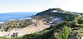 Bracelet Bay - geograph.org.uk - 19863.jpg 640 × 299; 62 KB
-
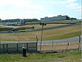 Brands Hatch - geograph.org.uk - 19993.jpg 638 × 480; 65 KB
-
 Brands Hatch - geograph.org.uk - 19995.jpg 640 × 480; 67 KB
-
 Bridge across the Leth fhonn - geograph.org.uk - 20350.jpg 640 × 480; 57 KB
-
 Bridge Inn, Topsham - geograph.org.uk - 20266.jpg 636 × 334; 87 KB
-
 Bridge over the River Skell - geograph.org.uk - 20280.jpg 640 × 480; 162 KB
-
 Bridport town - geograph.org.uk - 19954.jpg 640 × 385; 94 KB
-
 Buckland St Mary old rectory.jpg 640 × 480; 117 KB
-
 Budigarth, Haroldswick - geograph.org.uk - 305169.jpg 600 × 399; 15 KB
-
 Cam Chreag - geograph.org.uk - 20380.jpg 640 × 480; 157 KB
-
 Camping at Cae Du campsite - geograph.org.uk - 697382.jpg 640 × 480; 107 KB
-
 Campsite, Edale - geograph.org.uk - 106959.jpg 640 × 480; 70 KB
-
 Canalside Residence, Woolhampton Village - geograph.org.uk - 24081.jpg 640 × 480; 140 KB
-
 Capel-y-Garn - geograph.org.uk - 19674.jpg 640 × 480; 136 KB
-
 Caravans and Amusements, Clarach Bay - geograph.org.uk - 19677.jpg 640 × 480; 154 KB
-
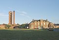 Cefn Coed Hospital - geograph.org.uk - 19854.jpg 640 × 442; 38 KB
-
 Chamberlain Road, Hull - geograph.org.uk - 19741.jpg 640 × 480; 95 KB
-

-
 Chawton Church - geograph.org.uk - 1106479.jpg 640 × 480; 100 KB
-
 Cholsey and Wallingford Railway 3.jpg 640 × 480; 86 KB
-
 Cliffs, Clarach Bay - geograph.org.uk - 19676.jpg 640 × 480; 153 KB
-
 Coastal view, Clarach Bay - geograph.org.uk - 19678.jpg 640 × 480; 139 KB
-
 Coastline view towards Ern Stack - geograph.org.uk - 40096.jpg 640 × 412; 48 KB
-
 Coes-faen from Barmouth Bridge - geograph.org.uk - 610691.jpg 640 × 480; 104 KB
-
 Colechester Castle.jpg 1,280 × 720; 680 KB
-
 Comins Coch - geograph.org.uk - 23379.jpg 640 × 480; 164 KB
-
 Corrie Fee - geograph.org.uk - 22212.jpg 640 × 480; 55 KB
-
 Corrie Kilbo - geograph.org.uk - 22215.jpg 640 × 480; 50 KB
-
 Cottages in Benvie - geograph.org.uk - 21398.jpg 640 × 480; 145 KB
-
 Countess Wear Bridge - geograph.org.uk - 20271.jpg 632 × 384; 98 KB
-
 Cragtop Bothy - geograph.org.uk - 230128.jpg 640 × 480; 93 KB
-
 Craigmillar Castle and Doocot - geograph.org.uk - 345716.jpg 640 × 480; 55 KB
-
 Cruise ship - geograph.org.uk - 283976.jpg 632 × 412; 73 KB
-
 Cryer's Hill Lane - geograph.org.uk - 1308861.jpg 640 × 480; 61 KB
-
 Damhead Organics - geograph.org.uk - 19691.jpg 640 × 451; 59 KB
-
 Dartington Church - geograph.org.uk - 20272.jpg 636 × 454; 126 KB
-
 Dartmoor ponies - geograph.org.uk - 411445.jpg 640 × 418; 158 KB
-
 Dee at Tongland.jpg 640 × 480; 146 KB
-
 Descent off Am Bodach - geograph.org.uk - 812298.jpg 480 × 640; 154 KB
-
 Disused railway, Winton. - geograph.org.uk - 88807.jpg 640 × 480; 74 KB
-
 Driesh and Little Driesh - geograph.org.uk - 22218.jpg 640 × 480; 69 KB
-
 Driesh Summit - geograph.org.uk - 22217.jpg 640 × 480; 77 KB
-
 Dumfries - Old Bridge - geograph.org.uk - 23595.jpg 640 × 480; 103 KB
-
 Eashing Bridge - geograph.org.uk - 19532.jpg 640 × 480; 194 KB
-
 East Links Elie - geograph.org.uk - 20450.jpg 640 × 480; 71 KB
-
 Eavestone Lake - geograph.org.uk - 20288.jpg 640 × 480; 153 KB
-
 Elie Golf Course Starter Hut - geograph.org.uk - 20451.jpg 640 × 480; 56 KB
-
 Emmetts - geograph.org.uk - 19972.jpg 637 × 480; 104 KB
-
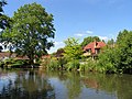
 Emsworth, the millpond - geograph.org.uk - 644522.jpg 640 × 429; 90 KB
-
 Ern Stack - geograph.org.uk - 40076.jpg 410 × 640; 56 KB
-
 Fair Brook - geograph.org.uk - 76504.jpg 480 × 640; 111 KB
-

-
 Fields and housing, nr. Bow Street - geograph.org.uk - 19632.jpg 640 × 480; 130 KB
-
 Findon Quarry - geograph.org.uk - 19625.jpg 640 × 480; 77 KB
-
 Fishing Boats by the Jetty - geograph.org.uk - 26358.jpg 640 × 427; 58 KB
-
 Foxgloves in a cleared area - geograph.org.uk - 73955.jpg 640 × 480; 157 KB
-
 Foxley Road Sunset - geograph.org.uk - 364367.jpg 640 × 480; 25 KB
-
 Freshmoor.jpg 640 × 480; 169 KB
-
 Frongoch Farm - geograph.org.uk - 19683.jpg 640 × 480; 155 KB
-
 Gardners Arms at Ardingly - geograph.org.uk - 19640.jpg 629 × 404; 58 KB
-
 Gatehouse to Meggernie Castle - geograph.org.uk - 20396.jpg 490 × 640; 175 KB
-
 George and Dragon, Clyst St. George - geograph.org.uk - 20268.jpg 636 × 424; 291 KB
-
 George Squared - Flickr - itmpa.jpg 1,478 × 1,477; 737 KB
-
 Gladsmuir old kirk - geograph.org.uk - 19752.jpg 640 × 458; 74 KB
-
 Gosport Millennium Time-space - geograph.org.uk - 81006.jpg 640 × 480; 143 KB
-
 Gough's Cave Reflection - geograph.org.uk - 994069.jpg 600 × 398; 93 KB
-
 Grandborough Manor - geograph.org.uk - 19653.jpg 640 × 480; 98 KB
-
 Gravel pit - geograph.org.uk - 19624.jpg 640 × 480; 100 KB
-

-
 Grey Seals on St Tudwal's Island East - geograph.org.uk - 79675.jpg 640 × 480; 170 KB
-
 Hatston Industrial Estate - geograph.org.uk - 283978.jpg 640 × 480; 78 KB
-
 Hebron Station.jpg 1,024 × 768; 156 KB
-
 High Grantley Village Hall - geograph.org.uk - 20287.jpg 640 × 480; 78 KB
-
 Hillend.jpg 640 × 421; 47 KB
-
 Hilltop Eavestone - geograph.org.uk - 20284.jpg 640 × 480; 168 KB
-
 Junction 29, M25 Motorway, Essex - geograph.org.uk - 19544.jpg 640 × 480; 93 KB
-
 Kennet and Avon Canal, Woolhampton - geograph.org.uk - 24078.jpg 640 × 480; 140 KB
-
 Kettlebury Hill - geograph.org.uk - 19610.jpg 640 × 480; 117 KB
-
 Kettlebury Hill - geograph.org.uk - 19616.jpg 640 × 480; 108 KB
-
 King Edward Mine - geograph.org.uk - 23327.jpg 640 × 479; 66 KB
-
 Kites Hardwick - geograph.org.uk - 19659.jpg 640 × 480; 127 KB
-
 Lake in Tatton Park - geograph.org.uk - 19787.jpg 640 × 480; 101 KB
-
 Largs Cumbrae ferry at slip.jpg 640 × 457; 98 KB
-
 Largs Promenade - geograph.org.uk - 20024.jpg 640 × 460; 121 KB
-

-
 Little Early Inclosure - geograph.org.uk - 19601.jpg 640 × 427; 125 KB
-
 All Saints Church, Llangorwen - geograph.org.uk - 19681.jpg 640 × 480; 135 KB
-
 Llynnau Gregennen - geograph.org.uk - 610606.jpg 640 × 480; 118 KB
-
 Local Shops, Jubilee Way - geograph.org.uk - 19960.jpg 636 × 288; 83 KB
-
 Loch Arthur - geograph.org.uk - 20390.jpg 480 × 640; 112 KB
-
 Loch Ba - geograph.org.uk - 20335.jpg 640 × 480; 46 KB
-
 Loch Spelve - geograph.org.uk - 20346.jpg 640 × 480; 51 KB
-

-
 Logan Botanic Gardens - geograph.org.uk - 1002509.jpg 640 × 480; 148 KB
-
 Logan Botanic Gardens - geograph.org.uk - 1111691.jpg 640 × 480; 143 KB
-
 Lonsdalecollegekidney.jpg 2,048 × 1,536; 888 KB
-

-
 M4 over River Neath.jpg 640 × 480; 87 KB
-
-
 Major General David Stewart - geograph.org.uk - 20505.jpg 480 × 640; 226 KB
-
 Mauchline Cross - geograph.org.uk - 297617.jpg 640 × 426; 70 KB
-
 Mauchline Parish Church - geograph.org.uk - 297572.jpg 426 × 640; 65 KB
-
 Mayar - geograph.org.uk - 22216.jpg 480 × 640; 46 KB
-
 Meadow at Fresh Moor - geograph.org.uk - 1606726.jpg 640 × 480; 114 KB
-
 Milford Hospital - geograph.org.uk - 19543.jpg 640 × 417; 102 KB
-
 Moorings on the River Tawe - geograph.org.uk - 23206.jpg 640 × 431; 62 KB
-
 Morton Mains - geograph.org.uk - 19672.jpg 640 × 451; 67 KB
-
 Mumbles Pier - geograph.org.uk - 19841.jpg 640 × 350; 37 KB
-
 New Ralph Cross, Rosedale - geograph.org.uk - 19609.jpg 480 × 640; 74 KB
-
 New woodland - geograph.org.uk - 19705.jpg 640 × 453; 63 KB
-
 Newsham Bridge - geograph.org.uk - 19617.jpg 640 × 480; 113 KB
-
 Old Royal Naval College, Greenwich - geograph.org.uk - 19760.jpg 640 × 480; 73 KB
-
 Orchardton Tower.jpg 640 × 480; 71 KB
-
 Ormiston.jpg 636 × 447; 98 KB
-
 Otter Warning Sign - geograph.org.uk - 26355.jpg 640 × 427; 36 KB
-
 Oystermouth Castle.jpg 640 × 434; 59 KB
-
 Padworth Lock at Aldermaston Wharf - geograph.org.uk - 19838.jpg 640 × 480; 431 KB
-
 Pasture and woodland, nr. Clarach - geograph.org.uk - 19675.jpg 640 × 480; 155 KB
-
 Pencaitland Railway - geograph.org.uk - 19703.jpg 640 × 480; 126 KB
-
 Pipe band - geograph.org.uk - 283981.jpg 640 × 480; 118 KB
-
 Pipe band in Albert St, Kirkwall - geograph.org.uk - 283982.jpg 640 × 480; 108 KB
-
 Portpatrick Harbour - geograph.org.uk - 1002507.jpg 640 × 480; 88 KB
-
 Post Box. Knock - geograph.org.uk - 19715.jpg 640 × 480; 79 KB
-
 Pound Lane - geograph.org.uk - 1606743.jpg 640 × 471; 78 KB
-

-
 Private Road entrance - geograph.org.uk - 20391.jpg 640 × 480; 171 KB
-

-
 Railway, Bow Street - geograph.org.uk - 19631.jpg 640 × 480; 178 KB
-
 Riverhead Church - geograph.org.uk - 19984.jpg 640 × 475; 76 KB
-
 Roker Pier - geograph.org.uk - 99298.jpg 640 × 480; 100 KB
-
 Ruscombe - geograph.org.uk - 24582.jpg 640 × 427; 108 KB
-
 Scott Street Bridge - geograph.org.uk - 19779.jpg 640 × 480; 80 KB
-
 Seal (East side) - geograph.org.uk - 19989.jpg 630 × 480; 72 KB
-
 Shetland ponies near Binnaquoy - geograph.org.uk - 283975.jpg 640 × 480; 83 KB
-
 Ship Inn, Morcombelake - geograph.org.uk - 19950.jpg 640 × 417; 106 KB
-
 Slopes of Foxdon Hill - geograph.org.uk - 1606669.jpg 640 × 477; 89 KB
-
 Sound of Barra Ferry Terminal, Barra - geograph.org.uk - 26376.jpg 640 × 427; 44 KB
-
 Southwold Pier1 KevinScottNL 2005.jpg 3,072 × 2,304; 2.81 MB
-
 Southwold Pier2 KevinScottNL 2005.jpg 2,304 × 3,072; 2.93 MB
-
 Southwold Pier3 KevinScottNL 2005.jpg 3,072 × 2,304; 2.86 MB
-
 SSW ridge of Cam Chreag - geograph.org.uk - 20513.jpg 640 × 480; 140 KB
-
 St Peters - Ardingly - geograph.org.uk - 19639.jpg 640 × 395; 88 KB
-
 Staplefitzpainechurch.jpg 480 × 640; 75 KB
-
 Sundridge Memorial - geograph.org.uk - 19978.jpg 640 × 480; 136 KB
-
 Survival craft inspectorate, Findon.jpg 640 × 480; 74 KB
-
 Swansea Marina (East) - geograph.org.uk - 23207.jpg 640 × 475; 67 KB
-
 Swansea-highst-railway.jpg 640 × 480; 77 KB
-
 Syston station - geograph.org.uk - 859520.jpg 640 × 480; 87 KB
-
 Tatton Old Hall - geograph.org.uk - 19786.jpg 640 × 570; 144 KB
-
 Thatched cottage - geograph.org.uk - 21390.jpg 640 × 480; 120 KB
-
 Thatched cottage - geograph.org.uk - 94700.jpg 640 × 482; 340 KB
-
 Thatched Dwellings, Kilmington - geograph.org.uk - 19945.jpg 633 × 305; 112 KB
-
 The Creek - geograph.org.uk - 305168.jpg 600 × 399; 13 KB
-
 The Creek, Haroldswick - geograph.org.uk - 305942.jpg 425 × 600; 35 KB
-
 The Cricketers. Great Notley's Village Pub - geograph.org.uk - 43085.jpg 640 × 426; 104 KB
-
 The Farmhouse, Brixington - geograph.org.uk - 19966.jpg 636 × 282; 74 KB
-
 The Greanamul Buoy - geograph.org.uk - 26375.jpg 427 × 640; 80 KB
-
 The Holt - geograph.org.uk - 24586.jpg 640 × 427; 93 KB
-
 The Mumbles Mile - geograph.org.uk - 19845.jpg 640 × 470; 78 KB
-
 The Needles and Needles Lighthouse - geograph.org.uk - 70602.jpg 640 × 479; 72 KB
-
 The Needles Light House - geograph.org.uk - 20105.jpg 640 × 480; 71 KB
-
 The Old Inn, Kilmington - geograph.org.uk - 19943.jpg 636 × 315; 85 KB
-
 The Quadrant Shopping Centre, Swansea - geograph.org.uk - 19833.jpg 640 × 506; 73 KB
-
-
 The road to Hedon - geograph.org.uk - 19748.jpg 640 × 370; 85 KB
-
 The Sand Spit St Mary's Well Bay - geograph.org.uk - 289483.jpg 640 × 480; 40 KB
-
 The Smit Young leaving South Queensferry for Sound point - panoramio.jpg 1,600 × 1,200; 621 KB
-
 The Weir, Topsham - geograph.org.uk - 20267.jpg 636 × 359; 296 KB
-
 Thistle Brands Hatch - geograph.org.uk - 19990.jpg 640 × 480; 84 KB
_from_Largs_Promenade_-_geograph.org.uk_-_20029.jpg)


_-_geograph.org.uk_-_19581.jpg)


_on_the_dunes_at_Machir_Bay_-_geograph.org.uk_-_101595.jpg)


_-_geograph.org.uk_-_19989.jpg)


_-_geograph.org.uk_-_23207.jpg)


