Category:United Kingdom photographs taken on 2005-06-02
Jump to navigation
Jump to search

Subcategories
This category has only the following subcategory.
Media in category "United Kingdom photographs taken on 2005-06-02"
The following 171 files are in this category, out of 171 total.
-
 American Memorial - geograph.org.uk - 15355.jpg 480 × 640; 105 KB
-
 Anlaby Road - geograph.org.uk - 23877.jpg 640 × 480; 118 KB
-
 Anstruther Harbour - geograph.org.uk - 831314.jpg 640 × 425; 60 KB
-
 At the end of a long track^ - geograph.org.uk - 14906.jpg 640 × 480; 74 KB
-
 Bamburgh Castle - geograph.org.uk - 16062.jpg 640 × 487; 98 KB
-
 Bamburgh Castle - geograph.org.uk - 16064.jpg 640 × 480; 92 KB
-
 Bamburgh Gargoyle - geograph.org.uk - 16063.jpg 640 × 550; 100 KB
-
 Barricane Beach - geograph.org.uk - 348249.jpg 640 × 512; 105 KB
-
 Berney Arms Mill - geograph.org.uk - 83902.jpg 480 × 640; 71 KB
-
 Bewdley bridge - geograph.org.uk - 592516.jpg 640 × 414; 70 KB
-
 Blackstone Rock - geograph.org.uk - 592518.jpg 640 × 438; 79 KB
-
 Brampton - geograph.org.uk - 17800.jpg 640 × 538; 72 KB
-
 Byrness Youth Hostel - geograph.org.uk - 48589.jpg 640 × 480; 113 KB
-
 Cadge's Mill - Reedham Marshes - geograph.org.uk - 83912.jpg 480 × 640; 88 KB
-
 Carradale Harbour - geograph.org.uk - 58022.jpg 640 × 480; 53 KB
-
 Carradale Harbour - geograph.org.uk - 58023.jpg 640 × 480; 76 KB
-
 Carraig Fhada - geograph.org.uk - 15822.jpg 640 × 480; 83 KB
-
 Cemetery - geograph.org.uk - 15823.jpg 640 × 480; 92 KB
-
 St Martin, Cheriton, Kent - Tower - geograph.org.uk - 326036.jpg 497 × 640; 156 KB
-
 St Martin, Cheriton, Kent.jpg 640 × 480; 151 KB
-
 Church crossroads, Horningtoft - geograph.org.uk - 306498.jpg 640 × 417; 79 KB
-
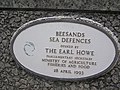
 Coastal defences, Beesands - geograph.org.uk - 69707.jpg 640 × 480; 130 KB
-
 Cock O' the Walk - geograph.org.uk - 1276024.jpg 640 × 409; 146 KB
-
 Course of the Dorchester Roman Aqueduct - geograph.org.uk - 24399.jpg 640 × 480; 445 KB
-
 Crail Harbour - geograph.org.uk - 831288.jpg 640 × 425; 92 KB
-
 Cullercoats Bay - geograph.org.uk - 16406.jpg 640 × 480; 102 KB
-
-
 Derrickhill to Offton village - geograph.org.uk - 958962.jpg 640 × 341; 44 KB
-
 Distant farm - geograph.org.uk - 14922.jpg 640 × 480; 71 KB
-
 Dun Athad - geograph.org.uk - 15512.jpg 640 × 480; 84 KB
-
 Farm building - geograph.org.uk - 14934.jpg 640 × 480; 134 KB
-
 Farm road - geograph.org.uk - 14923.jpg 640 × 480; 97 KB
-
 Farm road - geograph.org.uk - 14925.jpg 640 × 480; 95 KB
-
 Farm road - geograph.org.uk - 14939.jpg 640 × 480; 78 KB
-
 Farmhouse - geograph.org.uk - 14919.jpg 640 × 480; 93 KB
-
 Fisons factory, Bramford - geograph.org.uk - 958879.jpg 640 × 480; 71 KB
-
 Fisons factory, Bramford - geograph.org.uk - 958884.jpg 640 × 480; 70 KB
-
 Footpath - geograph.org.uk - 14941.jpg 640 × 480; 140 KB
-
 Garstang Basin - geograph.org.uk - 951317.jpg 640 × 480; 69 KB
-
 Gill Pier, Bay of Pierowall - geograph.org.uk - 90807.jpg 640 × 480; 57 KB
-
 Grobust bay - geograph.org.uk - 90801.jpg 640 × 480; 78 KB
-
 Holt Fleet bridge - geograph.org.uk - 592544.jpg 640 × 436; 68 KB
-
 Hull Royal Infirmary - geograph.org.uk - 23899.jpg 640 × 480; 151 KB
-
 Hyde Park 1 - geograph.org.uk - 14785.jpg 640 × 480; 74 KB
-
 Hyde Park 2 - geograph.org.uk - 14786.jpg 640 × 480; 115 KB
-
 Hyde Park 3 - geograph.org.uk - 14788.jpg 640 × 480; 108 KB
-
 Hyde Park Bandstand - geograph.org.uk - 14790.jpg 640 × 480; 160 KB
-
 Keyingham Church - geograph.org.uk - 14911.jpg 640 × 480; 84 KB
-
 Keyingham Drain - geograph.org.uk - 14946.jpg 640 × 480; 86 KB
-
 Keyingham Ski Pond - geograph.org.uk - 14948.jpg 640 × 480; 77 KB
-
 Kiln Point - geograph.org.uk - 16061.jpg 640 × 480; 118 KB
-
 Linhay Business Park, Ashburton - geograph.org.uk - 14683.jpg 629 × 329; 61 KB
-
 Linhay Quarry, Ashburton - geograph.org.uk - 14688.jpg 630 × 417; 75 KB
-
 Loch Sgioport (Skipport) - geograph.org.uk - 32494.jpg 640 × 480; 92 KB
-
 Lockgate Mill - geograph.org.uk - 83906.jpg 480 × 640; 81 KB
-
 Looking over to the Cathedral - geograph.org.uk - 831266.jpg 640 × 425; 54 KB
-
 Lunan Beach - geograph.org.uk - 831199.jpg 640 × 425; 28 KB
-
 Lympne Castle, Kent, UK.jpg 640 × 480; 116 KB
-
 Lytham Windmill - geograph.org.uk - 951287.jpg 640 × 480; 42 KB
-
 Lytham windmill - geograph.org.uk - 951294.jpg 640 × 480; 43 KB
-
 Monkey-Marsh-lock-by-John-Lloyd.jpg 640 × 480; 132 KB
-
 Mull of Oa - geograph.org.uk - 15348.jpg 640 × 480; 127 KB
-
-
 New Housing at Halfmoon - geograph.org.uk - 14673.jpg 636 × 424; 120 KB
-
 North Mill, Reedham.jpg 480 × 640; 102 KB
-
 Offton Church - geograph.org.uk - 958864.jpg 640 × 480; 88 KB
-
 Offton village green - geograph.org.uk - 958870.jpg 640 × 480; 61 KB
-
 Old Dunrobin Castle - geograph.org.uk - 793636.jpg 640 × 480; 101 KB
-
 Old station building - geograph.org.uk - 14935.jpg 640 × 480; 107 KB
-
 On the minor road south of Keyingham - geograph.org.uk - 14913.jpg 640 × 480; 92 KB
-

-
 Ottringham Church - geograph.org.uk - 14926.jpg 640 × 480; 75 KB
-
 Pavilion, Beesands - geograph.org.uk - 1622371.jpg 640 × 411; 37 KB
-
 Pennine Way north of Bellingham - geograph.org.uk - 48482.jpg 640 × 480; 115 KB
-
 Pennine Way, Redesdale Forest - geograph.org.uk - 48490.jpg 640 × 480; 132 KB
-
 Pierowall - geograph.org.uk - 90827.jpg 640 × 480; 55 KB
-
 Piles Copse - geograph.org.uk - 26274.jpg 480 × 640; 62 KB
-
 Plymouth Sound , 3 boats - geograph.org.uk - 82938.jpg 640 × 480; 66 KB
-
 Polkey's Mill 1 - Reedham Marshes - geograph.org.uk - 83914.jpg 480 × 640; 76 KB
-
 Polkey's Mill 2 - Reedham Marshes - geograph.org.uk - 83917.jpg 480 × 640; 105 KB
-
 Port Ellen Distillery - geograph.org.uk - 15395.jpg 640 × 480; 93 KB
-
 Promenade - geograph.org.uk - 16485.jpg 640 × 480; 93 KB
-
 Queen Elizabeth Gate, Hyde Park - geograph.org.uk - 14792.jpg 640 × 480; 138 KB
-
 Rip Rap at Beesands - geograph.org.uk - 69705.jpg 640 × 480; 152 KB
-
 Rocky Outcrops - geograph.org.uk - 15350.jpg 640 × 480; 82 KB
-

-
-
 Sea Cliffs - geograph.org.uk - 15358.jpg 640 × 480; 101 KB
-
 Sea defences, Beesands - geograph.org.uk - 69710.jpg 640 × 480; 154 KB
-
 Sedgemoor Services - geograph.org.uk - 15669.jpg 640 × 480; 104 KB
-
 Sgeir Fhada - geograph.org.uk - 15828.jpg 640 × 480; 56 KB
-
 Sherwood Forest Caravan Park - geograph.org.uk - 18489.jpg 640 × 481; 132 KB
-

-
 Snitterfield - Pigeon Green - geograph.org.uk - 14708.jpg 640 × 480; 83 KB
-
 Somersham village sign - geograph.org.uk - 958874.jpg 640 × 480; 93 KB
-
 St Leonard, Hythe, Kent - Chancel - geograph.org.uk - 326084.jpg 480 × 640; 103 KB
-
 St Leonard, Hythe, Kent - geograph.org.uk - 326082.jpg 640 × 480; 139 KB
-
 St Leonard, Hythe, Kent - geograph.org.uk - 326083.jpg 640 × 490; 108 KB
-
 St Leonard, Hythe, Kent - Sanctuary - geograph.org.uk - 326086.jpg 480 × 640; 122 KB
-
 St Leonard, Hythe, Kent - Window - geograph.org.uk - 326085.jpg 445 × 640; 177 KB
-
 St Martin, Cheriton, Kent - Churchyard - geograph.org.uk - 326038.jpg 480 × 640; 189 KB
-
 St Martin, Cheriton, Kent - East end - geograph.org.uk - 326035.jpg 452 × 640; 121 KB
-
 St Michael, Hythe, Kent - geograph.org.uk - 326040.jpg 640 × 386; 96 KB
-
 St Michael, Hythe, Kent - geograph.org.uk - 326041.jpg 640 × 509; 172 KB
-
 St Michael, Hythe, Kent - geograph.org.uk - 326043.jpg 640 × 500; 147 KB
-

-

-
 St Peter and St Paul, Saltwood, Kent - geograph.org.uk - 326072.jpg 640 × 451; 114 KB
-
 St Peter and St Paul, Saltwood, Kent - geograph.org.uk - 326076.jpg 640 × 474; 160 KB
-
 St Stephen, Lympne, Kent - East end - geograph.org.uk - 326059.jpg 458 × 640; 95 KB
-
 St Stephen, Lympne, Kent - geograph.org.uk - 326052.jpg 640 × 538; 143 KB
-
 St Stephen, Lympne, Kent - geograph.org.uk - 326054.jpg 640 × 429; 112 KB
-
 St Stephen, Lympne, Kent - geograph.org.uk - 326056.jpg 640 × 421; 130 KB
-
 St Stephen, Lympne, Kent - geograph.org.uk - 326057.jpg 480 × 640; 134 KB
-
 St Stephen, Lympne, Kent - Window - geograph.org.uk - 326060.jpg 242 × 640; 110 KB
-

-
 Statue of Achilles - geograph.org.uk - 14783.jpg 640 × 480; 99 KB
-
 Tarbert graveyard - geograph.org.uk - 1087228.jpg 640 × 480; 88 KB
-
 Tay Bridge walkway - geograph.org.uk - 831215.jpg 640 × 425; 37 KB
-
 Tenby - South Beach - geograph.org.uk - 166324.jpg 640 × 480; 60 KB
-
-
 The Bower - geograph.org.uk - 92212.jpg 640 × 480; 103 KB
-
 The Crooked Billet - geograph.org.uk - 14902.jpg 640 × 435; 65 KB
-
-

-
 The new track at TA24112314 - geograph.org.uk - 14918.jpg 640 × 480; 96 KB
-
 The road at Bridge Bungalows - geograph.org.uk - 14908.jpg 640 × 480; 85 KB
-
 Tin Sandcastles - geograph.org.uk - 16425.jpg 640 × 480; 98 KB
-
 Tower Bridge at dusk - geograph.org.uk - 100598.jpg 480 × 640; 51 KB
-
 Train-Lawrence Hill Station - Flickr - Greater Bristol Metro Rail.jpg 1,772 × 1,283; 2.24 MB
-
 Wellington Arch - geograph.org.uk - 14795.jpg 640 × 480; 83 KB
-
 West Port St Andrews - geograph.org.uk - 844783.jpg 640 × 425; 95 KB
-
 Westmead Hawk.jpg 595 × 480; 67 KB
-
 Widdicombe Ley - geograph.org.uk - 1622368.jpg 640 × 255; 30 KB
-
 Widmead-Lock-by-John-Lloyd.jpg 640 × 480; 130 KB
-
 Windfarm - geograph.org.uk - 150717.jpg 640 × 426; 62 KB
-
 Windmill - geograph.org.uk - 14924.jpg 640 × 599; 95 KB
-
 Windmill at Lytham - geograph.org.uk - 951290.jpg 640 × 480; 39 KB
-
 Botanic Gardens Sidings - geograph.org.uk - 23815.jpg 640 × 480; 134 KB
-
 Bottom Lock, Stourport - geograph.org.uk - 592533.jpg 640 × 435; 76 KB
-
 Bridleway Bridge - geograph.org.uk - 92209.jpg 640 × 480; 153 KB
-
 Brownrigg Head - geograph.org.uk - 48483.jpg 640 × 480; 116 KB
-
 Carradale Harbour - geograph.org.uk - 58021.jpg 640 × 480; 62 KB
-
 Carradale Point. - geograph.org.uk - 53356 (cropped).jpg 565 × 424; 44 KB
-
 Carradale Point. - geograph.org.uk - 53356.jpg 640 × 480; 79 KB
-
 Dufton - geograph.org.uk - 17791.jpg 640 × 567; 87 KB
-
 Farmland north of Bere Regis - geograph.org.uk - 24381.jpg 640 × 480; 384 KB
-
 Homestead remains excavated - geograph.org.uk - 737547.jpg 640 × 503; 146 KB
-
 Information Board ... - geograph.org.uk - 15519.jpg 640 × 480; 106 KB
-
 Irish Bridge - geograph.org.uk - 92210.jpg 640 × 480; 109 KB
-
 Jerry's Linn (waterfall) - geograph.org.uk - 92206.jpg 640 × 480; 127 KB
-

-

-
 Lympne Castle, Kent - from churchyard - geograph.org.uk - 326062.jpg 640 × 480; 131 KB
-
 Lympne Castle, Kent - geograph.org.uk - 326066.jpg 640 × 439; 103 KB
-
 Malthouse Farm across field - geograph.org.uk - 311116.jpg 640 × 427; 99 KB
-
-

-
 Piddlehinton surroundings - geograph.org.uk - 24397.jpg 640 × 480; 404 KB
-
 Port nan Gallan - geograph.org.uk - 15514.jpg 640 × 480; 106 KB
-
 Rocky Islands - geograph.org.uk - 15359.jpg 640 × 480; 56 KB
-

-
 Snitterfield - Bushes Farm - geograph.org.uk - 14704.jpg 640 × 480; 89 KB
-
 Snitterfield - Heath End - geograph.org.uk - 14711.jpg 640 × 480; 91 KB
-
 Stronachavie - geograph.org.uk - 139777.jpg 640 × 480; 76 KB
-
 Summit Cairn, Bleaberry Haws - geograph.org.uk - 20412.jpg 640 × 480; 69 KB
-
 Sunset over Nuthall - geograph.org.uk - 63740.jpg 640 × 476; 81 KB
-
-
 Waterfall - geograph.org.uk - 308869.jpg 637 × 451; 112 KB
-
 Wolverton - geograph.org.uk - 14706.jpg 640 × 480; 98 KB
-
 Woodbury Hill - geograph.org.uk - 24386.jpg 640 × 480; 365 KB


_-_geograph.org.uk_-_32494.jpg)


.jpg)


_-_geograph.org.uk_-_92206.jpg)


