Category:United Kingdom photographs taken on 2005-04-04
Jump to navigation
Jump to search
| ← | Monday 4 April 2005 | → | ||
| ← | April 2005 | → | ||

United Kingdom photographs taken on 4 April 2005.
Image files should be categorized here automatically using {{taken on}} template. Direct categorisation is also possible, if automatic is impossible.
Media in category "United Kingdom photographs taken on 2005-04-04"
The following 57 files are in this category, out of 57 total.
-
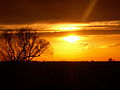
 A sunset at Eastoft, Lincolnshire 01.JPG 2,560 × 1,920; 1.35 MB
-
 A sunset at Eastoft, Lincolnshire 02.JPG 2,560 × 1,920; 1.57 MB
-
 A sunset at Eastoft, Lincolnshire 03.JPG 2,560 × 1,920; 1.87 MB
-
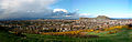
 Ashton-under-Lyne, UK - panoramio.jpg 2,048 × 1,536; 681 KB
-
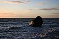
 Ballycastle waves - geograph.org.uk - 736928.jpg 640 × 420; 68 KB
-
 Beaumaris Castle - geograph.org.uk - 194836.jpg 640 × 480; 235 KB
-
 Beech trees below Cairn Hill - geograph.org.uk - 429627.jpg 640 × 479; 162 KB
-
 Black Hill view.jpg 640 × 480; 67 KB
-
 Box Hill - geograph.org.uk - 2395.jpg 640 × 170; 11 KB
-
 Breibhig Harbour - geograph.org.uk - 7661.jpg 474 × 640; 132 KB
-
 Caen Hill Flight, Lock 44 Downwards - geograph.org.uk - 321203.jpg 480 × 640; 88 KB
-
 Cairn Table Summit - geograph.org.uk - 6196.jpg 640 × 462; 73 KB
-

-
 Culvert under dry stone dyke - geograph.org.uk - 429639.jpg 640 × 479; 161 KB
-
 Dog on Achmelvich Beach - geograph.org.uk - 723989.jpg 640 × 426; 137 KB
-
 Dunkeld Cathedral - geograph.org.uk - 414271.jpg 640 × 410; 106 KB
-
 Dunkeld Cathedral - geograph.org.uk - 414277.jpg 640 × 411; 130 KB
-
 Eavestone Lake.jpg 512 × 640; 57 KB
-

-
 Foremark dam.jpg 2,530 × 1,892; 1.32 MB
-
 Former Assynt Primary School Elphin - geograph.org.uk - 825919.jpg 640 × 406; 164 KB
-
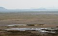
 Howden Dyke on the River Ouse, East Riding of Yorkshire, England 01.jpg 2,560 × 1,383; 2.72 MB
-
 Howden Dyke on the River Ouse, East Riding of Yorkshire, England 02.jpg 2,560 × 1,920; 3.96 MB
-

-
 Lindisfarne - geograph.org.uk - 18199.jpg 639 × 392; 41 KB
-
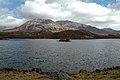
 Loch an Aigeil - geograph.org.uk - 724324.jpg 640 × 426; 160 KB
-
 Loch Shieldaig - geograph.org.uk - 548086.jpg 640 × 480; 99 KB
-
 Loch Stack - geograph.org.uk - 724194.jpg 640 × 426; 150 KB
-
 Martinstown - geograph.org.uk - 98310.jpg 640 × 480; 127 KB
-
 Mounting Block in High Street Beckley - geograph.org.uk - 758873.jpg 640 × 401; 91 KB
-
-
 Pattieshorn Low Loch - geograph.org.uk - 429512.jpg 640 × 479; 86 KB
-
 Summit ridge of Arkle - geograph.org.uk - 301028.jpg 640 × 349; 73 KB
-
 Talybont Reservoir, dam at north end - geograph.org.uk - 88109.jpg 640 × 480; 78 KB
-
 The Crown at Alvediston - geograph.org.uk - 94920.jpg 640 × 480; 115 KB
-
 The End of the Rainbow. - geograph.org.uk - 462214.jpg 480 × 640; 37 KB
-
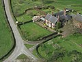 The Home Farm from Beeston Castle - geograph.org.uk - 372270.jpg 640 × 480; 93 KB
-

-

-
 Tropical Palms in Ventor Botanic Garden - geograph.org.uk - 1009681.jpg 480 × 640; 128 KB
-
 Trwyn Maen Dylan - geograph.org.uk - 7316.jpg 640 × 429; 71 KB
-
 View across to holcome - geograph.org.uk - 341761.jpg 640 × 480; 131 KB
-
 Wood beside the A894 - geograph.org.uk - 736867.jpg 640 × 431; 330 KB
-
 Approaching Loch Shin on the A838 - geograph.org.uk - 723948.jpg 640 × 426; 146 KB
-
 Birnam Post Office - geograph.org.uk - 409367.jpg 640 × 409; 117 KB
-
 Black Rock Sands - geograph.org.uk - 28843.jpg 640 × 480; 45 KB
-
 Craig Leek - geograph.org.uk - 101812.jpg 640 × 482; 81 KB
-
 Croft at Pollan, Assynt, Sutherland - geograph.org.uk - 110943.jpg 640 × 426; 195 KB
-
 Dune slack on the Sefton coast - geograph.org.uk - 1351.jpg 640 × 480; 75 KB
-
 Footpath by the River Tay - geograph.org.uk - 414294.jpg 638 × 640; 227 KB
-

-
 Hightown on the dunes - geograph.org.uk - 1364.jpg 640 × 480; 86 KB
-
 Newholm - geograph.org.uk - 1857.jpg 640 × 480; 38 KB
-
 Path by the River Tay - geograph.org.uk - 414323.jpg 640 × 639; 224 KB
-
 River Tay near Dunkeld - geograph.org.uk - 414320.jpg 639 × 640; 210 KB
-
 Saltwick Nab - geograph.org.uk - 1780.jpg 640 × 480; 35 KB
-
 Street in Puddletown - geograph.org.uk - 108056.jpg 640 × 480; 83 KB


