Category:United Kingdom photographs taken on 2004-08-27
Jump to navigation
Jump to search
| ← | Friday 27 August 2004 | → | ||
| ← | August 2004 | → | ||

United Kingdom photographs taken on 27 August 2004.
Image files should be categorized here automatically using {{taken on}} template. Direct categorisation is also possible, if automatic is impossible.
Media in category "United Kingdom photographs taken on 2004-08-27"
The following 56 files are in this category, out of 56 total.
-
 156443 at Carlisle.JPG 2,048 × 1,536; 667 KB
-
 37411 'The Scottish Railway Preservation Society' at Carlisle.JPG 2,048 × 1,536; 686 KB
-
 390045 at Carlisle.JPG 2,048 × 1,536; 696 KB
-
 87030 'Black Douglas' at Carlisle.jpg 2,048 × 1,536; 698 KB
-
 90015 'The International Brigades' at Carlisle.JPG 2,048 × 1,536; 674 KB
-
 A view of Blackwaterfoot. - geograph.org.uk - 134556.jpg 640 × 480; 120 KB
-
 Beechgrove Terrace, Aberdeen - geograph.org.uk - 142648.jpg 640 × 480; 85 KB
-
 Bodiam Castle entrance - geograph.org.uk - 19386.jpg 600 × 294; 72 KB
-
 Broad Haven beach - geograph.org.uk - 81901.jpg 640 × 480; 92 KB
-
 Callaly, Bronze Age round cairn - geograph.org.uk - 29668.jpg 614 × 461; 76 KB
-
 Church near Brynsiencyn, Anglesey - geograph.org.uk - 32674.jpg 640 × 480; 90 KB
-
 Cliffs along coast - geograph.org.uk - 145592.jpg 640 × 394; 96 KB
-
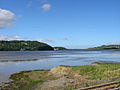 Conwy Estuary from Llansanffraid - geograph.org.uk - 32654.jpg 640 × 480; 70 KB
-
 Deal Pier at low water - geograph.org.uk - 1097378.jpg 640 × 480; 44 KB
-
 St Mary's Church, Ditchingham - geograph.org.uk - 198079.jpg 480 × 640; 122 KB
-
 Finals for Kirkwall Airport - geograph.org.uk - 591955.jpg 640 × 427; 69 KB
-
 Former chapel, Langley Street - geograph.org.uk - 198096.jpg 640 × 480; 101 KB
-
 Houses in Church Street, Knighton - geograph.org.uk - 29756.jpg 640 × 417; 78 KB
-
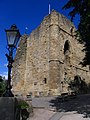 Knaresborough Castle - geograph.org.uk - 12902.jpg 480 × 640; 110 KB
-
 All Hallows, Regent Terrace, Leeds - geograph.org.uk - 94114.jpg 640 × 426; 100 KB
-
 Loch Morlich. - geograph.org.uk - 420576.jpg 640 × 427; 78 KB
-
 Marloes beach - geograph.org.uk - 15848.jpg 640 × 425; 113 KB
-
 Mill Haven - geograph.org.uk - 95999.jpg 640 × 480; 112 KB
-
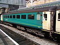 Mk 2F TSO 6035 at Carlisle.JPG 2,048 × 1,536; 671 KB
-
 Motorway Sidings - geograph.org.uk - 346010.jpg 640 × 426; 124 KB
-
 Narrowboats near Braunston - geograph.org.uk - 1650541.jpg 640 × 427; 69 KB
-
 Piece Hall North Entrance - geograph.org.uk - 947.jpg 640 × 480; 41 KB
-
 Sidmouth , Jacob's Ladder - geograph.org.uk - 1140247.jpg 512 × 640; 38 KB
-
 Sidmouth , Sea Wall - geograph.org.uk - 1140259.jpg 640 × 512; 44 KB
-
 Skomer Island - geograph.org.uk - 15841.jpg 640 × 425; 67 KB
-
 St Bees Railway station, Cumbria - geograph.org.uk - 1502572.jpg 640 × 432; 71 KB
-
 St. Martin Of Tours, West Coker - geograph.org.uk - 1170638.jpg 640 × 480; 85 KB
-
 St. Martin Of Tours, West Coker - geograph.org.uk - 1170674.jpg 480 × 640; 48 KB
-

-

-
 Tenements in Jamaica Street, Aberdeen - geograph.org.uk - 109592.jpg 640 × 480; 82 KB
-

-

-

-
 Walshaw Dean Reservoirs - geograph.org.uk - 360273.jpg 640 × 480; 91 KB
-

-

-

-

-
 Glenmore Lodge. - geograph.org.uk - 420573.jpg 640 × 427; 89 KB
-
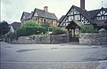
 Hannah's House, Castlegate, Knaresborough - geograph.org.uk - 12908.jpg 640 × 480; 114 KB
-
 Hardware Shop, Castlegate, Knaresborough - geograph.org.uk - 12901.jpg 640 × 480; 168 KB
-
 Market Square, Knaresborough - geograph.org.uk - 12906.jpg 640 × 480; 106 KB
-
 On Saughy Hill - geograph.org.uk - 315907.jpg 640 × 480; 55 KB
-
 Pennine Way crossing Haworth Moor - geograph.org.uk - 364871.jpg 640 × 480; 72 KB
-
 Skomer and the Anvil - geograph.org.uk - 15859.jpg 640 × 425; 136 KB
-
-
 Track to the east of Saughy Hill - geograph.org.uk - 315904.jpg 640 × 480; 87 KB
-
 Usway Burn looking upstream - geograph.org.uk - 315930.jpg 640 × 480; 99 KB
-
 Vale of Edale - geograph.org.uk - 11083.jpg 480 × 640; 58 KB
-
 Victorian Railway Viaduct, Knaresborough - geograph.org.uk - 12907.jpg 640 × 480; 197 KB


