Category:United Kingdom photographs taken on 2004-08-01
Jump to navigation
Jump to search
| ← | Sunday 1 August 2004 | → | ||
| ← | August 2004 | → | ||

United Kingdom photographs taken on 1 August 2004.
Image files should be categorized here automatically using {{taken on}} template. Direct categorisation is also possible, if automatic is impossible.
Subcategories
This category has the following 2 subcategories, out of 2 total.
Media in category "United Kingdom photographs taken on 2004-08-01"
The following 106 files are in this category, out of 106 total.
-
 '257 Squadron' at Swanage - geograph.org.uk - 854877.jpg 640 × 470; 126 KB
-
 Agill Dam - geograph.org.uk - 466688.jpg 640 × 480; 60 KB
-

-
 Barcos pesqueros en puerto de Ullapool, Escocia - panoramio.jpg 2,048 × 1,536; 2.92 MB
-
 Barn door - geograph.org.uk - 49923.jpg 480 × 640; 87 KB
-
 Barnoid - Bombus Lapidarius (by-sa).jpg 1,134 × 846; 315 KB
-

-
 Bay of Ollaberry - geograph.org.uk - 101430.jpg 640 × 480; 70 KB
-
-
 Boat and Bikes at Dunwich - geograph.org.uk - 20679.jpg 640 × 480; 67 KB
-

-
 Clevedon Pier - geograph.org.uk - 10378.jpg 640 × 482; 76 KB
-
 Col between Yr Elen and Carnedd Llewelyn - geograph.org.uk - 192496.jpg 640 × 514; 112 KB
-
 Comb Fellside - geograph.org.uk - 17616.jpg 640 × 480; 89 KB
-
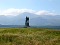 Commando Memorial, Spean Bridge - geograph.org.uk - 107762.jpg 640 × 480; 99 KB
-
 Corfe Castle - geograph.org.uk - 854903.jpg 640 × 433; 85 KB
-
 Corfe Castle village - geograph.org.uk - 855567.jpg 640 × 480; 77 KB
-
 Cwm Caseg and Ffynnon Caseg - geograph.org.uk - 192562.jpg 593 × 640; 120 KB
-

-
 Disused leadmines in the Elan valley - geograph.org.uk - 220866.jpg 640 × 480; 148 KB
-
 Doddington Hall - panoramio - PJMarriott (1).jpg 2,048 × 1,536; 718 KB
-
 Doddington Hall - panoramio - PJMarriott.jpg 2,048 × 1,536; 789 KB
-
 Doddington Hall - panoramio.jpg 2,048 × 1,536; 922 KB
-
 Dun Caan, Raasay - geograph.org.uk - 39026.jpg 480 × 640; 53 KB
-
 Eilean Ruisteil 652257.jpg 640 × 410; 63 KB
-
 Entrance to Doddington Hall - panoramio.jpg 2,048 × 1,536; 773 KB
-

-
 Fairford church - geograph.org.uk - 2443.jpg 640 × 480; 51 KB
-
 Farmland near Grange of Cree - geograph.org.uk - 1040049.jpg 640 × 480; 92 KB
-
 Garden at Doddington Hall - panoramio - PJMarriott.jpg 2,048 × 1,536; 828 KB
-
 Garden at Doddington Hall - panoramio.jpg 2,048 × 1,536; 709 KB
-
 Gatehouse Doddington Hall - panoramio.jpg 2,048 × 1,536; 708 KB
-
 HenryJenkinsMemorial.jpeg 450 × 600; 99 KB
-
 Highland cattle Inverlochy Castle farm. - geograph.org.uk - 107769.jpg 640 × 480; 188 KB
-
 Inverlochy Castle. - geograph.org.uk - 107767.jpg 640 × 480; 145 KB
-
 Linhope Vale - geograph.org.uk - 17614.jpg 640 × 480; 54 KB
-
 Loch a' Chada-charnaich, Raasay - geograph.org.uk - 39031.jpg 480 × 640; 52 KB
-

-
 Low Bridestones - geograph.org.uk - 1602125.jpg 640 × 457; 91 KB
-
 Lower Cwm Llechen - geograph.org.uk - 59675.jpg 640 × 480; 94 KB
-
 Main entrance Inverlochy Castle. - geograph.org.uk - 107768.jpg 640 × 480; 140 KB
-
 Melrose Abbey01.jpg 1,600 × 1,200; 1,004 KB
-
 Melrose Abbey02.jpg 1,600 × 1,200; 1.02 MB
-
 Melrose Abbey03.jpg 1,600 × 1,200; 880 KB
-

-

-
 Sailor's Bethel Newcastle - geograph.org.uk - 248347.jpg 640 × 480; 54 KB
-
 Noche de verano en Ullapool - panoramio.jpg 1,772 × 1,329; 192 KB
-
 Noche de verano en Ullapool, Escocia - panoramio.jpg 1,280 × 960; 131 KB
-
 Norden station, Swanage Railway - geograph.org.uk - 854892.jpg 640 × 480; 92 KB
-

-

-
 Richmond Park - geograph.org.uk - 1120164.jpg 640 × 475; 165 KB
-
 River Tyne near Ovingham - geograph.org.uk - 957912.jpg 640 × 480; 77 KB
-
-

-
 Sail Liath - geograph.org.uk - 1022591.jpg 480 × 640; 135 KB
-
 Sculpture, Longleat - geograph.org.uk - 256195.jpg 640 × 480; 103 KB
-
 Start Bay - geograph.org.uk - 191171.jpg 640 × 480; 91 KB
-
 Summit Cairn of Sail Liath - geograph.org.uk - 1022599.jpg 640 × 480; 92 KB
-
 The Mythic Garden, Stone Farm - geograph.org.uk - 970519.jpg 640 × 480; 200 KB
-
 The River Weaver, near Kingsley. - geograph.org.uk - 65262.jpg 640 × 480; 68 KB
-
 Traeth Llyfn from the coastal path. - geograph.org.uk - 911302.jpg 640 × 480; 76 KB
-
 Traigh Chrossapol, Coll - geograph.org.uk - 8304.jpg 640 × 480; 134 KB
-
 Turls Head and Gruna Stack - geograph.org.uk - 99193.jpg 640 × 480; 71 KB
-
 Uig Sands, Isle of Lewis - geograph.org.uk - 31372.jpg 640 × 480; 64 KB
-
 Ullapool, Escocia - panoramio.jpg 2,048 × 1,536; 2.5 MB
-

-
 Upper Loch Torridon from Beinn Damh - geograph.org.uk - 347675.jpg 640 × 480; 71 KB
-
 View from Lochindorb castle - geograph.org.uk - 326488.jpg 640 × 480; 85 KB
-
 View of Crathes Castle Garden - geograph.org.uk - 18286.jpg 640 × 480; 147 KB
-
 View of Culross - geograph.org.uk - 172422.jpg 640 × 480; 103 KB
-
 Vital Spark at Crinan lock basin. - geograph.org.uk - 233936.jpg 640 × 480; 129 KB
-
 Warter Road, Middleton on the Wolds - geograph.org.uk - 6679.jpg 640 × 480; 103 KB
-
 Whitstone and Bridgerule station - geograph.org.uk - 727855.jpg 640 × 426; 69 KB
-
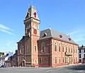 Wigtown Town Hall - geograph.org.uk - 1232692.jpg 640 × 549; 102 KB
-
 Yr Elen summit - geograph.org.uk - 192566.jpg 640 × 600; 123 KB
-
 Yr Elen summit and east ridge - geograph.org.uk - 192548.jpg 574 × 640; 111 KB
-
 Beinn Heasgarnich and Lochan. - geograph.org.uk - 9557.jpg 640 × 480; 74 KB
-
 Carn Mor - geograph.org.uk - 387310.jpg 640 × 480; 61 KB
-
 Coire Ban Beag - geograph.org.uk - 9561.jpg 640 × 423; 58 KB
-
 Coire Ban Mor - geograph.org.uk - 9558.jpg 640 × 444; 48 KB
-
 Cotton grass on Beinn Heasgarnich - geograph.org.uk - 9563.jpg 640 × 449; 71 KB
-
 Drium an Aonaich, Raasay - geograph.org.uk - 39484.jpg 640 × 480; 70 KB
-
 Headland at southern end of Hell's Mouth - geograph.org.uk - 439423.jpg 600 × 451; 194 KB
-
 Hillside - geograph.org.uk - 18411.jpg 640 × 480; 50 KB
-
 Langleeford Vale - geograph.org.uk - 18415.jpg 480 × 640; 85 KB
-
 Main Road, Coll - geograph.org.uk - 8320.jpg 640 × 480; 81 KB
-
 Maol Chean-Dearg from Beinn Damh - geograph.org.uk - 347671.jpg 640 × 480; 53 KB
-
 Moine Achlarich - geograph.org.uk - 9556.jpg 640 × 480; 55 KB
-
 Mynydd Cwm Mynach - geograph.org.uk - 59687.jpg 640 × 480; 97 KB
-
 Old gravestone - geograph.org.uk - 254466.jpg 444 × 640; 129 KB
-
 On Meall a'Chail - geograph.org.uk - 9564.jpg 640 × 453; 69 KB
-
 Railway Bridge at Spey Bay - geograph.org.uk - 116338.jpg 640 × 480; 75 KB
-

-
 Sand Martin nests at Hell's Mouth - geograph.org.uk - 439438.jpg 600 × 450; 188 KB
-
 Shank Burn Valley - geograph.org.uk - 17620.jpg 640 × 480; 78 KB
-

-
 St Bride's Haven - geograph.org.uk - 73757.jpg 640 × 480; 131 KB
-
 Stagsike - geograph.org.uk - 4196.jpg 640 × 480; 70 KB
-
 Standrop Rigg - geograph.org.uk - 18426.jpg 640 × 480; 58 KB
-
 Summit, Creag nam Bodach - geograph.org.uk - 9555.jpg 640 × 395; 46 KB
-
 Tearing Ledges - Scillies - geograph.org.uk - 31518.jpg 640 × 425; 53 KB
-

-
 Tullich Kirkyard notice - geograph.org.uk - 254462.jpg 640 × 439; 79 KB
-
 Upper Cwm Llechen - geograph.org.uk - 59693.jpg 640 × 480; 117 KB


.jpg)


.jpg)

.jpg)


_-_geograph.org.uk_-_254457.jpg)


