Category:United Kingdom photographs taken on 2004-05-08
Jump to navigation
Jump to search

Subcategories
This category has the following 2 subcategories, out of 2 total.
Media in category "United Kingdom photographs taken on 2004-05-08"
The following 96 files are in this category, out of 96 total.
-
 River Thames at night - geograph.org.uk - 57679.jpg 640 × 480; 34 KB
-
 Thames Path at Abingdon bridge - geograph.org.uk - 58879.jpg 640 × 474; 80 KB
-
 Abingdon High Street - geograph.org.uk - 58902.jpg 640 × 480; 88 KB
-
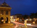 Abingdon museum and market square - geograph.org.uk - 58891.jpg 640 × 474; 66 KB
-
 Barton Court, Abingdon - geograph.org.uk - 58897.jpg 471 × 640; 132 KB
-
 Aire and Calder Navigation - geograph.org.uk - 1725.jpg 640 × 480; 215 KB
-
 All Saints, Great Steeping - geograph.org.uk - 436588.jpg 640 × 480; 70 KB
-
 All Saints, Great Steeping - geograph.org.uk - 436591.jpg 640 × 480; 81 KB
-
 All Saints, Great Steeping - geograph.org.uk - 436600.jpg 640 × 480; 62 KB
-
 All Saints, Great Steeping - geograph.org.uk - 436606.jpg 480 × 640; 42 KB
-
 All Saints, Great Steeping - geograph.org.uk - 436607.jpg 480 × 640; 68 KB
-
 All Saints, Great Steeping - geograph.org.uk - 436612.jpg 480 × 640; 128 KB
-
-
 All Saints, Theydon Garnon, Essex - geograph.org.uk - 334900.jpg 422 × 640; 101 KB
-

-
 Aqueduct at Stanley Ferry - geograph.org.uk - 1723.jpg 640 × 480; 258 KB
-
 Balliol College, Oxford - geograph.org.uk - 58956.jpg 640 × 480; 84 KB
-
 Blenheim Palace grounds - geograph.org.uk - 58945.jpg 640 × 480; 77 KB
-
 Bluebells in the deerpark - geograph.org.uk - 866025.jpg 640 × 480; 107 KB
-
 Bluebells in the woods - geograph.org.uk - 7807.jpg 640 × 480; 183 KB
-
 Boat in Port Logan Harbour - geograph.org.uk - 12779.jpg 504 × 360; 31 KB
-
 Bradford-on-Avon Town Bridge - geograph.org.uk - 20547.jpg 640 × 480; 110 KB
-
 Buildings at Manod Quarry - geograph.org.uk - 251556.jpg 640 × 441; 54 KB
-
 St Laurence Church - geograph.org.uk - 444689.jpg 427 × 640; 92 KB
-
 St. Bartholomew's Church, Corsham - geograph.org.uk - 515518.jpg 640 × 480; 94 KB
-
 Erme Pits - geograph.org.uk - 15218.jpg 640 × 425; 164 KB
-
 Erme stream - geograph.org.uk - 15217.jpg 640 × 425; 186 KB
-
 Footpath near St Andrew's Church, Firsby - geograph.org.uk - 432740.jpg 640 × 480; 126 KB
-
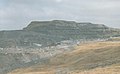 Graig Ddu Quarry - geograph.org.uk - 251537.jpg 640 × 393; 37 KB
-
 Hampton Court Palace (255703615).jpg 1,200 × 1,600; 365 KB
-
 Hampton Court Palace Gardens.jpg 1,600 × 1,200; 364 KB
-
 Harrowthorn plantation - Dartmoor - geograph.org.uk - 120620.jpg 640 × 425; 104 KB
-
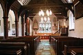
 Interior of St Andrew, Firsby - geograph.org.uk - 432722.jpg 480 × 640; 65 KB
-
 Interior of St Andrew, Firsby - geograph.org.uk - 432723.jpg 480 × 640; 76 KB
-
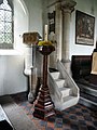
 Interior of St Andrew, Firsby - geograph.org.uk - 432725.jpg 480 × 640; 79 KB
-
 Interior of St Andrew, Firsby - geograph.org.uk - 432727.jpg 480 × 640; 82 KB
-
 Interior of St Andrew, Firsby - geograph.org.uk - 432728.jpg 640 × 480; 77 KB
-
 Interior of St Andrew, Firsby - geograph.org.uk - 432730.jpg 640 × 480; 87 KB
-
 Interior of St Andrew, Firsby - geograph.org.uk - 432734.jpg 480 × 640; 71 KB
-
 Interior of St Andrew, Firsby - geograph.org.uk - 432735.jpg 640 × 480; 76 KB
-
 Interior of St Andrew, Firsby - geograph.org.uk - 432737.jpg 640 × 480; 55 KB
-
 Jubilee Pool - geograph.org.uk - 848534.jpg 640 × 432; 73 KB
-
 Kilchurn Castle from the boat - geograph.org.uk - 254009.jpg 640 × 440; 112 KB
-
 Langcombe Hill - Dartmoor - geograph.org.uk - 120574.jpg 640 × 425; 151 KB
-
 Langcombe Hill - Dartmoor - geograph.org.uk - 21340.jpg 640 × 425; 149 KB
-
 Little Houghton from bypass. - geograph.org.uk - 493273.jpg 640 × 480; 128 KB
-
 London Cathedrale Saint-Paul 08052004 - panoramio.jpg 1,361 × 1,814; 492 KB
-
 London Harrod's Brompton Road 07052004 - panoramio.jpg 1,814 × 1,361; 782 KB
-
 London Smithfield Market 08052004 - panoramio.jpg 1,361 × 1,814; 758 KB
-
 London Tower London White Tower 08052004 - panoramio.jpg 1,814 × 1,361; 858 KB
-
 London Tower of London Tower Bridge 08052004 - panoramio.jpg 1,760 × 1,260; 556 KB
-
 London Tower of London White Tower Chapelle Saint-Jean 08052004 - panoramio.jpg 1,814 × 1,361; 720 KB
-
 LondonTower of London Palais Medieval 08052004 - panoramio.jpg 1,814 × 1,361; 691 KB
-
 Mill Loch - geograph.org.uk - 438631.jpg 640 × 480; 130 KB
-
 Millennium stone, Woodstock - geograph.org.uk - 58947.jpg 524 × 640; 88 KB
-
 Mousehole - geograph.org.uk - 308757.jpg 640 × 480; 129 KB
-
 Mull of Galloway Lighthouse - geograph.org.uk - 12770.jpg 504 × 360; 28 KB
-

-
 Old Trafford (262757615).jpg 1,600 × 1,200; 340 KB
-
 Old Trafford (262774812).jpg 1,600 × 1,200; 352 KB
-
 Penlee Memorials - geograph.org.uk - 848496.jpg 640 × 480; 139 KB
-
 Penzance Heliport - geograph.org.uk - 31551.jpg 640 × 373; 58 KB
-
 Plenty of Silverware on Display in the Manchester United Museum (262764554).jpg 1,600 × 1,200; 366 KB
-
 Ryan Giggs (Manchester United Museum) - Flickr - edwin.11.jpg 1,600 × 1,200; 316 KB
-

-

-
 St Andrew, Firsby - geograph.org.uk - 432721.jpg 480 × 640; 142 KB
-
 St Helen's Church, Abingdon - geograph.org.uk - 58895.jpg 503 × 640; 57 KB
-
 St Mary Bourne - War Memorial - geograph.org.uk - 573503.jpg 512 × 640; 156 KB
-
 St Mary's Church Penzance - geograph.org.uk - 308813.jpg 640 × 427; 76 KB
-
 Starbucks leeds.jpg 800 × 600; 99 KB
-
 Statue de Busby à Old Trafford.jpg 1,600 × 1,200; 336 KB
-

-
 Stourhead Lake on cold spring day - geograph.org.uk - 1776546.jpg 640 × 480; 108 KB
-
 The Bell at Avening - geograph.org.uk - 365208.jpg 640 × 427; 55 KB
-
 The Meadows - geograph.org.uk - 15216.jpg 640 × 425; 148 KB
-

-
 Tidal Swimming Pool - geograph.org.uk - 848470.jpg 640 × 403; 75 KB
-
 Tribune Est de Old Trafford.jpg 1,600 × 1,200; 342 KB
-
 Up for Repairs - geograph.org.uk - 308782.jpg 640 × 427; 85 KB
-
 St. Laurence Upton, Slough - geograph.org.uk - 71130.jpg 640 × 512; 115 KB
-
 Waterfall, Middle Black Clough - geograph.org.uk - 380251.jpg 480 × 640; 96 KB
-
 Weir by Abingdon lock - geograph.org.uk - 58885.jpg 640 × 480; 93 KB
-
 Welcome to Little Houghton. - geograph.org.uk - 493054.jpg 640 × 480; 120 KB
-
 Bare House from the South West - geograph.org.uk - 440818.jpg 640 × 480; 45 KB
-
 End of the Road^ - geograph.org.uk - 493065.jpg 640 × 480; 127 KB
-

-
 Marazion Marsh - geograph.org.uk - 31550.jpg 640 × 423; 84 KB
-
 Moons Plantation - geograph.org.uk - 235246.jpg 640 × 480; 77 KB
-
 Residential street, Old Woodstock - geograph.org.uk - 58952.jpg 516 × 640; 99 KB
-
 The Newlyn River reaches the Sea - geograph.org.uk - 308798.jpg 640 × 480; 102 KB
-

-
 View from Waggles toilet - geograph.org.uk - 126181.jpg 640 × 492; 65 KB
-

-
 Waggles toilet - geograph.org.uk - 126176.jpg 640 × 492; 127 KB
-
 Welland Valley Vineyard, East Farndon - geograph.org.uk - 289771.jpg 640 × 480; 135 KB


.jpg)


.jpg)
.jpg)


.jpg)
_-_Flickr_-_edwin.11.jpg)


