Category:United Kingdom photographs taken on 2003-03-23
Jump to navigation
Jump to search
| ← | Sunday 23 March 2003 | → | ||
| ← | March 2003 | → | ||

United Kingdom photographs taken on 23 March 2003.
Image files should be categorized here automatically using {{taken on}} template. Direct categorisation is also possible, if automatic is impossible.
Subcategories
This category has only the following subcategory.
Media in category "United Kingdom photographs taken on 2003-03-23"
The following 45 files are in this category, out of 45 total.
-
 Aerial Photograph of Castle Morris - geograph.org.uk - 946657.jpg 640 × 449; 99 KB
-
 Aerial Photograph of Castle Morris - geograph.org.uk - 946658.jpg 640 × 457; 125 KB
-
 Aerial view of Castle Morris - geograph.org.uk - 946659.jpg 640 × 446; 107 KB
-
 An English Cottage - geograph.org.uk - 559153.jpg 640 × 480; 94 KB
-
 Batsford church - geograph.org.uk - 5497.jpg 640 × 498; 68 KB
-
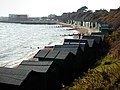
 Beach huts at Hill Head - geograph.org.uk - 417585.jpg 640 × 480; 127 KB
-
 Beach Huts at Hill Head - geograph.org.uk - 452243.jpg 640 × 480; 99 KB
-

-
 Building a new Broadway - geograph.org.uk - 404238.jpg 640 × 480; 71 KB
-
 Building the Broadway Gardens Fountain - geograph.org.uk - 404241.jpg 640 × 480; 106 KB
-
 Byway through the Woods - geograph.org.uk - 44336.jpg 640 × 427; 141 KB
-
 Castell y Gwynt silhouette - geograph.org.uk - 193235.jpg 640 × 398; 136 KB
-
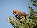 Common Crossbill (Loxia curvirostra) - geograph.org.uk - 419190.jpg 640 × 480; 50 KB
-
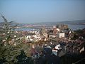 Conwy - geograph.org.uk - 28847.jpg 640 × 480; 71 KB
-
 Dunwich beach - geograph.org.uk - 841967.jpg 640 × 480; 73 KB
-
 Llyn y Gaseg-fraith and Glyder Fach - geograph.org.uk - 193232.jpg 640 × 454; 102 KB
-
-
 Llyn y Gaseg-Fraith and Y Foel Goch - geograph.org.uk - 193230.jpg 640 × 398; 231 KB
-
 Goleigh Manor - geograph.org.uk - 44315.jpg 640 × 427; 89 KB
-
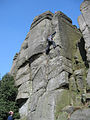 Rock climbing on Burbage Edge - geograph.org.uk - 689150.jpg 480 × 640; 107 KB
-
 Selborne, Hampshire - geograph.org.uk - 44320.jpg 640 × 427; 128 KB
-
 St Laurence Church - geograph.org.uk - 111904.jpg 640 × 427; 127 KB
-
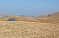
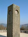 Stone Island at Carsington Water - geograph.org.uk - 206399.jpg 360 × 480; 31 KB
-
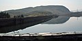 Tanygrisiau reservoir - geograph.org.uk - 1041855.jpg 640 × 320; 212 KB
-
 Tanygrisiau reservoir - geograph.org.uk - 1041862.jpg 640 × 409; 286 KB
-
 The Dam, Llyn Stwlan - geograph.org.uk - 1041874.jpg 640 × 480; 388 KB
-
 The landslip near Hawkley - geograph.org.uk - 44344.jpg 640 × 426; 69 KB
-
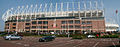 The Stadium of Light.jpg 640 × 252; 97 KB
-
 Tipping fingers, Lee Quarry - geograph.org.uk - 534810.jpg 640 × 480; 64 KB
-
 Tryfan and Llyn y Gaseg-fraith - geograph.org.uk - 193231.jpg 640 × 480; 121 KB
-
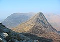 Tryfan with Pen yr Ole Wen behind - geograph.org.uk - 193233.jpg 640 × 442; 120 KB
-
 View from Glyder Fach summit plain - geograph.org.uk - 193234.jpg 640 × 428; 97 KB
-
 Welcome to Lancashire - geograph.org.uk - 221497.jpg 640 × 536; 66 KB
-
 Window at St Teilo's Church, Llandeloy - geograph.org.uk - 946539.jpg 483 × 640; 134 KB
-
 Y Foel Goch summit - geograph.org.uk - 193229.jpg 640 × 375; 87 KB
-
 Along the Dam, Llyn Stwlan - geograph.org.uk - 1041881.jpg 640 × 480; 334 KB
-

-
 Boulder - geograph.org.uk - 634199.jpg 480 × 640; 80 KB
-
 Calder Place from Muirside Street. - geograph.org.uk - 1462892.jpg 640 × 483; 45 KB
-

-
 Daffodils in Huckers Lane - geograph.org.uk - 44326.jpg 640 × 427; 134 KB
-
 Field near Six Mile Bottom - geograph.org.uk - 23859.jpg 640 × 480; 66 KB
-
-
 Ford near Gillingham - geograph.org.uk - 306374.jpg 640 × 480; 97 KB
-
 Small tarn near Neaum Crag - geograph.org.uk - 240922.jpg 640 × 442; 49 KB


_-_geograph.org.uk_-_419190.jpg)


