Category:United Kingdom photographs taken on 2003-02-15
Jump to navigation
Jump to search
| ← | Saturday 15 February 2003 | → | ||
| ← | February 2003 | → | ||

United Kingdom photographs taken on 15 February 2003.
Image files should be categorized here automatically using {{taken on}} template. Direct categorisation is also possible, if automatic is impossible.
Subcategories
This category has only the following subcategory.
D
Media in category "United Kingdom photographs taken on 2003-02-15"
The following 51 files are in this category, out of 51 total.
-
 A'Bhuidheanach Bheag - geograph.org.uk - 31197.jpg 640 × 480; 48 KB
-
 At the side of a copse on the Wolds Way - geograph.org.uk - 10206.jpg 640 × 480; 122 KB
-
 Cattedown - geograph.org.uk - 293048.jpg 640 × 427; 83 KB
-
 Does this stop dizziness^ - geograph.org.uk - 43100.jpg 640 × 360; 99 KB
-
 Hartshead Green - geograph.org.uk - 827538.jpg 640 × 457; 369 KB
-
 High Teighton How - geograph.org.uk - 11490.jpg 640 × 480; 109 KB
-
 Holm Dale - geograph.org.uk - 10218.jpg 640 × 480; 88 KB
-
 Huggate from the Wolds Way - geograph.org.uk - 10204.jpg 640 × 480; 110 KB
-
 Just north of Great Plantation - geograph.org.uk - 10216.jpg 640 × 480; 115 KB
-
 Llangollen Canal at Ellesmere (Salop) - geograph.org.uk - 52017.jpg 640 × 480; 174 KB
-
 Llyn y Foel, Moel Siabod - geograph.org.uk - 71601.jpg 640 × 480; 67 KB
-
 London Anti Iraq War march, 15Feb 2003.jpg 312 × 452; 38 KB
-
 Looking down West Dale - geograph.org.uk - 10217.jpg 480 × 640; 125 KB
-
 Moel Siabod Summit Ridge - geograph.org.uk - 71610.jpg 640 × 480; 93 KB
-
 Mount Batten Memorial and Tower - geograph.org.uk - 293311.jpg 496 × 640; 69 KB
-
 Mountbatten Redoubt and Breakwater - geograph.org.uk - 31347.jpg 640 × 411; 85 KB
-
 Near Hartshead Green - geograph.org.uk - 827540.jpg 640 × 457; 324 KB
-
 Near Lily Lanes - geograph.org.uk - 827539.jpg 640 × 457; 298 KB
-
 Near Lily Lanes - geograph.org.uk - 827576.jpg 640 × 457; 341 KB
-
 Nobland Green Farm - geograph.org.uk - 811980.jpg 640 × 480; 44 KB
-
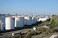 Oil Storage Tanks by the Cattewater - geograph.org.uk - 293046.jpg 640 × 427; 70 KB
-
 Old Rectory Hardington Mandeville - geograph.org.uk - 507739.jpg 640 × 480; 110 KB
-
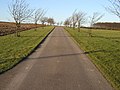 On the road to Northfield House - geograph.org.uk - 10220.jpg 640 × 480; 124 KB
-

-
 Piers from an old Railway Bridge - geograph.org.uk - 104180.jpg 640 × 438; 92 KB
-
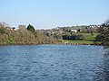
 Pomphett Lake.jpg 640 × 427; 82 KB
-
 Radford Lake Causeway - geograph.org.uk - 293233.jpg 640 × 427; 94 KB
-
 Radford Lake in Plymstock - geograph.org.uk - 31351.jpg 640 × 480; 99 KB
-
 Reflection of Shipbrook Hill farmhouse - geograph.org.uk - 896186.jpg 640 × 494; 174 KB
-
 Shropshire Union Canal at Tetchill - geograph.org.uk - 51925.jpg 640 × 480; 100 KB
-
 South-East Ridge - Moel Siabod - geograph.org.uk - 144389.jpg 640 × 311; 41 KB
-
 Summit of Stob Coire Easain - geograph.org.uk - 221591.jpg 640 × 480; 72 KB
-
 The Barbican, Plymouth - geograph.org.uk - 31410.jpg 640 × 419; 97 KB
-
 The Cattewater - geograph.org.uk - 104054.jpg 640 × 391; 46 KB
-

-
 The Path from Capel Curig to Moel Siabod - geograph.org.uk - 71603.jpg 640 × 480; 117 KB
-
 The Rocky Eastern Ridge of Moel Siabod - geograph.org.uk - 71607.jpg 640 × 480; 101 KB
-

-
 The view up Holm Dale - geograph.org.uk - 278503.jpg 640 × 480; 113 KB
-
 The west entrance to Ellesmere "tunnel" - geograph.org.uk - 51818.jpg 640 × 480; 175 KB
-
 The Wolds Way - geograph.org.uk - 10211.jpg 640 × 480; 136 KB
-
 Thixen Dale - geograph.org.uk - 8805.jpg 640 × 480; 111 KB
-
 Tun Dale - geograph.org.uk - 8802.jpg 640 × 480; 127 KB
-
 Two Bridges Cross The Laira - geograph.org.uk - 293055.jpg 640 × 480; 71 KB
-
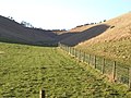
 View down Holm Dale - geograph.org.uk - 278500.jpg 640 × 480; 138 KB
-
 Where Harper, Horse and Holm Dales meet. - geograph.org.uk - 10219.jpg 640 × 480; 142 KB
-

-
 Long Crag - geograph.org.uk - 11492.jpg 640 × 480; 116 KB
-
 Tarnclose Crag - geograph.org.uk - 11487.jpg 640 × 480; 153 KB
-
 Thixen Dale - geograph.org.uk - 8806.jpg 640 × 480; 132 KB
-
 Wrynose Fell - geograph.org.uk - 11494.jpg 640 × 480; 110 KB


_-_geograph.org.uk_-_52017.jpg)


