Category:United Kingdom photographs taken on 2002-05-31
Jump to navigation
Jump to search

Media in category "United Kingdom photographs taken on 2002-05-31"
The following 51 files are in this category, out of 51 total.
-
 Achnasheen - geograph.org.uk - 1742063.jpg 800 × 600; 239 KB
-
 Beinn Shiantaidh from Beinn an Oir - geograph.org.uk - 1465068.jpg 640 × 367; 72 KB
-
 Borvemore - geograph.org.uk - 76270.jpg 640 × 404; 84 KB
-
 Bull Ring outdoor market. - geograph.org.uk - 708018.jpg 640 × 480; 104 KB
-
 Bwlch y Gwyddel - geograph.org.uk - 893893.jpg 640 × 480; 48 KB
-
 Carn a'Ghille Chearr summit. - geograph.org.uk - 18865.jpg 640 × 406; 61 KB
-
 Carn na h-Iolaire. - geograph.org.uk - 18867.jpg 640 × 407; 48 KB
-
 Cnoc na Seilg - geograph.org.uk - 18861.jpg 640 × 409; 54 KB
-
 Descending from Fionn Bheinn - geograph.org.uk - 533870.jpg 800 × 561; 215 KB
-
 Dunan's Castle, Glendaruel - geograph.org.uk - 367299.jpg 349 × 640; 104 KB
-
 Dunan's Castle, Glendaruel - geograph.org.uk - 367302.jpg 640 × 426; 100 KB
-
 Dunans Castle, Glendaruel - geograph.org.uk - 367295.jpg 460 × 513; 141 KB
-
 Dunans Castle, Glendaruel, from bridge - geograph.org.uk - 367287.jpg 640 × 375; 133 KB
-
 Gleann an t-Siob - geograph.org.uk - 1464844.jpg 640 × 368; 63 KB
-

-
 In Birmingham Rag Market. - geograph.org.uk - 708019.jpg 640 × 480; 89 KB
-
 Lane and farmland near Edgmond - geograph.org.uk - 869909.jpg 640 × 480; 83 KB
-
 Llandudno and Deganwy from the Great Orme - geograph.org.uk - 116331.jpg 640 × 480; 105 KB
-
 Llandudno from the Great Orme - geograph.org.uk - 116339.jpg 640 × 480; 106 KB
-
 Looking up to Hay Bluff - geograph.org.uk - 740321.jpg 640 × 425; 47 KB
-
 North-east ridge of Beinn an Oir - geograph.org.uk - 1465238.jpg 640 × 368; 78 KB
-
 On Carn Eachie - geograph.org.uk - 18863.jpg 640 × 411; 41 KB
-
 Pass of Aberglaslyn - geograph.org.uk - 893873.jpg 640 × 480; 92 KB
-
 Pendeen Church - geograph.org.uk - 16770.jpg 640 × 480; 119 KB
-
 Red deer below Beinn Shiantaidh - geograph.org.uk - 1465275.jpg 640 × 368; 102 KB
-

-
 Skelbo Street - geograph.org.uk - 783317.jpg 640 × 265; 45 KB
-
 Snowdon Mountain Railway - geograph.org.uk - 210506.jpg 640 × 480; 87 KB
-
 Snowdon Mountain Railway - geograph.org.uk - 642556.jpg 640 × 480; 68 KB
-
 Snowdon Mountain Railway - geograph.org.uk - 642559.jpg 640 × 480; 53 KB
-
 Snowdon Mountain Railway - geograph.org.uk - 642560.jpg 640 × 480; 103 KB
-
 Snowdon Mountain Railway - geograph.org.uk - 642562.jpg 640 × 480; 103 KB
-

-
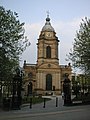 St Philip's Cathedral - geograph.org.uk - 708037.jpg 480 × 640; 88 KB
-
 Talland Bay from the West - geograph.org.uk - 254206.jpg 640 × 480; 108 KB
-
 The summit of Beinn an Oir - geograph.org.uk - 1465142.jpg 640 × 368; 69 KB
-
 The summit of Fionn Bheinn - geograph.org.uk - 533865.jpg 800 × 600; 232 KB
-
 View out over the Toll Mor - geograph.org.uk - 533868.jpg 640 × 463; 52 KB
-
 View west from Fionn Bheinn - geograph.org.uk - 1013263.jpg 640 × 480; 62 KB
-
 Waterstones bookshop New St. - geograph.org.uk - 708017.jpg 640 × 480; 101 KB
-
 West Wemyss from near Blair Point - geograph.org.uk - 1141322.jpg 480 × 640; 53 KB
-
 Westminster, The Clock - geograph.org.uk - 493422.jpg 431 × 640; 90 KB
-
-
 Beinn a'Chaolais from Beinn an Oir - geograph.org.uk - 1465042.jpg 640 × 368; 79 KB
-
 Beinn a'Chaolais from Beinn an Oir - geograph.org.uk - 1465095.jpg 640 × 368; 66 KB
-
 Beinn an Oir, south side - geograph.org.uk - 1464863.jpg 640 × 368; 73 KB
-
 Cutting into Lansallos Cove - geograph.org.uk - 254227.jpg 480 × 640; 93 KB
-
 Heathland Pond near Pompey's Corner - geograph.org.uk - 28701.jpg 640 × 480; 192 KB
-
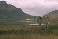 Loch Long - geograph.org.uk - 675830.jpg 640 × 427; 50 KB
-
 Struan cottage - geograph.org.uk - 76275.jpg 640 × 428; 78 KB
-


