Category:Underhoull
Jump to navigation
Jump to search
English: Underhoull is a hamlet on the island of Unst, in the council area of the Shetland Islands, Scotland.
Media in category "Underhoull"
The following 22 files are in this category, out of 22 total.
-
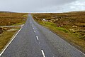
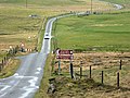
 A698 near Underhoull - geograph.org.uk - 5943713.jpg 800 × 533; 541 KB
-
-
 Broch of Underhoull from Vinstrick Ness - geograph.org.uk - 2921732.jpg 800 × 532; 201 KB
-
 Houll at Vinstrick - geograph.org.uk - 2921745.jpg 800 × 532; 200 KB
-

-

-
 Kirkamires, Westing - geograph.org.uk - 1282593.jpg 640 × 424; 62 KB
-

-
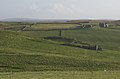
 Newhouse and Burragarth, Westing - geograph.org.uk - 953843.jpg 640 × 426; 90 KB
-
 Newhouse, Westing - geograph.org.uk - 1282607.jpg 640 × 426; 93 KB
-
 Noust at Underhoull and Lund.jpg 3,024 × 4,032; 4.36 MB
-
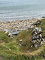
 Ottersgeo, Westing - geograph.org.uk - 6788557.jpg 1,600 × 740; 369 KB
-
 Scarecrow at Underhoull, Westing - geograph.org.uk - 4732034.jpg 1,024 × 576; 90 KB
-
 Schoolhouse, Westing - geograph.org.uk - 1282625.jpg 640 × 426; 70 KB
-
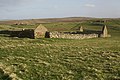
 Schoolhouse, Westing - geograph.org.uk - 982122.jpg 640 × 426; 80 KB
-
 Silage fields at Underhoull, Westing - geograph.org.uk - 5101810.jpg 1,024 × 681; 184 KB
-
 Small shed at Underhoull, Westing - geograph.org.uk - 5539193.jpg 1,024 × 682; 226 KB
-
 The road to Underhoull and Westing - geograph.org.uk - 5010563.jpg 2,592 × 1,944; 1.46 MB
-
 Tourist information signs - geograph.org.uk - 4505266.jpg 640 × 480; 247 KB
-
 Underhoull broch, Westing - geograph.org.uk - 305796.jpg 600 × 399; 45 KB
-
 Underhoull dig, Westing - geograph.org.uk - 953823.jpg 640 × 426; 135 KB
-


