Category:Underground Cologne
Jump to navigation
Jump to search
| Object location | | View all coordinates using: OpenStreetMap |
|---|
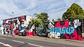
club in Ehrenfeld, Germany  | |||||
| Upload media | |||||
| Instance of | |||||
|---|---|---|---|---|---|
| Location | Ehrenfeld, Cologne, Cologne Government Region, North Rhine-Westphalia, Germany | ||||
| Start time |
| ||||
| End time |
| ||||
| official website | |||||
 | |||||
Subcategories
This category has only the following subcategory.
Media in category "Underground Cologne"
The following 21 files are in this category, out of 21 total.
-
 2016-09-12-Heliosturm Köln-8212.jpg 3,798 × 5,697; 11.82 MB
-
 Blowsight Underground 2011.JPG 4,752 × 3,168; 3.41 MB
-
 Coldburn Live Cologne 2.jpeg 3,264 × 2,448; 3.91 MB
-
 Coldburn Live Cologne.jpeg 3,264 × 2,448; 3.92 MB
-
 Eric Spring in 't Veld.jpg 875 × 581; 60 KB
-
 Intwine.jpg 885 × 586; 64 KB
-
 Jacob Streefkerk.jpg 582 × 768; 56 KB
-
 Jacobstreefkerk.JPG 582 × 845; 47 KB
-
 Jon Symons.jpg 805 × 535; 53 KB
-
 Jonsymons.JPG 554 × 844; 59 KB
-
 Kvelertak @ Underground (ColoniaCologne, Köln).jpg 3,020 × 2,448; 1.1 MB
-
 Kvelertak @ Underground (ColoniaCologne, Köln)2.jpg 3,264 × 2,448; 1.47 MB
-
 LizaLiWiki.jpg 1,294 × 1,506; 410 KB
-
 Roger Peterson.jpg 583 × 876; 54 KB
-
 Rogerpeterson.JPG 581 × 840; 46 KB
-
 The Ice - Cologne 2009.jpg 945 × 631; 628 KB
-
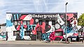
 Underground Club Cologne.jpg 1,280 × 960; 295 KB
-
 Underground Cologne 2017-1844.jpg 4,213 × 2,370; 6.85 MB
-
 Underground Cologne 2017-1845.jpg 4,213 × 2,370; 7.61 MB
-
 Underground Cologne 2017-1846.jpg 4,299 × 2,418; 8.09 MB
-
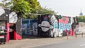
 Underground in Ehrenfeld 2012.jpg 1,680 × 1,120; 309 KB


.jpg)
2.jpg)


