Category:Ullet Road, Liverpool
Jump to navigation
Jump to search

Ullet Road is a short (1.3 miles) road connecting Dingle, Liverpool (A561) to Smithdown Road (A562). It is formerly part of the A5089 (as which it is still shown on some online maps) but renamed the B5342 in the 2010s.
Subcategories
This category has the following 17 subcategories, out of 17 total.
2
6
A
B
H
I
- The Inglenook (7 F)
M
- Mary Clark Home (7 F)
P
- Park Mount, 38 Ullet Road (3 F)
- Parkside, Ullet Road (5 F)
- Princes Lodge, Sefton Park (9 F)
R
S
- Sefton Court Mansions (5 F)
- Sefton View, 40 Ullet Road (3 F)
U
- Ullet Grange, 36 Ullet Road (4 F)
- Ullet Road gates to Sefton Park (13 F)
Media in category "Ullet Road, Liverpool"
The following 30 files are in this category, out of 30 total.
-
 42, Ullet Road.jpg 3,000 × 4,000; 4.81 MB
-
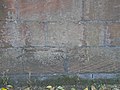
 Benchmark at 25 Ullet Road.jpg 4,128 × 3,402; 6.44 MB
-
 Benchmark at 36 Ullet Road.jpg 3,594 × 3,180; 6.42 MB
-
 Benchmark at 4 & 6 Ullet Road.jpg 4,266 × 2,838; 6.62 MB
-
 Benchmark at 48 Ullet Road.jpg 4,278 × 3,024; 6.87 MB
-
 Benchmark at Alexandra Drive & Ullet Road.jpg 4,308 × 3,732; 8.12 MB
-
 Benchmark at Sefton Court Mansions.jpg 5,184 × 3,456; 12.2 MB
-
 Benchmark at St Hilda's School.jpg 3,954 × 3,384; 6.8 MB
-
 Benchmark at Ullet Road & Linnet Lane.jpg 4,710 × 3,630; 8.67 MB
-
 Benchmark on wall of Turner Memorial Home.jpg 5,152 × 3,864; 7.4 MB
-
 Benchmark opposite 117 Ullet Road.jpg 5,152 × 3,864; 7.53 MB
-
 Benchmark opposite 99 & 101 Ullet Road.jpg 4,182 × 3,336; 7.65 MB
-
 Benchmark, Ancient Chapel of Toxteth.jpg 4,073 × 3,303; 7.09 MB
-
 Esso petrol station, Ullet Road.jpg 5,152 × 3,864; 7.51 MB
-
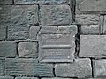 Health Committee plate, junction Alexandra Drive.jpg 5,152 × 3,864; 6.92 MB
-
 Health Committee plate, Ullet Road.jpg 4,833 × 3,418; 8.51 MB
-
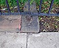 Pivot benchmark opposite Parkfield Road.jpg 4,092 × 3,372; 7.29 MB
-
 Red brick house, Ullet Road - geograph.org.uk - 2650586.jpg 2,592 × 1,944; 1.3 MB
-
 St Agnes Field play area.jpg 5,152 × 3,864; 7.79 MB
-
 Talka House, 42 Ullet Road.jpg 5,152 × 3,864; 7.3 MB
-
 Ullet Road & Smithdown Road junction.jpg 4,249 × 3,420; 12.02 MB
-
 Ullet Road approaching Smithdown Road.jpg 4,904 × 3,390; 26.3 MB
-
 Ullet Road at Bellerive.jpg 4,688 × 3,624; 7.67 MB
-
 Ullet Road at Croxteth Gate.jpg 3,864 × 5,152; 6.97 MB
-
 Ullet Road Eco Offices.jpg 4,956 × 3,422; 19.21 MB
-
 Ullet Road entrance to Sefton Park - geograph.org.uk - 2233121.jpg 640 × 480; 126 KB
-
 Ullet Road looking east.jpg 4,936 × 3,704; 10.3 MB
-
 Ullet Road, Liverpool - geograph.org.uk - 3223241.jpg 640 × 480; 165 KB
-
 Ullet Road, Liverpool - geograph.org.uk - 3223242.jpg 640 × 480; 144 KB
-
 Ullet Road, Liverpool - geograph.org.uk - 3223254.jpg 640 × 480; 157 KB


