Category:Uithof 4, Burum
Jump to navigation
Jump to search
| Object location | | View all coordinates using: OpenStreetMap |
|---|
 | |||||
| Upload media | |||||
| Instance of | |||||
|---|---|---|---|---|---|
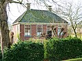
| Location | Burum, Friesland, Noardeast-Fryslân, Friesland, Netherlands | ||||
| Street address |
| ||||
| Located on street |
| ||||
| Heritage designation |
| ||||
 | |||||
|
This is a category about rijksmonument number 23722
|
| Address |
|
Media in category "Uithof 4, Burum"
The following 9 files are in this category, out of 9 total.
-
 Burum - Uithof 4 van links.jpg 3,413 × 2,560; 3.23 MB
-
 Burum - Uithof 4.jpg 4,000 × 3,000; 3.89 MB
-
 Detail voorgevel - Burum - 20046083 - RCE.jpg 1,178 × 1,200; 386 KB
-
 Exterieur AANZICHT - Burum - 20315078 - RCE.jpg 1,195 × 1,200; 382 KB
-
 Linker zijgevel - Burum - 20046084 - RCE.jpg 1,188 × 1,200; 459 KB
-
 Overzicht achterzijde - Burum - 20046086 - RCE.jpg 1,188 × 1,200; 307 KB
-
 Rechter zijgevel - Burum - 20046085 - RCE.jpg 1,190 × 1,200; 471 KB
-
 Voorgevel - Burum - 20046082 - RCE.jpg 1,179 × 1,200; 356 KB
-
 Voormalige pastorie, Burum.jpg 2,309 × 1,732; 1.81 MB


