Category:Uckington, Gloucestershire
Jump to navigation
Jump to search
village and civil parish in Gloucestershire, UK  | |||||
| Upload media | |||||
| Instance of | |||||
|---|---|---|---|---|---|
| Location | Tewkesbury, Gloucestershire, South West England, England | ||||
| Population |
| ||||
 | |||||
English: Uckington is a settlement and civil parish in the Tewkesbury district, in the county of Gloucestershire, England.
Media in category "Uckington, Gloucestershire"
The following 49 files are in this category, out of 49 total.
-
 A4019 - Uckington crossroads - geograph.org.uk - 3233686.jpg 640 × 480; 195 KB
-
 A4019 at the westbound layby - geograph.org.uk - 3233683.jpg 640 × 480; 71 KB
-
 A4019 Entering Uckington - geograph.org.uk - 4375106.jpg 640 × 422; 32 KB
-
 A4019 in Uckington - geograph.org.uk - 4951399.jpg 1,600 × 1,067; 559 KB
-
 A4019 Turn for Uckington - geograph.org.uk - 4245571.jpg 640 × 438; 42 KB
-
 A4019 Uckington - geograph.org.uk - 4375102.jpg 640 × 480; 49 KB
-
-
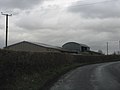
 Barn conversion taking place - geograph.org.uk - 898139.jpg 640 × 439; 113 KB
-
 Bull in a field at Uckington - geograph.org.uk - 1862546.jpg 640 × 480; 239 KB
-
 Bus stop and phone box in Uckington - geograph.org.uk - 5807219.jpg 6,000 × 4,000; 6.87 MB
-
 Bus stops on the A4019, Uckington - geograph.org.uk - 3233701.jpg 634 × 432; 173 KB
-
 Cattle at Church Farm - geograph.org.uk - 5807175.jpg 5,713 × 3,807; 3.39 MB
-
 Church Farm, Elmstone Hardwicke - geograph.org.uk - 3233693.jpg 640 × 480; 110 KB
-
 Dog Bark Lane - geograph.org.uk - 1862527.jpg 640 × 480; 250 KB
-
 Elmstone Hardwicke, church - geograph.org.uk - 5168817.jpg 600 × 800; 99 KB
-
 Emerging crop near Church Farm - geograph.org.uk - 5807181.jpg 6,000 × 4,000; 7 MB
-
 End of dual carriageway, eastbound A4019 - geograph.org.uk - 3233680.jpg 640 × 480; 140 KB
-
 Entering Elmstone Hardwicke - geograph.org.uk - 5807122.jpg 6,000 × 4,000; 7.09 MB
-
 Entering Uckington from the north - geograph.org.uk - 3233700.jpg 637 × 375; 219 KB
-
 Equestrian land at Emstone Hardwicke - geograph.org.uk - 5807145.jpg 5,784 × 3,855; 3.35 MB
-
 Ex-chapel at Uckington - geograph.org.uk - 1862555.jpg 640 × 480; 247 KB
-
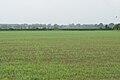
 Fallow field near Uckington - geograph.org.uk - 5807201.jpg 6,000 × 4,000; 5.44 MB
-
 Field at Withy Bridge - geograph.org.uk - 2002637.jpg 640 × 426; 89 KB
-
 Fields near Uckington - geograph.org.uk - 5807193.jpg 6,000 × 4,000; 4.82 MB
-
 Footpath near Chestnut Farm - geograph.org.uk - 5807186.jpg 6,000 × 4,000; 7.69 MB
-
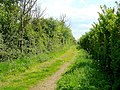
 Footpath near Elmstone Hardwicke - geograph.org.uk - 5807156.jpg 6,000 × 4,000; 5.17 MB
-
 Houses in The Green, Uckington - geograph.org.uk - 4951408.jpg 1,600 × 1,200; 686 KB
-
 Iron Chapel, Uckington - geograph.org.uk - 76452.jpg 640 × 479; 102 KB
-

-
 Lane to Hardwicke Brake - geograph.org.uk - 3233696.jpg 640 × 480; 171 KB
-
 Lay-by by A4019 east of M5 junction 10 - geograph.org.uk - 4951390.jpg 1,600 × 1,200; 628 KB
-

-
 Moat Lane - geograph.org.uk - 898138.jpg 640 × 495; 149 KB
-
 Moat Lane, Uckington - geograph.org.uk - 5807212.jpg 6,000 × 4,000; 6.81 MB
-
 New house, Homecroft Drive - geograph.org.uk - 3815298.jpg 640 × 480; 73 KB
-
 Poster on the Cheltenham Circular Footpath - geograph.org.uk - 5807164.jpg 6,000 × 4,000; 7.25 MB
-
 Rusty-roofed barn, Uckington - geograph.org.uk - 898149.jpg 640 × 429; 111 KB
-
 Sainsbury's Supermarket - geograph.org.uk - 5318.jpg 640 × 480; 49 KB
-
 Sheep near Elmstone Hardwicke - geograph.org.uk - 5807141.jpg 5,670 × 3,780; 2.76 MB
-
 Signs at the end of the dual carriageway of A4019 - geograph.org.uk - 4951376.jpg 1,600 × 1,199; 649 KB
-

-
 Sports Ground off Tewkesbury Road - geograph.org.uk - 1408646.jpg 640 × 402; 240 KB
-

-
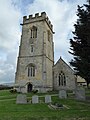
 St Mary Magdalene, Elmstone Hardwicke - geograph.org.uk - 5807114.jpg 6,000 × 4,000; 5.32 MB
-
 Tewkesbury Road, Passing B4634 - geograph.org.uk - 3123171.jpg 640 × 480; 72 KB
-
 The road from Elmstone Hardwicke - geograph.org.uk - 5807206.jpg 5,713 × 3,807; 3.71 MB
-
-

-
 Withy Bridge Lane - geograph.org.uk - 897970.jpg 640 × 480; 118 KB


