Category:US National Archives series: Maps Relating to Proposed Country Boundaries, 1918 - 1919
Jump to navigation
Jump to search
Media in category "US National Archives series: Maps Relating to Proposed Country Boundaries, 1918 - 1919"
The following 44 files are in this category, out of 44 total.
-
 1918-1919 Map of Languages of Turkey by the American Commission to Negotiate Peace.jpg 8,480 × 6,062; 6.54 MB
-

-
-

-
 1918-1919 Map of Railroads in Turkey by the American Commission to Negotiate Peace.jpg 10,232 × 6,464; 5.84 MB
-

-
 1918-1919 Map of the Pan-Turanian Area by the American Commission to Negotiate Peace.jpg 5,664 × 4,196; 2.54 MB
-
 1918-1919 Map of Turkish Sanjaks by the American Commission to Negotiate Peace.jpg 7,488 × 6,820; 5.48 MB
-
 Anatolia & Armenia Showing the Administrative Divisions - NARA - 109182099.jpg 12,789 × 7,840; 9.3 MB
-
 Anatolia, Proposed Boundaries - NARA - 109182101.jpg 8,469 × 6,048; 6.04 MB
-
 Christian Population in Anatolia and Armenia - NARA - 84785587.jpg 25,532 × 15,680; 43.86 MB
-
 Density of Population in Asiatic Turkey According to Hogarth - NARA - 109182073.jpg 4,992 × 4,307; 2.09 MB
-
 Density of Population in Asiatic Turkey According to Hogarth - NARA - 109182081.jpg 12,794 × 7,872; 9.48 MB
-
 Distribution of Jewish Population - DPLA - cdc9e80ad795d3c3194b2d5b86bba0a6.JPG 4,224 × 5,724; 1.75 MB
-
 Distribution of Mineral Products & Railways of Asia Minor - NARA - 109182071.jpg 5,152 × 4,185; 2.08 MB
-
 Distribution of Mineral Products & Railways of Asia Minor - NARA - 109182075.jpg 12,792 × 7,872; 9.32 MB
-
 Divisions in Asiatic Turkey - NARA - 109182095.jpg 12,786 × 7,840; 9.8 MB
-
 Divisions in Asiatic Turkey - NARA - 109182097.jpg 12,788 × 7,872; 9.51 MB
-
 Divisions of Asia Minor - NARA - 109182087.jpg 7,488 × 6,746; 5.2 MB
-
 European Spheres of Influence in Turkey - NARA - 109182069.jpg 5,696 × 4,199; 2.38 MB
-
 German Map of Schlesien - DPLA - 0ebd5fe97359d8c8e52c4f49a0388e64.jpg 10,090 × 7,488; 9.21 MB
-
 Industrial Population - DPLA - 0783a34f3314e4feb4a6980d33876807.jpg 10,208 × 12,538; 15.42 MB
-
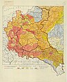
 Map of Poland Showing Railroads - DPLA - 34f494c3cee1c9e4275b9060e9e12c8e.jpg 4,128 × 3,858; 1.48 MB
-
 Poland- Barley per Capita - DPLA - 62a2a14ae479cc546f1549c892e68ec5.jpg 4,832 × 4,068; 2.31 MB
-
 Poland- Barley Yield - DPLA - b8d9dcc985ce472c61bc5335d74a6bf5.JPG 4,832 × 4,079; 2.72 MB
-
 Poland- Communications - DPLA - d7446f87dbcdc91db45694b6b929dc7c.jpg 10,240 × 12,546; 14.06 MB
-
 Poland- Ecclesiastical Map - DPLA - 15538661b353dc5663dd3a6a53ec5aa1.jpg 10,240 × 12,542; 15.33 MB
-
 Poland- Industries - DPLA - 3f1686813aee2adbaa5d50066f6e9a52.jpg 10,240 × 12,544; 14.46 MB
-
 Poland- Instruction - DPLA - 1c7ccf3f4d0fc0ffa576873f04ff353a.jpg 10,240 × 12,535; 15.32 MB
-
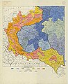
 Poland- Limits of Polish Population - DPLA - efb44d14c00644ddb172a1ff67ab5542.jpg 4,192 × 5,452; 2.03 MB
-
 Poland- Oats per Capita - DPLA - 67f1a52f369149d25056f9924f8e858e.jpg 6,304 × 5,255; 4.63 MB
-
 Poland- Rye per Capita - DPLA - f8181a9ddbf0d2c6d0fcc81de94493fd.jpg 4,864 × 4,156; 3.14 MB
-
 Poland- Rye Yield - DPLA - a4e260662611ec79c768e8107575fdc9.jpg 4,832 × 4,087; 2.24 MB
-
 Poland- Savings Deposits - DPLA - e3e5158d739fa6eb274bad2988d4bc67.jpg 10,144 × 12,539; 15.16 MB
-
 Poland- Wheat Yield - DPLA - d62945130022d6fcd98f5197cb49c7d4.jpg 4,800 × 4,085; 2.61 MB
-
 Polish Publications - DPLA - e63be78cee2dbded59a72f7afeeb97dc.jpg 10,240 × 12,548; 13.75 MB
-

-

-
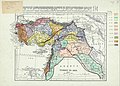
 Proposed Boundaries in Middle East - DPLA - 39e9d5dea3b30159b50fd009f59d91f0 (page 1).jpg 13,696 × 21,146; 12.79 MB
-
 Proposed Boundaries in Middle East - DPLA - 39e9d5dea3b30159b50fd009f59d91f0 (page 2).jpg 13,568 × 21,431; 9.12 MB
-
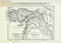
 Proposed Boundaries in Middle East - DPLA - 39e9d5dea3b30159b50fd009f59d91f0 (page 3).jpg 13,600 × 22,040; 15.75 MB
-
 Proposed Boundaries in Middle East - DPLA - 39e9d5dea3b30159b50fd009f59d91f0 (page 4).jpg 13,600 × 21,038; 12.39 MB
-
 The Polish Area- The Peoples - DPLA - 9383fccb94d8bc6d4e84f4cf930876d9.jpg 10,560 × 12,243; 15.7 MB
-
 The Polish Press - DPLA - 02a5e8091f9fde659acdb1991f03d92a.JPG 10,240 × 12,541; 13.49 MB


.jpg)
.jpg)
.jpg)
.jpg)
.jpg)
.jpg)

