Category:US Census Bureau division maps
Jump to navigation
Jump to search
Media in category "US Census Bureau division maps"
The following 17 files are in this category, out of 17 total.
-
 US Census Division - East North Central.svg 215 × 255; 10 KB
-
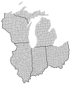 US Census Divisions - East North Central with counties.svg 228 × 270; 129 KB
-
 US Census Division - East South Central.svg 175 × 205; 5 KB
-
 US Census Division - Middle Atlantic.svg 145 × 155; 5 KB
-
 US Census Division - Mountain.svg 320 × 420; 5 KB
-
 US Census Divisions - Mountain with counties.svg 327 × 438; 158 KB
-
 US Census Division - New England.svg 98 × 158; 5 KB
-
 US Census Division - Pacific.svg 395 × 385; 14 KB
-
 US Census Division - South Atlantic and East South Central.svg 285 × 360; 18 KB
-

-
 US Census Division - South Atlantic.svg 215 × 360; 13 KB
-
 US Census Divisions - South Atlantic with counties.svg 224 × 380; 217 KB
-
 SouthAtlanticStates.png 904 × 593; 17 KB
-
 US Census Division - West North Central.svg 255 × 300; 7 KB
-
 US Census Divisions - West North Central with counties.svg 275 × 316; 170 KB
-
 US Census Division - West South Central.svg 340 × 250; 8 KB
-
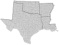 US Census Divisions - West South Central with counties.svg 357 × 271; 165 KB


