Category:US Borax Mine
Jump to navigation
Jump to search
English: Locality: U.S. Borax Mine (historic name, currently the en:Rio Tinto Borax Mine) — (Pacific West Coast Borax; Pacific Coast Borax Co.; Boron Mine; U.S. Borax and Chemical Corp.; US Borax Open Pit; Kramer Mine; Baker Mine), Kramer Borate deposit, Boron, Kramer District, eastern Kern County—Mojave Desert, Southern California, U.S.
Deutsch: Fundort: U.S. Borax Mine (Pacific West Coast Borax; Pacific Coast Borax County; Boron Mine; U.S. Borax and Chemical Corp.; Kramer Mine; Baker Mine), Kramer Borate deposit, Bor, Kramer District, Kern County, Kalifornien, Vereinigte Staaten
| Object location | | View all coordinates using: OpenStreetMap |
|---|
Subcategories
This category has the following 2 subcategories, out of 2 total.
B
- Baker Mine (5 F)
U
- US Borax Open Pit (17 F)
Media in category "US Borax Mine"
The following 14 files are in this category, out of 14 total.
-
 1910-rp1947-ca furnace-creek 30-crop.jpg 2,090 × 1,504; 2.98 MB
-
 Borax - Kramer Borate deposit, Boron, Kern Co, California, USA.jpg 1,024 × 987; 224 KB
-
 Colemanite.jpg 2,896 × 2,019; 1,005 KB
-
 Kernite - USGS Mineral Specimens 691.jpg 1,400 × 643; 734 KB
-
 Kernite - USGS Mineral Specimens 692.jpg 958 × 1,400; 1.03 MB
-
 Kernite - USGS Mineral Specimens 693.jpg 1,335 × 1,400; 1.35 MB
-
 Kernite - USGS Mineral Specimens 694.jpg 1,400 × 1,086; 1.22 MB
-
 Kernite - USGS Mineral Specimens 695.jpg 1,005 × 1,400; 1.21 MB
-
 Kernite boronca.jpg 3,872 × 2,592; 633 KB
-
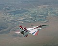 NF-15B NASA 837 over US Borax Mine during IFCS testing flight (EC02-0281-2).jpg 3,000 × 2,400; 7.39 MB
-
 Rio Tinto Borax mine from ISS.jpg 594 × 466; 313 KB
-
 Rio Tinto Boron mine and plant.jpg 4,638 × 3,092; 4.13 MB
-
 Ryan company townsite.JPG 4,000 × 2,664; 3.64 MB
-
 Tincalconite-Borax-261775.jpg 600 × 299; 34 KB


.jpg)


