Category:U.S. Route 75 in Nebraska
Jump to navigation
Jump to search
section of U.S. Numbered Highway in Nebraska, United States .jpg)  _map.svg) | |||||
| Upload media | |||||
| Instance of | |||||
|---|---|---|---|---|---|
| Location | |||||
| Transport network |
| ||||
| Connects with | |||||
| Owned by | |||||
| Maintained by | |||||
| Inception |
| ||||
| Length |
| ||||
| Terminus |
| ||||
| Partially coincident with | |||||
| |||||
{{en|Media related to U.S. Route 75 in Nebraska (US 75), a 187.54-mile (301.82 km) section of U.S. Numbered Highway in Nebraska, United States, that connects US 75 in Kansas with Interstate 129/U.S. Route 20/US 75 in Iowa.
Subcategories
This category has the following 2 subcategories, out of 2 total.
Media in category "U.S. Route 75 in Nebraska"
The following 10 files are in this category, out of 10 total.
-
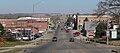 Auburn, Nebraska US75.JPG 2,172 × 957; 795 KB
-
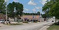
 Dawson, Nebraska Ridge St 1.JPG 2,560 × 993; 1.12 MB
-
 I-480-US 75 sign.jpg 1,159 × 831; 139 KB
-
 Kennedy Freeway, Omaha.jpg 836 × 594; 101 KB
-
 Offutt AFB at 1000 ft.JPG 2,048 × 1,536; 2.11 MB
-
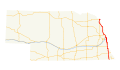 US 75 (NE) map.svg 1,180 × 688; 277 KB
-
 US 75 Nebraska 1926.svg 1,485 × 1,440; 31 KB
-
 US 75 Nebraska 1963.svg 600 × 600; 16 KB
-
 US75nSignRoadside-FromNE8 (28851074526).jpg 1,200 × 800; 448 KB
-
 Winnebago, Nebraska Hwy 75-77 3.JPG 2,560 × 1,295; 1.5 MB


