Category:U.S. Route 50 in Hampshire County, West Virginia
Jump to navigation
Jump to search
Subcategories
This category has the following 4 subcategories, out of 4 total.
Media in category "U.S. Route 50 in Hampshire County, West Virginia"
The following 17 files are in this category, out of 17 total.
-

-

-

-

-

-

-
 Cemetery at edge of Romney1a34276v.jpg 1,024 × 718; 252 KB
-
 Fort Edwards Historical Marker Capon Bridge WV 2014 10 05 01.jpg 2,448 × 3,264; 3.67 MB
-
 Fort Edwards Historical Marker Capon Bridge WV 2014 10 05 02.JPG 3,264 × 2,448; 3.42 MB
-
 Ice Mountain Historical Marker Augusta WV 2014 10 05 01.JPG 3,264 × 2,448; 3.01 MB
-
 Ice Mountain Historical Marker Augusta WV 2014 10 05 02.jpg 2,448 × 3,264; 3.35 MB
-
 IndianMoundCemetery1942RomneyWV.jpg 1,024 × 718; 118 KB
-
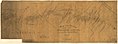 Map of the location of part of the North-Western Turnpike Road.jpg 1,564 × 577; 140 KB
-
 New Century Hotel Romney WV.jpg 375 × 227; 23 KB
-
 Road out of Romney, West Va.1a34283v.jpg 1,024 × 710; 278 KB
-
 US50LookingWestRomneyWV.jpg 1,024 × 710; 139 KB
-
 WV Schools for the Deaf and Blind Romney WV 2009 02 01 07.jpg 3,264 × 2,448; 3.19 MB
_just_west_of_High_Street_in_Romney,_Hampshire_County,_West_Virginia.jpg)
_near_Bolton_Street_in_Romney,_Hampshire_County,_West_Virginia.jpg)
_between_Grafton_Street_and_Antigo_Place_in_Romney,_Hampshire_County,_West_Virginia.jpg)
_at_Tannery_Road_in_Capon_Bridge,_Hampshire_County,_West_Virginia.jpg)
_between_Tannery_Road_and_Cold_Stream_Road_in_Capon_Bridge,_Hampshire_County,_West_Virginia.jpg)
_at_Charlevoix_Place_in_Romney,_Hampshire_County,_West_Virginia.jpg)


