Category:U.S. Route 40 in Utah
Jump to navigation
Jump to search
 | number: | (fourty-) |
|---|---|---|
| U.S. Highways in Utah: | 30 · 40 · 50 |
States of the United States: California · Colorado · Delaware · Illinois · Indiana · Kansas · Maryland · Missouri · Nevada · New Jersey · Ohio · Pennsylvania · Utah · West Virginia
section of U.S. Numbered Highway in Utah, United States _map.svg) | |||||
| Upload media | |||||
| Instance of | |||||
|---|---|---|---|---|---|
| Part of | |||||
| Location |
| ||||
| Transport network | |||||
| Owned by | |||||
| Maintained by | |||||
| Inception |
| ||||
| Length |
| ||||
| Terminus | |||||
| Replaces | |||||
| Said to be the same as | Utah State Route 6 | ||||
| Partially coincident with | |||||
 | |||||
English: Media related to U.S. Route 40 in Utah (US 40), a 175.0382-mile (281.6967 km) section of U.S. Numbered Highway in Utah, United States, that is a major east-west corridor in the northeastern part of the state that connects Interstate 80 at Silver Creek Junction (northeast of Park City) with US 40 in Colorado.
From 1910 to 1977, the nearly current corridor of US 40 in Utah was designated by the Utah State Legislature as Utah State Route 6. In 1977, State Route 6 designation was applied to U.S. Route 6 and US 40 was designated at State Route 40.
Subcategories
This category has the following 7 subcategories, out of 7 total.
*
Media in category "U.S. Route 40 in Utah"
The following 7 files are in this category, out of 7 total.
-

-
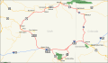 DinosaurDiamond map.svg 1,475 × 860; 769 KB
-
 Polar King ice cream sign, Route 40, Vernal, Utah (LOC).jpg 1,024 × 704; 265 KB
-
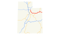 US 40 (UT) map.svg 1,180 × 688; 144 KB
-
 US 40 Utah 1926.svg 1,485 × 1,440; 28 KB
-
 Utah 40.svg 600 × 600; 11 KB
-
 Utah SR 40.svg 385 × 385; 7 KB

.jpg)


