Category:U.S. Route 31 in Michigan
Jump to navigation
Jump to search
section of U.S. Highway in Michigan, United States   | |||||
| Upload media | |||||
| Instance of | |||||
|---|---|---|---|---|---|
| Location | |||||
| Transport network | |||||
| Owned by | |||||
| Maintained by | |||||
| Has part(s) |
| ||||
| Start time |
| ||||
| Length |
| ||||
| Terminus | |||||
| |||||
Subcategories
This category has the following 2 subcategories, out of 2 total.
Media in category "U.S. Route 31 in Michigan"
The following 42 files are in this category, out of 42 total.
-
 Alanson Michigan Downtown 2 US31.jpg 1,910 × 1,214; 677 KB
-
 Alanson Michigan Sign US31.jpg 1,936 × 1,288; 1.23 MB
-
 Bay Harbor Michigan Downtown Looking South US31.jpg 1,936 × 1,288; 938 KB
-
 Bay Shore Michigan Sign US31.jpg 1,936 × 1,288; 991 KB
-
 Bay View Michigan Sign US31.jpg 1,504 × 754; 413 KB
-
 Benton Harbor–St. Joseph Oct. 1, 1957.png 548 × 545; 725 KB
-
 Benzonia Village Park.jpg 2,249 × 1,387; 551 KB
-
 Charlevoix II.JPG 2,816 × 1,880; 2.19 MB
-
 Charlevoix Michigan Downtown Panorama US31.jpg 1,936 × 1,288; 1.31 MB
-
 Charlevoix Michigan Sign.jpg 1,936 × 1,288; 1.26 MB
-
 Cherry Hut.jpg 2,508 × 1,801; 762 KB
-
 Elk Rapids Michigan Sign US31.jpg 1,936 × 1,288; 1 MB
-
 Grandview Parkway Traverse City.jpg 3,264 × 1,785; 2.44 MB
-
 Grandview Parkway.jpg 3,024 × 4,032; 1.96 MB
-
 Honor (1).jpg 2,546 × 1,808; 839 KB
-
 I-196 Black River Bridge South Haven.jpg 3,296 × 2,472; 1,020 KB
-
 I-67 (MI 1957).svg 600 × 600; 11 KB
-
 I-67 (MI) Metric.svg 601 × 601; 19 KB
-
 I-94 at future St. Joseph Valley Pkwy (future US 31) and I-94 BL.jpg 1,918 × 1,080; 310 KB
-
 I-94 at US 31 (Napier Avenue) (October 2021).jpg 1,153 × 649; 116 KB
-
 M-37 Sign.jpg 3,024 × 4,032; 2.15 MB
-
 M-66 (Michigan highway) northern terminus.jpg 5,179 × 2,914; 2.82 MB
-
 Michigan Left.svg 1,045 × 426; 24 KB
-
 MichiganLeftSign.svg 293 × 136; 17 KB
-
 MichiganLeftSigns.png 500 × 512; 13 KB
-
 Northern Michigan Hospital Petoskey Michigan.jpg 1,936 × 1,288; 1.04 MB
-
 Pellston Michigan Downtown Looking South US31.jpg 1,936 × 1,288; 930 KB
-
 Pellston Michigan Sign US31.jpg 1,936 × 1,288; 919 KB
-
 Petoskey Michigan Sign US31.jpg 1,936 × 1,288; 1.14 MB
-
 Traverse City State Park Traverse City Michigan.jpg 1,936 × 1,288; 1.57 MB
-
 U.S. Route 31 northern terminus.jpg 5,180 × 2,914; 2.99 MB
-
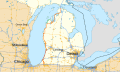 US 31 MI map.svg 1,027 × 609; 2.76 MB
-
 US 31 Michigan 1926.svg 1,485 × 1,440; 38 KB
-
 US 31 Michigan 1948.svg 1,485 × 1,440; 45 KB
-
 US 31, Manistee, Michigan.jpg 3,072 × 2,304; 374 KB
-
 US 31A Michigan 1926.svg 1,485 × 1,440; 31 KB
-
 US 31A Michigan 1948.svg 1,485 × 1,440; 35 KB
-
 US Route 31 Oceana Drive (Michigan).jpg 3,072 × 2,304; 417 KB
-
 US Route 31 Winston Road (Michigan).jpg 3,072 × 2,304; 433 KB
-
 US31 Sign Looking North Bay View Michigan.jpg 1,936 × 1,288; 1.16 MB
-
 Veterans Park (1).jpg 2,547 × 1,759; 804 KB
-
 Yuba Michigan Sign US31.jpg 1,936 × 1,288; 960 KB


.jpg)

.svg)
_Metric.svg)
_and_I-94_BL.jpg)
_(October_2021).jpg)

_northern_terminus.jpg)


.jpg)
.jpg)

.jpg)
