Category:U.S. Route 181
Jump to navigation
Jump to search
 | number: | (one hundred eighty-one) |
|---|---|---|
| U.S. Routes: | 163 · 165 · 166 · 167 · 168 · 169 · 170 · 171 · 175 · 176 · 177 · 178 · 179 · 180 · 181 · 183 · 184 · 189 · 190 · 191 · 192 · 195 · 197 · 199 · 201 |
U.S. Numbered Highway in Texas, United States   | |||||
| Upload media | |||||
| Instance of | |||||
|---|---|---|---|---|---|
| Location |
| ||||
| Transport network | |||||
| Owned by | |||||
| Maintained by | |||||
| Start time |
| ||||
| Inception |
| ||||
| Length |
| ||||
| Terminus | |||||
| Partially coincident with | |||||
| |||||
English: Media related to U.S. Route 181, a 136.76-mile (220.09 km) U.S. Numbered Highway in Texas, United States, that connects Interstate 37 (I-37) in Corpus Christi with I-37 in San Antonio (forming an eastern loop off I-37).
Subcategories
This category has the following 5 subcategories, out of 5 total.
Media in category "U.S. Route 181"
The following 4 files are in this category, out of 4 total.
-
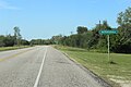 Normanna-tx2015-2.jpg 2,385 × 1,590; 1.25 MB
-
 Texas 188 map.svg 870 × 516; 602 KB
-
 US 181 map.png 1,688 × 984; 48 KB
-
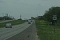 US 181, San Antonio, Texas.JPG 3,872 × 2,592; 2.22 MB

