Category:U.S. Military Installations in Okinawa
Jump to navigation
Jump to search
U.S. Military Installations in Okinawa
Subcategories
This category has the following 2 subcategories, out of 2 total.
Media in category "U.S. Military Installations in Okinawa"
The following 112 files are in this category, out of 112 total.
-
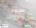
 11管区 在日米軍 訓練水域区域 2.png 1,746 × 1,125; 584 KB
-
 11管区 在日米軍 訓練水域区域.png 2,045 × 1,134; 549 KB
-
 1945 Katsuren before construction of White Beach - 7th NCB photograph.png 1,910 × 1,125; 921 KB
-
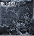
 1946 Iejima Airfield.png 1,959 × 969; 1.91 MB
-
 1977年 伊波城観光ホテル.png 1,061 × 838; 1.9 MB
-
 2018年 3ha 返還場所.png 422 × 284; 248 KB
-
 2018年 3ha 返還部分.png 459 × 287; 208 KB
-
 7th Psychological Operations Group.jpg 800 × 647; 117 KB
-
 Active Shooter Exercise CAMP LESTER, OKINAWA, JAPAN.webp 1,000 × 667; 114 KB
-
 Active Shooter Exercise, CAMP LESTER, OKINAWA.webp 1,000 × 667; 104 KB
-
 Akamaru-Misake, Okuma, Okinawa, 1945.jpg 800 × 621; 237 KB
-
 Awase Airfield 1945.jpg 800 × 629; 161 KB
-
 Awase Airstrip, Okinawa, Ryukyu Islands.jpg 800 × 825; 230 KB
-
 Awase Communication Site, 2007, ogb.png 1,136 × 793; 1.47 MB
-
 Awase Meadows Golf Course Location.png 846 × 693; 805 KB
-
 Bivouac area adjacent to Awase Airfield, Okinawa.jpg 800 × 654; 161 KB
-
 Camp Boone and Camp Mercy Map 1959.jpg 2,048 × 1,371; 585 KB
-
 Camp Chinen 1970 approximate location.png 901 × 736; 798 KB
-
 Camp Courtney, Central Exchange Warehousing Yards.jpg 800 × 682; 92 KB
-
 Camp Ginbaru.png 2,000 × 1,067; 2.29 MB
-
 Camp Hauge 1968 - It was quonset huts - Home, Sweet Home.png 463 × 265; 123 KB
-
 Camp Hauge 1968 - It was the stroll from Kinser to Hauge 01.png 449 × 270; 105 KB
-
 Camp Hauge Approximate Location.png 1,214 × 750; 1.04 MB
-
 Camp Nupunja.png 589 × 522; 225 KB
-
 Camp Shields Construction progress April, 1969.png 925 × 527; 916 KB
-
 Camp Shields.png 1,000 × 1,469; 1.7 MB
-
 Construction of Camp Shields (then Camp Kinser).png 1,562 × 881; 1,007 KB
-
 Construction of Pontoon bridge.png 1,032 × 826; 605 KB
-
 Early stage of construction on the Mace Missile Site at White Beach.png 1,518 × 981; 2.33 MB
-
 Gesaji LORAN C Station.jpg 800 × 790; 187 KB
-
 Hospital on Camp Lester officially closes (03.25.2013).webp 1,000 × 667; 186 KB
-
 Ichi Banare (Ikei Jima) Coast Guard LORAN Station, 1952.jpg 800 × 659; 143 KB
-
 Ichi Banare Loran Transmitting Station 1.jpg 800 × 644; 94 KB
-
 Ichi Banare Loran Transmitting Station 2.jpg 800 × 645; 116 KB
-
 Ichi Banare Loran Transmitting Station 3.jpg 800 × 648; 261 KB
-
 Ie Jima LHD, Aug. 12, 2019 01.jpg 5,760 × 3,840; 3.36 MB
-
 Ie Jima LHD, Aug. 12, 2019 02.jpg 5,760 × 3,840; 2.61 MB
-
 Ishikawa Beach, Okinawa, 1954 5.jpg 800 × 655; 107 KB
-
 Ishikawa Beach, Okinawa, 1954.png 1,032 × 813; 1.13 MB
-
 Kadena Ammunition Storage Area Taiyo Golf Club.png 579 × 466; 463 KB
-
 KatchinHantoPeninsulabase.jpg 640 × 487; 95 KB
-
 Kin Airfield, Okinawa 1946.png 1,103 × 1,169; 2.08 MB
-
 Kubasaki Camp (MCB3 1957-1959).png 1,014 × 1,170; 943 KB
-
 Kubasaki pier construction 1945.png 1,268 × 947; 530 KB
-
 Kuwae Booster Station Pipeline.jpg 450 × 336; 55 KB
-
 Kuwae Booster Station Reverted.jpg 450 × 338; 46 KB
-
 Machinato Airfield (1945-12-10).jpg 3,938 × 3,781; 1.67 MB
-
 Machinato Housing Area 1977.png 636 × 720; 980 KB
-
 Monument to Yaka prisoner of war camp, Kin, Okinawa.jpg 450 × 338; 69 KB
-
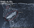 Motobu Airstrip, Okinawa 1946.png 1,389 × 1,122; 2.8 MB
-
 North Part of Camp Lester Reverted in.png 952 × 833; 1.01 MB
-
 Okinawa Seabees Map NMCB-9 1968-69.png 1,696 × 1,125; 2.39 MB
-
 Okuma Rest Center 1962-06-29.jpg 3,937 × 3,779; 742 KB
-
 OneofmanyroadimprovementbySeabeeonOkinawa1945.jpg 640 × 465; 89 KB
-
 POL Pipeline 1, Okinawa 01.png 1,857 × 1,208; 2.45 MB
-
 POL Pipeline 2.png 1,428 × 1,125; 1.91 MB
-
 PontoonCausewayat Okinawa1945.jpg 640 × 409; 55 KB
-
 Psychological Warfare (Machinato Service Area).jpg 800 × 1,005; 156 KB
-
 Psychological Warfare, Machinato Service Area (radio station).jpg 800 × 799; 161 KB
-
 South Part of Camp Lester.png 944 × 831; 1.08 MB
-
 Start of construction on the new Camp Courtney base.jpg 800 × 656; 163 KB
-
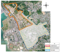
 Tengan Communication Site (Approximate Location) 1973.png 911 × 634; 692 KB
-
 The 44th Infantry Service Club at Camp Napunja 01.jpg 800 × 635; 102 KB
-
 The 44th Infantry Service Club at Camp Napunja 02.jpg 800 × 642; 123 KB
-
 U.S. Army Awase Meadows Golf Club began in 1946.jpg 300 × 199; 19 KB
-
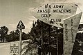 U.S. Army Awase Meadows Golf Club.jpg 300 × 199; 19 KB
-
 US Army Hospital. Kue Camp.jpg 800 × 652; 150 KB
-
 USCAR Moves, 1968-1-9.jpg 800 × 540; 91 KB
-
 VOA Relay Station Okuma 1962-06-30.jpg 3,937 × 3,779; 853 KB
-
 VUNC, Psychological Warfare.jpg 800 × 650; 153 KB
-
 White Beach - 7th NCB photograph.png 1,637 × 543; 874 KB
-
 White Beach 1945.jpg 800 × 630; 190 KB
-
 Yaedake Communication Site.jpg 450 × 338; 38 KB
-
 Yaka Beach EM Rest Center, 1954.jpg 800 × 624; 132 KB
-
 Yozadake sites.png 749 × 724; 555 KB
-
 Zakimi Castle.jpg 800 × 800; 220 KB
-
 みなと村のおよその範囲.png 1,093 × 705; 847 KB
-
 キャンプ瑞慶覧 (Camp Foster) 海兵隊キャンプ・バトラー司令部.jpg 450 × 335; 38 KB
-
 キャンプ瑞慶覧 泡瀬ゴルフ場跡地(北中城村)現在.jpg 4,665 × 2,999; 5.33 MB
-
 キャンプ瑞慶覧 泡瀬ゴルフ場(北中城村).jpg 517 × 616; 122 KB
-
 キャンプ瑞慶覧(施設技術部地区).png 1,162 × 929; 1.76 MB
-
 与儀タンクファーム 1970年 空中写真.jpg 4,134 × 3,801; 1.94 MB
-
 与儀タンクファーム 那覇第2貯油施設 (1970).png 2,000 × 977; 1.11 MB
-
 与儀タンクファーム.png 1,319 × 1,015; 1.44 MB
-
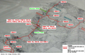
 北部訓練場の射撃場建設.png 747 × 535; 483 KB
-
 北部訓練場ヘリ墜落現場.png 846 × 1,221; 1.27 MB
-
 北部訓練場旧ヘリパット LZ-FBJ, LZ-1A, LZ-1, LZ-2, LZ-2A, LZ-3, LZ-21.png 710 × 1,125; 1.17 MB
-
 天願城 天願グスク 天願貝塚 キャンプ・コートニー.png 780 × 744; 1.07 MB
-
 普天間飛行場 Futenma Airfield (1945-12-10).jpg 3,937 × 3,780; 1.07 MB
-
 楚辺通信所 象のオリ (2003-09-08) 01.jpg 480 × 360; 89 KB
-
 楚辺通信所 象のオリ (2003-09-08) 02.jpg 480 × 360; 56 KB
-
 楚辺通信所 象のオリ (2003-09-08) 03.jpg 480 × 360; 70 KB
-
 沖縄北飛行場 読谷.jpg 800 × 760; 227 KB
-
 泡瀬倉庫地区 1970.png 1,904 × 1,025; 2.29 MB
-
 波平陸軍補助施設 (1970).png 1,195 × 1,123; 1.53 MB
-
 渡嘉敷島北部 (1971年03月20日撮影) 渡嘉敷陸軍補助施設.jpg 3,793 × 4,109; 1.06 MB
-
 渡嘉敷陸軍補助施設 跡地.jpg 450 × 338; 77 KB
-
 漫湖を横断するパイプライン 国場川 1965年 01.jpg 800 × 564; 92 KB
-
 漫湖を横断するパイプライン 国場川 1965年 02.jpg 800 × 564; 105 KB
-
 牧港補給地区 (1970年).png 1,642 × 2,398; 4.55 MB
-
 牧港補給地区.jpg 450 × 338; 36 KB
-
 空中写真 嘉手納弾薬庫 1993.jpg 4,094 × 3,780; 1.65 MB
-
 第一護郷隊と第二護郷隊.png 1,200 × 775; 939 KB
-
 米軍 本部採石場 (1971年).png 1,135 × 1,120; 2.05 MB
-
 米軍 牧港住宅地区.png 1,086 × 732; 825 KB
-
 米軍施設 石川ビーチ (1967年).jpg 800 × 564; 160 KB
-
 米軍砂辺倉庫跡.jpg 450 × 338; 31 KB
-
 米軍砂辺倉庫跡2.jpg 450 × 338; 41 KB
-
 糸満市摩文仁 1945年6月28日.jpg 800 × 642; 153 KB
-
 読谷村のミサイルサイト (1970年).png 1,062 × 739; 763 KB
-
 辺野古 キャンプ・シュワブ 空中写真 1971.png 1,114 × 1,125; 2.09 MB
-
 那覇軍港と奥武山 (1945年から1973年).png 1,106 × 1,380; 1.45 MB


.png)


.webp)
_Coast_Guard_LORAN_Station,_1952.jpg)


.png)


.jpg)


.jpg)
.jpg)


_1973.png)


_%E6%B5%B7%E5%85%B5%E9%9A%8A%E3%82%AD%E3%83%A3%E3%83%B3%E3%83%97%E3%83%BB%E3%83%90%E3%83%88%E3%83%A9%E3%83%BC%E5%8F%B8%E4%BB%A4%E9%83%A8.jpg)


.png)


.jpg)
_01.jpg)
_02.jpg)
_03.jpg)


.png)
_%E6%B8%A1%E5%98%89%E6%95%B7%E9%99%B8%E8%BB%8D%E8%A3%9C%E5%8A%A9%E6%96%BD%E8%A8%AD.jpg)


.png)


.png)

.jpg)


.png)

.png)