Category:Type A/B post boxes in the City of Leeds
Jump to navigation
Jump to search

Subcategories
This category has only the following subcategory.
W
Media in category "Type A/B post boxes in the City of Leeds"
The following 84 files are in this category, out of 84 total.
-
 Ashfield Way, Whitehall Trading Estate - geograph.org.uk - 6392829.jpg 4,601 × 2,893; 3.32 MB
-
 Bench - Vicar Lane - geograph.org.uk - 1971195.jpg 640 × 480; 102 KB
-
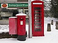 Bramhope Post Office - geograph.org.uk - 137015.jpg 640 × 480; 119 KB
-
 Brandling Court - geograph.org.uk - 830939.jpg 640 × 480; 48 KB
-
 Calverley Newsagents - Woodhall Road - geograph.org.uk - 1821962.jpg 640 × 529; 73 KB
-
 Drinks Plus - Station Road - geograph.org.uk - 1865116.jpg 525 × 640; 78 KB
-
 Dry cleaners on Cardigan Road - geograph.org.uk - 6540727.jpg 1,024 × 768; 169 KB
-
 Edward VII Postbox - Batley Road - geograph.org.uk - 3273191.jpg 434 × 640; 67 KB
-
 Edward VII Postbox, The Avenue - geograph.org.uk - 5256380.jpg 683 × 1,024; 239 KB
-
 Edward VIII Postbox, Cookridge Lane - geograph.org.uk - 5534829.jpg 683 × 1,024; 316 KB
-
 Elizabeth II postbox on Gelderd Road - geograph.org.uk - 6392834.jpg 406 × 800; 103 KB
-
 Elizabeth II postbox on Haigh Wood Road - geograph.org.uk - 5988228.jpg 2,595 × 4,618; 2.25 MB
-

-

-
 Elizabeth II Postbox, Cow Close Road - geograph.org.uk - 5428349.jpg 683 × 1,024; 216 KB
-
 Elizabeth II postbox, Dixon Lane - geograph.org.uk - 5705763.jpg 683 × 1,024; 230 KB
-
 Elizabeth II Postbox, Domestic Street, Holbeck - geograph.org.uk - 5396197.jpg 683 × 1,024; 269 KB
-
 Elizabeth II Postbox, Gelderd Road - geograph.org.uk - 5395174.jpg 683 × 1,024; 166 KB
-

-
 Elizabeth II Postbox, Royds Lane - geograph.org.uk - 5571770.jpg 683 × 1,024; 264 KB
-
 Elizabeth II Postbox, Town Street, Middleton - geograph.org.uk - 5025041.jpg 682 × 1,024; 243 KB
-
 Elizabeth II Postbox, Windmill Lane, Rothwell - geograph.org.uk - 5163371.jpg 683 × 1,024; 244 KB
-
 Elland Way - Elland Road - geograph.org.uk - 2824103.jpg 640 × 480; 82 KB
-
 Entrance to Western Flatts Park - geograph.org.uk - 5417517.jpg 1,024 × 683; 417 KB
-
 Five Lane Ends, Lower Wortley - geograph.org.uk - 5393975.jpg 1,024 × 683; 255 KB
-
 Gelderd Road (A62) - geograph.org.uk - 6392833.jpg 5,184 × 3,888; 3.69 MB
-

-

-

-
 George V Postbox, Beeston Road - geograph.org.uk - 5430370.jpg 683 × 1,024; 292 KB
-
 George V Postbox, Green Hill Lane - geograph.org.uk - 5417513.jpg 683 × 1,024; 404 KB
-
 George V Postbox, Green Hill Lane, Wortley - geograph.org.uk - 6514419.jpg 1,024 × 768; 329 KB
-
 George V postbox, Lowfields Road - geograph.org.uk - 5713852.jpg 683 × 1,024; 223 KB
-
 George V Postbox, Moor Road - geograph.org.uk - 4380676.jpg 682 × 1,024; 187 KB
-
 George VI postbox on Vesper Road - geograph.org.uk - 6436076.jpg 1,024 × 768; 263 KB
-
 George VI Postbox, Dixon Lane, Lower Wortley - geograph.org.uk - 5393969.jpg 683 × 1,024; 242 KB
-
 George VI Postbox, Gelderd Road - geograph.org.uk - 5026419.jpg 682 × 1,024; 163 KB
-
 George VI postbox, Hawthorn Drive, Yeadon - geograph.org.uk - 6559662.jpg 1,024 × 768; 223 KB
-
 George VI Postbox, Shafton Lane, Holbeck - geograph.org.uk - 5396170.jpg 683 × 1,024; 371 KB
-
 George VI Postbox, Weetwood Avenue - geograph.org.uk - 4383553.jpg 682 × 1,024; 197 KB
-
 Georgian postbox, Gotts Park Avenue, Wyther - geograph.org.uk - 4679479.jpg 1,024 × 768; 542 KB
-
 Headingley (34300102293).jpg 5,992 × 3,129; 7.21 MB
-

-
 Kingswood Gardens - Kedleston Road - geograph.org.uk - 1446577.jpg 640 × 480; 242 KB
-

-
 Pair of postboxes in Woodhouse Square - geograph.org.uk - 6395663.jpg 1,024 × 768; 158 KB
-
 Post Office, Rothwell - geograph.org.uk - 2740791.jpg 640 × 480; 64 KB
-
 Postbox and phone box, Kirkstall Lane - geograph.org.uk - 6468118.jpg 1,024 × 768; 270 KB
-
 Postbox and phone box, Swinnow Road, Pudsey - geograph.org.uk - 4986927.jpg 1,024 × 768; 237 KB
-

-

-
 Postbox on Aberford Road, Garforth - geograph.org.uk - 6175445.jpg 1,065 × 1,600; 527 KB
-
 Postbox on Armley Road - geograph.org.uk - 6187199.jpg 1,024 × 768; 210 KB
-
 Postbox on Blue Hill Lane - geograph.org.uk - 6483653.jpg 1,024 × 768; 227 KB
-
 Postbox on Calverley Lane - geograph.org.uk - 6527503.jpg 1,024 × 768; 218 KB
-
 Postbox on Green Hill Road, - geograph.org.uk - 6427692.jpg 1,024 × 768; 223 KB
-
 Postbox on Hartley Crescent - geograph.org.uk - 6109271.jpg 1,024 × 768; 234 KB
-
 Postbox on Quarry Hill (geograph 5162418).jpg 744 × 1,024; 138 KB
-
 Postbox on Raynel Gardens - geograph.org.uk - 6477930.jpg 1,024 × 768; 205 KB
-
 Postbox on Shafton Lane, Holbeck - geograph.org.uk - 4937666.jpg 1,024 × 768; 176 KB
-
 Postbox on St Anne's Road - geograph.org.uk - 6528068.jpg 1,024 × 768; 93 KB
-

-
 Postbox on Tong Road - geograph.org.uk - 6439239.jpg 1,024 × 768; 170 KB
-
 Postbox on Waterloo Way, Bramley - geograph.org.uk - 6441555.jpg 1,024 × 767; 384 KB
-
 Postbox, Burley Road - geograph.org.uk - 4920464.jpg 1,024 × 768; 163 KB
-
 Postbox, Houghley Lane, Bramley - geograph.org.uk - 6445995.jpg 1,024 × 768; 196 KB
-
 Postbox, Hunslet Hall Road - geograph.org.uk - 4936199.jpg 1,024 × 768; 279 KB
-
 Postbox, Lower Town Street, Bramley - geograph.org.uk - 4598624.jpg 1,024 × 768; 231 KB
-
 Postbox, Rossefield Grove, Bramley - geograph.org.uk - 4838026.jpg 1,024 × 768; 152 KB
-
 Postbox, Springfield Mount, Armley - details - geograph.org.uk - 6527384.jpg 1,024 × 768; 218 KB
-
 Postbox, St Chad's Drive, Headingley - geograph.org.uk - 6528078.jpg 975 × 768; 142 KB
-
 Postboxes at the main Royal Mail delivery office - geograph.org.uk - 5627963.jpg 1,280 × 960; 400 KB
-
 Postboxes on Goodman Street, Leeds - geograph.org.uk - 5279618.jpg 1,024 × 768; 314 KB
-
 Postboxes on Royds Lane - geograph.org.uk - 6527184.jpg 1,024 × 768; 160 KB
-

-
 Priority postbox, Otley Old Road - geograph.org.uk - 6533488.jpg 768 × 1,024; 175 KB
-
 Raglan Road, Leeds - geograph.org.uk - 1761142.jpg 640 × 480; 113 KB
-
 Ring Road Low Wortley (A6110), Leeds - geograph.org.uk - 6392839.jpg 640 × 451; 87 KB
-
 Royal Mail GR Postbox - geograph.org.uk - 4628512.jpg 683 × 1,024; 695 KB
-
 Stainbeck Road - geograph.org.uk - 783444.jpg 640 × 480; 88 KB
-
 Street Lane Chippy - Street Lane - geograph.org.uk - 1927542.jpg 480 × 640; 82 KB
-
 The co-operative food - Otley Road - geograph.org.uk - 2728722.jpg 640 × 480; 95 KB
-
 Victorian Letterbox in Headingley - geograph.org.uk - 672673.jpg 427 × 640; 208 KB
-
 War memorial. Farsley - geograph.org.uk - 6609226.jpg 2,000 × 1,369; 842 KB


_-_geograph.org.uk_-_6392833.jpg)
,_Leeds_-_geograph.org.uk_-_6392837.jpg)
,_Gildersome_-_geograph.org.uk_-_6393043.jpg)


.jpg)


.jpg)


,_Leeds_-_geograph.org.uk_-_6392839.jpg)


