Category:Tyne Water
Jump to navigation
Jump to search
Tyne Water rises in the Moorfoot Hills, Midlothian and flows north and joins the Birns Water to the east of Pencaitland, East Lothian, to become the River Tyne.
Media in category "Tyne Water"
The following 14 files are in this category, out of 14 total.
-
 Birky Side - geograph.org.uk - 1557833.jpg 640 × 480; 131 KB
-
 Carr below Birky Bank - geograph.org.uk - 1557822.jpg 640 × 480; 154 KB
-
 Colegate - geograph.org.uk - 1556667.jpg 640 × 480; 154 KB
-
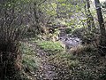 Crichton to Borthwick path - geograph.org.uk - 1556260.jpg 640 × 480; 167 KB
-
 Maggie Bowies Glen - geograph.org.uk - 1556283.jpg 640 × 480; 123 KB
-
 Mossy logs - geograph.org.uk - 76146.jpg 640 × 480; 122 KB
-
 Ormiston Sewage Works. - geograph.org.uk - 19699.jpg 640 × 387; 54 KB
-
 Pencaitland Bridge - geograph.org.uk - 662409.jpg 640 × 480; 128 KB
-
 Scrub by the Tyne - geograph.org.uk - 1483191.jpg 640 × 480; 134 KB
-
 Thomas Telford's Lothian Bridge, Pathhead, Midlothian.JPG 2,560 × 1,920; 2.05 MB
-
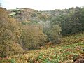
 Tyne Valley, Crichton. - geograph.org.uk - 48945.jpg 640 × 480; 92 KB
-
 Tyne Water - geograph.org.uk - 662464.jpg 640 × 480; 138 KB
-

-
 Wetland below Birky Bank - geograph.org.uk - 1557825.jpg 640 × 480; 99 KB


