Category:Tuweep Area
Jump to navigation
Jump to search
Also known as the Toroweap Area, on the North Rim of Grand Canyon National Park, Arizona.
Subcategories
This category has the following 4 subcategories, out of 4 total.
T
- Toroweap Point (3 F)
- Tuweep Campground (1 F)
- Tuweep Ranger Station (3 F)
Media in category "Tuweep Area"
The following 19 files are in this category, out of 19 total.
-
 05871 Grand Canyon Ranger John Riffey 1980 (4739748744).jpg 322 × 480; 57 KB
-
 05877 Grand Canyon Ranger John Riffey 1980 (4739114835).jpg 314 × 480; 59 KB
-
 Approaching Toroweap-Tuweep Ranger Station - Flickr - brewbooks.jpg 3,264 × 2,448; 3.22 MB
-
 Entering Grand Canyon National Park Tuweep Area - Flickr - brewbooks.jpg 3,264 × 1,757; 2.6 MB
-
 Flickr - brewbooks - Field of Globe Mallow.jpg 3,147 × 2,294; 4.02 MB
-
 Hiking out of Saddle Canyon. Grand Canyon National Park, Arizona (26291171562).jpg 5,271 × 3,514; 10.63 MB
-
 NPS grand-canyon-national-park-map.pdf 3,314 × 2,508; 15.2 MB
-
 Old Farm Implement - Flickr - brewbooks.jpg 3,005 × 1,794; 2.38 MB
-
 Park and Hike - Flickr - brewbooks.jpg 3,264 × 2,448; 3.95 MB
-
 Pools at Toroweap.jpg 4,944 × 3,423; 11.08 MB
-
 Toroweap Area - Flickr - brewbooks.jpg 3,164 × 1,833; 2.35 MB
-
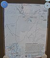 Toroweap Area map - Flickr - brewbooks.jpg 2,073 × 2,393; 1.62 MB
-
 Toroweap area of Grand Canyon - Flickr - brewbooks (1).jpg 3,264 × 2,448; 3.97 MB
-
 Toroweap Area Trails - Flickr - brewbooks.jpg 1,993 × 2,187; 1.58 MB
-
 Toroweap Clay, a Thick Candy Shell - panoramio.jpg 676 × 507; 396 KB
-
 Toroweap Rainbow - panoramio.jpg 676 × 507; 326 KB
-
 Turnoff Highway 389 to Toroweap - Flickr - brewbooks.jpg 3,264 × 1,577; 2.43 MB
-
 Turnoff to Mount Trumbull - Flickr - brewbooks.jpg 3,264 × 2,448; 3.06 MB
-
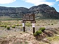 Warning Signs - Flickr - brewbooks.jpg 3,264 × 2,448; 4.55 MB
.jpg)
.jpg)


.jpg)


.jpg)


